Walway Wood

Wood, Forest in Herefordshire

England

Walway Wood

Mistletoe, Newton The road runs down to Hill House.
Mistletoe, Newton Credit: Richard Webb

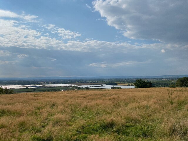
Walway Wood is a picturesque woodland located in the county of Herefordshire, England. Covering an area of approximately 100 acres, it is known for its natural beauty and diverse range of flora and fauna. The wood is situated in a rural setting, surrounded by rolling hills and fields, providing a tranquil and serene environment for visitors.

The wood is predominantly made up of native broadleaf trees such as oak, beech, and ash, which create a dense canopy overhead, allowing only dappled sunlight to filter through to the forest floor. This creates a unique and enchanting atmosphere, particularly during the spring and summer months when the woodland is alive with vibrant wildflowers, including bluebells and primroses.

Walway Wood is home to a variety of wildlife, including various species of birds, small mammals, and insects. Birdwatchers can look out for species such as woodpeckers, nuthatches, and owls, while lucky visitors might spot deer or foxes roaming through the undergrowth. The wood is also home to a diverse range of butterflies and insects, making it a haven for nature enthusiasts and photographers.

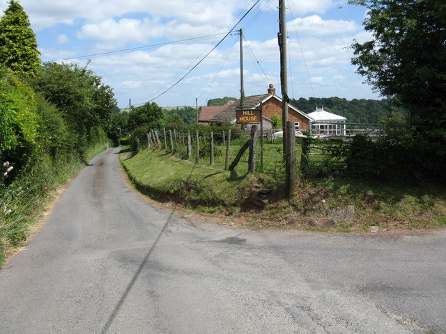
Several walking trails wind through the wood, providing visitors with the opportunity to explore its beauty at their own pace. These paths are well-maintained and clearly marked, making them accessible to people of all ages and abilities. Along the trails, visitors can enjoy the sounds of nature, breathe in the fresh woodland air, and immerse themselves in the peacefulness of the surroundings.

Overall, Walway Wood is a hidden gem in Herefordshire, offering a haven of tranquility and natural beauty for those seeking to escape the hustle and bustle of everyday life.

If you have any feedback on the listing, please let us know in the comments section below.

Walway Wood Images

Images are sourced within 2km of 52.186365/-2.7503794 or Grid Reference SO4854. Thanks to Geograph Open Source API. All images are credited.

Mistletoe, Newton The road runs down to Hill House.
Mistletoe, Newton
The road runs down to Hill House.
Morgans Hill Trig Point Flush Bracket S7895
View from Morgans Hill Trig Point Flush Bracket S7895
Hill House This drive gives access to Hill House, seen here in the background, in the hamlet of Newton, and is also a public footpath to Hope-under-Dinmore.
Hill House
This drive gives access to Hill House, seen here in the background, in the hamlet of Newton, and is also a public footpath to Hope-under-Dinmore.
No through road in Newton The grass growing in the centre of the road suggest there is little traffic on this no through road in the hamlet of Newton.
No through road in Newton
The grass growing in the centre of the road suggest there is little traffic on this no through road in the hamlet of Newton.
Newton - Lane to Cold Oak Farm Single track dead end lane at Newton leading from the B4361 to Cold Oak Farm. Picture taken facing East, the house on the right is High Spring Cottage.
Newton - Lane to Cold Oak Farm
Single track dead end lane at Newton leading from the B4361 to Cold Oak Farm. Picture taken facing East, the house on the right is High Spring Cottage.
Morgans Hill trig
Morgans Hill trig
Newton - footpath toward Dinmore
Newton - Hill House and the lane
Valley of the Marl Brook
Cold Oak Lane Passing through the scattered hamlet of Newton, looking west.
Cold Oak Lane
Passing through the scattered hamlet of Newton, looking west.
Footpath and drive to Hill House In the hamlet of Newton.
Footpath and drive to Hill House
In the hamlet of Newton.
Morgans Hill triangulation pillar Clee Hill in the distance.
Morgans Hill triangulation pillar
Clee Hill in the distance.
Orchard, Marlbrook
Orchard, Marlbrook
Limekiln, Marlbrook Most of the rock here is old red sandstone which often produces acid soil. Every now and then, limestone outcrops and it was roasted for lime which would raise soil pH and crop yields.  Here there is a band of Devonian Bishop's Frome limestone which outcrops around Brierley Woods.
Limekiln, Marlbrook
Most of the rock here is old red sandstone which often produces acid soil. Every now and then, limestone outcrops and it was roasted for lime which would raise soil pH and crop yields. Here there is a band of Devonian Bishop's Frome limestone which outcrops around Brierley Woods.
Path towards Brierley
Nice old post box - no longer in active use
View to Oast House An Oast House is a building used to dry fresh hops before they are sent to the brewers, to be used for flavouring beer. A traditional Oast House consists of the 'oast' and the 'stowage'. The oast was a kiln, with a plenum chamber fired by charcoal at ground floor and the drying floor directly above. The steep pitched roof channelled the hot air through the hops to the top. The stowage, was the barn section, it had a cooling floor and press at first floor and storage area at ground floor. Read more <a title="https://www.geograph.org.uk/article/Oast-Houses" href="https://www.geograph.org.uk/article/Oast-Houses">Link</a>
View to Oast House
An Oast House is a building used to dry fresh hops before they are sent to the brewers, to be used for flavouring beer. A traditional Oast House consists of the 'oast' and the 'stowage'. The oast was a kiln, with a plenum chamber fired by charcoal at ground floor and the drying floor directly above. The steep pitched roof channelled the hot air through the hops to the top. The stowage, was the barn section, it had a cooling floor and press at first floor and storage area at ground floor. Read more Link
Show me another place!

Walway Wood is located at Grid Ref: SO4854 (Lat: 52.186365, Lng: -2.7503794)

Unitary Authority: County of Herefordshire

Police Authority: West Mercia

What 3 Words

///dripping.playoffs.perusing. Near Hope under Dinmore, Herefordshire

Related Wikis

Ivington Camp

Ivington Camp is an Iron Age hill fort located at Brierley, 3 km south of Leominster, Herefordshire. == Further reading == Children, G; Nash, G (1994)...

Newton, Hampton Court

Newton is a linear settlement hamlet and civil parish in the county of Herefordshire, England, and is 10 miles (16 km) north from the city and county town...

Marlbrook, Herefordshire

Marlbrook is an industrial and business park on the borders of and split between the civil parishes of Hope under Dinmore and Newton, in Herefordshire...

Ford Bridge railway station

Ford Bridge railway station was a station in Marlbrook, Herefordshire, England. The station was opened in 1854 and closed in 1954. After closure, the station...

Ivington

Ivington () is a village in the county of Herefordshire, England, approximately 13 miles (21 km) north of Hereford. It is about 2 miles (3 km) south-west...

Birley with Upper Hill

Birley with Upper Hill is a civil parish in Herefordshire, England, consisting of the small villages of Birley and Upper Hill, and most of the hamlet of...

Hope under Dinmore

Hope under Dinmore is a village and civil parish in Herefordshire, England. The village is on the A49 road, 4 miles (6 km) south of Leominster and 9 miles...

Broadward, Herefordshire

Broadward is a hamlet in Herefordshire, England. It is situated approximately 1 mile (1.6 km) south of the town of Leominster, on the B4361 road (Hereford...

Nearby Amenities

Located within 500m of 52.186365,-2.7503794
The data included in this document is from www.openstreetmap.org. The data is made available under ODbL.

Have you been to Walway Wood?

Leave your review of Walway Wood below (or comments, questions and feedback).