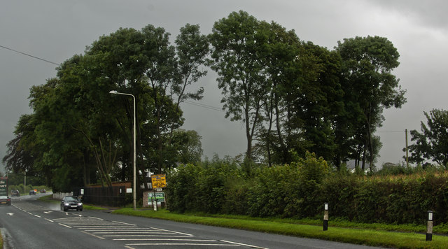
Green Wood

Wood, Forest in Lancashire Wyre

England

Green Wood

Churchtown near Garstang - St Helen's Church
Churchtown near Garstang - St Helen's Church Credit: Colin Park

Green Wood is a small village located in the county of Lancashire, in the north-west of England. Situated amidst lush greenery and picturesque landscapes, Green Wood is renowned for its abundant woodlands and forests, making it an ideal destination for nature enthusiasts and outdoor lovers.

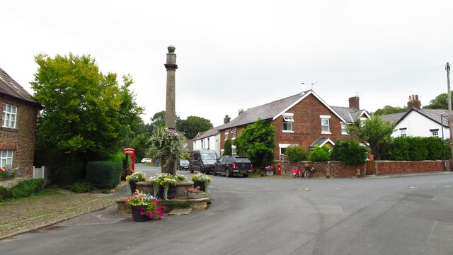
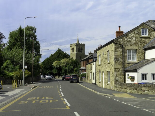
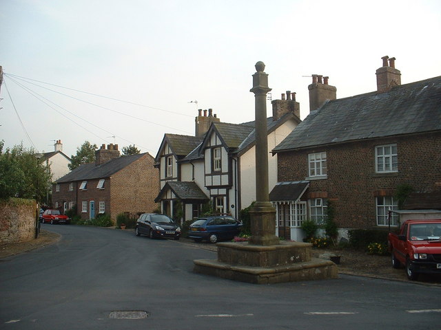
The village is characterized by its tranquil atmosphere and close-knit community. With a population of around 500 residents, it offers a peaceful and idyllic lifestyle away from the hustle and bustle of city living. The village is centered around a charming main street, lined with quaint cottages and small local businesses.

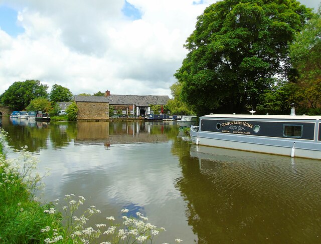
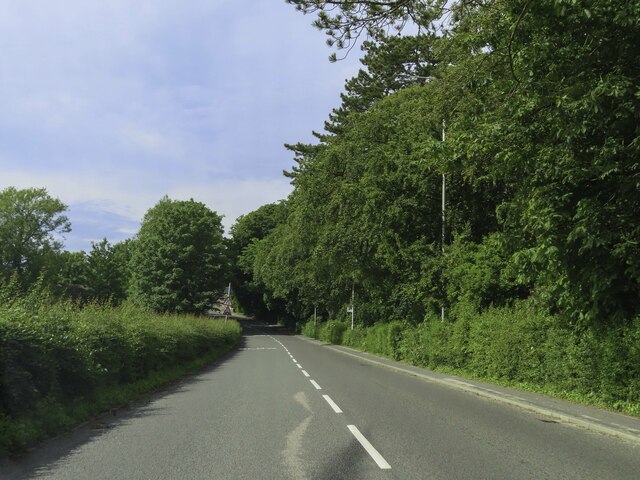
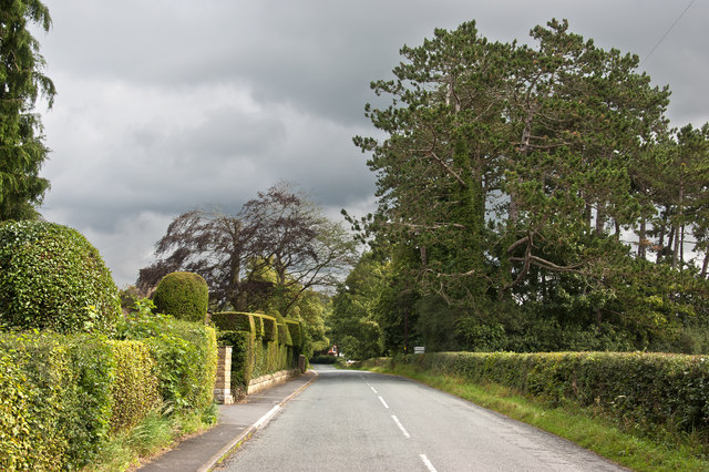
Green Wood is particularly famous for its expansive woodlands and forests, which cover a significant portion of the surrounding area. The woodlands are home to a diverse range of flora and fauna, including ancient oak trees, wildflowers, and various bird species. The village is a popular destination for hiking, walking, and cycling, with several well-maintained trails and paths that meander through the enchanting forests.

In addition to its natural beauty, Green Wood boasts a rich history. The village has a number of historical landmarks, such as a medieval church and a centuries-old manor house. These sites add to the charm of Green Wood and attract visitors interested in exploring the village's heritage.

Overall, Green Wood in Lancashire is a tranquil and picturesque village that offers a serene escape into nature. With its lush woodlands, friendly community, and historical sites, it is a hidden gem for those seeking a peaceful retreat in the heart of the countryside.

If you have any feedback on the listing, please let us know in the comments section below.

Green Wood Images

Images are sourced within 2km of 53.88131/-2.7870219 or Grid Reference SD4843. Thanks to Geograph Open Source API. All images are credited.

Churchtown near Garstang - St Helen's Church
Churchtown near Garstang, - village cross
Old Milestone, Lancaster Canal NW of Byerworth Bridge, Garstang.

Inscription reads: Preston / 17

Milestone Society National ID: LAN-17
Old Milestone, Lancaster Canal
NW of Byerworth Bridge, Garstang. Inscription reads: Preston / 17 Milestone Society National ID: LAN-17
The Wyre Aqueduct This is the Wyre Aqueduct which carries the section of the Lancaster Canal passing through Garstang over the River Wyre. This feat of engineering was first used in 1797 according to the plaque on the opposite side of the canal from where I am standing; the same plaque gives the length of the aqueduct as 110 feet and height above the river as 34 feet.
The Wyre Aqueduct
This is the Wyre Aqueduct which carries the section of the Lancaster Canal passing through Garstang over the River Wyre. This feat of engineering was first used in 1797 according to the plaque on the opposite side of the canal from where I am standing; the same plaque gives the length of the aqueduct as 110 feet and height above the river as 34 feet.
Canal basin, Garstang I am approaching the canal basin on the section of Lancaster Canal as it passes through Garstang, Lancashire. The Owd Tithe Barn pub and restaurant lies on the  north side.
Canal basin, Garstang
I am approaching the canal basin on the section of Lancaster Canal as it passes through Garstang, Lancashire. The Owd Tithe Barn pub and restaurant lies on the north side.
Garstang Road approaching Calder Bridge
Garstang Road in Bowgreave
Garstang Road approaching Garstang
Bonds Lane
Bonds Lane
Old Milestone Marker 40-17 F (between bridges 61-60), Lancaster Canal Old Milestone located by the side of the Lancaster Canal
This milestone is 17 miles from the centre of Preston and 40 miles from Kendal

Inscription reads:- 
Preston / 17 :: Lancaster / 13 

Milestone Society National ID: LAN-17
Old Milestone Marker 40-17 F (between bridges 61-60), Lancaster Canal
Old Milestone located by the side of the Lancaster Canal This milestone is 17 miles from the centre of Preston and 40 miles from Kendal Inscription reads:- Preston / 17 :: Lancaster / 13 Milestone Society National ID: LAN-17
Calder House Lane
Calder House Lane
The Kirkland and Catterall Memorial Hall
Catterall Lodge Farm Nurseries
The wind turbine is not bothered by the rain
Footbridge over the River Wyre At Churchtown.
Footbridge over the River Wyre
At Churchtown.
Footpath at Catterall Hall The path leads from Catterall to Churchtown.
Footpath at Catterall Hall
The path leads from Catterall to Churchtown.
St. Helen's Church, Churchtown Church of England parish church.
St. Helen's Church, Churchtown
Church of England parish church.
Show me another place!

Green Wood is located at Grid Ref: SD4843 (Lat: 53.88131, Lng: -2.7870219)

Administrative County: Lancashire

District: Wyre

Police Authority: Lancashire

What 3 Words

///postage.spaceship.sculpting. Near Catterall, Lancashire

Related Wikis

Kirkland, Lancashire

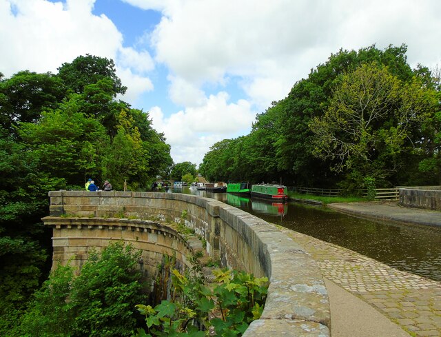
Kirkland is a civil parish, located on the banks of the River Wyre, midway between Preston and Lancaster, in the English county of Lancashire. It is also...

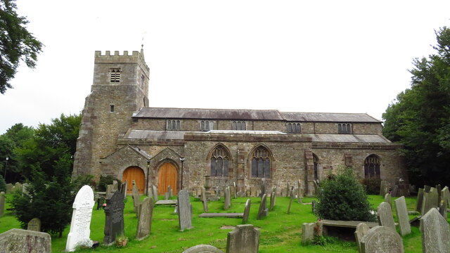
St Helen's Church, Churchtown

St Helen's Church is an Anglican church in the village of Churchtown in Lancashire, England. Historically, it was the parish church of Garstang; today...

Bowgreave

Bowgreave is a village in the parish of Barnacre-with-Bonds, Lancashire, England. Its nearest town is Garstang, a mile to the north. Garstang Community...

Catterall

Catterall is a village and civil parish in the borough of Wyre, Lancashire, England. Historically in the Amounderness Hundred, it is situated on the A6...

Garstang Community Academy

Garstang Community Academy (formerly Garstang High School) is a secondary school with academy status in the parish of Barnacre-with-Bonds near Garstang...

Bonds, Lancashire

Bonds is a village in Lancashire, England. It lies immediately south of Garstang town centre, on the opposite bank of the River Wyre. It is bounded by...

Church of St Mary and St Michael, Bonds

The Church of St Mary and St Michael is in the village of Bonds, to the south of Garstang, Lancashire, England. It is an active Roman Catholic church in...

St Thomas' Church, Garstang

St Thomas' Church is a Church of England church in Garstang, a market town in Lancashire, England. It is an active Church of England parish church in the...

Nearby Amenities

Located within 500m of 53.88131,-2.7870219
The Avenue
Bus: yes
Naptan AtcoCode: 2500DCL2069
Naptan Bearing: W
Naptan BusStopType: MKD
Naptan CommonName: The Avenue
Naptan Indicator: o/s
Naptan Landmark: The Avenue
Naptan LocalityCode: E0016543
Naptan NaptanCode: landatjm
Naptan Street: Ainspool Lane
Naptan Verified: no
Public Transport: stop_position
Ref: landatjm
Lat/Long: 53.8811092/-2.7824027
Churchtown
Note: also called Kirkland (civil parish)
Place: village
Source: npe
Lat/Long: 53.8810241/-2.7898489
Post Box
Lat/Long: 53.8811658/-2.782093
Telephone
Defibrillator
Booth: K6
Covered: booth
Defibrillator Location: inside old red phone box, Ainspool Lane, Churchtown
Emergency: defibrillator
Listed Status: Grade II
Man Made: telephone_box
Lat/Long: 53.8803803/-2.7905579
Historic: wayside_cross
Lat/Long: 53.880253/-2.7904505
Barrier: stile
Lat/Long: 53.8845197/-2.784633
Kindergarten
Jelly Beans
Addr City: Preston
Addr Country: GB
Addr Postcode: PR3 0HS
Addr Suburb: Churchtown
Fhrs Id: 146778
Lat/Long: 53.8806409/-2.786025
Horns Inn
Bus: yes
Naptan AtcoCode: 25001659
Naptan Bearing: W
Naptan BusStopType: MKD
Naptan CommonName: Horns Inn
Naptan Indicator: o/s
Naptan Landmark: Horns Inn (west)
Naptan LocalityCode: E0016543
Naptan NaptanCode: lanatapm
Naptan Street: The Avenue
Naptan Verified: no
Public Transport: stop_position
Ref: lanatapm
Lat/Long: 53.8808287/-2.7874629
The Avenue
Bus: yes
Naptan AtcoCode: 2500DCL2068
Naptan Bearing: E
Naptan BusStopType: MKD
Naptan CommonName: The Avenue
Naptan Indicator: by
Naptan Landmark: The Avenue
Naptan LocalityCode: E0016543
Naptan NaptanCode: landatjg
Naptan Street: Ainspool Lane
Naptan Verified: no
Public Transport: stop_position
Ref: landatjg
Lat/Long: 53.8811622/-2.7818615
Horns Inn
Bus: yes
Naptan AtcoCode: 250020125
Naptan Bearing: E
Naptan BusStopType: MKD
Naptan CommonName: Horns Inn
Naptan Indicator: opp
Naptan Landmark: Horns Inn (east)
Naptan LocalityCode: E0016543
Naptan NaptanCode: lanatptg
Naptan Street: Ainspool Lane
Naptan Verified: no
Public Transport: stop_position
Ref: lanatptg
Lat/Long: 53.8808467/-2.7875837
Turning Circle
Lat/Long: 53.8841998/-2.7850582
Cafe
Wild Bean Cafe
Brand: Wild Bean Cafe
Brand Wikidata: Q61804826
Cuisine: coffee_shop
Takeaway: yes
Lat/Long: 53.8820258/-2.781522
Bench
Lat/Long: 53.8807779/-2.7873489
Give Way
Direction: backward
Lat/Long: 53.880281/-2.7903709
Advertising: board
Lat/Long: 53.8803426/-2.7905176
Bench
Lat/Long: 53.8803057/-2.7904765
Post Box
Post Box Type: wall
Royal Cypher: GVIR
Royal Cypher Wikidata: Q33102169
Lat/Long: 53.8803489/-2.790312
Noexit: yes
Lat/Long: 53.8810034/-2.7801713
The data included in this document is from www.openstreetmap.org. The data is made available under ODbL.

Have you been to Green Wood?

Leave your review of Green Wood below (or comments, questions and feedback).