Acorn Coppice

Wood, Forest in Shropshire

England

Acorn Coppice

Small car park at Harton Hollow Nature Reserve Wenlock Edge was formed 425 million years ago as a coral reef in a shallow sea. The thickly wooded limestone escarpment stretches in an unbroken line for 18 miles (30 km) between Ironbridge and Craven Arms in Shropshire.
Small car park at Harton Hollow Nature Reserve Credit: Mat Fascione

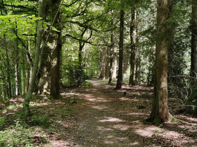
Acorn Coppice is a charming woodland located in the county of Shropshire, England. Covering an area of approximately 50 hectares, this idyllic forest is a haven for nature enthusiasts and outdoor lovers alike.

The woodland is primarily composed of oak trees, which give it its name, but also features a diverse range of other tree species such as birch, beech, and ash. The dense canopy created by the towering trees creates a serene and tranquil atmosphere, making it a popular destination for those seeking a peaceful retreat from the hustle and bustle of everyday life.

Acorn Coppice is home to a rich variety of wildlife, including numerous bird species, small mammals, and insects. Birdwatchers will delight in the opportunity to spot species such as woodpeckers, owls, and various songbirds in their natural habitat. The forest floor is carpeted with a plethora of wildflowers and ferns, adding to the beauty and biodiversity of the area.

Visitors to Acorn Coppice can explore its network of walking trails, which wind through the woodland and offer breathtaking views of the surrounding countryside. These trails cater to every level of fitness, with options for leisurely strolls or more challenging hikes. The forest is also a popular spot for picnicking, with designated areas providing a perfect setting for alfresco dining.

Acorn Coppice truly is a hidden gem in Shropshire, offering a peaceful and enchanting experience for all who venture into its leafy embrace. Whether it's for birdwatching, hiking, or simply immersing oneself in nature, this woodland provides a delightful escape from the demands of modern life.

If you have any feedback on the listing, please let us know in the comments section below.

Acorn Coppice Images

Images are sourced within 2km of 52.47676/-2.7634682 or Grid Reference SO4886. Thanks to Geograph Open Source API. All images are credited.

Small car park at Harton Hollow Nature Reserve Wenlock Edge was formed 425 million years ago as a coral reef in a shallow sea. The thickly wooded limestone escarpment stretches in an unbroken line for 18 miles (30 km) between Ironbridge and Craven Arms in Shropshire.
Small car park at Harton Hollow Nature Reserve
Wenlock Edge was formed 425 million years ago as a coral reef in a shallow sea. The thickly wooded limestone escarpment stretches in an unbroken line for 18 miles (30 km) between Ironbridge and Craven Arms in Shropshire.
Picnic area next to the car park At the Harton Hollow Nature Reserve.
Picnic area next to the car park
At the Harton Hollow Nature Reserve.
Farmland next to the Harton Hollow Nature Reserve
Countryside view near Wenlock Edge Looking east from the picnic area at the Harton Hollow Nature Reserve, on the horizon is Brown Clee Hill, about 7 miles away.
Countryside view near Wenlock Edge
Looking east from the picnic area at the Harton Hollow Nature Reserve, on the horizon is Brown Clee Hill, about 7 miles away.
Information board at Harton Hollow Nature Reserve Wenlock Edge was formed 425 million years ago as a coral reef in a shallow sea. The thickly wooded limestone escarpment stretches in an unbroken line for 18 miles (30 km) between Ironbridge and Craven Arms in Shropshire.
Information board at Harton Hollow Nature Reserve
Wenlock Edge was formed 425 million years ago as a coral reef in a shallow sea. The thickly wooded limestone escarpment stretches in an unbroken line for 18 miles (30 km) between Ironbridge and Craven Arms in Shropshire.
Path through Harton Hollow Wood
Path along the edge of Harton Hollow Wood Wenlock Edge was formed 425 million years ago as a coral reef in a shallow sea. The thickly wooded limestone escarpment stretches in an unbroken line for 18 miles (30 km) between Ironbridge and Craven Arms in Shropshire.
Path along the edge of Harton Hollow Wood
Wenlock Edge was formed 425 million years ago as a coral reef in a shallow sea. The thickly wooded limestone escarpment stretches in an unbroken line for 18 miles (30 km) between Ironbridge and Craven Arms in Shropshire.
Path through Harton Hollow Wood Wenlock Edge was formed 425 million years ago as a coral reef in a shallow sea. The thickly wooded limestone escarpment stretches in an unbroken line for 18 miles (30 km) between Ironbridge and Craven Arms in Shropshire.
Path through Harton Hollow Wood
Wenlock Edge was formed 425 million years ago as a coral reef in a shallow sea. The thickly wooded limestone escarpment stretches in an unbroken line for 18 miles (30 km) between Ironbridge and Craven Arms in Shropshire.
Hope Dale viewed from Harton Hollow Wood On the horizon is Brown Clee Hill, about 7 miles away.
Hope Dale viewed from Harton Hollow Wood
On the horizon is Brown Clee Hill, about 7 miles away.
Briarhill Wood at Wenlock Edge
Path crossing the Harton Hollow Way Wenlock Edge was formed 425 million years ago as a coral reef in a shallow sea. The thickly wooded limestone escarpment stretches in an unbroken line for 18 miles (30 km) between Ironbridge and Craven Arms in Shropshire.
Path crossing the Harton Hollow Way
Wenlock Edge was formed 425 million years ago as a coral reef in a shallow sea. The thickly wooded limestone escarpment stretches in an unbroken line for 18 miles (30 km) between Ironbridge and Craven Arms in Shropshire.
Harton Hollow Way in Burwood Coppice Wenlock Edge was formed 425 million years ago as a coral reef in a shallow sea. The thickly wooded limestone escarpment stretches in an unbroken line for 18 miles (30 km) between Ironbridge and Craven Arms in Shropshire.
Harton Hollow Way in Burwood Coppice
Wenlock Edge was formed 425 million years ago as a coral reef in a shallow sea. The thickly wooded limestone escarpment stretches in an unbroken line for 18 miles (30 km) between Ironbridge and Craven Arms in Shropshire.
Burwood Coppice at Wenlock Edge Wenlock Edge was formed 425 million years ago as a coral reef in a shallow sea. The thickly wooded limestone escarpment stretches in an unbroken line for 18 miles (30 km) between Ironbridge and Craven Arms in Shropshire.
Burwood Coppice at Wenlock Edge
Wenlock Edge was formed 425 million years ago as a coral reef in a shallow sea. The thickly wooded limestone escarpment stretches in an unbroken line for 18 miles (30 km) between Ironbridge and Craven Arms in Shropshire.
Path through Burwood Coppice Wenlock Edge was formed 425 million years ago as a coral reef in a shallow sea. The thickly wooded limestone escarpment stretches in an unbroken line for 18 miles (30 km) between Ironbridge and Craven Arms in Shropshire.
Path through Burwood Coppice
Wenlock Edge was formed 425 million years ago as a coral reef in a shallow sea. The thickly wooded limestone escarpment stretches in an unbroken line for 18 miles (30 km) between Ironbridge and Craven Arms in Shropshire.
Harton Wood at Wenloc Edge Wenlock Edge was formed 425 million years ago as a coral reef in a shallow sea. The thickly wooded limestone escarpment stretches in an unbroken line for 18 miles (30 km) between Ironbridge and Craven Arms in Shropshire.
Harton Wood at Wenloc Edge
Wenlock Edge was formed 425 million years ago as a coral reef in a shallow sea. The thickly wooded limestone escarpment stretches in an unbroken line for 18 miles (30 km) between Ironbridge and Craven Arms in Shropshire.
Path through Harton Wood Wenlock Edge was formed 425 million years ago as a coral reef in a shallow sea. The thickly wooded limestone escarpment stretches in an unbroken line for 18 miles (30 km) between Ironbridge and Craven Arms in Shropshire.
Path through Harton Wood
Wenlock Edge was formed 425 million years ago as a coral reef in a shallow sea. The thickly wooded limestone escarpment stretches in an unbroken line for 18 miles (30 km) between Ironbridge and Craven Arms in Shropshire.
Flat Coppice at Wenlock Edge Wenlock Edge was formed 425 million years ago as a coral reef in a shallow sea. The thickly wooded limestone escarpment stretches in an unbroken line for 18 miles (30 km) between Ironbridge and Craven Arms in Shropshire.
Flat Coppice at Wenlock Edge
Wenlock Edge was formed 425 million years ago as a coral reef in a shallow sea. The thickly wooded limestone escarpment stretches in an unbroken line for 18 miles (30 km) between Ironbridge and Craven Arms in Shropshire.
Show me another place!

Acorn Coppice is located at Grid Ref: SO4886 (Lat: 52.47676, Lng: -2.7634682)

Unitary Authority: Shropshire

Police Authority: West Mercia

What 3 Words

///herb.drawn.dumpling. Near Craven Arms, Shropshire

Related Wikis

Westhope, Shropshire

Westhope is a small village in Shropshire, England. == History == Historically, the manor of Westhope was centred by a house to the east of the church...

Ludlow (UK Parliament constituency)

Ludlow is a constituency in Shropshire represented in the House of Commons of the UK Parliament since 2005 by Philip Dunne, a member of the Conservative...

Corfton

Corfton is a small village in Shropshire, England, located 4.5 miles (7.2 km) east of Craven Arms and 7.5 miles (12.1 km) north of Ludlow, the two nearest...

Bache Mill

Bache Mill is a village in Shropshire, England.

Nearby Amenities

Located within 500m of 52.47676,-2.7634682
Building: yes
Lat/Long: 52.4798182/-2.7646323
Building: yes
Lat/Long: 52.4804544/-2.7618182
Ele: 310
Natural: peak
Lat/Long: 52.4758032/-2.7626588
The data included in this document is from www.openstreetmap.org. The data is made available under ODbL.

Have you been to Acorn Coppice?

Leave your review of Acorn Coppice below (or comments, questions and feedback).