Copeland Wood

Wood, Forest in Westmorland South Lakeland

England

Copeland Wood

The view from Scout Scar A short way from Kendal town brings these fine views over the National Park.
The view from Scout Scar Credit: David M Clark

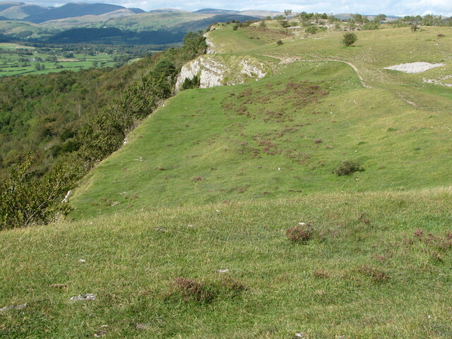
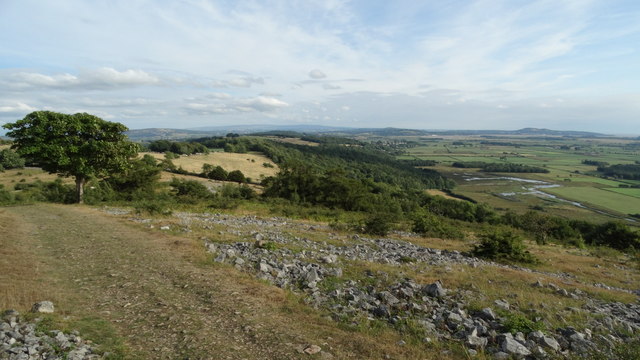
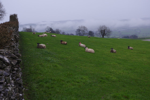
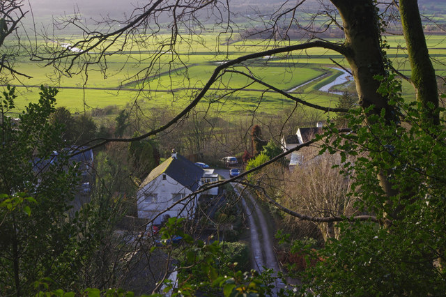
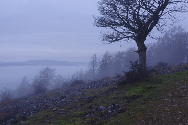
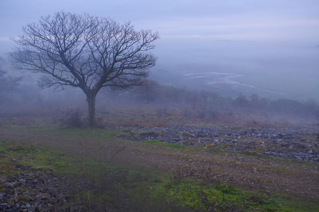
Copeland Wood, located in Westmorland, is a picturesque forest that offers a serene and natural escape from the bustling world. Covering an area of approximately 500 acres, this ancient woodland is abundant in diverse flora and fauna, making it a haven for nature enthusiasts and wildlife lovers.

The wood is predominantly composed of a mix of broadleaf trees, including oak, ash, beech, and birch, creating a vibrant and evergreen canopy that offers shade and shelter to the woodland floor. The forest floor is adorned with a rich carpet of wildflowers, mosses, and ferns, adding to the enchanting atmosphere of the wood.

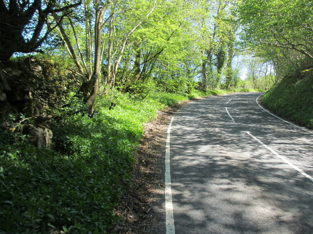
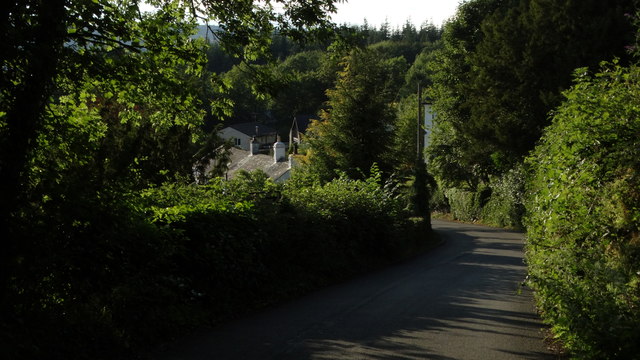
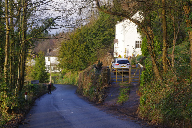
Copeland Wood is crisscrossed by a network of well-marked walking trails, allowing visitors to explore its beauty at their own pace. These trails wind through the forest, leading to scenic viewpoints, tranquil ponds, and hidden clearings, offering ample opportunities for photography and quiet contemplation.

The wood also supports a wide range of wildlife, with many species finding refuge within its boundaries. Birdwatchers can spot various species of woodland birds, including woodpeckers, owls, and thrushes. Squirrels, foxes, and badgers are also commonly seen, along with occasional sightings of deer and rabbits.

Copeland Wood has a rich history, with evidence of human activity dating back centuries. The wood has been managed sustainably, with traditional woodland management practices being followed to preserve its natural beauty and biodiversity.

Overall, Copeland Wood in Westmorland is a stunning and tranquil forest that offers a captivating blend of natural beauty, diverse wildlife, and a peaceful escape from the modern world.

If you have any feedback on the listing, please let us know in the comments section below.

Copeland Wood Images

Images are sourced within 2km of 54.314783/-2.7990247 or Grid Reference SD4891. Thanks to Geograph Open Source API. All images are credited.

The view from Scout Scar A short way from Kendal town brings these fine views over the National Park.
The view from Scout Scar
A short way from Kendal town brings these fine views over the National Park.
Rivet benchmark on milestone in Underbarrow Road Ordnance Survey rivet benchmark on the top of an old milestone that once read 'Kendal 2'. The mark was levelled at 171.225m above Newlyn Datum, verified 1971. For a wider view see <a href="https://www.geograph.org.uk/photo/7456528">SD4892 : Underbarrow Road and a 'Kendal' milestone</a> and  <a href="https://www.geograph.org.uk/photo/2819112">SD4892 : Mile stone, Underbarrow Road</a>  <span class="nowrap"><a title="https://www.bench-marks.org.uk/bm190192" rel="nofollow ugc noopener" href="https://www.bench-marks.org.uk/bm190192">Link</a><img style="margin-left:2px;" alt="External link" title="External link - shift click to open in new window" src="https://s1.geograph.org.uk/img/external.png" width="10" height="10"/></span>
Rivet benchmark on milestone in Underbarrow Road
Ordnance Survey rivet benchmark on the top of an old milestone that once read 'Kendal 2'. The mark was levelled at 171.225m above Newlyn Datum, verified 1971. For a wider view see SD4892 : Underbarrow Road and a 'Kendal' milestone and SD4892 : Mile stone, Underbarrow Road LinkExternal link
Underbarrow Road and a 'Kendal' milestone Looking towards Kendal on Underbarrow Road, and on the left there is an old milestone that once read 'Kendal 2'. On top of the milestone there is an Ordnance Survey rivet benchmark <a href="https://www.geograph.org.uk/photo/7456523">SD4892 : Rivet benchmark on milestone in Underbarrow Road</a>

Milestone Society National ID: WE_KDCE02
Underbarrow Road and a 'Kendal' milestone
Looking towards Kendal on Underbarrow Road, and on the left there is an old milestone that once read 'Kendal 2'. On top of the milestone there is an Ordnance Survey rivet benchmark SD4892 : Rivet benchmark on milestone in Underbarrow Road Milestone Society National ID: WE_KDCE02
Trig point of Scout Scar, 229m
Gateway to Gamblesmire Lane from Underbarrow Road
Benchmark on Barrowfield triangulation pillar Ordnance Survey flush bracket (serial identifier S5672) levelled at 229.454m above Newlyn Datum in 1953
Benchmark on Barrowfield triangulation pillar
Ordnance Survey flush bracket (serial identifier S5672) levelled at 229.454m above Newlyn Datum in 1953
Barrowfield trig point above Scout Scar There is an Ordnance Survey benchmark <a href="https://www.geograph.org.uk/photo/7660251">SD4891 : Benchmark on Barrowfield triangulation pillar</a> set into the face of the pillar towards the camera. The pillar is described at <span class="nowrap"><a title="https://trigpointing.uk/trig/1062" rel="nofollow ugc noopener" href="https://trigpointing.uk/trig/1062">Link</a><img style="margin-left:2px;" alt="External link" title="External link - shift click to open in new window" src="https://s1.geograph.org.uk/img/external.png" width="10" height="10"/></span>
Barrowfield trig point above Scout Scar
There is an Ordnance Survey benchmark SD4891 : Benchmark on Barrowfield triangulation pillar set into the face of the pillar towards the camera. The pillar is described at LinkExternal link
Footpath from Scout Scar to Underbarrow Road
Path at southern end of Helsington Barrows
Brigsteer Brow leading into Brigsteer
Sheep by Brigsteer Road Seen here on a grey late December day with mist hanging in the Kent valley.
Sheep by Brigsteer Road
Seen here on a grey late December day with mist hanging in the Kent valley.
Whetstone Lane, near Brigsteer The signs warn that the road ahead is closed due to roadworks on the A591. Given the dates on the yellow sign it would appear that the work has badly overrun.
Whetstone Lane, near Brigsteer
The signs warn that the road ahead is closed due to roadworks on the A591. Given the dates on the yellow sign it would appear that the work has badly overrun.
Brigsteer Looking over part of Brigsteer village with the Lyth Valley beyond.
Brigsteer
Looking over part of Brigsteer village with the Lyth Valley beyond.
Brigsteer Brow The road drops down quite steeply into Brigsteer village.
Brigsteer Brow
The road drops down quite steeply into Brigsteer village.
Approaching Brigsteer Looking along the road from Underbarrow at the junction for a narrow lane that heads across the Lyth Valley. The blackboard advertises the Wheatsheaf 'Award winning inn'.
Approaching Brigsteer
Looking along the road from Underbarrow at the junction for a narrow lane that heads across the Lyth Valley. The blackboard advertises the Wheatsheaf 'Award winning inn'.
Helsington Barrows Bleak conditions above Brigsteer village with fog lying in the Lyth Valley. Despite appearances the weather is mild for the time of year. This is National Trust land.
Helsington Barrows
Bleak conditions above Brigsteer village with fog lying in the Lyth Valley. Despite appearances the weather is mild for the time of year. This is National Trust land.
Helsington Barrows Looking down in misty conditions into the Lyth Valley from above Brigsteer.
Helsington Barrows
Looking down in misty conditions into the Lyth Valley from above Brigsteer.
Old Milepost by Brigsteer Road, Brigsteer, Kendal parish Metal post with attached metal plates by the UC road, in parish of KENDAL (SOUTH LAKELAND District), Brigsteer, in bank, on East side of road. Day iron casting, erected by the County Council in the 20th century. 

Inscription reads:-
: KENDAL / 3 / MILES : : 1900 : : BRIG / STEER / ¼ / MILE :
Maker:-
: DAY / KENDAL : 

Milestone Society National ID: WE_KDBS03.
Old Milepost by Brigsteer Road, Brigsteer, Kendal parish
Metal post with attached metal plates by the UC road, in parish of KENDAL (SOUTH LAKELAND District), Brigsteer, in bank, on East side of road. Day iron casting, erected by the County Council in the 20th century. Inscription reads:- : KENDAL / 3 / MILES : : 1900 : : BRIG / STEER / ¼ / MILE : Maker:- : DAY / KENDAL : Milestone Society National ID: WE_KDBS03.
Show me another place!

Copeland Wood is located at Grid Ref: SD4891 (Lat: 54.314783, Lng: -2.7990247)

Administrative County: Cumbria

District: South Lakeland

Police Authority: Cumbria

What 3 Words

///graph.crust.commoners. Near Kendal, Cumbria

Nearby Locations

Copeland Wood

Related Wikis

Cunswick Scar

Cunswick Scar is a limestone scar (cliff or steep rock face) in the Lake District, England. There are extensive views from the large cairn at the top...

Scout Scar

Scout Scar, also called Underbarrow Scar, is a hill in the English Lake District, west of Kendal, Cumbria and above the village of Underbarrow. It reaches...
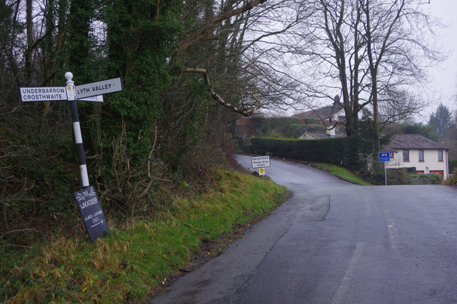
Underbarrow

Underbarrow is a small village in Cumbria, England, located 3 miles (4.8 km) west of Kendal. The village is in the Lake District National Park. It is in...

Helsington

Helsington is a civil parish in the South Lakeland district of the English county of Cumbria. It includes the village of Brigsteer and Sizergh Castle...

Brigsteer

Brigsteer is a village in Cumbria, England. On 1 August 2016 it was included in the Lake District National Park. == Politics == In 1974, under the Local...

Helsfell Hall

Helsfell Hall was a country house near Kentrigg in Cumbria. That part of the building which survives, and is now used as a barn, is a Grade II listed building...

Castle Howe

Castle Howe is a motte and bailey castle in the town of Kendal, England. == History == Castle Howe was built after the Norman conquest of England, either...

Lyth Valley

The Lyth Valley is on the edge of the Lake District National Park in Cumbria, England. It gives its name to an electoral ward (one of 45 in South Lakeland...

Nearby Amenities

Located within 500m of 54.314783,-2.7990247
Barrier: stile
Lat/Long: 54.310391/-2.7989495
Barrier: kissing_gate
Lat/Long: 54.310524/-2.7976557
Power: pole
Lat/Long: 54.3148264/-2.8049575
The data included in this document is from www.openstreetmap.org. The data is made available under ODbL.

Have you been to Copeland Wood?

Leave your review of Copeland Wood below (or comments, questions and feedback).