Burntbarrow Plantation

Wood, Forest in Westmorland South Lakeland

England

Burntbarrow Plantation

View of the Kent estuary From St. Anthony's Hill, Milnthorpe.
View of the Kent estuary Credit: Phil and Juliette Platt

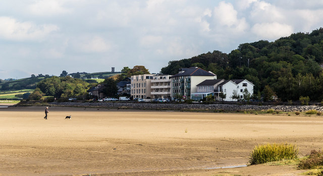
Burntbarrow Plantation is a picturesque woodland located in Westmorland, a historic county in the northwest of England. Situated on the fringe of the Lake District National Park, this enchanting forest covers an area of approximately 350 acres.

The plantation derives its name from a burnt burial mound known as a barrow, which once stood within its boundaries. This ancient site, now believed to date back to the Bronze Age, adds a sense of mystery and intrigue to the woodland.

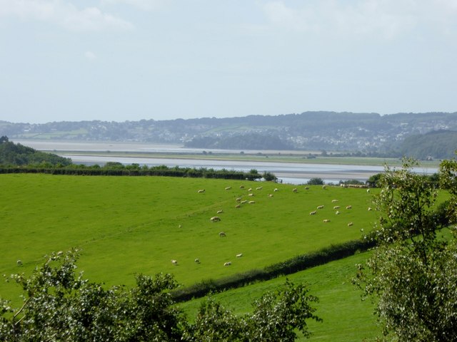
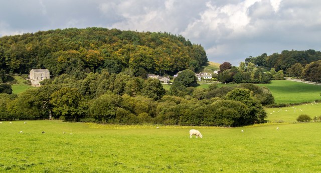
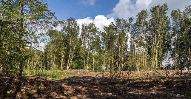
Burntbarrow Plantation is predominantly composed of mixed deciduous trees, including oak, beech, and birch. These trees create a stunning tapestry of colors throughout the year, with vibrant greens in the spring and summer, and fiery reds and oranges in the autumn. The forest floor is adorned with a rich carpet of wildflowers, ferns, and mosses, adding to its natural beauty.

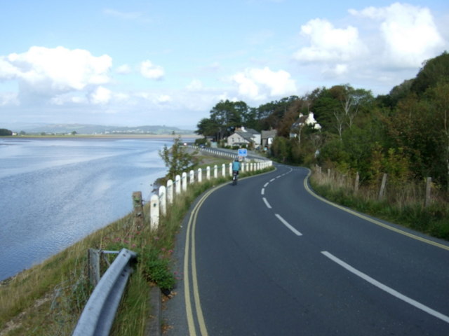
The plantation is crisscrossed by a network of walking trails, offering visitors the opportunity to explore its tranquil surroundings. These paths wind their way through the woodland, providing glimpses of wildlife such as deer, squirrels, and a variety of bird species.

Burntbarrow Plantation not only provides a haven for nature enthusiasts but also serves as a valuable habitat for numerous flora and fauna. The forest is carefully managed to maintain its ecological balance and preserve its natural heritage.

With its idyllic setting and diverse ecosystem, Burntbarrow Plantation offers a serene escape from the hustle and bustle of everyday life, allowing visitors to connect with nature and experience the peacefulness of the Westmorland countryside.

If you have any feedback on the listing, please let us know in the comments section below.

Burntbarrow Plantation Images

Images are sourced within 2km of 54.21425/-2.797481 or Grid Reference SD4880. Thanks to Geograph Open Source API. All images are credited.

View of the Kent estuary From St. Anthony's Hill, Milnthorpe.
View of the Kent estuary
From St. Anthony's Hill, Milnthorpe.
A6 The junction of Paradise Lane with the A6.
A6
The junction of Paradise Lane with the A6.
Park Road Flats on Park Road.
Park Road
Flats on Park Road.
Haverbrack
Haverbrack
Wray Cottages Visible after the felling of trees.
Wray Cottages
Visible after the felling of trees.
Storth Builders Merchants in Storth.
Storth
Builders Merchants in Storth.
The Ship Inn, Sandside
Sign for the Ship Inn, Sandside
Sands at Sandside The channel seems to have shifted from the position on the map, allowing easy access at low tide.
Sands at Sandside
The channel seems to have shifted from the position on the map, allowing easy access at low tide.
Restaurant on Park Road, Sandside
Bungalow on Park Road (B5292)
The River Bela From Milnthorpe Bridge.
The River Bela
From Milnthorpe Bridge.
Cycling on Park Road (B5282) Heading north east.
Cycling on Park Road (B5282)
Heading north east.
Dropping down on the coastal road into Sandside Heading north east.
Dropping down on the coastal road into Sandside
Heading north east.
Kent Channel and Milnthorpe Sands
The Kent Channel and Milnthorpe Sands
The Kent Channel and Milnthorpe Sands The channel seems to have shifted from the position on the map, allowing easy access at low tide.
The Kent Channel and Milnthorpe Sands
The channel seems to have shifted from the position on the map, allowing easy access at low tide.
Apartments at Sandside On Park Road (B5282).
Apartments at Sandside
On Park Road (B5282).
Show me another place!

Burntbarrow Plantation is located at Grid Ref: SD4880 (Lat: 54.21425, Lng: -2.797481)

Administrative County: Cumbria

District: South Lakeland

Police Authority: Cumbria

What 3 Words

///latches.gosh.driftwood. Near Milnthorpe, Cumbria

Related Wikis

Dog Hole Cave

Dog Hole Cave is an archaeologically significant cave near Storth, Cumbria, England. Other names for the cave include Haverbrack Bank Pot, Haverbrack Dog...

Sandside railway station

Sandside was a railway station situated on the Hincaster Branch of the Furness Railway serving the hamlet and quarries of Sandside. The following station...

Sandside, Beetham

Sandside is a hamlet near Storth in Beetham parish, South Lakeland, Cumbria, England. Historically in Westmorland, it lies on the south shore of the estuary...
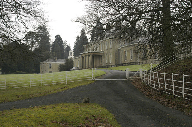
Dallam Tower

Dallam Tower is a grade I listed country house in Beetham parish, near Milnthorpe, South Lakeland, Cumbria, England. It is a member of the Historic Houses...

Carr Bank

Carr Bank is a small hamlet near Arnside, Cumbria, England. It is in the civil parish of Beetham in South Lakeland local government district. == References... ==

Storth

Storth is a village near Arnside in Cumbria, England, situated near the border with Lancashire. It is in the historic county of Westmorland. The village...

Hazelslack

Hazelslack is a hamlet in the South Lakeland district, in the English county of Cumbria. It is near the villages of Arnside and Storth. Nearby Hazelslack...
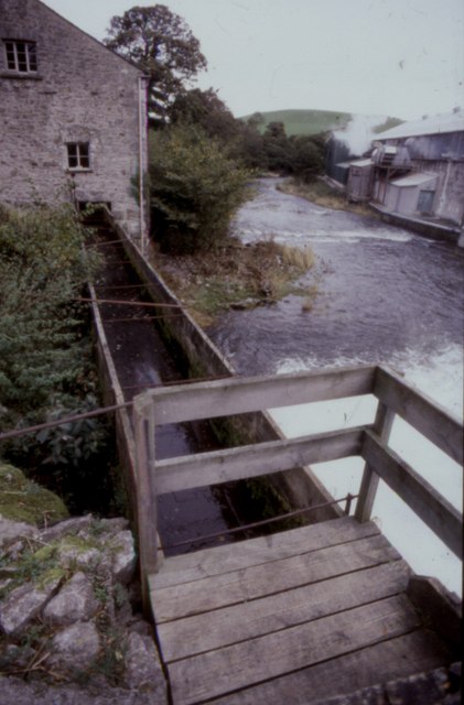
Heron Corn Mill

The Heron Corn Mill is a working 18th-century water mill on the River Bela at Beetham, Cumbria, England. The mill and its mill race are Grade II* listed...

Nearby Amenities

Located within 500m of 54.21425,-2.797481
Barrier: stile
Source: Recent walk, GPS and photos
Lat/Long: 54.2129294/-2.7922447
Barrier: stile
Lat/Long: 54.2154269/-2.801124
Barrier: stile
Source: Recent walk, GPS and photos
Lat/Long: 54.2124471/-2.793872
Give Way
Direction: forward
Lat/Long: 54.2121736/-2.8021271
Barrier: stile
Lat/Long: 54.2140941/-2.7907031
Barrier: stile
Lat/Long: 54.2122361/-2.8007734
Generator Method: photovoltaic
Generator Orientation: south
Generator Output Electricity: yes
Generator Solar Modules: 16
Generator Source: solar
Generator Type: solar_photovoltaic_panel
Location: roof
Power: generator
Lat/Long: 54.2123116/-2.8039698
Generator Method: photovoltaic
Generator Orientation: west
Generator Output Electricity: yes
Generator Solar Modules: 16
Generator Source: solar
Generator Type: solar_photovoltaic_panel
Location: roof
Power: generator
Lat/Long: 54.2132073/-2.8034407
Generator Method: photovoltaic
Generator Orientation: south
Generator Output Electricity: yes
Generator Solar Modules: 15
Generator Source: solar
Generator Type: solar_photovoltaic_panel
Location: roof
Power: generator
Lat/Long: 54.2151599/-2.8033753
Generator Method: solar_thermal
Generator Orientation: south
Generator Output Hot Water: yes
Generator Solar Modules: 2
Generator Source: solar
Generator Type: solar_thermal_collector
Location: roof
Power: generator
Lat/Long: 54.2151327/-2.803403
Generator Method: photovoltaic
Generator Orientation: south_east
Generator Output Electricity: yes
Generator Solar Modules: 8
Generator Source: solar
Generator Type: solar_photovoltaic_panel
Location: roof
Power: generator
Lat/Long: 54.2152307/-2.8024841
Burntbarrow Plantation
Natural: wood
Lat/Long: 54.214607/-2.7963362
Longtail Wood
Natural: wood
Lat/Long: 54.2121561/-2.7915401
Information: guidepost
Tourism: information
Lat/Long: 54.2124191/-2.7939061
Information: guidepost
Tourism: information
Lat/Long: 54.212911/-2.7922706
Information: board
Tourism: information
Lat/Long: 54.2129488/-2.7922706
Information: guidepost
Tourism: information
Lat/Long: 54.2144006/-2.7913002
Information: guidepost
Tourism: information
Lat/Long: 54.2139664/-2.7901613
Tourism: viewpoint
Lat/Long: 54.2154565/-2.7929452
The Dog Hole
Access: no
Natural: cave_entrance
Lat/Long: 54.2149458/-2.7948382
The data included in this document is from www.openstreetmap.org. The data is made available under ODbL.

Have you been to Burntbarrow Plantation?

Leave your review of Burntbarrow Plantation below (or comments, questions and feedback).