Brush Wood

Wood, Forest in Herefordshire

England

Brush Wood

Farm track near Richard's Castle In valleys of springs of rivers,
           By Onny and Teme and Clun,
          The country for easy livers,
           The quietest under the sun.

Excerpt from 'A Shropshire Lad' by AE Housman
Farm track near Richard's Castle Credit: Jeremy Bolwell

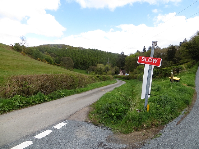
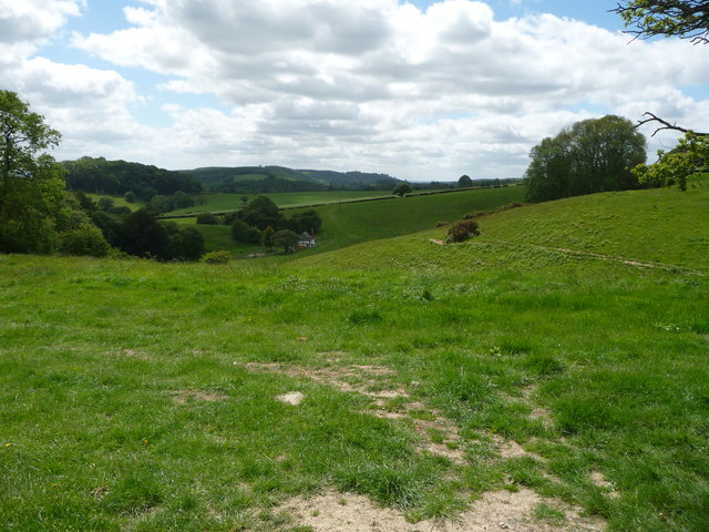
Brush Wood is a small woodland located in Herefordshire, England. It is situated near the village of Brush, hence its name. This woodland is known for its rich biodiversity and natural beauty, making it a popular destination for nature enthusiasts and hikers.

Covering an area of approximately 50 acres, Brush Wood is predominantly composed of deciduous trees such as oak, beech, and birch. The dense canopy provides a habitat for a wide variety of wildlife, including birds, mammals, and insects. It is not uncommon to spot species such as deer, foxes, and squirrels roaming through the woodland.

The woodland is crisscrossed by several footpaths and trails, allowing visitors to explore its enchanting surroundings. These paths wind through the thick undergrowth, passing by babbling brooks and small ponds. From these vantage points, visitors can often observe ducks, herons, and other waterfowl enjoying the tranquil waters.

Brush Wood is managed by the local conservation authority, ensuring the preservation of its natural habitat. In recent years, efforts have been made to enhance the biodiversity of the woodland by planting native wildflowers and supporting the growth of rare plant species.

This woodland offers a peaceful retreat away from the hustle and bustle of modern life, providing a serene environment for relaxation and contemplation. Whether it's a leisurely walk, birdwatching, or simply enjoying the beauty of nature, Brush Wood is a delightful destination for all nature lovers.

If you have any feedback on the listing, please let us know in the comments section below.
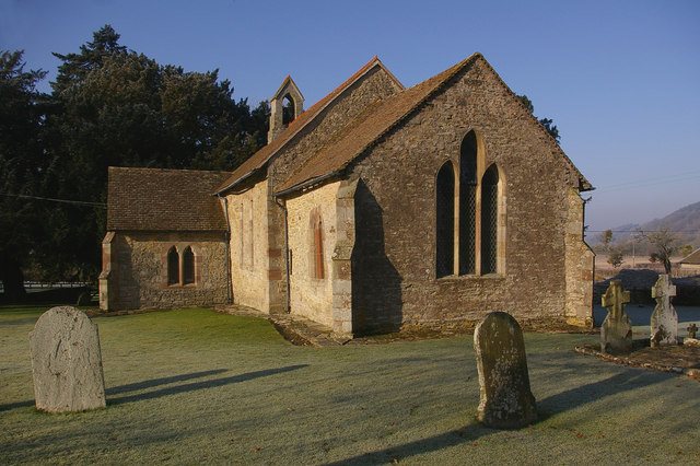
Brush Wood Images

Images are sourced within 2km of 52.335041/-2.7767135 or Grid Reference SO4771. Thanks to Geograph Open Source API. All images are credited.

Farm track near Richard's Castle In valleys of springs of rivers,
           By Onny and Teme and Clun,
          The country for easy livers,
           The quietest under the sun.

Excerpt from 'A Shropshire Lad' by AE Housman
Farm track near Richard's Castle
In valleys of springs of rivers, By Onny and Teme and Clun, The country for easy livers, The quietest under the sun. Excerpt from 'A Shropshire Lad' by AE Housman
Lane and footpath near Richard's Castle A waymarker sits between lanes at the junction point.
Lane and footpath near Richard's Castle
A waymarker sits between lanes at the junction point.
The Goggin A road follows a scenic valley up the dip side of the big limestone ridge. The scarp side, Killhorse Lane is not so forgiving.
The Goggin
A road follows a scenic valley up the dip side of the big limestone ridge. The scarp side, Killhorse Lane is not so forgiving.
The Goggin View uphill.  There is a string of small cottages along the road as it ascends the pass.
The Goggin
View uphill. There is a string of small cottages along the road as it ascends the pass.
The Goggin Goggin Copse - off the beaten track
The Goggin
Goggin Copse - off the beaten track
Valley to the east of High Cullis This was taken looking west towards Oldfield Farm from about SO469696
Valley to the east of High Cullis
This was taken looking west towards Oldfield Farm from about SO469696
A long field A very much unimproved field off Woodhouse Lane. Sheep pasture in a long strip.
A long field
A very much unimproved field off Woodhouse Lane. Sheep pasture in a long strip.
Woodhouse Lane Single track road from Richard's Castle to the Goggin.
Woodhouse Lane
Single track road from Richard's Castle to the Goggin.
Brightall Common Woodland off the Goggin road. I can remember this being an open bracken covered hillside, but like many Herefordshire commons it has reverted to woodland.
Brightall Common
Woodland off the Goggin road. I can remember this being an open bracken covered hillside, but like many Herefordshire commons it has reverted to woodland.
Richards Castle - The Rock Shown on the OS maps as Rock Farm, but the name plate says "The Rock".
Richards Castle - The Rock
Shown on the OS maps as Rock Farm, but the name plate says "The Rock".
Tower on High Vinnalls Tower on the highest point of High Vinnalls.  I'm intrigued as to how the daffodils got there - not your standard place for dumping a few bulbs!
Tower on High Vinnalls
Tower on the highest point of High Vinnalls. I'm intrigued as to how the daffodils got there - not your standard place for dumping a few bulbs!
Woodlands A farm off Killhorse Lane.
Woodlands
A farm off Killhorse Lane.
Woodlands A farm off Killhorse Lane.
Woodlands
A farm off Killhorse Lane.
Look Out Point on the High Vinnals
A sunken way outside Batchcott This is an old droveway down off Hanway Common into the village, one of many in this area.
A sunken way outside Batchcott
This is an old droveway down off Hanway Common into the village, one of many in this area.
Footpath up Hanway Common The footpath skirts large gorse bushes, where sheep and large lambs are hiding from the sun, and offers expanding views back towards Titterstone Clee.
Footpath up Hanway Common
The footpath skirts large gorse bushes, where sheep and large lambs are hiding from the sun, and offers expanding views back towards Titterstone Clee.
Rhuddshole A small and isolated cottage on the Salwey estate, one of several dotting the surrounding common. A splendid isolation on a day in May.
Rhuddshole
A small and isolated cottage on the Salwey estate, one of several dotting the surrounding common. A splendid isolation on a day in May.
The detached bell tower of the church of St. Bartholomew, Richard's Castle The detached tower is relatively rare, although there are apparently seven in Herefordshire (including this one) and dates from the late 13th century or early 14th century. It was built detached for defensive or military purposes - it could be defended against the Welsh, or other attackers and its outlook covers areas that the nearby castle did not. The tower apparently had a wooden spire, which burned down in 1800 and was replaced with a slated roof, and weathervane.
The detached bell tower of the church of St. Bartholomew, Richard's Castle
The detached tower is relatively rare, although there are apparently seven in Herefordshire (including this one) and dates from the late 13th century or early 14th century. It was built detached for defensive or military purposes - it could be defended against the Welsh, or other attackers and its outlook covers areas that the nearby castle did not. The tower apparently had a wooden spire, which burned down in 1800 and was replaced with a slated roof, and weathervane.
Show me another place!

Brush Wood is located at Grid Ref: SO4771 (Lat: 52.335041, Lng: -2.7767135)

Unitary Authority: County of Herefordshire

Police Authority: West Mercia

What 3 Words

///overdone.poetic.giant. Near Elton, Herefordshire

Nearby Locations

Pool Plantation Brush Wood

Related Wikis

Elton, Herefordshire

Elton is a hamlet and civil parish in the far north of Herefordshire. It is situated on the Wigmore to Ludlow road. The village is northeast of Leinthall...

St Bartholomew's Church, Richard's Castle

St Bartholomew's Church is a redundant Anglican church in the village of Richard's Castle, Herefordshire, England. It is recorded in the National Heritage...

Pipe Aston

Pipe Aston is a small village and civil parish in the far north of Herefordshire, close to the border with Shropshire. It has a population of about 24...

High Vinnalls

High Vinnalls is a hill in the English county of Herefordshire, though commonly considered a member of the Shropshire Hills. It is located in the parish...

Richard's Castle

Richard's Castle is a village, castle and two civil parishes on the border of the counties of Herefordshire and Shropshire in England. The Herefordshire...

Moor Park School

Moor Park School is a coeducational preparatory day and boarding school in the village of Richard's Castle, near Ludlow, England. It educates about 300...
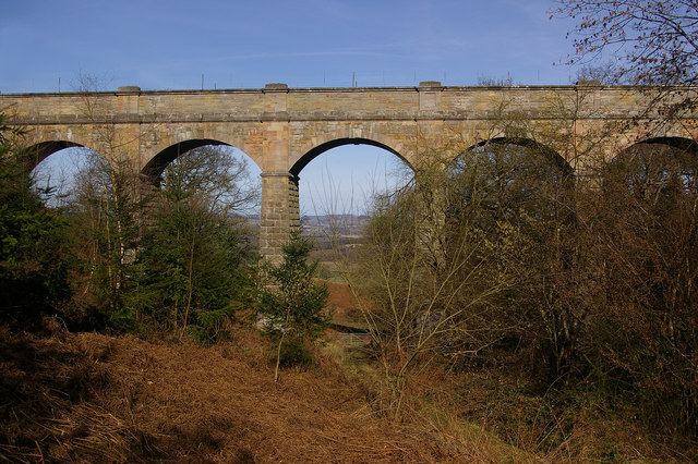
Elan aqueduct

The Elan aqueduct crosses Wales and the Midlands of England, running eastwards from the Elan Valley Reservoirs in Mid Wales to Birmingham's Frankley Reservoir...

Mortimer Forest

Mortimer Forest is a forest on the Shropshire/Herefordshire border in England, near the town of Ludlow. It covers hilly terrain, including the marilyn...

Nearby Amenities

Located within 500m of 52.335041,-2.7767135
Ele: 330
Natural: peak
Lat/Long: 52.3370775/-2.7724888
The data included in this document is from www.openstreetmap.org. The data is made available under ODbL.

Have you been to Brush Wood?

Leave your review of Brush Wood below (or comments, questions and feedback).