Bringewood

Wood, Forest in Herefordshire

England

Bringewood

Track near Mary Knoll An ancient hunting forest on the Ludlow Anticlyne. Traditionally an oak forest, coppiced for charcoal it is now a commercial conifer wood. It is managed, but not entirely owned by the Forestry Commission.
The charcoal used to supply the iron smelters at Bringewood Forge.
Since the late 1970s the forest has been opened up to recreational use and is now quite busy, with a dense path network. 
The forest carries a large herd of fallow deer including the long haired variety supposedly unique to Haye Park.
Track near Mary Knoll Credit: N Chadwick

Bringewood is a small village located in the county of Herefordshire, England. Situated amidst the picturesque countryside, Bringewood is renowned for its abundant woodlands and lush forests, making it a haven for nature enthusiasts and outdoor adventurers.

The village is nestled within the expansive Bringewood Chase, a designated Area of Outstanding Natural Beauty. The landscape is characterized by rolling hills, dense woodlands, and meandering streams, creating a serene and tranquil atmosphere. The area is home to a diverse range of flora and fauna, including ancient oak trees, wildflowers, and various species of birds and mammals.

Bringewood offers a plethora of outdoor activities for visitors to enjoy. Hiking and walking trails crisscross the surrounding forests, offering breathtaking views and opportunities to spot wildlife. Cyclists can also explore the area on the numerous off-road tracks and trails. Additionally, Bringewood is a popular destination for horse riding, with several equestrian paths available for riders of all levels.

The village itself is small, with a close-knit community. It boasts a handful of historic buildings, including a charming parish church and a traditional village pub, where locals and tourists can enjoy a drink and traditional English cuisine. Despite its rural setting, Bringewood is well-connected to nearby towns and cities, making it easily accessible for day trips or longer stays.

In summary, Bringewood is a picturesque village in Herefordshire, renowned for its natural beauty and abundant woodlands. It offers a range of outdoor activities and a close-knit community, making it an ideal destination for nature lovers and those seeking a peaceful retreat in the heart of the English countryside.

If you have any feedback on the listing, please let us know in the comments section below.
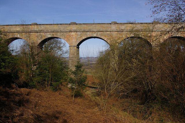
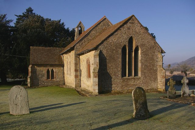
Bringewood Images

Images are sourced within 2km of 52.356981/-2.7815474 or Grid Reference SO4673. Thanks to Geograph Open Source API. All images are credited.

Track near Mary Knoll An ancient hunting forest on the Ludlow Anticlyne. Traditionally an oak forest, coppiced for charcoal it is now a commercial conifer wood. It is managed, but not entirely owned by the Forestry Commission.
The charcoal used to supply the iron smelters at Bringewood Forge.
Since the late 1970s the forest has been opened up to recreational use and is now quite busy, with a dense path network. 
The forest carries a large herd of fallow deer including the long haired variety supposedly unique to Haye Park.
Track near Mary Knoll
An ancient hunting forest on the Ludlow Anticlyne. Traditionally an oak forest, coppiced for charcoal it is now a commercial conifer wood. It is managed, but not entirely owned by the Forestry Commission. The charcoal used to supply the iron smelters at Bringewood Forge. Since the late 1970s the forest has been opened up to recreational use and is now quite busy, with a dense path network. The forest carries a large herd of fallow deer including the long haired variety supposedly unique to Haye Park.
Conifers, Bringewood (Mortimer Forest) An ancient hunting forest on the Ludlow Anticlyne. Traditionally an oak forest, coppiced for charcoal it is now a commercial conifer wood. It is managed, but not entirely owned by the Forestry Commission.
The charcoal used to supply the iron smelters at Bringewood Forge.
Since the late 1970s the forest has been opened up to recreational use and is now quite busy, with a dense path network. 
The forest carries a large herd of fallow deer including the long haired variety supposedly unique to Haye Park.
Conifers, Bringewood (Mortimer Forest)
An ancient hunting forest on the Ludlow Anticlyne. Traditionally an oak forest, coppiced for charcoal it is now a commercial conifer wood. It is managed, but not entirely owned by the Forestry Commission. The charcoal used to supply the iron smelters at Bringewood Forge. Since the late 1970s the forest has been opened up to recreational use and is now quite busy, with a dense path network. The forest carries a large herd of fallow deer including the long haired variety supposedly unique to Haye Park.
Mary Knoll Clearing Large open area in the middle of the forest.
Mary Knoll Clearing
Large open area in the middle of the forest.
Disused quarry, Mary Knoll An outcrop of Bringewood Beds (also known as Amystry Limestone).
Disused quarry, Mary Knoll
An outcrop of Bringewood Beds (also known as Amystry Limestone).
Bridleway, Mary Knoll An ancient hunting forest on the Ludlow Anticlyne. Traditionally an oak forest, coppiced for charcoal it is now a commercial conifer wood. It is managed, but not entirely owned by the Forestry Commission.
The charcoal used to supply the iron smelters at Bringewood Forge.
Since the late 1970s the forest has been opened up to recreational use and is now quite busy, with a dense path network. 
The forest carries a large herd of fallow deer including the long haired variety supposedly unique to Haye Park.
Bridleway, Mary Knoll
An ancient hunting forest on the Ludlow Anticlyne. Traditionally an oak forest, coppiced for charcoal it is now a commercial conifer wood. It is managed, but not entirely owned by the Forestry Commission. The charcoal used to supply the iron smelters at Bringewood Forge. Since the late 1970s the forest has been opened up to recreational use and is now quite busy, with a dense path network. The forest carries a large herd of fallow deer including the long haired variety supposedly unique to Haye Park.
An edge of the Bringewood (Mortimer) Forest, near Mary Knoll An ancient hunting forest on the Ludlow Anticlyne. Traditionally an oak forest, coppiced for charcoal it is now a commercial conifer wood. It is managed, but not entirely owned by the Forestry Commission.
The charcoal used to supply the iron smelters at Bringewood Forge.
Since the late 1970s the forest has been opened up to recreational use and is now quite busy, with a dense path network. 
The forest carries a large herd of fallow deer including the long haired variety supposedly unique to Haye Park.
An edge of the Bringewood (Mortimer) Forest, near Mary Knoll
An ancient hunting forest on the Ludlow Anticlyne. Traditionally an oak forest, coppiced for charcoal it is now a commercial conifer wood. It is managed, but not entirely owned by the Forestry Commission. The charcoal used to supply the iron smelters at Bringewood Forge. Since the late 1970s the forest has been opened up to recreational use and is now quite busy, with a dense path network. The forest carries a large herd of fallow deer including the long haired variety supposedly unique to Haye Park.
Barn near Mary Knoll House
Mary Knoll House
Mary Knoll House
Whitcliffe Rd
Whitcliffe Rd
Whitcliffe Rd to Gorsty
Gates to Mary Knoll House
Whitecliffe Rd Approaching the top of the climb out of Ludlow.
Whitecliffe Rd
Approaching the top of the climb out of Ludlow.
Gorsty Farm By the Whitcliffe Rd.
Gorsty Farm
By the Whitcliffe Rd.
Footpath off Whitcliffe Rd near Gorsty The Mortimer Forest is the name given to the remnant of a Saxon Hunting forest on the Shropshire / Herefordshire border near Ludlow (Bringewood Forest). It is owned and managed by the Forestry Commission, who invented the name. The forest has car parks, information boards and trails.  The underlying rocks are Upper Silurian and the forest is the type site for these rocks (the Ludlovian).
Footpath off Whitcliffe Rd near Gorsty
The Mortimer Forest is the name given to the remnant of a Saxon Hunting forest on the Shropshire / Herefordshire border near Ludlow (Bringewood Forest). It is owned and managed by the Forestry Commission, who invented the name. The forest has car parks, information boards and trails. The underlying rocks are Upper Silurian and the forest is the type site for these rocks (the Ludlovian).
Footpath to Monstay Farm The Mortimer Forest is the name given to the remnant of a Saxon Hunting forest on the Shropshire / Herefordshire border near Ludlow (Bringewood Forest). It is owned and managed by the Forestry Commission, who invented the name. The forest has car parks, information boards and trails.  The underlying rocks are Upper Silurian and the forest is the type site for these rocks (the Ludlovian).
Footpath to Monstay Farm
The Mortimer Forest is the name given to the remnant of a Saxon Hunting forest on the Shropshire / Herefordshire border near Ludlow (Bringewood Forest). It is owned and managed by the Forestry Commission, who invented the name. The forest has car parks, information boards and trails. The underlying rocks are Upper Silurian and the forest is the type site for these rocks (the Ludlovian).
Disused quarry, Mortimer Forest Quarry into the Elton Beds.
Disused quarry, Mortimer Forest
Quarry into the Elton Beds.
Forestry Track, Mortimer Forest The Mortimer Forest is the name given to the remnant of a Saxon Hunting forest on the Shropshire / Herefordshire border near Ludlow (Bringewood Forest). It is owned and managed by the Forestry Commission, who invented the name. The forest has car parks, information boards and trails.  The underlying rocks are Upper Silurian and the forest is the type site for these rocks (the Ludlovian).
Forestry Track, Mortimer Forest
The Mortimer Forest is the name given to the remnant of a Saxon Hunting forest on the Shropshire / Herefordshire border near Ludlow (Bringewood Forest). It is owned and managed by the Forestry Commission, who invented the name. The forest has car parks, information boards and trails. The underlying rocks are Upper Silurian and the forest is the type site for these rocks (the Ludlovian).
Conifers, Mortimer Forest The Mortimer Forest is the name given to the remnant of a Saxon Hunting forest on the Shropshire / Herefordshire border near Ludlow (Bringewood Forest). It is owned and managed by the Forestry Commission, who invented the name. The forest has car parks, information boards and trails.  The underlying rocks are Upper Silurian and the forest is the type site for these rocks (the Ludlovian).
Conifers, Mortimer Forest
The Mortimer Forest is the name given to the remnant of a Saxon Hunting forest on the Shropshire / Herefordshire border near Ludlow (Bringewood Forest). It is owned and managed by the Forestry Commission, who invented the name. The forest has car parks, information boards and trails. The underlying rocks are Upper Silurian and the forest is the type site for these rocks (the Ludlovian).
Show me another place!

Bringewood is located at Grid Ref: SO4673 (Lat: 52.356981, Lng: -2.7815474)

Unitary Authority: County of Herefordshire

Police Authority: West Mercia

What 3 Words

///allows.offstage.onlookers. Near Burrington, Herefordshire

Nearby Locations

Deep Wood Bringewood

Related Wikis

Elan aqueduct

The Elan aqueduct crosses Wales and the Midlands of England, running eastwards from the Elan Valley Reservoirs in Mid Wales to Birmingham's Frankley Reservoir...

Mortimer Forest

Mortimer Forest is a forest on the Shropshire/Herefordshire border in England, near the town of Ludlow. It covers hilly terrain, including the marilyn...

High Vinnalls

High Vinnalls is a hill in the English county of Herefordshire, though commonly considered a member of the Shropshire Hills. It is located in the parish...

Pipe Aston

Pipe Aston is a small village and civil parish in the far north of Herefordshire, close to the border with Shropshire. It has a population of about 24...

Nearby Amenities

Located within 500m of 52.356981,-2.7815474
Bringewood Hill
Ele: 363
Man Made: survey_point
Natural: peak
Lat/Long: 52.3568027/-2.781061
Man Made: manhole
Manhole: water
Lat/Long: 52.3612861/-2.7818911
The data included in this document is from www.openstreetmap.org. The data is made available under ODbL.

Have you been to Bringewood?

Leave your review of Bringewood below (or comments, questions and feedback).