Alcaston Coppice

Wood, Forest in Shropshire

England

Alcaston Coppice

Lane near Callow Hill
Lane near Callow Hill Credit: Mat Fascione

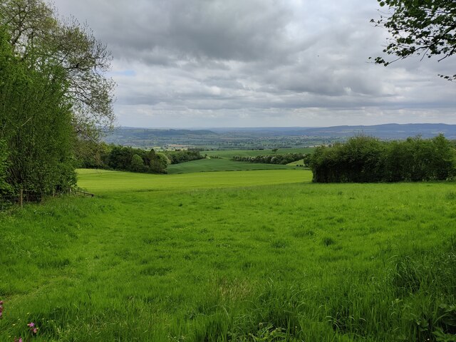
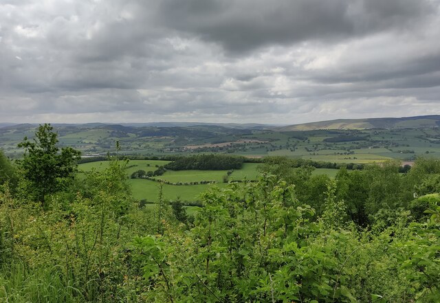
Alcaston Coppice is a picturesque woodland located in the county of Shropshire, England. Covering an area of approximately 50 acres, it is known for its natural beauty and diverse range of flora and fauna. The coppice is situated on the outskirts of the village of Alcaston, nestled in the rolling hills of the Shropshire countryside.

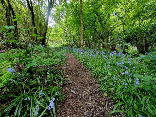
The woodland is predominantly made up of deciduous trees such as oak, birch, and beech, which provide a stunning display of colors during the autumn months. The dense canopy of the trees creates a tranquil and shady environment, making it an ideal destination for nature lovers and outdoor enthusiasts.

Alcaston Coppice is home to a wide variety of wildlife, including birds, mammals, and insects. Birdwatchers can spot species such as woodpeckers, owls, and various songbirds. The woodland also provides a habitat for small mammals like squirrels and rabbits, as well as a diverse range of insects, including butterflies and dragonflies.

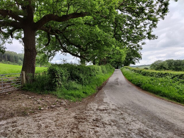
Visitors to Alcaston Coppice can explore the woodland through a network of well-maintained footpaths and trails. These paths lead through the heart of the woodland, offering stunning vistas and opportunities for peaceful walks and picnics. The beauty and tranquility of the coppice make it a popular destination for nature photography and nature study.

Overall, Alcaston Coppice is a hidden gem in the Shropshire countryside, providing a beautiful and serene escape for those seeking to connect with nature.

If you have any feedback on the listing, please let us know in the comments section below.

Alcaston Coppice Images

Images are sourced within 2km of 52.477363/-2.788067 or Grid Reference SO4686. Thanks to Geograph Open Source API. All images are credited.

Lane near Callow Hill
Woodland at Callow Hill Callow Hill, 336m (1,102 ft), is the highest point of Wenlock Edge, Flounders' Folly is a tower on the summit.
Woodland at Callow Hill
Callow Hill, 336m (1,102 ft), is the highest point of Wenlock Edge, Flounders' Folly is a tower on the summit.
Track and bridleway at Callow Hill Callow Hill, 336m (1,102 ft), is the highest point of Wenlock Edge, Flounders' Folly is a tower on the summit.
Track and bridleway at Callow Hill
Callow Hill, 336m (1,102 ft), is the highest point of Wenlock Edge, Flounders' Folly is a tower on the summit.
Path through Frizland Coppice at Callow Hill
Corve Dale viewed from Callow Hill Callow Hill, 336m (1,102 ft), is the highest point of Wenlock Edge, Flounders' Folly is a tower on the summit.
Corve Dale is the valley formed by the River Corve, it lies between Wenlock Edge and the Clee Hills in Shropshire.
Corve Dale viewed from Callow Hill
Callow Hill, 336m (1,102 ft), is the highest point of Wenlock Edge, Flounders' Folly is a tower on the summit. Corve Dale is the valley formed by the River Corve, it lies between Wenlock Edge and the Clee Hills in Shropshire.
Flounders' Folly on Callow Hill Callow Hill, 336m (1,102 ft), is the highest point of Wenlock Edge.
Flounders' Folly is a tower on the summit of Callow Hill, it is 80 feet (24 m) tall and 16 feet (4.9 m) square. It was built in 1838 by Benjamin Flounders (1768–1846), an industrial entrepreneur and philanthropic Yorkshireman. It has had several owners down the years, and was owned for a time by the actress Julie Christie. It is now owned by the Flounders Folly Trust and is occasionally open to the public.
Flounders' Folly on Callow Hill
Callow Hill, 336m (1,102 ft), is the highest point of Wenlock Edge. Flounders' Folly is a tower on the summit of Callow Hill, it is 80 feet (24 m) tall and 16 feet (4.9 m) square. It was built in 1838 by Benjamin Flounders (1768–1846), an industrial entrepreneur and philanthropic Yorkshireman. It has had several owners down the years, and was owned for a time by the actress Julie Christie. It is now owned by the Flounders Folly Trust and is occasionally open to the public.
Wenlock Edge viewed from Callow Hill Callow Hill, 336m (1,102 ft), is the highest point of Wenlock Edge, Flounders' Folly is a tower on the summit.
Wenlock Edge viewed from Callow Hill
Callow Hill, 336m (1,102 ft), is the highest point of Wenlock Edge, Flounders' Folly is a tower on the summit.
Flounders' Folly on Callow Hill Callow Hill, 336m (1,102 ft), is the highest point of Wenlock Edge.
Flounders' Folly is a tower on the summit of Callow Hill, it is 80 feet (24 m) tall and 16 feet (4.9 m) square. It was built in 1838 by Benjamin Flounders (1768–1846), an industrial entrepreneur and philanthropic Yorkshireman. It has had several owners down the years, and was owned for a time by the actress Julie Christie. It is now owned by the Flounders Folly Trust and is occasionally open to the public.
Flounders' Folly on Callow Hill
Callow Hill, 336m (1,102 ft), is the highest point of Wenlock Edge. Flounders' Folly is a tower on the summit of Callow Hill, it is 80 feet (24 m) tall and 16 feet (4.9 m) square. It was built in 1838 by Benjamin Flounders (1768–1846), an industrial entrepreneur and philanthropic Yorkshireman. It has had several owners down the years, and was owned for a time by the actress Julie Christie. It is now owned by the Flounders Folly Trust and is occasionally open to the public.
Trees on Callow Hill Callow Hill, 336m (1,102 ft), is the highest point of Wenlock Edge.
Trees on Callow Hill
Callow Hill, 336m (1,102 ft), is the highest point of Wenlock Edge.
Track and bridleway at Callow Hill Callow Hill, 336m (1,102 ft), is the highest point of Wenlock Edge, Flounders' Folly is a tower on the summit.
Track and bridleway at Callow Hill
Callow Hill, 336m (1,102 ft), is the highest point of Wenlock Edge, Flounders' Folly is a tower on the summit.
Dead tree below Flounders Folly On the west side of Callow Hill, the highest point of Wenlock Edge.
Dead tree below Flounders Folly
On the west side of Callow Hill, the highest point of Wenlock Edge.
Moorwood farmland About 215 metres above sea level.
Moorwood farmland
About 215 metres above sea level.
Road junction, near Moorwood The lane heading left [west] at the grass triangle continues past Moorwood House as a bridleway and in the 1880s led to quarries and a limekiln. The lane going right [north-east] heads to Westhope.
Road junction, near Moorwood
The lane heading left [west] at the grass triangle continues past Moorwood House as a bridleway and in the 1880s led to quarries and a limekiln. The lane going right [north-east] heads to Westhope.
Small car park at Harton Hollow Nature Reserve Wenlock Edge was formed 425 million years ago as a coral reef in a shallow sea. The thickly wooded limestone escarpment stretches in an unbroken line for 18 miles (30 km) between Ironbridge and Craven Arms in Shropshire.
Small car park at Harton Hollow Nature Reserve
Wenlock Edge was formed 425 million years ago as a coral reef in a shallow sea. The thickly wooded limestone escarpment stretches in an unbroken line for 18 miles (30 km) between Ironbridge and Craven Arms in Shropshire.
Picnic area next to the car park At the Harton Hollow Nature Reserve.
Picnic area next to the car park
At the Harton Hollow Nature Reserve.
Farmland next to the Harton Hollow Nature Reserve
Countryside view near Wenlock Edge Looking east from the picnic area at the Harton Hollow Nature Reserve, on the horizon is Brown Clee Hill, about 7 miles away.
Countryside view near Wenlock Edge
Looking east from the picnic area at the Harton Hollow Nature Reserve, on the horizon is Brown Clee Hill, about 7 miles away.
Information board at Harton Hollow Nature Reserve Wenlock Edge was formed 425 million years ago as a coral reef in a shallow sea. The thickly wooded limestone escarpment stretches in an unbroken line for 18 miles (30 km) between Ironbridge and Craven Arms in Shropshire.
Information board at Harton Hollow Nature Reserve
Wenlock Edge was formed 425 million years ago as a coral reef in a shallow sea. The thickly wooded limestone escarpment stretches in an unbroken line for 18 miles (30 km) between Ironbridge and Craven Arms in Shropshire.
Show me another place!

Alcaston Coppice is located at Grid Ref: SO4686 (Lat: 52.477363, Lng: -2.788067)

Unitary Authority: Shropshire

Police Authority: West Mercia

What 3 Words

///chairs.surpasses.fluid. Near Craven Arms, Shropshire

Related Wikis

Westhope, Shropshire

Westhope is a small village in Shropshire, England. == History == Historically, the manor of Westhope was centred by a house to the east of the church...

Alcaston

Alcaston is a village in Shropshire, England. == See also == Listed buildings in Acton Scott == External links == Media related to Alcaston at Wikimedia...
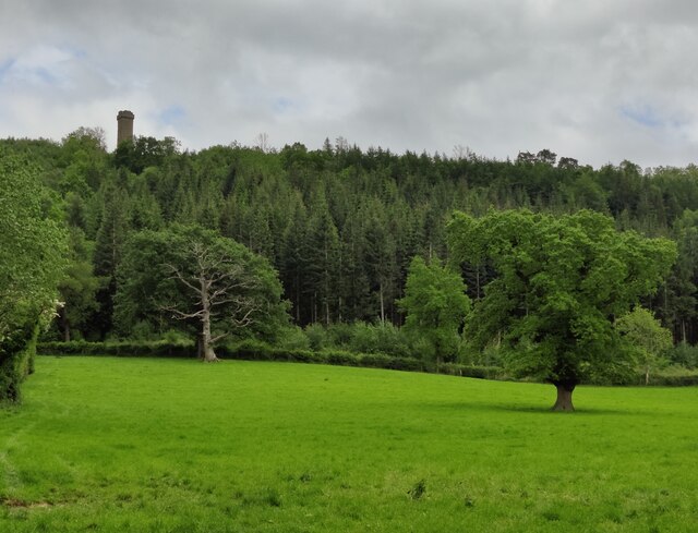
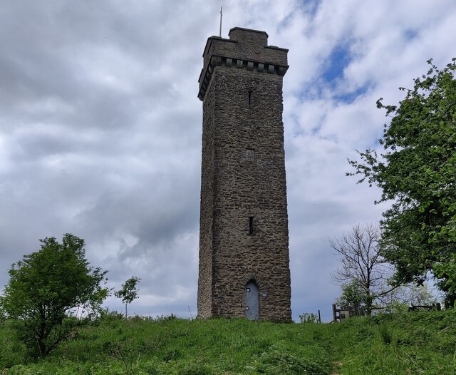
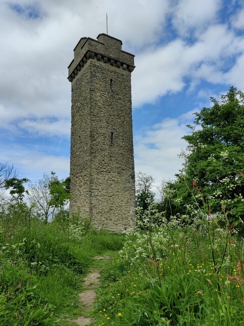
Flounders' Folly

Flounders' Folly is a tower, built in 1838, on Callow Hill, near Craven Arms at the western end of Wenlock Edge in Shropshire, England. The tower is approximately...

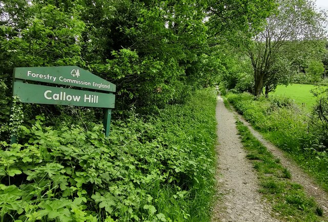
Callow Hill, Shropshire

Callow Hill is a hill near the village of Lower Dinchope between Craven Arms and Ludlow in the English county of Shropshire. Its summit marks the highest...

Have you been to Alcaston Coppice?

Leave your review of Alcaston Coppice below (or comments, questions and feedback).