Coldwaltham

Settlement in Sussex Horsham

England

Coldwaltham

Pondweed on the north side of Amberley Wild Brooks
Pondweed on the north side of Amberley Wild Brooks Credit: Ian Cunliffe

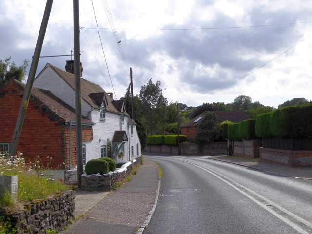
Coldwaltham is a small village located in West Sussex, England. Situated approximately 3 miles west of Pulborough, the village lies within the South Downs National Park. With a population of around 400 residents, it is a close-knit community that offers a tranquil and picturesque countryside setting.

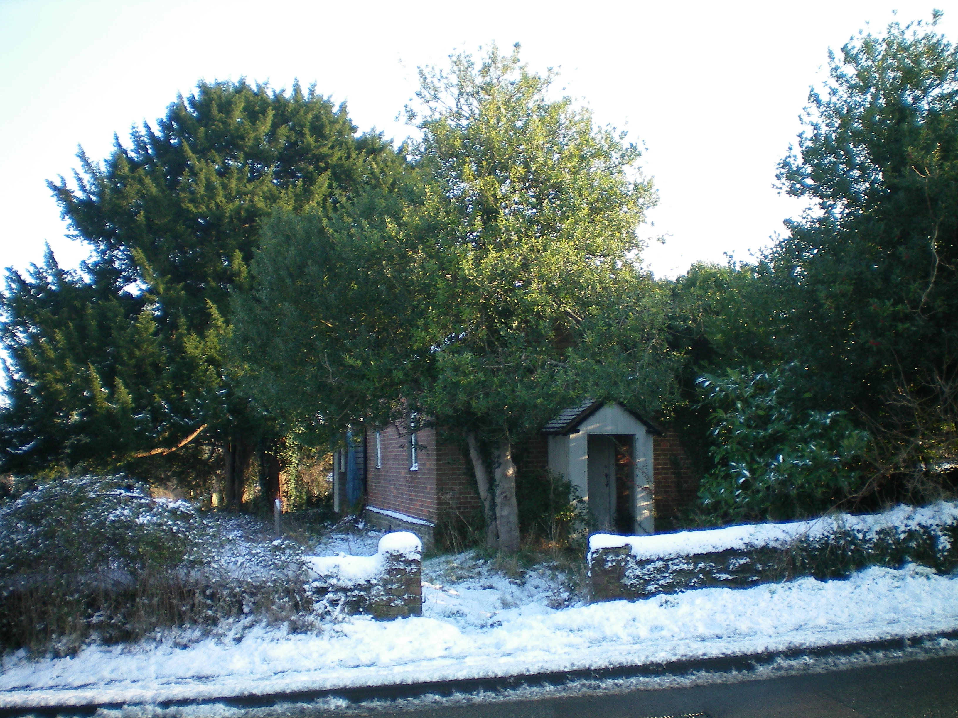
The village is characterized by its charming rural atmosphere and traditional architecture. Many of the houses are made from local materials such as flint and brick, adding to the village's unique character. The surrounding landscape is predominantly agricultural, with rolling hills and fertile farmland stretching as far as the eye can see.

Despite its small size, Coldwaltham boasts a range of amenities to cater to its residents. These include a village hall, a primary school, and a local pub that serves as a hub for social gatherings. The village also benefits from good transport links, with regular bus services connecting it to nearby towns and villages.

Nature enthusiasts will find plenty to explore in Coldwaltham and its surroundings. The village is surrounded by beautiful countryside, offering opportunities for scenic walks, cycling, and horse riding. The nearby Pulborough Brooks nature reserve is a haven for birdwatchers, with its diverse range of avian species and tranquil wetland habitats.

In conclusion, Coldwaltham is a peaceful and picturesque village nestled in the heart of West Sussex. With its idyllic countryside setting, friendly community, and convenient amenities, it provides a charming place to live or visit for those seeking a rural escape.

If you have any feedback on the listing, please let us know in the comments section below.
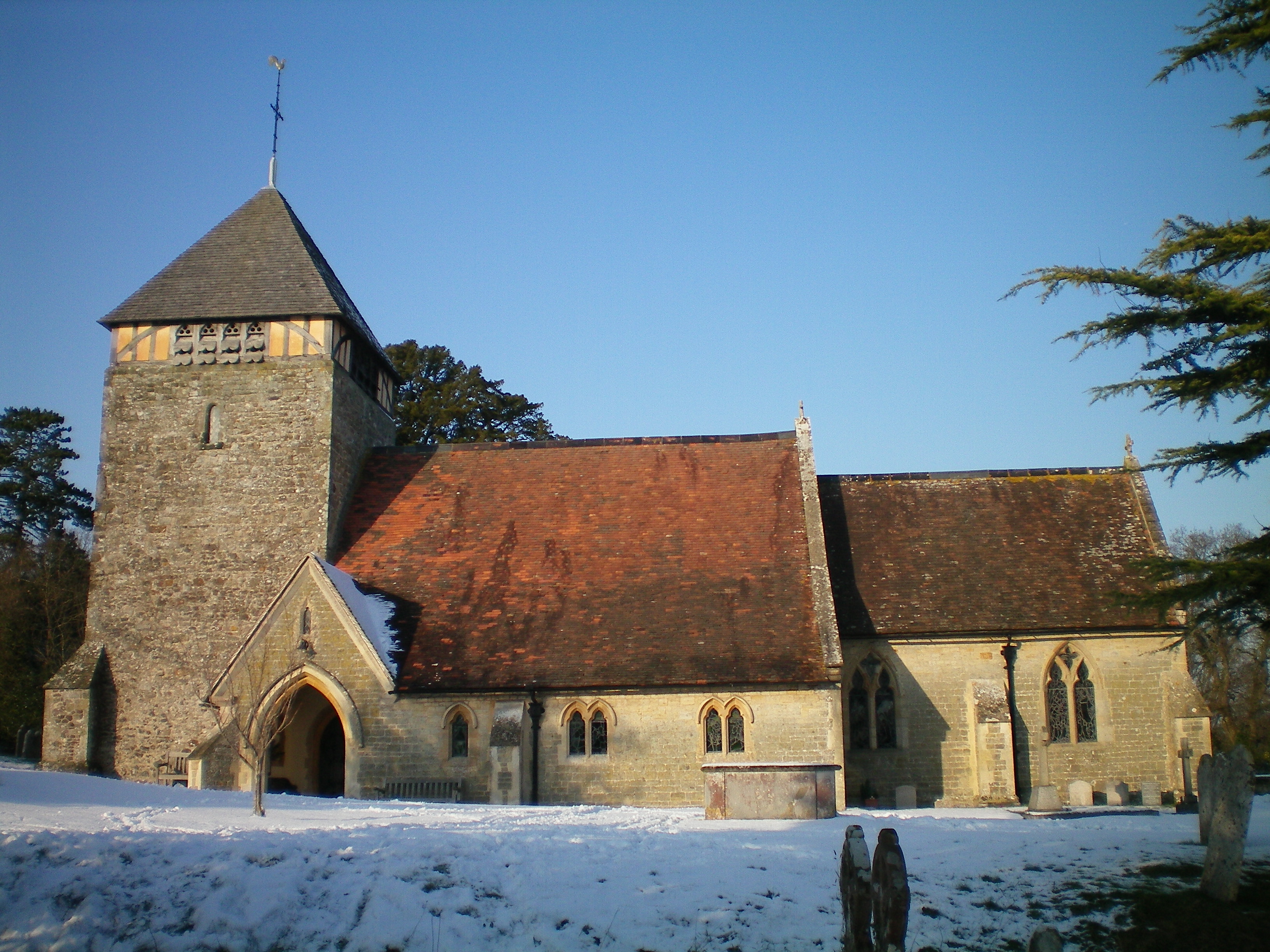
Coldwaltham Images

Images are sourced within 2km of 50.935766/-0.546069 or Grid Reference TQ0216. Thanks to Geograph Open Source API. All images are credited.

Pondweed on the north side of Amberley Wild Brooks
Footbridge carrying the Wey-South Path over a drainage ditch The vegetation hereabouts was exceptionally lush, and the path was overgrown. I'm not sure whether this is a consequence of the prolonged heat and sunshine. I've noticed it in other damp places too.
Footbridge carrying the Wey-South Path over a drainage ditch
The vegetation hereabouts was exceptionally lush, and the path was overgrown. I'm not sure whether this is a consequence of the prolonged heat and sunshine. I've noticed it in other damp places too.
Ditch in Amberley Wild Brooks
Dock leaves These were very large leaves - c 60 cm in length. I assume this is a species of dock.
Dock leaves
These were very large leaves - c 60 cm in length. I assume this is a species of dock.
Isolated phone box near Greatham
Tree-lined road leading to Greatham Bridge
Greatham Bridge over River Arun
River Arun from Greatham Bridge
Reeds by the River Arun seen from Greatham Bridge There is a small raised bank to protect the surrounding fields when the water is high
Reeds by the River Arun seen from Greatham Bridge
There is a small raised bank to protect the surrounding fields when the water is high
Bus shelter by A29 in Coldwaltham
London Road, Watersfield
River Lane, Watersfield
Ditches in the Arun Valley
Rough grazing, Arun Valley
Farm building
Farm building
Amberley Wild Brooks
Arun Vale, Coldwaltham
Show me another place!

Coldwaltham is located at Grid Ref: TQ0216 (Lat: 50.935766, Lng: -0.546069)

Administrative County: West Sussex

District: Horsham

Police Authority: Sussex

What 3 Words

///inkjet.cools.sprain. Near Pulborough, West Sussex

Nearby Locations

Coldwaltham

Related Wikis

Coldwaltham

Coldwaltham is a village and civil parish in the Horsham District of West Sussex, England. It is divided in two by the A29 road and lies 2.4 miles (3.9...
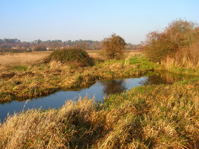
Waltham Brooks

Waltham Brooks is a 47.4-hectare (117-acre) biological Site of Special Scientific Interest south-west of Pulborough in West Sussex. It is owned and managed...

Watersfield

Watersfield is a hamlet in the Horsham District of West Sussex, England. It lies on the A29 road 3.1 miles (5 km) southwest of Pulborough. At the 2011...

Hardham Priory

Hardham Priory was an Augustinian priory in Hardham, West Sussex, England. It was founded around 1248 by Sir William Dawtrey as a priory of Black Canons...

River Rother, West Sussex

The River Rother flows from Empshott in Hampshire, England, to Stopham in West Sussex, where it joins the River Arun. At 52 kilometres (32 mi) long, most...

Greatham, West Sussex

Greatham ( GRET-əm) is a small village and former civil parish, now in the parish of Parham, in the Horsham district of West Sussex, England. It lies on...

Greatham Church

Greatham Church (the dedication is unrecorded) is the Anglican parish church of the hamlet of Greatham in the district of Horsham, one of seven local government...

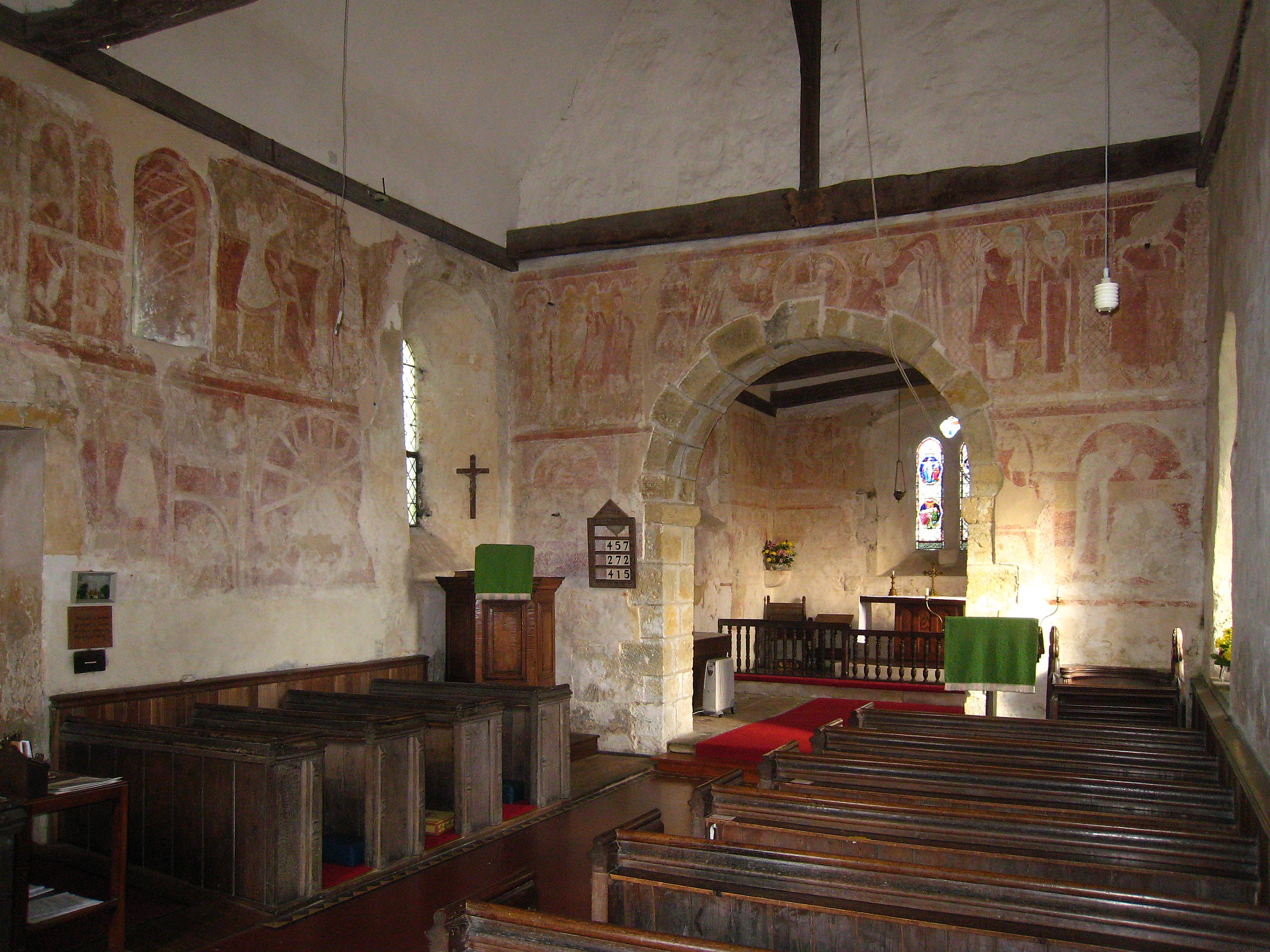
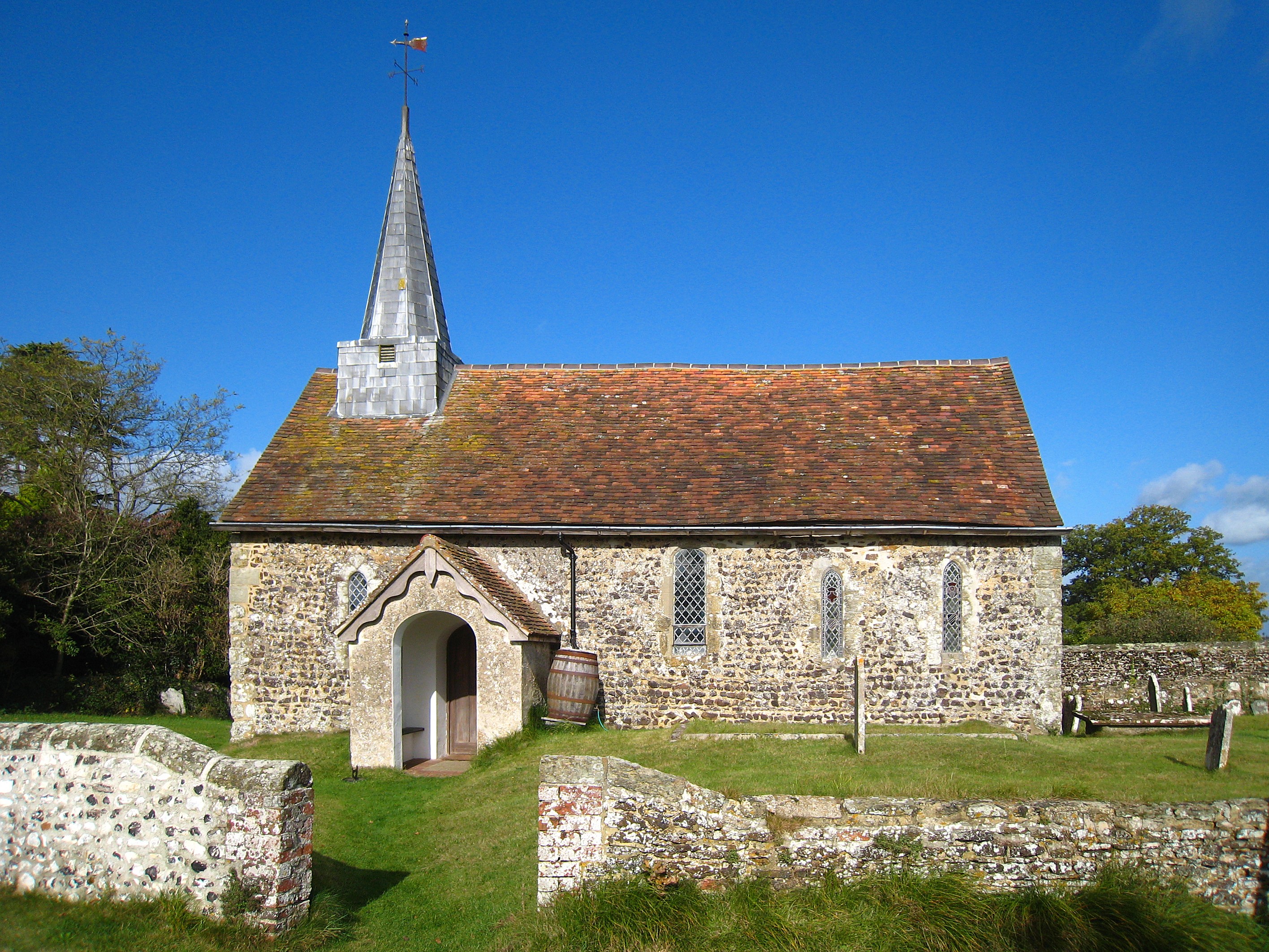
St Botolph's Church, Hardham

St Botolph's Church is the Church of England parish church of Hardham, West Sussex. It is in Horsham District and is a Grade I listed building. It contains...

Nearby Amenities

Located within 500m of 50.935766,-0.546069
Source: Landsat
Lat/Long: 50.9316435/-0.547642
Coldwaltham
Is In: West Sussex, England, UK
Place: village
Wikidata: Q2003226
Lat/Long: 50.9374664/-0.5448989
Bus Stop
A29 Arun Vale
Bus: yes
Naptan AtcoCode: 4400HR0078
Naptan Bearing: SW
Naptan BusStopType: CUS
Naptan CommonName: A29 Arun Vale
Naptan Indicator: adj Silverdale
Naptan Landmark: Silverdale
Naptan NaptanCode: wsxatjdj
Naptan Street: London Road
Naptan Verified: yes
Public Transport: platform
Seats: 2
Shelter: yes
Shelter Type: public_transport
Source: naptan_import
Lat/Long: 50.9389356/-0.5441118
Bus Stop
Church
Bus: yes
Naptan AtcoCode: 4400HR0079
Naptan Bearing: NE
Naptan BusStopType: CUS
Naptan CommonName: Church
Naptan Indicator: opp Silverdale
Naptan Landmark: Church Lane
Naptan NaptanCode: wsxatjdm
Naptan Street: London Road
Naptan Verified: yes
Public Transport: platform
Source: naptan_import
Lat/Long: 50.9388001/-0.544785
Bus Stop
Brookview
Bus: yes
Naptan AtcoCode: 4400HR0080
Naptan Bearing: SW
Naptan CommonName: Brookview
Naptan Indicator: adj Brookview
Naptan Landmark: Brookview
Naptan NaptanCode: wsxatjdp
Naptan Street: London Road
Naptan Verified: no
Public Transport: platform
Source: naptan_import
Lat/Long: 50.9364126/-0.5494994
Bus Stop
Brookview
Bus: yes
Naptan AtcoCode: 4400HR0081
Naptan Bearing: NE
Naptan CommonName: Brookview
Naptan Indicator: opp. Brookview
Naptan Landmark: Brookview
Naptan NaptanCode: wsxatjdt
Naptan Street: London Road
Naptan Verified: no
Public Transport: platform
Source: naptan_import
Lat/Long: 50.9369687/-0.5486566
Railway: crossing
Lat/Long: 50.9320503/-0.5472658
Railway: crossing
Lat/Long: 50.9320368/-0.5472207
Post Box
Brand: Royal Mail
Brand Wikidata: Q638098
Brand Wikipedia: en:Royal Mail
Collection Plate: CP7
Collection Times: Mo-Fr 16:00; Sa 09:45
Operator: Royal Mail
Operator Wikidata: Q638098
Post Box Type: lamp
Ref: RH20 53
Royal Cypher: EIIR
Royal Cypher Wikidata: Q33102113
Lat/Long: 50.9382868/-0.5453834
Post Box
Collection Plate: CP7D
Collection Times: Mo-Fr 09:00; Sa 07:00
Operator: Royal Mail
Post Box Type: lamp
Ref: RH20 385D
Royal Cypher: EIIR
Royal Cypher Wikidata: Q33102113
Lat/Long: 50.9362797/-0.5473021
The data included in this document is from www.openstreetmap.org. The data is made available under ODbL.

Have you been to Coldwaltham?

Leave your review of Coldwaltham below (or comments, questions and feedback).