Coldred

Settlement in Kent Dover

England

Coldred

Lydden County Primary School, Stonehall Road Dover District Council has raised no objection under application number DOV/21/00956 for the “demolition of existing school hall and replacement with new school hall linked to existing building, formation of new vehicular access and staff car park”
Lydden County Primary School, Stonehall Road Credit: John Baker

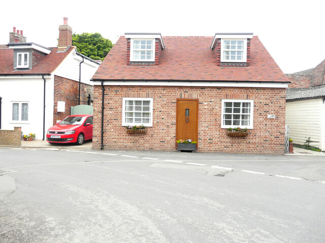
Coldred is a small village located in the district of Dover, in the county of Kent, England. Situated approximately 11 miles northwest of the town of Dover, Coldred is nestled within the picturesque landscape of the North Downs, offering its residents and visitors breathtaking views of the surrounding countryside.

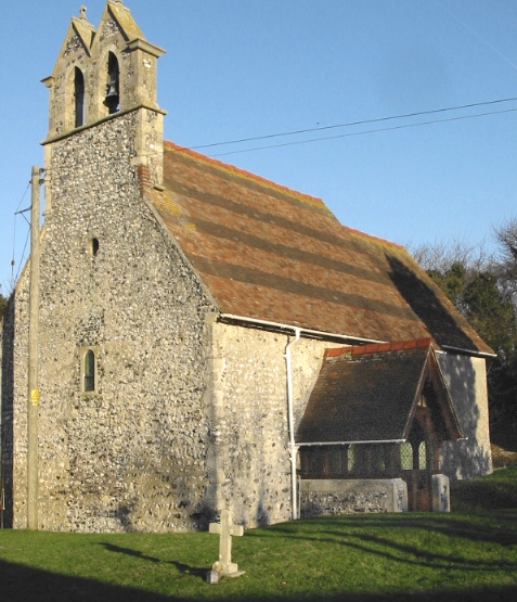
With a population of just over 200 people, Coldred is a close-knit community that exudes a peaceful and rural ambiance. The village is characterized by its charming and well-preserved historic buildings, including the beautiful St. Pancras Church, which dates back to the 12th century. The church's striking architecture and serene graveyard make it a popular spot for visitors interested in history and architecture.

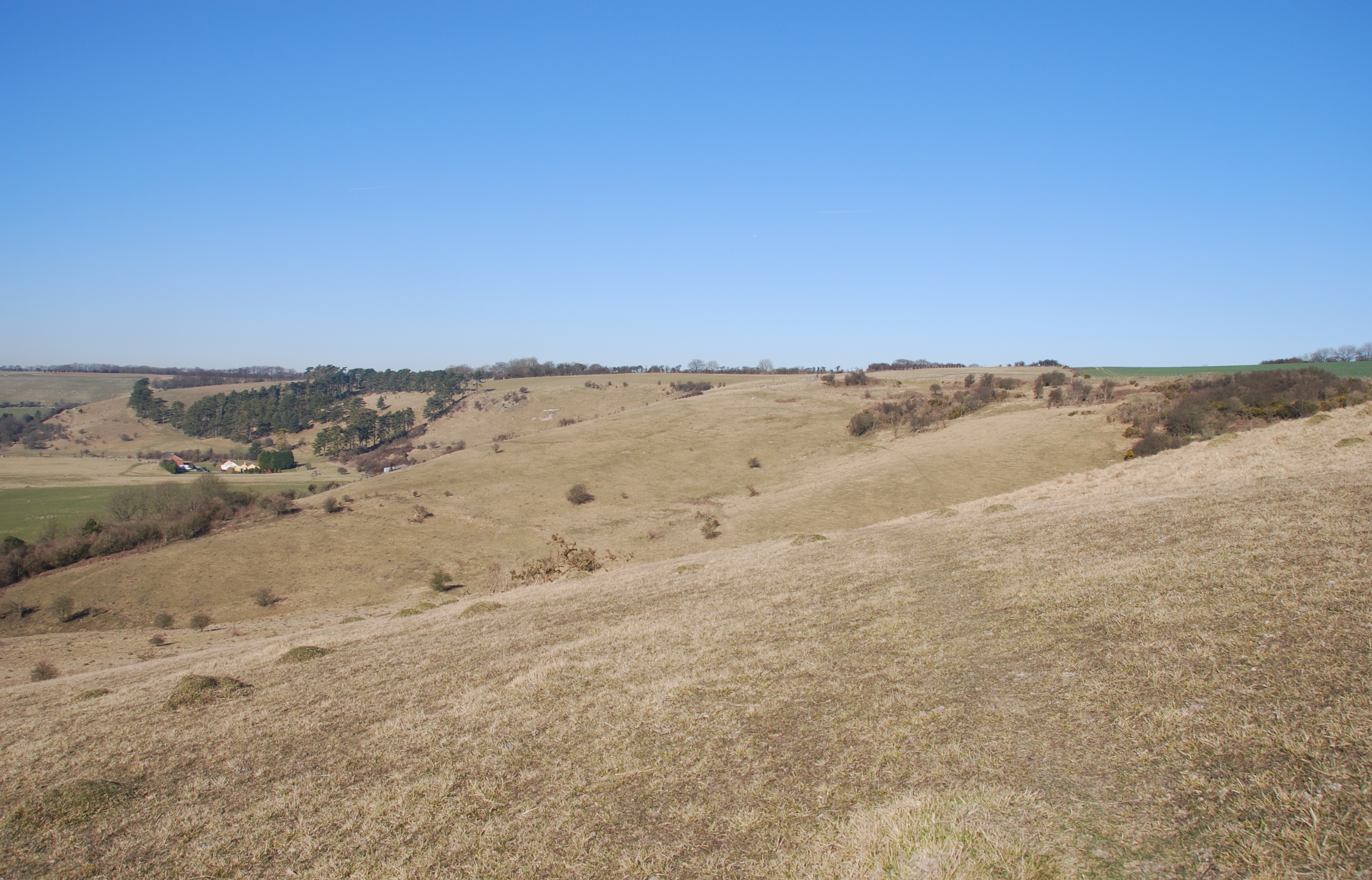
Coldred is also known for its tranquil and idyllic countryside, making it a haven for nature enthusiasts and hikers. The village is surrounded by rolling hills, woodlands, and fields, providing ample opportunities for outdoor activities such as walking, cycling, and birdwatching. The nearby North Downs Way, a long-distance footpath, passes through Coldred, attracting hikers who wish to explore the area's natural beauty.

Despite its small size, Coldred boasts a strong sense of community and offers several amenities to its residents, including a village hall that hosts various social events and activities. The village also has a local pub, providing a gathering place for locals and visitors to enjoy a drink or a meal.

Overall, Coldred is a charming and tranquil village that offers a peaceful retreat from the hustle and bustle of larger towns and cities. Its natural beauty, rich history, and tight-knit community make it an appealing destination for those seeking a slice of rural English life.

If you have any feedback on the listing, please let us know in the comments section below.

Coldred Images

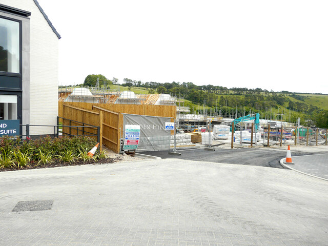
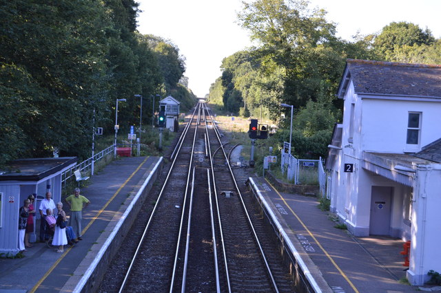
Images are sourced within 2km of 51.177814/1.249253 or Grid Reference TR2747. Thanks to Geograph Open Source API. All images are credited.

Lydden County Primary School, Stonehall Road Dover District Council has raised no objection under application number DOV/21/00956 for the “demolition of existing school hall and replacement with new school hall linked to existing building, formation of new vehicular access and staff car park”
Lydden County Primary School, Stonehall Road
Dover District Council has raised no objection under application number DOV/21/00956 for the “demolition of existing school hall and replacement with new school hall linked to existing building, formation of new vehicular access and staff car park”
House under construction, Canterbury Road Planning permission has been granted by Dover District Council under application number DOV/20/01117 for the “erection of a detached dwelling, vehicular access and associated parking”.
House under construction, Canterbury Road
Planning permission has been granted by Dover District Council under application number DOV/20/01117 for the “erection of a detached dwelling, vehicular access and associated parking”.
Entrance to Lydden Hills Lydden Hills is a housing estate off Canterbury Road, which is under construction.
Entrance to Lydden Hills
Lydden Hills is a housing estate off Canterbury Road, which is under construction.
Road to Lydden Hills Lydden Hills is a housing estate off Canterbury Road, which is under construction.
Road to Lydden Hills
Lydden Hills is a housing estate off Canterbury Road, which is under construction.
Lydden Hills Lydden Hills is a housing estate off Canterbury Road, which is under construction.
Lydden Hills
Lydden Hills is a housing estate off Canterbury Road, which is under construction.
Lydden Hills Lydden Hills is a housing estate off Canterbury Road, which is under construction.
Lydden Hills
Lydden Hills is a housing estate off Canterbury Road, which is under construction.
Trains at the East Kent Railway
Lydden’s 2021 Christmas tree <a href="https://www.geograph.org.uk/photo/6729906">TR2645 : Lydden’s 2020 Christmas tree</a> was a bit larger.
Lydden’s 2021 Christmas tree
Brett Aggregates shunter on the East Kent Railway Shepherdswell station was the southern terminus of the East Kent Light Railway. The line was constructed between 1911 and 1917 to serve the Kent Coalfields. It opened on 16th October 1916 and closed to passenger traffic on 30th October 1948. The normal practice was to run coaches into the station under gravity. Shepherdswell was the location of the engine shed and works, and a large number of sidings. 

The station reopened as part of the East Kent Railway in 1993. Trains now run from here to Eythorne – see <span class="nowrap"><a title="http://www.eastkentrailway.co.uk/" rel="nofollow ugc noopener" href="http://www.eastkentrailway.co.uk/">Link</a><img style="margin-left:2px;" alt="External link" title="External link - shift click to open in new window" src="https://s1.geograph.org.uk/img/external.png" width="10" height="10"/></span>  The shunter seen here was originally at the Brett Aggregates site at Cliffe in North Kent. It can be seen in its previous location at <a title="https://www.geograph.org.uk/photo/6438761" href="https://www.geograph.org.uk/photo/6438761">Link</a>
Brett Aggregates shunter on the East Kent Railway
Shepherdswell station was the southern terminus of the East Kent Light Railway. The line was constructed between 1911 and 1917 to serve the Kent Coalfields. It opened on 16th October 1916 and closed to passenger traffic on 30th October 1948. The normal practice was to run coaches into the station under gravity. Shepherdswell was the location of the engine shed and works, and a large number of sidings. The station reopened as part of the East Kent Railway in 1993. Trains now run from here to Eythorne – see LinkExternal link The shunter seen here was originally at the Brett Aggregates site at Cliffe in North Kent. It can be seen in its previous location at Link
83, Church Hill The house was built on the site of <a href="https://www.geograph.org.uk/photo/6548635">TR2647 : The Forge, 83, Church Hill</a>.
83, Church Hill
The house was built on the site of TR2647 : The Forge, 83, Church Hill.
Development site, Mill Lane Four 4-bedroom semi-detached houses with parking are to be constructed on the site.
Development site, Mill Lane
Four 4-bedroom semi-detached houses with parking are to be constructed on the site.
Lydden Hills Lydden Hills is a housing estate off Canterbury Road, which is under construction.

A similar view of <a href="https://www.geograph.org.uk/photo/7038916">TR2645 : Lydden Hills</a> taken in November 2021.
Lydden Hills
Lydden Hills is a housing estate off Canterbury Road, which is under construction. A similar view of TR2645 : Lydden Hills taken in November 2021.
Lydden Hills Lydden Hills is a housing estate off Canterbury Road, which is under construction.
Lydden Hills
Lydden Hills is a housing estate off Canterbury Road, which is under construction.
The Winding House, Singledge Lane The Winding House is a spectacular restoration of an old Kent coal heritage building, where weddings are held  
<span class="nowrap"><a title="https://www.akentishceremony.com/venues/the-winding-house/" rel="nofollow ugc noopener" href="https://www.akentishceremony.com/venues/the-winding-house/">Link</a><img style="margin-left:2px;" alt="External link" title="External link - shift click to open in new window" src="https://s1.geograph.org.uk/img/external.png" width="10" height="10"/></span>
The Winding House, Singledge Lane
The Winding House is a spectacular restoration of an old Kent coal heritage building, where weddings are held LinkExternal link
Hope Gardens, Canterbury Road A similar view of <a href="https://www.geograph.org.uk/photo/6585141">TR2645 : Hope Gardens, Canterbury Road</a> during the construction of some of the houses.
Hope Gardens, Canterbury Road
A similar view of TR2645 : Hope Gardens, Canterbury Road during the construction of some of the houses.
Stonehall Road The puddles along the road were the result of recent rain.
Stonehall Road
The puddles along the road were the result of recent rain.
Broadacre A cul-de-sac overlooked by a new development called <a href="https://www.geograph.org.uk/photo/7038914">TR2645 : Lydden Hills</a>. A couple of puddles on the road’s surface were the result of recent rain.
Broadacre
A cul-de-sac overlooked by a new development called TR2645 : Lydden Hills. A couple of puddles on the road’s surface were the result of recent rain.
Lydden's 2022 Christmas tree <a href="https://www.geograph.org.uk/photo/7075821">TR2645 : Lydden’s 2021 Christmas tree</a> was a bit smaller. Lying snow, along the verge, was melting due to a rise in the temperature.
Lydden's 2022 Christmas tree
TR2645 : Lydden’s 2021 Christmas tree was a bit smaller. Lying snow, along the verge, was melting due to a rise in the temperature.
Show me another place!

Coldred is located at Grid Ref: TR2747 (Lat: 51.177814, Lng: 1.249253)

Administrative County: Kent

District: Dover

Police Authority: Kent

What 3 Words

///rewriting.lowest.bandwagon. Near Shepherdswell, Kent

Nearby Locations

Coldred

Related Wikis

Coldred

Coldred is a settlement and former civil parish, now in the parish of Shepherdswell with Coldred, in the Dover district of Kent, England. The main part...

Shepherdswell with Coldred

Shepherdswell with Coldred is a civil parish in the Dover District of Kent, England. The parish contains the villages of Shepherdswell and Coldred, 1 mile...

Stonehall and Lydden Halt railway station

Stonehall and Lydden Halt railway station served the village of Lydden, Kent, England, from 1914 to 1954 on the Chatham Main Line. == History == The station...

Waldershare

Waldershare is a village near Dover in Kent, England. In 1086, the village was in the hundred of Eastry in the ancient Lathe of Eastry. By 1295 the ancient...

Shepherdswell

Shepherdswell (also Sibertswold) is a village and former civil parish, now in the parish of Shepherdswell with Coldred, in the Dover district of Kent,...

Lydden and Temple Ewell Downs

Lydden and Temple Ewell Downs is a 63.2-hectare (156-acre) biological Site of Special Scientific Interest north-west of Dover in Kent. It is a Special...

Shepherds Well railway station

Shepherds Well railway station is on the Dover branch of the Chatham Main Line in England, and serves the village of Shepherdswell, Kent. It is 71 miles...

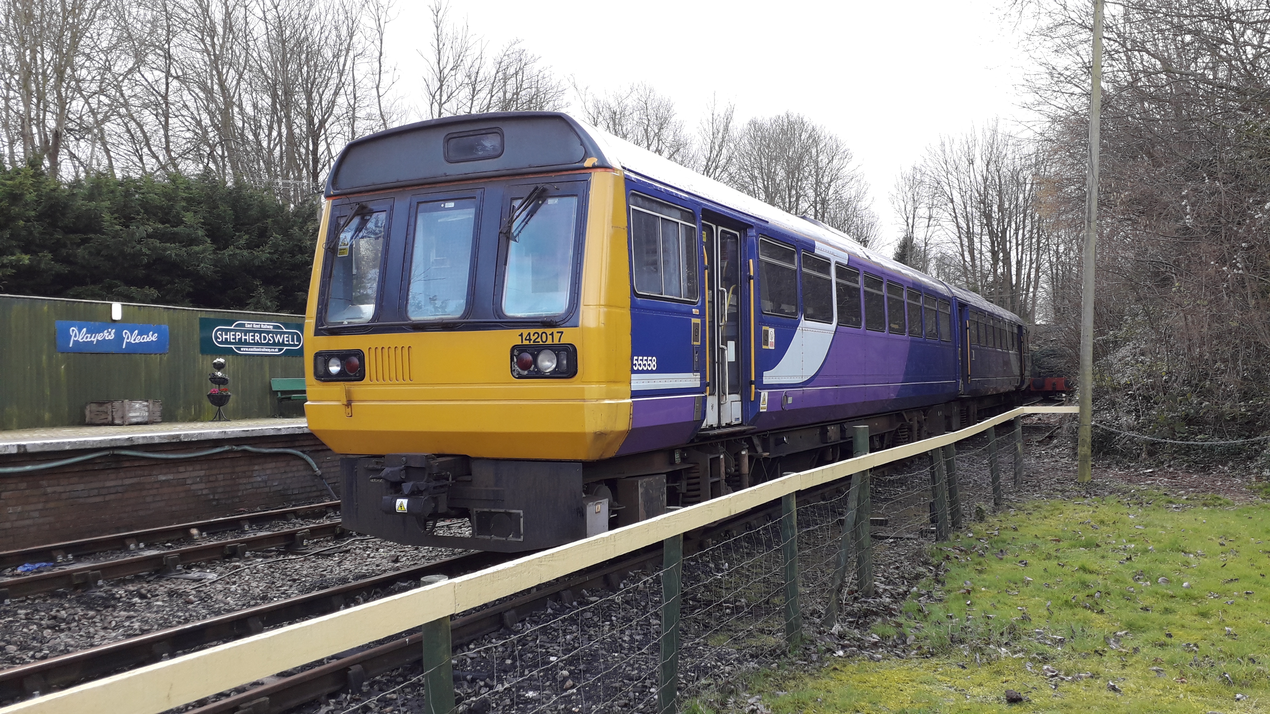
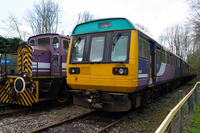
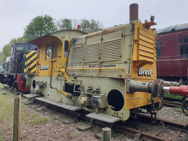
Shepherdswell railway station (EKLR)

Shepherdswell railway station is a station on the East Kent Railway. The southern terminus of the East Kent Light Railway, It opened on 16 October 1916...

Nearby Amenities

Located within 500m of 51.177814,1.249253
Coldred
Is In: Kent, England, UK
Is In County: Kent
Is In District: Dover
Place: hamlet
Wikidata: Q5142545
Lat/Long: 51.1763227/1.2468642
Church Road
Disused Highway: bus_stop
Disused Public Transport: platform
Local Ref: NE-bound
Naptan AtcoCode: 240097173
Naptan Bearing: NE
Naptan BusStopType: MKD
Naptan CommonName: Church Road
Naptan Indicator: NE-bound
Naptan Landmark: Highfields
Naptan NaptanCode: kntgmjga
Naptan RevisionNumber: 2
Naptan Status: del
Naptan Street: Church Road
Naptan Verified: no
Ref: kntgmjga
Source: naptan_import
Source Date: 2018-01-02
Lat/Long: 51.1770309/1.2461013
Church Road
Disused Highway: bus_stop
Disused Public Transport: platform
Local Ref: SW-bound
Naptan AtcoCode: 240097175
Naptan Bearing: SW
Naptan BusStopType: MKD
Naptan CommonName: Church Road
Naptan Indicator: SW-bound
Naptan Landmark: Highfields
Naptan NaptanCode: kntgmjdt
Naptan RevisionNumber: 2
Naptan Status: del
Naptan Street: Church Road
Naptan Verified: no
Ref: kntgmjdt
Source: naptan_import
Source Date: 2018-01-02
Lat/Long: 51.1769761/1.2464552
Bus Stop
The Carpenters Arms
Flag: no
Local Ref: opp
Naptan AtcoCode: 2400A043480A
Naptan Bearing: NW
Naptan BusStopType: CUS
Naptan CommonName: The Carpenters Arms
Naptan Indicator: opp
Naptan Landmark: The Carpenters Arms
Naptan NaptanCode: kntdtpma
Naptan RevisionNumber: 2
Naptan Status: act
Naptan Street: Coldred Hill
Naptan Verified: no
Public Transport: platform
Ref: kntdtpma
Source: naptan_import
Source Date: 2018-01-02
Lat/Long: 51.1761312/1.2461096
Bus Stop
The Carpenters Arms
Local Ref: adj
Naptan AtcoCode: 2400A043490A
Naptan Bearing: SE
Naptan BusStopType: MKD
Naptan CommonName: The Carpenters Arms
Naptan Indicator: adj
Naptan Landmark: The Carpenters Arms
Naptan NaptanCode: kntdtpmd
Naptan RevisionNumber: 2
Naptan Status: act
Naptan Street: Coldred Hill
Naptan Verified: no
Public Transport: platform
Ref: kntdtpmd
Shelter: yes
Source: naptan_import
Source Date: 2018-01-02
Lat/Long: 51.1761017/1.2465225
Church
Disused Highway: bus_stop
Disused Public Transport: platform
Flag: no
Local Ref: adj
Naptan AtcoCode: 2400A070760A
Naptan Bearing: NE
Naptan BusStopType: CUS
Naptan CommonName: Church
Naptan Indicator: adj
Naptan Landmark: Church
Naptan NaptanCode: kntgdjmp
Naptan RevisionNumber: 4
Naptan Status: del
Naptan Street: Church Road
Naptan Verified: no
Ref: kntgdjmp
Source: naptan_import
Source Date: 2018-01-02
Lat/Long: 51.1814817/1.2523105
Post Box
Brand: Royal Mail
Brand Wikidata: Q638098
Collection Times: Mo-Fr 17:30; Sa 09:00
Operator: Royal Mail
Operator Wikidata: Q638098
Post Box Mounting: brick_pillar
Post Box Type: wall
Postal Code: CT15
Ref: CT15 16
Royal Cypher: GVIR
Royal Cypher Wikidata: Q33102169
Source: survey
Lat/Long: 51.1760501/1.2465909
Generator Method: photovoltaic
Generator Output Electricity: yes
Generator Source: solar
Generator Type: solar_photovoltaic_panel
Location: roof
Power: generator
Lat/Long: 51.1769469/1.2457117
Generator Method: photovoltaic
Generator Output Electricity: yes
Generator Source: solar
Generator Type: solar_photovoltaic_panel
Location: roof
Power: generator
Lat/Long: 51.1765853/1.2442178
Generator Method: photovoltaic
Generator Output Electricity: yes
Generator Source: solar
Generator Type: solar_photovoltaic_panel
Location: roof
Power: generator
Lat/Long: 51.1767594/1.2438758
Generator Method: photovoltaic
Generator Output Electricity: yes
Generator Source: solar
Generator Type: solar_photovoltaic_panel
Location: roof
Power: generator
Lat/Long: 51.1767602/1.2439415
Defibrillator
Booth: K6
Covered: booth
Defibrillator Location: inside old red phone box by green in Coldred
Disused Amenity: telephone
Emergency: defibrillator
Man Made: telephone_box
Lat/Long: 51.1763111/1.2451635
Information: guidepost
Tourism: information
Lat/Long: 51.176444/1.2455716
Man Made: village_sign
Lat/Long: 51.1762842/1.245805
Bench
Lat/Long: 51.1762708/1.2458251
Man Made: flagpole
Lat/Long: 51.1758924/1.2465748
Information: board
Tourism: information
Lat/Long: 51.1759084/1.2465211
Bench
Lat/Long: 51.175826/1.2466888
Bench
Lat/Long: 51.1758975/1.2465426
The data included in this document is from www.openstreetmap.org. The data is made available under ODbL.

Have you been to Coldred?

Leave your review of Coldred below (or comments, questions and feedback).