Ball Wood

Wood, Forest in Somerset

England

Ball Wood

Goblin Combe Pleasant walks, a few climbable rock outcrops and a lot of trees
Goblin Combe Credit: Doug Lee

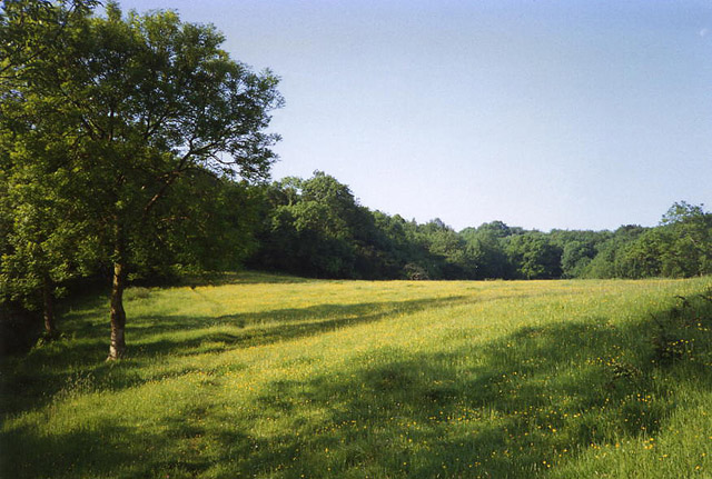
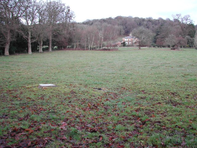
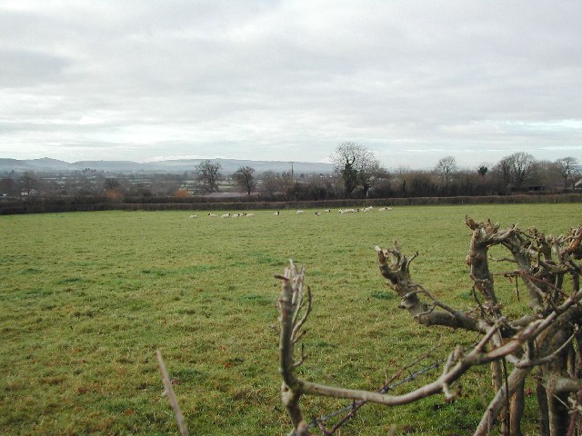
Ball Wood is a picturesque forest located in Somerset, England. It is situated near the village of Ball, hence its name. Covering an area of approximately 100 hectares, this woodland is a haven for nature enthusiasts and hikers alike.

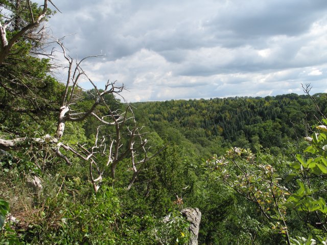
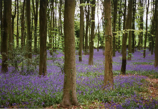
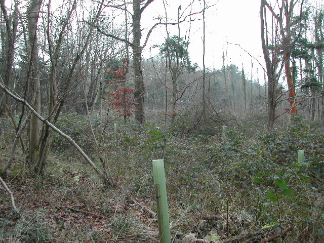
With its diverse ecosystem, Ball Wood boasts an assortment of flora and fauna. The dense canopy is dominated by a variety of tree species, including oak, beech, and birch, creating a beautiful, green landscape. The forest floor is adorned with a carpet of wildflowers, adding a splash of color to the surroundings.

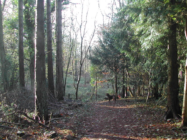
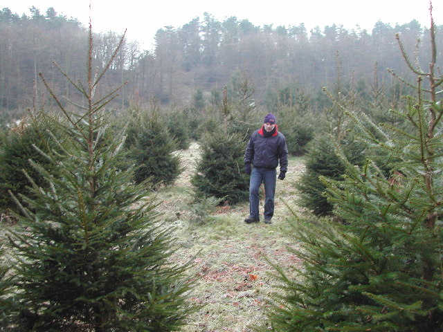
The wood is intersected by several well-maintained trails, making it an ideal destination for walkers and nature lovers. These paths wind through the forest, taking visitors on a journey through its enchanting beauty. Along the way, one may encounter a range of woodland creatures, such as deer, foxes, and squirrels, as well as a plethora of bird species.

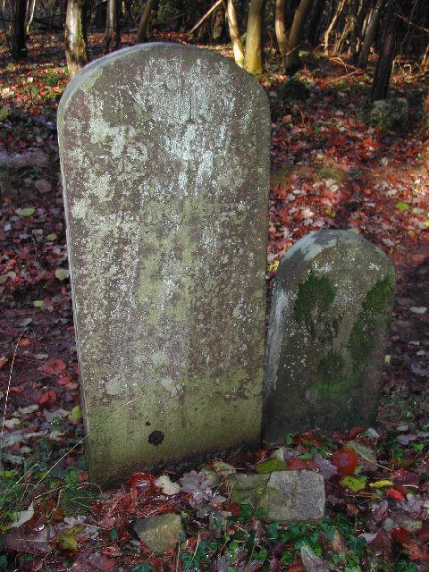
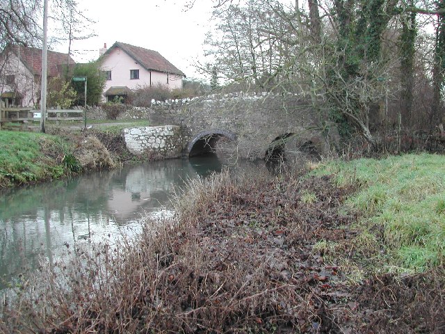
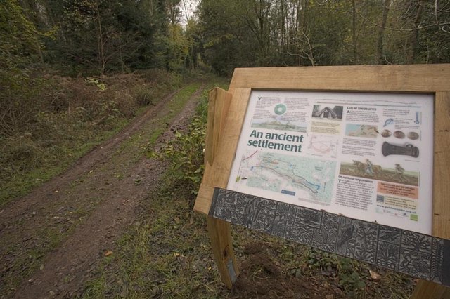
Ball Wood is also home to a number of historic features. Ancient relics, such as burial mounds and stone circles, can be found within its grounds, providing a glimpse into the area's rich history. These archaeological treasures add an extra layer of intrigue to the woodland, attracting history buffs and archaeology enthusiasts.

Overall, Ball Wood in Somerset offers a tranquil escape from the hustle and bustle of everyday life. Its natural beauty, diverse wildlife, and historical significance make it a must-visit destination for those seeking a peaceful retreat in the heart of nature.

If you have any feedback on the listing, please let us know in the comments section below.

Ball Wood Images

Images are sourced within 2km of 51.373908/-2.7796142 or Grid Reference ST4564. Thanks to Geograph Open Source API. All images are credited.

Goblin Combe Pleasant walks, a few climbable rock outcrops and a lot of trees
Goblin Combe
Pleasant walks, a few climbable rock outcrops and a lot of trees
Cleeve: bluebell wood By the road linking Cleeve and Wrington
Cleeve: bluebell wood
By the road linking Cleeve and Wrington
ST4464 Overlooking Smallway Nursery, Congesbury Taken from Cadbury Hill (ST440648) looking SW over grid square ST4464. Smallway Nursery in foreground with Urchinwood to the left and Congresbury village to the right. Mendip in the distance.
ST4464 Overlooking Smallway Nursery, Congesbury
Taken from Cadbury Hill (ST440648) looking SW over grid square ST4464. Smallway Nursery in foreground with Urchinwood to the left and Congresbury village to the right. Mendip in the distance.
ST4464 Ancient Hill Fort, Cadbury Hill This Ancient fort, directly under the flight path from Bristol International Airport, is on top of Cadbury Hill and must have been an easily defendable position.  Whilst wooded all around the top is kept clear by occasional grazing. Owned by Yatton Parish Council it provides open access and excellent walks for the public.
ST4464 Ancient Hill Fort, Cadbury Hill
This Ancient fort, directly under the flight path from Bristol International Airport, is on top of Cadbury Hill and must have been an easily defendable position. Whilst wooded all around the top is kept clear by occasional grazing. Owned by Yatton Parish Council it provides open access and excellent walks for the public.
King's Wood - typical scenery This part of King's Wood is owned by the Vincent Wildlife Trust <span class="nowrap"><a title="http://www.vwt.org.uk/" rel="nofollow ugc noopener" href="http://www.vwt.org.uk/">Link</a><img style="margin-left:2px;" alt="External link" title="External link - shift click to open in new window" src="https://s1.geograph.org.uk/img/external.png" width="10" height="10"/></span>.  Minimally managed woodland with public access through most of it.  Excellent for wildlife and fauna, especially bluebells in spring.
King's Wood - typical scenery
This part of King's Wood is owned by the Vincent Wildlife Trust LinkExternal link. Minimally managed woodland with public access through most of it. Excellent for wildlife and fauna, especially bluebells in spring.
King's Wood - Boundary Stones Many of these boundary stones appear throughout the wood and more in the surrounding area. There are several of the larger stones marked "Manor of Congresbury" - this one being "No. 15" in the wood with more examples around the nearby villages of Congresbury and Yatton. The smaller "TW" stones appear more frequently throughout the woods but are generally to be found off the paths.
King's Wood - Boundary Stones
Many of these boundary stones appear throughout the wood and more in the surrounding area. There are several of the larger stones marked "Manor of Congresbury" - this one being "No. 15" in the wood with more examples around the nearby villages of Congresbury and Yatton. The smaller "TW" stones appear more frequently throughout the woods but are generally to be found off the paths.
Cleeve: field path to King’s Wood Looking south
Cleeve: field path to King’s Wood
Looking south
King's Wood/Corporation Wood Typical scrubland in this relatively unmanaged wood. Much of this woodland is managed by the Vincent Wildlife Trust for bat conservation <span class="nowrap"><a title="http://www.vwt.org.uk/" rel="nofollow ugc noopener" href="http://www.vwt.org.uk/">Link</a><img style="margin-left:2px;" alt="External link" title="External link - shift click to open in new window" src="https://s1.geograph.org.uk/img/external.png" width="10" height="10"/></span>
King's Wood/Corporation Wood
Typical scrubland in this relatively unmanaged wood. Much of this woodland is managed by the Vincent Wildlife Trust for bat conservation LinkExternal link
Replanted areas in the north of this grid square Parts of the northern end of this grid square have been cleared for replanting of firs. This area also provides roosts for pheasant which are bred locally.
Replanted areas in the north of this grid square
Parts of the northern end of this grid square have been cleared for replanting of firs. This area also provides roosts for pheasant which are bred locally.
Millennium Bridge, Congresbury This pedestrian bridge which spans the river Yeo links the main part of the village  to the Congresbury Millennium Green.  The bridge and green formed part of the village's marking of the year 2000 celebrations.
Millennium Bridge, Congresbury
This pedestrian bridge which spans the river Yeo links the main part of the village to the Congresbury Millennium Green. The bridge and green formed part of the village's marking of the year 2000 celebrations.
Congresbury Millennium bridge barrier! Notice boards and access restrictions to the Congresbury Millennium bridge and green. Yet another example of having the right principle but using the wrong method. This motorcycle barrier does not prevent motorcycles from passing but does stop scooters for the disabled, double buggies, prams, large wheelchairs, etc.  If we need to stop the occasional rogue motorcycle we should take effective measures to do this but NOT limit access for a section of the population!
Congresbury Millennium bridge barrier!
Notice boards and access restrictions to the Congresbury Millennium bridge and green. Yet another example of having the right principle but using the wrong method. This motorcycle barrier does not prevent motorcycles from passing but does stop scooters for the disabled, double buggies, prams, large wheelchairs, etc. If we need to stop the occasional rogue motorcycle we should take effective measures to do this but NOT limit access for a section of the population!
View eastwards across grid square Showing Urchinwood Manor <span class="nowrap"><a title="http://www.urchinwoodmanor.co.uk/" rel="nofollow ugc noopener" href="http://www.urchinwoodmanor.co.uk/">Link</a><img style="margin-left:2px;" alt="External link" title="External link - shift click to open in new window" src="https://s1.geograph.org.uk/img/external.png" width="10" height="10"/></span> the pink building to the right in the distance and Wrington Hill to the left distance.
View eastwards across grid square
Showing Urchinwood Manor LinkExternal link the pink building to the right in the distance and Wrington Hill to the left distance.
The Congresbury Yeo flows through the hamlet of Iwood
Broad Street, Wrington looking westwards For more information see the village website <span class="nowrap"><a title="http://www.wringtonsomerset.org.uk/" rel="nofollow ugc noopener" href="http://www.wringtonsomerset.org.uk/">Link</a><img style="margin-left:2px;" alt="External link" title="External link - shift click to open in new window" src="https://s1.geograph.org.uk/img/external.png" width="10" height="10"/></span>
Broad Street, Wrington looking westwards
For more information see the village website LinkExternal link
Broad Street, Wrington looking eastwards For further information see the village website <span class="nowrap"><a title="http://www.wringtonsomerset.org.uk/" rel="nofollow ugc noopener" href="http://www.wringtonsomerset.org.uk/">Link</a><img style="margin-left:2px;" alt="External link" title="External link - shift click to open in new window" src="https://s1.geograph.org.uk/img/external.png" width="10" height="10"/></span>
Broad Street, Wrington looking eastwards
For further information see the village website LinkExternal link
Wrington school For further information see the school website <span class="nowrap"><a title="http://www.wringtonprimary.ik.org/" rel="nofollow ugc noopener" href="http://www.wringtonprimary.ik.org/">Link</a><img style="margin-left:2px;" alt="External link" title="External link - shift click to open in new window" src="https://s1.geograph.org.uk/img/external.png" width="10" height="10"/></span>
Wrington school
For further information see the school website LinkExternal link
Southern slopes of King's Wood around the hamlet of Udley
From the Wrington Road - typical farmland Looking South West across grid square. The western reaches of the Mendip Hills can be seen in the distance.
From the Wrington Road - typical farmland
Looking South West across grid square. The western reaches of the Mendip Hills can be seen in the distance.
Show me another place!

Ball Wood is located at Grid Ref: ST4564 (Lat: 51.373908, Lng: -2.7796142)

Unitary Authority: North Somerset

Police Authority: Avon and Somerset

What 3 Words

///sleepers.sour.mornings. Near Wrington, Somerset

Related Wikis

King's Wood and Urchin Wood SSSI

King's Wood and Urchin Wood SSSI (grid reference ST454645) is a 128.1 hectare biological Site of Special Scientific Interest near the villages of Cleeve...

Urchinwood Manor

Urchinwood Manor is a Grade II* listed building at Congresbury within the English county of Somerset.Part of the house was built around 1620 with additions...

Bow Bridge, Iwood

Bow Bridge ( ) is a Grade II listed stone arched bridge, that crosses the Congresbury Yeo at Iwood, a hamlet of Congresbury in North Somerset. The bridge...

Cleeve Toot

Cleeve Toot is an Iron Age univallate hillfort above Goblin Combe, Cleeve, Somerset, England. It is a Scheduled Ancient Monument.It is a roughly oval settlement...

Goblin Combe

Goblin Combe is a dry valley in North Somerset which stretches for approximately 3½ km from Redhill, near Bristol International Airport on the A38, through...

Cadbury Hill

Cadbury Hill is a small hill, mostly in the civil parish of Congresbury, overlooking the village of Yatton in North Somerset. On its summit stands an Iron...

Wrington

Wrington is a village and a civil and ecclesiastical parish on the north slopes of the Mendip Hills in North Somerset, England. Both include nearby Redhill...

Cleeve, Somerset

Cleeve is a village and civil parish in the ceremonial county of Somerset, England. It is situated within the unitary authority of North Somerset, 9 miles...

Nearby Amenities

Located within 500m of 51.373908,-2.7796142
Woolmers
Is In: North Somerset, England, UK
Place: hamlet
Lat/Long: 51.3774989/-2.7781953
Man Made: mineshaft
Lat/Long: 51.3736195/-2.7724251
Woolmers dew pond
Historic: archaeological_site
Source: survey
Survey: gps
Lat/Long: 51.3774024/-2.7840452
Boundary Stone No 25 Manor of Congresbury
Historic: memorial
Lat/Long: 51.3741612/-2.7778771
Boundary Stone No 24 Manor of Congresbury
Historic: memorial
Lat/Long: 51.3756267/-2.7780382
Boundary Stone No 23 Manor of Congresbury
Historic: memorial
Lat/Long: 51.3747638/-2.7743831
Boundary Stone No 22 Manor of Congresbury
Historic: memorial
Lat/Long: 51.3742045/-2.7727881
Boundary Stone No 26 Parish of Congresbury Centenary 1895-1995
Historic: monument
Lat/Long: 51.3711706/-2.7774468
Camera Mount: pole
Camera Type: fixed
Man Made: surveillance
Surveillance Type: camera
Lat/Long: 51.3771493/-2.7787654
Camera Mount: pole
Camera Type: fixed
Man Made: surveillance
Surveillance Type: camera
Lat/Long: 51.3771499/-2.7787846
The data included in this document is from www.openstreetmap.org. The data is made available under ODbL.

Have you been to Ball Wood?

Leave your review of Ball Wood below (or comments, questions and feedback).