Auterstone Wood

Wood, Forest in Westmorland Eden

England

Auterstone Wood

Old Boundary Marker on The Dodd Parish Boundary Marker on The Dodd, 1820 metres north of Loadpot Hill. On the boundary of Barton and Askham parishes.

Milestone Society National ID: WE_BART12pb
Old Boundary Marker on The Dodd Credit: Colin Smith

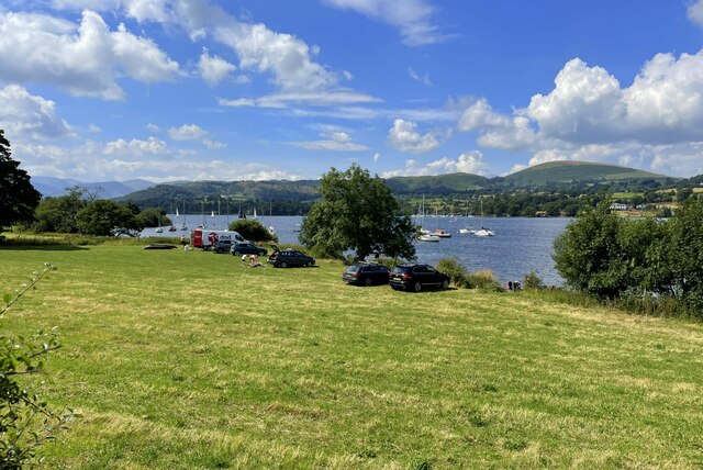
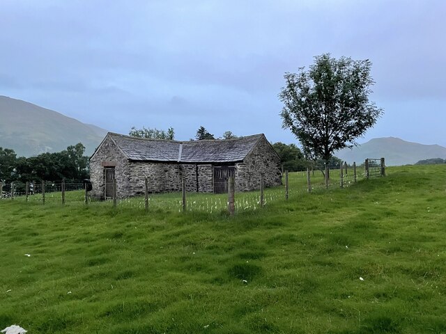
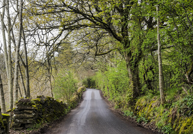
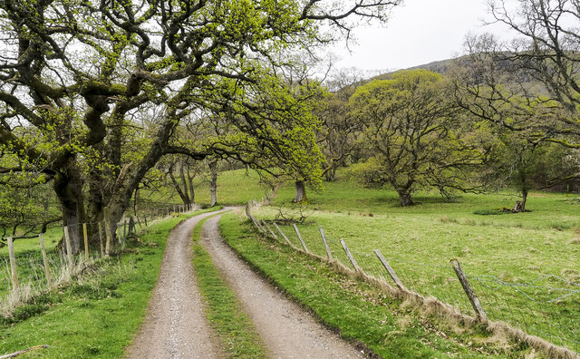
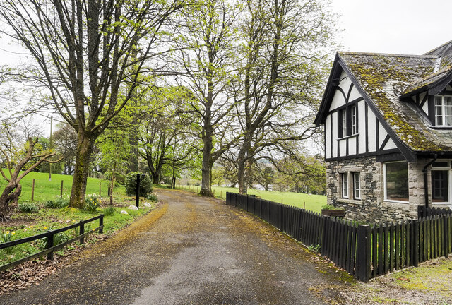
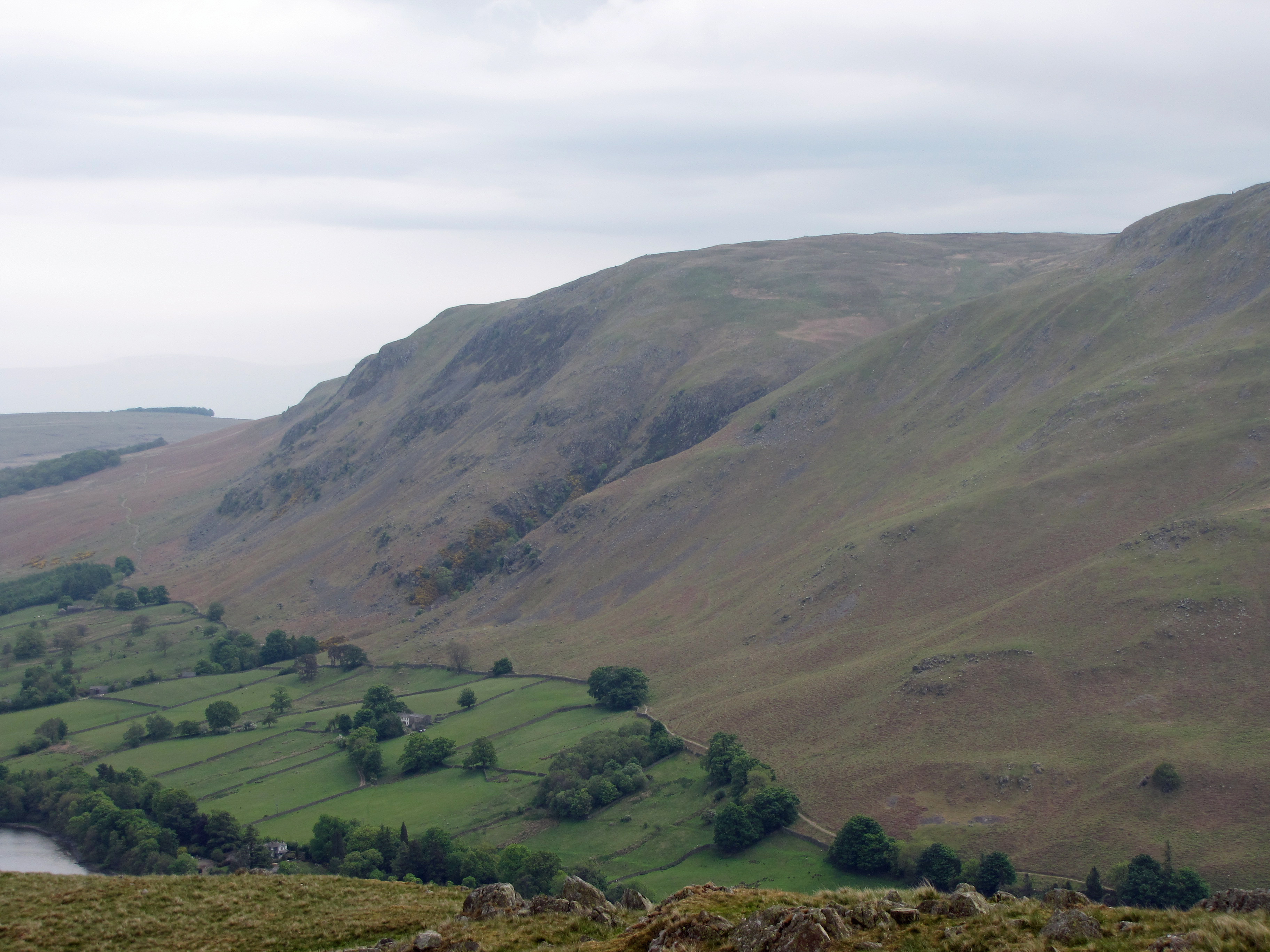
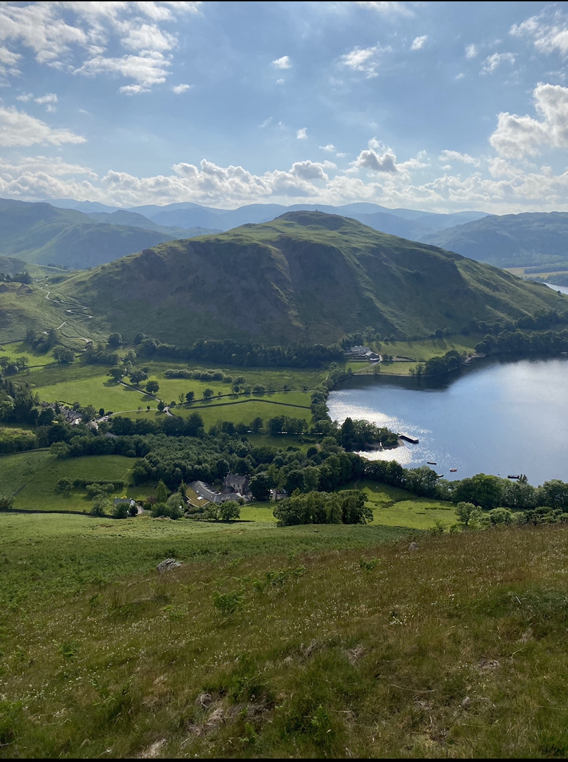
Auterstone Wood is a picturesque forest located in Westmorland, a county in the northwestern region of England. Covering an area of approximately 100 hectares, this woodland is a haven for nature enthusiasts and those seeking a tranquil escape from the bustle of urban life.

The forest is predominantly composed of broad-leafed trees, including oak, beech, and birch, which create a stunning tapestry of colors throughout the year. In spring, the woods come alive with a vibrant display of wildflowers, such as bluebells and primroses, adding to its natural beauty. The diverse ecosystem provides a habitat for various wildlife species, including deer, foxes, and a wide variety of bird species, making it a popular spot for birdwatchers and wildlife photographers.

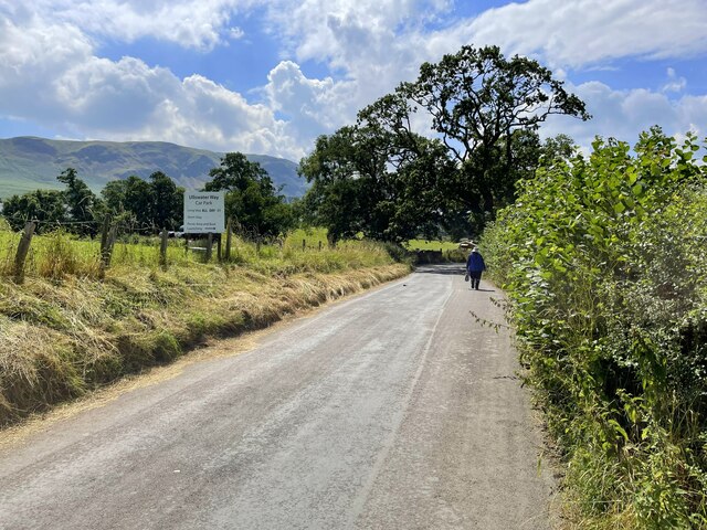
Auterstone Wood offers a network of well-maintained walking trails, allowing visitors to explore its enchanting landscape. These trails wind through the forest, providing breathtaking views of the surrounding countryside and the nearby hills. There are also designated picnic areas and benches scattered throughout the woodland, providing visitors with the perfect opportunity to relax and enjoy the serene atmosphere.

Managed by the local forestry commission, Auterstone Wood is a sustainable forest, with ongoing efforts to preserve its natural features and protect its inhabitants. The forest also plays a significant role in carbon sequestration, contributing to the fight against climate change.

Overall, Auterstone Wood is a truly idyllic destination for nature lovers, offering a delightful escape into the heart of Westmorland's natural splendor.

If you have any feedback on the listing, please let us know in the comments section below.

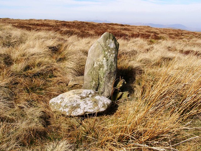
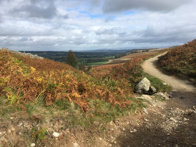
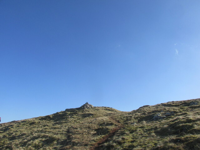
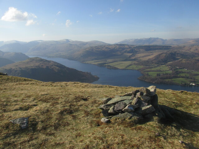
Auterstone Wood Images

Images are sourced within 2km of 54.584465/-2.8399917 or Grid Reference NY4521. Thanks to Geograph Open Source API. All images are credited.

Old Boundary Marker on The Dodd Parish Boundary Marker on The Dodd, 1820 metres north of Loadpot Hill. On the boundary of Barton and Askham parishes.

Milestone Society National ID: WE_BART12pb
Old Boundary Marker on The Dodd
Parish Boundary Marker on The Dodd, 1820 metres north of Loadpot Hill. On the boundary of Barton and Askham parishes. Milestone Society National ID: WE_BART12pb
Path crossing Aik Beck
Small cairn on the summit of Arthur's Pike
Summit cairn on Bonscale Pike Good views over Ullswater.
Summit cairn on Bonscale Pike
Good views over Ullswater.
Parked up by the lakeside
Strolling down the lane to Howtown
Leeming House Hotel
Leeming House Hotel
Oldchurch bay on Ullswater
Shepherds shelter by Ullswater
Minor road on eastern side of Ullswater The road heading north close to the farm at Bonscale, below the hill, Bonscale Pike.
Minor road on eastern side of Ullswater
The road heading north close to the farm at Bonscale, below the hill, Bonscale Pike.
Access road for Sharrow Cottages The road leaves the minor public road on the east side of Ullswater south of Sharrow Bay. It's also the route of a public footpath.
Access road for Sharrow Cottages
The road leaves the minor public road on the east side of Ullswater south of Sharrow Bay. It's also the route of a public footpath.
Access road for Sharrow Bay Hotel The Sharrow Bay Hotel closed in March 2020 blaming the Covid-19 pandemic for its inability to continue trading. On the day the image was recorded the access road remained barred and notices were in place forbidding entry to the site.
Access road for Sharrow Bay Hotel
The Sharrow Bay Hotel closed in March 2020 blaming the Covid-19 pandemic for its inability to continue trading. On the day the image was recorded the access road remained barred and notices were in place forbidding entry to the site.
Old Boundary Marker at Wartches Parish Boundary Marker at Wartches, 2820 metres southwest of Ketley Gate. On the boundary of Barton and Askham parishes. See also <a title="https://www.geograph.org.uk/photo/1563511" href="https://www.geograph.org.uk/photo/1563511">Link</a> and <a title="https://www.geograph.org.uk/photo/3275338" href="https://www.geograph.org.uk/photo/3275338">Link</a>.

Milestone Society National ID: WE_BART08pb
Old Boundary Marker at Wartches
Parish Boundary Marker at Wartches, 2820 metres southwest of Ketley Gate. On the boundary of Barton and Askham parishes. See also Link and Link. Milestone Society National ID: WE_BART08pb
Old Boundary Marker on Brown Rigg Parish Boundary Marker on Brown Rigg, 1970 metres southwest of Ketley Gate. On the boundary of Barton and Askham parishes. See also <a title="https://www.geograph.org.uk/photo/2852174" href="https://www.geograph.org.uk/photo/2852174">Link</a>.

Milestone Society National ID: WE_BART11pb
Old Boundary Marker on Brown Rigg
Parish Boundary Marker on Brown Rigg, 1970 metres southwest of Ketley Gate. On the boundary of Barton and Askham parishes. See also Link. Milestone Society National ID: WE_BART11pb
Old Boundary Marker near Swarthbeck Cottage Township Boundary Marker surrounded by a drystone wall on the west side of the road at Swarthbeck Cottage. On the boundary of Martindale and Barton townships in Barton parish. Martindale became a separate parish in 1866. Grade II Listed details <span class="nowrap"><a title="https://historicengland.org.uk/listing/the-list/list-entry/1145264" rel="nofollow ugc noopener" href="https://historicengland.org.uk/listing/the-list/list-entry/1145264">Link</a><img style="margin-left:2px;" alt="External link" title="External link - shift click to open in new window" src="https://s1.geograph.org.uk/img/external.png" width="10" height="10"/></span>. See also <span class="nowrap"><a title="http://www.geog.port.ac.uk/webmap/thelakes/photos/blo79.jpg" rel="nofollow ugc noopener" href="http://www.geog.port.ac.uk/webmap/thelakes/photos/blo79.jpg">Link</a><img style="margin-left:2px;" alt="External link" title="External link - shift click to open in new window" src="https://s1.geograph.org.uk/img/external.png" width="10" height="10"/></span>.

Milestone Society National ID: WE_MARBAR01pb
Old Boundary Marker near Swarthbeck Cottage
Township Boundary Marker surrounded by a drystone wall on the west side of the road at Swarthbeck Cottage. On the boundary of Martindale and Barton townships in Barton parish. Martindale became a separate parish in 1866. Grade II Listed details LinkExternal link. See also LinkExternal link. Milestone Society National ID: WE_MARBAR01pb
Leaving Arthur's Pike On the ridge heading for Bonscale Pike. Ullswater in shot.
Leaving Arthur's Pike
On the ridge heading for Bonscale Pike. Ullswater in shot.
Sharrow Bay Cottages By the side of Ullswater on the road to Martindale, under Barton Fell
Sharrow Bay Cottages
By the side of Ullswater on the road to Martindale, under Barton Fell
Farmland near Sharrow Bay Looking south towards Swarthbeck and the fells of Martindale Common.
Farmland near Sharrow Bay
Looking south towards Swarthbeck and the fells of Martindale Common.
Show me another place!

Auterstone Wood is located at Grid Ref: NY4521 (Lat: 54.584465, Lng: -2.8399917)

Administrative County: Cumbria

District: Eden

Police Authority: Cumbria

What 3 Words

///insulated.sprain.unless. Near Penrith, Cumbria

Related Wikis

Sharrow Bay Country House

Sharrow Bay Country House was a hotel and restaurant located on the eastern shore of Ullswater near Pooley Bridge, Cumbria, England. The hotel is associated...

Arthur's Pike

Arthur's Pike is a fell in the English Lake District, near Ullswater. It is a subsidiary top on the ridge falling north from Loadpot Hill in the Far Eastern...

Bonscale Pike

Bonscale Pike is a fell in the English Lake District, standing above Howtown on Ullswater. It is the northern end of a spur running north north west from...

Watermillock

Watermillock is a village and former civil parish, now in the parish of Matterdale, in the Westmorland and Furness district, in the ceremonial county of...

Howtown

Howtown is a hamlet in Cumbria, England, situated at a small harbour on the east shore of Ullswater in the Lake District. It lies within the civil parish...

Howtown Hotel

Howtown Hotel is a hotel in Howtown, Cumbria, England, located near the southern shore of the Ullswater lake. Although it won the César Award for Best...
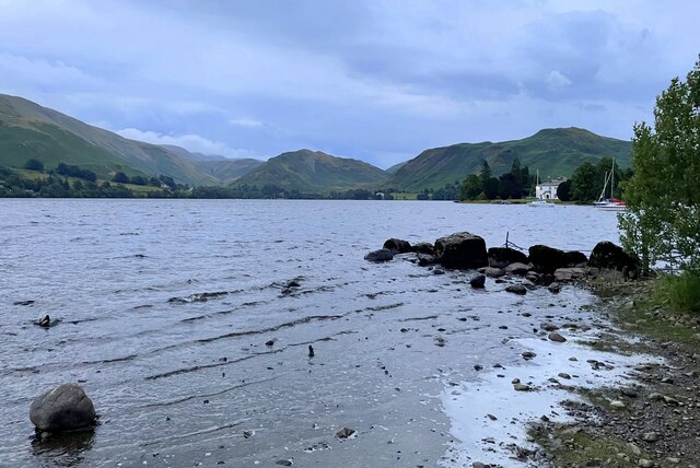
Ullswater

Ullswater is a glacial lake in Cumbria, England and part of the Lake District National Park. It is the second largest lake in the region by both area and...

Hallin Fell

Hallin Fell is a hill in the English Lake District surrounded on three sides by Ullswater. == Topography == The fell is a continuation of the ridge leading...

Nearby Amenities

Located within 500m of 54.584465,-2.8399917
Ford: yes
Lat/Long: 54.5848567/-2.8360729
Sharrow Mire
Place: locality
Lat/Long: 54.5885741/-2.8371803
Power: pole
Lat/Long: 54.5834429/-2.8462315
Power: pole
Lat/Long: 54.5839232/-2.8455824
Power: pole
Lat/Long: 54.5846724/-2.8444934
Power: pole
Lat/Long: 54.5854076/-2.8434956
Power: pole
Lat/Long: 54.5862469/-2.842353
Power: pole
Lat/Long: 54.5871391/-2.8411111
Power: pole
Lat/Long: 54.5879364/-2.8399926
Power: pole
Lat/Long: 54.5887756/-2.8388634
Information: guidepost
Source: GPS
Tourism: information
Lat/Long: 54.5882907/-2.8435278
Information: guidepost
Source: GPS
Tourism: information
Lat/Long: 54.5868795/-2.8449172
The Sitting Stone
Tourism: artwork
Lat/Long: 54.5855821/-2.8342943
Barrier: entrance
Lat/Long: 54.5830292/-2.8435189
The data included in this document is from www.openstreetmap.org. The data is made available under ODbL.

Have you been to Auterstone Wood?

Leave your review of Auterstone Wood below (or comments, questions and feedback).