Coldmeece

Settlement in Staffordshire Stafford

England

Coldmeece

Factory Mill Factory near to Coldmeece.
Factory Mill Credit: Andy and Hilary

Coldmeece is a small village located in the county of Staffordshire, England. Situated approximately 5 miles east of the town of Stone, Coldmeece is nestled in a picturesque rural setting, surrounded by rolling hills and lush green fields. The village is part of the Stone Rural district and falls within the Staffordshire Moorlands parliamentary constituency.

Although its origins date back centuries, Coldmeece is a relatively quiet and tranquil village with a close-knit community. The village is known for its charming rural charm and traditional architecture, with many well-preserved cottages and farmhouses dotting the landscape. The local church, St. Michael's, is a prominent feature of the village, adding to its historical character.

Despite its small size, Coldmeece boasts a few amenities to serve its residents. These include a village hall, a primary school, and a local pub, providing a hub for social gatherings and community events. The village also benefits from its proximity to the larger town of Stone, which offers a wider range of amenities and services.

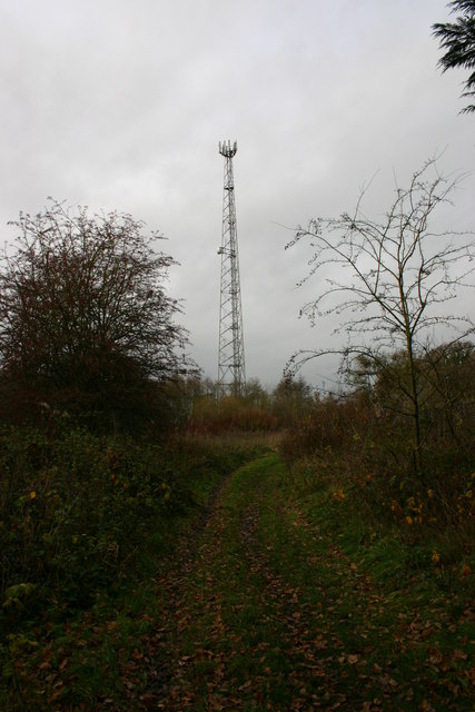
Coldmeece's idyllic location also attracts outdoor enthusiasts, with numerous walking trails and nature reserves in the surrounding area. The village offers a peaceful retreat from the hustle and bustle of urban life, allowing residents and visitors to immerse themselves in the beauty of the Staffordshire countryside.

In summary, Coldmeece is a charming and tranquil village in Staffordshire, renowned for its rural beauty, historical architecture, and close-knit community. It provides a serene environment for those seeking a peaceful countryside lifestyle.

If you have any feedback on the listing, please let us know in the comments section below.

Coldmeece Images

Images are sourced within 2km of 52.889734/-2.216965 or Grid Reference SJ8532. Thanks to Geograph Open Source API. All images are credited.

Factory Mill Factory near to Coldmeece.
Factory Mill
Factory near to Coldmeece.
Swynnerton Training Camp Back entrance to Swynnerton army training camp. The site was a massive ordnance factory during World War Two. In the 1980s the base was used by nuclear weapons convoys for overnight stops (using this gate), and was also the scene of a controversial exercise when a demonstration of how to clean up nuclear contamination apparently used real nuclear contaminated material.
Swynnerton Training Camp
Back entrance to Swynnerton army training camp. The site was a massive ordnance factory during World War Two. In the 1980s the base was used by nuclear weapons convoys for overnight stops (using this gate), and was also the scene of a controversial exercise when a demonstration of how to clean up nuclear contamination apparently used real nuclear contaminated material.
Mainline Near Millmeece From the Road Bridge
Mainline Near Millmeece
From the Road Bridge
Baden Hall A large, historic, timber-framed granary function centre, home of Baden Hall Fishery and Eccelshall RUFC.
Baden Hall
A large, historic, timber-framed granary function centre, home of Baden Hall Fishery and Eccelshall RUFC.
Baden Hall Fishery BADEN HALL FISHERY is now one of the largest pleasure fisheries in the Midlands - if not the Country - comprising eight individual pools, covering over 30 acres of water and holding over 275 pegs, specialising in pleasure and club anglers.

All of the pools are stocked with coarse fish - carp, bream, roach, tench, barble, orfe, golden orfe, etc.
Baden Hall Fishery
BADEN HALL FISHERY is now one of the largest pleasure fisheries in the Midlands - if not the Country - comprising eight individual pools, covering over 30 acres of water and holding over 275 pegs, specialising in pleasure and club anglers. All of the pools are stocked with coarse fish - carp, bream, roach, tench, barble, orfe, golden orfe, etc.
Brookside Business Park The office complex was previously owned by BT for use as a training college now converted to offices and workshops.
Brookside Business Park
The office complex was previously owned by BT for use as a training college now converted to offices and workshops.
Pilstones Wood Pilstones Wood lies on the Eccleshall to Swynnerton just north of Coldmeece
Pilstones Wood
Pilstones Wood lies on the Eccleshall to Swynnerton just north of Coldmeece
Yarnfield The Labour In Vain, Yarnfield
Yarnfield
The Labour In Vain, Yarnfield
Toward Yarnfield From the roundabout on the Eccleshall to Stone B5026, the other road goes off toward Coldmeece
Toward Yarnfield
From the roundabout on the Eccleshall to Stone B5026, the other road goes off toward Coldmeece
Labour in vain Picture taken at the height of the world cup fever, 2006, as you can see by the flags.
Labour in vain
Picture taken at the height of the world cup fever, 2006, as you can see by the flags.
Highlows Lane, Yarnfield Highlows Lane going out of Yarnfield. The lane and public footpath lead to Swynnerton across very boggy ground.
Highlows Lane, Yarnfield
Highlows Lane going out of Yarnfield. The lane and public footpath lead to Swynnerton across very boggy ground.
Highlows Lane, Yarnfield This is Highlows Lane at the start (or end) of a public footpath to and from Swynnerton looking towards Yarnfield.
Highlows Lane, Yarnfield
This is Highlows Lane at the start (or end) of a public footpath to and from Swynnerton looking towards Yarnfield.
Broken Stile This broken stile is on a public footpath from Yarnfield to Swynnerton. At this point during the time I was here there was an almost constant sound of armoury being fired from Swynnerton army camp and helicopters flying overhead.
Broken Stile
This broken stile is on a public footpath from Yarnfield to Swynnerton. At this point during the time I was here there was an almost constant sound of armoury being fired from Swynnerton army camp and helicopters flying overhead.
Broken Stile Ahead This public footpath, across very boggy ground, goes from Yarnfield to Swynnerton. At this point, gunfire and heavier artillery being fired can be heard from Swynnerton Army Camp.
Broken Stile Ahead
This public footpath, across very boggy ground, goes from Yarnfield to Swynnerton. At this point, gunfire and heavier artillery being fired can be heard from Swynnerton Army Camp.
Radio Mast This radio mast is just by the side of a public footpath continuing from Highlows Lane, Yarnfield near Stone.
Radio Mast
This radio mast is just by the side of a public footpath continuing from Highlows Lane, Yarnfield near Stone.
Watch Out for the Lions! Elephant grass experimental crop. This crop (over 6 feet tall) is being grown as an ecological and environmentally friendly alternative to 'conventional' energy production, especially for heating. This crop is near to Yarnfield, there are several fields being grown in the area. The clear area is a public footpath through the field.
Watch Out for the Lions!
Elephant grass experimental crop. This crop (over 6 feet tall) is being grown as an ecological and environmentally friendly alternative to 'conventional' energy production, especially for heating. This crop is near to Yarnfield, there are several fields being grown in the area. The clear area is a public footpath through the field.
Five-Bar Gate This gaste is to a public footpath next to a field of Elephant Grass. The footpath leads to Yarnfield.
Five-Bar Gate
This gaste is to a public footpath next to a field of Elephant Grass. The footpath leads to Yarnfield.
The Long and Not So Winding Road This concrete farm track runs between Highlows Farm and Swynnerton Army Camp. The elephant grass either side is at least 6 feet tall and is being grown as an experimental crop for environmentally friendly energy.
The Long and Not So Winding Road
This concrete farm track runs between Highlows Farm and Swynnerton Army Camp. The elephant grass either side is at least 6 feet tall and is being grown as an experimental crop for environmentally friendly energy.
Show me another place!

Coldmeece is located at Grid Ref: SJ8532 (Lat: 52.889734, Lng: -2.216965)

Administrative County: Staffordshire

District: Stafford

Police Authority: Staffordshire

What 3 Words

///dodges.dislodge.booth. Near Eccleshall, Staffordshire

Nearby Locations

Coldmeece

Related Wikis

Cold Meece railway station

Cold Meece railway station was a short-lived railway station built during the Second World War by the London, Midland and Scottish Railway (LMS) to serve...

ROF Swynnerton

ROF Swynnerton was a Royal Ordnance Factory, more specifically a filling factory, located south of the village of Swynnerton in Staffordshire, United Kingdom...

Yarnfield

Yarnfield is a village in Staffordshire, England. Population details as taken in the 2011 census can be found under Swynnerton It is considered part of...

Stone Old Alleynians F.C.

Stone Old Alleynians Football Club is a football club based in the town of Stone, Staffordshire, England. The club plays in the Midland League Premier...

Nearby Amenities

Located within 500m of 52.889734,-2.216965
Cold Meece
Place: village
Lat/Long: 52.8917513/-2.2158565
Bus Stop
South Road
Bus: yes
Naptan AtcoCode: 3800C715900
Naptan Bearing: SE
Naptan CommonName: South Road
Naptan Indicator: Opp
Naptan Landmark: South Rd
Naptan Street: Meece Rd
Naptan Verified: no
Public Transport: platform
Source: naptan_import
Lat/Long: 52.8920921/-2.2144547
Bus Stop
South Road
Bus: yes
Naptan AtcoCode: 3800C715901
Naptan Bearing: NW
Naptan CommonName: South Road
Naptan Indicator: Adj
Naptan Landmark: South Rd
Naptan Street: Meece Rd
Naptan Verified: no
Public Transport: platform
Source: naptan_import
Lat/Long: 52.8921097/-2.214648
Power: gas_installation
Lat/Long: 52.8926468/-2.2156573
Barrier: block
Lat/Long: 52.8897326/-2.2219138
Historic: memorial
Memorial: war_memorial
Lat/Long: 52.8929481/-2.2160568
Criddles Burgess
Power: substation
Ref: 861595
Voltage: 11000
Lat/Long: 52.8898368/-2.2220488
Barrier: block
Lat/Long: 52.8940498/-2.2157834
Barrier: block
Lat/Long: 52.8931488/-2.2160401
Cold Meece
Abandoned Railway: station
Alt Name: Coldmeece
Railway: site
Lat/Long: 52.8904853/-2.2171978
The data included in this document is from www.openstreetmap.org. The data is made available under ODbL.

Have you been to Coldmeece?

Leave your review of Coldmeece below (or comments, questions and feedback).