Blakebank Moss

Wood, Forest in Westmorland South Lakeland

England

Blakebank Moss

Lane off Hyning Brow
Lane off Hyning Brow Credit: Anthony Parkes

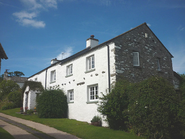
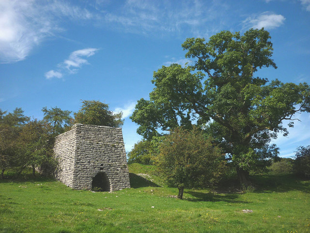
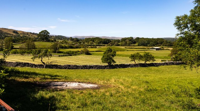
Blakebank Moss is a picturesque woodland area located in Westmorland, a historic county in the northwest of England. Situated amidst the stunning natural beauty of the Lake District National Park, this moss is an enchanting destination for nature enthusiasts and those seeking tranquility.

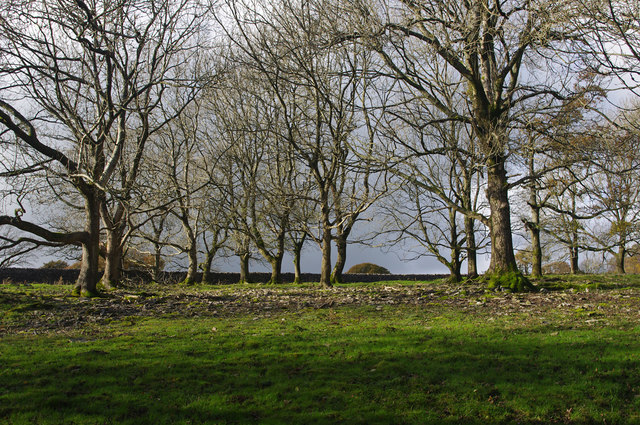
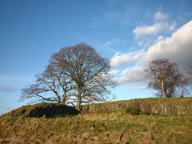
Covering an area of approximately 100 acres, Blakebank Moss is predominantly composed of ancient woodlands that have been preserved for centuries. The moss is characterized by its dense canopy of towering trees, including oak, ash, and beech, which create a cool and shaded atmosphere even during the summer months.

The forest floor is rich in flora, hosting a diverse range of plant species such as bluebells, primroses, and wood anemones. This abundance of vegetation attracts a variety of wildlife, including deer, foxes, badgers, and numerous bird species, making it a haven for wildlife enthusiasts and birdwatchers.

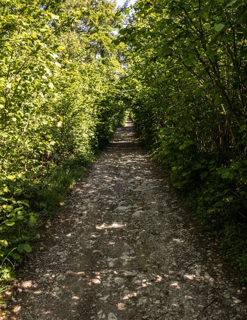
Visitors to Blakebank Moss can explore the numerous walking trails that wind through the woods, providing an opportunity to immerse oneself in the peaceful ambiance and connect with nature. The moss is also home to a small stream that meanders through the forest, adding to the overall serenity of the landscape.

The moss is easily accessible, with a car park located nearby, and is open to the public year-round. It offers a welcome escape from the bustling urban life and provides a chance to reconnect with the natural world in a truly breathtaking setting.

If you have any feedback on the listing, please let us know in the comments section below.

Blakebank Moss Images

Images are sourced within 2km of 54.310047/-2.8347607 or Grid Reference SD4590. Thanks to Geograph Open Source API. All images are credited.

Lane off Hyning Brow
Cottage at Row Beside the lane/public footpath which heads west of the hamlet towards open pastureland and the wooded heights of Whitbarrow.
Cottage at Row
Beside the lane/public footpath which heads west of the hamlet towards open pastureland and the wooded heights of Whitbarrow.
Lime kiln above Row This impressively large kiln above the footpath is remarkably well-preserved and is a Grade II listed structure <span class="nowrap"><a title="http://www.britishlistedbuildings.co.uk/en-77110-limekiln-approximately-150-metres-north-w#.V8KwdhI6tI4" rel="nofollow ugc noopener" href="http://www.britishlistedbuildings.co.uk/en-77110-limekiln-approximately-150-metres-north-w#.V8KwdhI6tI4">Link</a><img style="margin-left:2px;" alt="External link" title="External link - shift click to open in new window" src="https://s1.geograph.org.uk/img/external.png" width="10" height="10"/></span>
Lime kiln above Row
This impressively large kiln above the footpath is remarkably well-preserved and is a Grade II listed structure LinkExternal link
Scattered trees, Township Allotment Old maps indicate that the wall on the west side of this woodland (visible in the photo) was built later than the plantation walls on the north and south sides.
Scattered trees, Township Allotment
Old maps indicate that the wall on the west side of this woodland (visible in the photo) was built later than the plantation walls on the north and south sides.
Whitbarrow Road Witbarrow Road approaching Fellend Plantation.
Whitbarrow Road
Witbarrow Road approaching Fellend Plantation.
Whitbarrow Road
Whitbarrow Road
Lyth Valley
Lyth Valley
Dawson Fold Farm
Dawson Fold Farm
Gated Field in The Lyth Valley
Fellside Plantation
Fellside Plantation
Immaculate Dry stone Wall Township Allotment The dry stone walls here are absolutely perfect.  They are almost as neat as if built from clay bricks.  My own theory as to why is the abundance of stone lying around all over the ground nearby.  The wall builders would have been spoiled for choice and were able to use exactly the right size and shape stones for the task.
Immaculate Dry stone Wall Township Allotment
The dry stone walls here are absolutely perfect. They are almost as neat as if built from clay bricks. My own theory as to why is the abundance of stone lying around all over the ground nearby. The wall builders would have been spoiled for choice and were able to use exactly the right size and shape stones for the task.
Dobdale Hill, Helsington Moss The 'hill' rises a mighty 10m above the surrounding flat fields of the Lyth Valley. It was probably an island when this was an estuary before the land was reclaimed and drained. On the right is the 188m top of Hollow Stones.
Dobdale Hill, Helsington Moss
The 'hill' rises a mighty 10m above the surrounding flat fields of the Lyth Valley. It was probably an island when this was an estuary before the land was reclaimed and drained. On the right is the 188m top of Hollow Stones.
Trees and small quarry, south west flank of Dobdale Hill This side of the hill appears to have been worked for the Silurian rock.
Trees and small quarry, south west flank of Dobdale Hill
This side of the hill appears to have been worked for the Silurian rock.
Lyth Valley sheep near Row
The River Gilpin near Row The Lyth Valley here is flat and low-lying with the river and other water courses confined between earth embankments to alleviate flooding and allow drainage.
The River Gilpin near Row
The Lyth Valley here is flat and low-lying with the river and other water courses confined between earth embankments to alleviate flooding and allow drainage.
Drainage channel by Savinhill Road, Lyth Valley Looking towards Hollow Stones (188m).
Drainage channel by Savinhill Road, Lyth Valley
Looking towards Hollow Stones (188m).
The lane through Row, Lyth Valley Row is a pleasant mix of modern and older cottages, probably too small and lacking amenities to be known as a village.
The lane through Row, Lyth Valley
Row is a pleasant mix of modern and older cottages, probably too small and lacking amenities to be known as a village.
The footpath through Durham Bridge Wood A sunny clearing dominated by a large beech tree.
The footpath through Durham Bridge Wood
A sunny clearing dominated by a large beech tree.
Show me another place!

Blakebank Moss is located at Grid Ref: SD4590 (Lat: 54.310047, Lng: -2.8347607)

Administrative County: Cumbria

District: South Lakeland

Police Authority: Cumbria

What 3 Words

///entire.tastier.justifies. Near Kendal, Cumbria

Related Wikis

Lyth Valley

The Lyth Valley is on the edge of the Lake District National Park in Cumbria, England. It gives its name to an electoral ward (one of 45 in South Lakeland...

Underbarrow

Underbarrow is a small village in Cumbria, England, located 3 miles (4.8 km) west of Kendal. The village is in the Lake District National Park. It is in...

Crosthwaite

Crosthwaite is a small village located in the Parish of Crosthwaite and Lyth, South Lakeland, Cumbria, England. It is in the Lake District National Park...

Helsington

Helsington is a civil parish in the South Lakeland district of the English county of Cumbria. It includes the village of Brigsteer and Sizergh Castle...

Brigsteer

Brigsteer is a village in Cumbria, England. On 1 August 2016 it was included in the Lake District National Park. == Politics == In 1974, under the Local...

South Lakeland

South Lakeland was a local government district in Cumbria, England, from 1974 to 2023. Its council was based in Kendal. The district covered the southern...

Westmorland and Lonsdale (UK Parliament constituency)

Westmorland and Lonsdale is a constituency in the south of Cumbria, represented in the House of Commons of the UK Parliament since 2005 by Tim Farron,...

Sedbergh Rural District

Sedbergh Rural District was a rural district in the West Riding of Yorkshire in England from 1894 to its abolition in 1974. The district consisted of the...

Related Videos

Travel Vlog #5: Beginner’s Friendly Hike | Lhing Bratinella

Mt. Haponang Banoi •Mt. Pamitinan (Side trip to) Wawa Dam, Rizal •Mt. Maculot •Mt. Balagbag Connect with me: ...

The beautiful sounding bell ringing from the outside at ST Marys Crosthwaite Cumbria

Join this channel to get access to Amazing perks Emogis Badges Videos and more: ...

A walk in the rain in Brigsteer Woods, Cumbria #forestbathing #mindfulness #mindbodyspirit

Join me on a gentle stroll through Brigsteer Woods, one of the oldest in England . It's raining but we're dressed for the ...

Border Collies in Cumbria

Border Collie Experience in Cumbria UK the.

Nearby Amenities

Located within 500m of 54.310047,-2.8347607
Man Made: utility_pole
Lat/Long: 54.3143591/-2.8349127
Man Made: utility_pole
Lat/Long: 54.3145169/-2.8342831
Man Made: utility_pole
Lat/Long: 54.3143462/-2.8354081
Power: pole
Lat/Long: 54.3100116/-2.8392288
Power: pole
Lat/Long: 54.3092735/-2.8409832
Power: pole
Lat/Long: 54.3107882/-2.8373462
Power: pole
Lat/Long: 54.3123046/-2.8341469
Power: pole
Lat/Long: 54.3130925/-2.8322425
The data included in this document is from www.openstreetmap.org. The data is made available under ODbL.

Have you been to Blakebank Moss?

Leave your review of Blakebank Moss below (or comments, questions and feedback).