Bennett's Wood

Wood, Forest in Westmorland South Lakeland

England

Bennett's Wood

Anastice, Whitbarrow Most of the eastern side of Whitbarrow is heavily wooded. There are a few tracks which penetrate the broken limestone upland but they are overgrown, particularly in the summer. The curiously named Anastice area overlooks a structural valley created by the dipping limestone strata. The place has a very 'Lost World' feel about it and a fly-by of pterodactyls wouldn't seem out of place here.
Anastice, Whitbarrow Credit: Karl and Ali

Bennett's Wood is a picturesque forest located in the county of Westmorland, in the northwest region of England. Spanning an area of approximately 100 acres, this woodland is renowned for its natural beauty and rich biodiversity.

The wood is characterized by its dense canopy of oak, beech, and birch trees, which provide a sheltered habitat for a wide variety of plant and animal species. The forest floor is covered with a lush carpet of ferns, mosses, and wildflowers, creating a vibrant and colorful landscape throughout the year.

Bennett's Wood is popular among nature enthusiasts and hikers due to its extensive network of well-maintained trails. These trails wind their way through the forest, offering visitors the opportunity to explore the diverse ecosystems and enjoy the tranquility of the surroundings.

The wood is also home to a diverse range of wildlife, including deer, badgers, foxes, and a multitude of bird species. Birdwatchers will be delighted to spot species such as woodpeckers, owls, and various songbirds that inhabit the area. In spring, the woodland comes alive with the songs of birds and the vibrant colors of blooming flowers, creating a breathtaking sight for visitors.

Bennett's Wood is not only a haven for flora and fauna but also serves as an important ecological site. It acts as a carbon sink, absorbing CO2 from the atmosphere and helping to combat climate change. Conservation efforts are in place to preserve the woodland and protect its delicate ecosystem for future generations to enjoy.

If you have any feedback on the listing, please let us know in the comments section below.

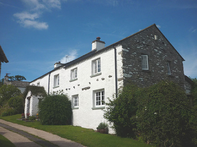
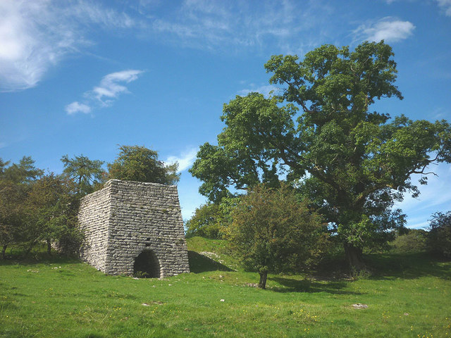
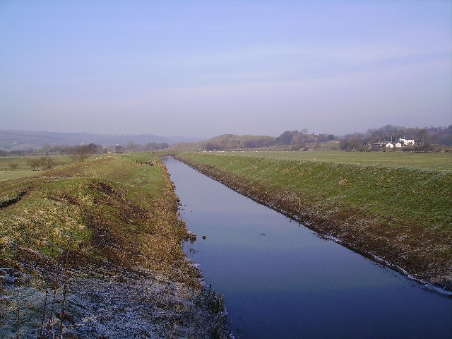
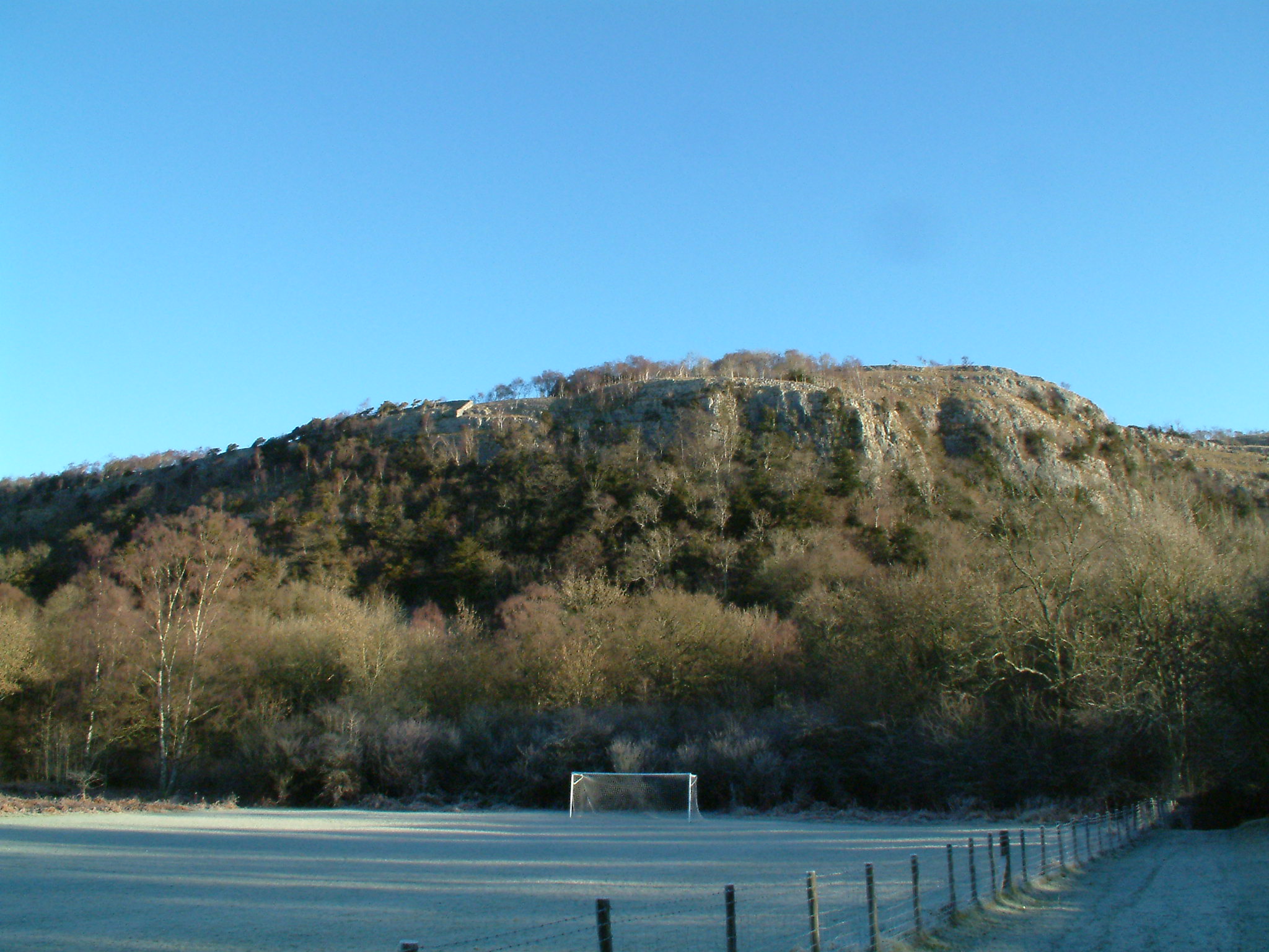
Bennett's Wood Images

Images are sourced within 2km of 54.280525/-2.8359145 or Grid Reference SD4587. Thanks to Geograph Open Source API. All images are credited.

Anastice, Whitbarrow Most of the eastern side of Whitbarrow is heavily wooded. There are a few tracks which penetrate the broken limestone upland but they are overgrown, particularly in the summer. The curiously named Anastice area overlooks a structural valley created by the dipping limestone strata. The place has a very 'Lost World' feel about it and a fly-by of pterodactyls wouldn't seem out of place here.
Anastice, Whitbarrow
Most of the eastern side of Whitbarrow is heavily wooded. There are a few tracks which penetrate the broken limestone upland but they are overgrown, particularly in the summer. The curiously named Anastice area overlooks a structural valley created by the dipping limestone strata. The place has a very 'Lost World' feel about it and a fly-by of pterodactyls wouldn't seem out of place here.
Joe Hole, Whitbarrow The cave has quite a large bedding plane entrance close to the track which descends south towards Pether Pots. Reaching it at this time of year involves some serious bramble-bashing. It consists of about 6m of crawling before becoming too low/choked. There is little cave development on Whitbarrow, possibly due to the lack of impervious capping rock and hence large surface streams able to produce them.
Joe Hole, Whitbarrow
The cave has quite a large bedding plane entrance close to the track which descends south towards Pether Pots. Reaching it at this time of year involves some serious bramble-bashing. It consists of about 6m of crawling before becoming too low/choked. There is little cave development on Whitbarrow, possibly due to the lack of impervious capping rock and hence large surface streams able to produce them.
Bedding passage, Joe Hole, Whitbarrow The interior of <a href="https://www.geograph.org.uk/photo/4620198">SD4586 : Joe Hole, Whitbarrow</a> consists of crawling in a low, bedding plane passage which appears to rapidly choke with rocks.
Bedding passage, Joe Hole, Whitbarrow
The interior of SD4586 : Joe Hole, Whitbarrow consists of crawling in a low, bedding plane passage which appears to rapidly choke with rocks.
Charcoal kiln, Wakebarrow Converting recently harvested wood into charcoal using an iron kiln.
Charcoal kiln, Wakebarrow
Converting recently harvested wood into charcoal using an iron kiln.
Wakebarrow Pot entrance, Whitbarrow There is little known cave development on Whitbarrow despite the considerable thickness of Carboniferous limestone available. This is the closest local equivalent to the deep systems of the nearby Yorkshire Dales. A small seepage stream sinks nearby and in wet weather reaches the restricted entrance. It was explored in 1964 by the Red Rose Cave & Pothole Club to a low crawl a few metres inside. This was extended in 1982 (by the Bishop Auckland Caving Club) through to 15m and 5m vertical pitches into a large chamber at a depth of 32m. So far, this seems to remain the limit despite the obvious potential for further depth. It isn't known if the water has been traced to link it with potential resurgences but obvious possible destinations are <a href="https://www.geograph.org.uk/photo/2655296">SD4387 : Fairies' Cave (Pool Bank Cave)</a> or <a href="https://www.geograph.org.uk/photo/4829035">SD4484 : Beck Head rising</a>. If I was still an active caver this would be an obvious target for 'pushing'.
Wakebarrow Pot entrance, Whitbarrow
There is little known cave development on Whitbarrow despite the considerable thickness of Carboniferous limestone available. This is the closest local equivalent to the deep systems of the nearby Yorkshire Dales. A small seepage stream sinks nearby and in wet weather reaches the restricted entrance. It was explored in 1964 by the Red Rose Cave & Pothole Club to a low crawl a few metres inside. This was extended in 1982 (by the Bishop Auckland Caving Club) through to 15m and 5m vertical pitches into a large chamber at a depth of 32m. So far, this seems to remain the limit despite the obvious potential for further depth. It isn't known if the water has been traced to link it with potential resurgences but obvious possible destinations are SD4387 : Fairies' Cave (Pool Bank Cave) or SD4484 : Beck Head rising. If I was still an active caver this would be an obvious target for 'pushing'.
Inside Wakebarrow Pot This is looking down through a narrow 'squeeze' just inside <a href="https://www.geograph.org.uk/photo/4620789">SD4487 : Wakebarrow Pot entrance, Whitbarrow</a>. Going in feet-first a ledge can be gained (on the right), from where a small chamber can be reached - just visible beyond. That's as far as I fancied going with just a small head torch. From there a low crawl leads to vertical drops into a big chamber. About 20 years ago I attempted to descend these but could not locate any reasonable anchors to tie a rope to without rubbing points on the sharp limestone.
Inside Wakebarrow Pot
This is looking down through a narrow 'squeeze' just inside SD4487 : Wakebarrow Pot entrance, Whitbarrow. Going in feet-first a ledge can be gained (on the right), from where a small chamber can be reached - just visible beyond. That's as far as I fancied going with just a small head torch. From there a low crawl leads to vertical drops into a big chamber. About 20 years ago I attempted to descend these but could not locate any reasonable anchors to tie a rope to without rubbing points on the sharp limestone.
Lord's Seat, Whitbarrow A large memorial cairn adorns Lord's Seat at about 215m, the highest point on the limestone massif of Whitbarrow. There are extensive views in most directions. Northwards are the higher fells of the eastern Lake District.
Lord's Seat, Whitbarrow
A large memorial cairn adorns Lord's Seat at about 215m, the highest point on the limestone massif of Whitbarrow. There are extensive views in most directions. Northwards are the higher fells of the eastern Lake District.
Limestone outcrop, Whitbarrow 'Whitbarrow' means 'white hill' and when the sun shines on outcrops on the open ridge, it's easy to see why. Dark mats of low-growing juniper reflect the exposed location.
Limestone outcrop, Whitbarrow
'Whitbarrow' means 'white hill' and when the sun shines on outcrops on the open ridge, it's easy to see why. Dark mats of low-growing juniper reflect the exposed location.
Wind-pruned yew, Whitbarrow The upper part of this yew tree growing in a corner of the limestone scar has been pruned by the prevailing wind.
Wind-pruned yew, Whitbarrow
The upper part of this yew tree growing in a corner of the limestone scar has been pruned by the prevailing wind.
Overhangs on Slape Scar The overhangs of this limestone scar resemble a frozen breaking wave about 10m high. There are about 50 rock climbs of all grades spread along the cliff.
Overhangs on Slape Scar
The overhangs of this limestone scar resemble a frozen breaking wave about 10m high. There are about 50 rock climbs of all grades spread along the cliff.
Blue butterfly and red beetle, Whitbarrow NNR I think this is a Common Blue butterfly and a Red-headed Cardinal beetle.
Blue butterfly and red beetle, Whitbarrow NNR
I think this is a Common Blue butterfly and a Red-headed Cardinal beetle.
On Lord's Seat, Whitbarrow Sun on the summit of the 'white hill' with its large memorial cairn. The higher Lakeland fells to the north are overcast and gloomy.
On Lord's Seat, Whitbarrow
Sun on the summit of the 'white hill' with its large memorial cairn. The higher Lakeland fells to the north are overcast and gloomy.
Winter sun on Whitbarrow
Wind-bent tree, Whitbarrow One of a number of remarkable yew trees shaped by the prevailing wind on the escarpment on top of Whitbarrow. In the distance is the dark ridge of Gummer's How which overlooks the foot of Windermere.
Wind-bent tree, Whitbarrow
One of a number of remarkable yew trees shaped by the prevailing wind on the escarpment on top of Whitbarrow. In the distance is the dark ridge of Gummer's How which overlooks the foot of Windermere.
Track on Farrer's Allotment, Whitbarrow The track descends through light woodland into one of the dry valleys that are incised into the 'lost world' of the Whitbarrow limestone massif.
Track on Farrer's Allotment, Whitbarrow
The track descends through light woodland into one of the dry valleys that are incised into the 'lost world' of the Whitbarrow limestone massif.
Wind-shaped yew, Whitbarrow The trunk and lower branches have huddled into the relative shelter of the corner whilst the upper part has been pruned by the prevailing wind.
Wind-shaped yew, Whitbarrow
The trunk and lower branches have huddled into the relative shelter of the corner whilst the upper part has been pruned by the prevailing wind.
Cottage at Row Beside the lane/public footpath which heads west of the hamlet towards open pastureland and the wooded heights of Whitbarrow.
Cottage at Row
Beside the lane/public footpath which heads west of the hamlet towards open pastureland and the wooded heights of Whitbarrow.
Lime kiln above Row This impressively large kiln above the footpath is remarkably well-preserved and is a Grade II listed structure <span class="nowrap"><a title="http://www.britishlistedbuildings.co.uk/en-77110-limekiln-approximately-150-metres-north-w#.V8KwdhI6tI4" rel="nofollow ugc noopener" href="http://www.britishlistedbuildings.co.uk/en-77110-limekiln-approximately-150-metres-north-w#.V8KwdhI6tI4">Link</a><img style="margin-left:2px;" alt="External link" title="External link - shift click to open in new window" src="https://s1.geograph.org.uk/img/external.png" width="10" height="10"/></span>
Lime kiln above Row
This impressively large kiln above the footpath is remarkably well-preserved and is a Grade II listed structure LinkExternal link
Show me another place!

Bennett's Wood is located at Grid Ref: SD4587 (Lat: 54.280525, Lng: -2.8359145)

Administrative County: Cumbria

District: South Lakeland

Police Authority: Cumbria

What 3 Words

///sometimes.kingpin.gums. Near Milnthorpe, Cumbria

Related Wikis

Nearby Amenities

Located within 500m of 54.280525,-2.8359145
Passing Place
Lat/Long: 54.2809367/-2.8332732
Power: pole
Lat/Long: 54.2836731/-2.8336488
Power: pole
Lat/Long: 54.277834/-2.8348602
Power: pole
Lat/Long: 54.2781689/-2.8376353
Power: pole
Lat/Long: 54.2767451/-2.8348999
Power: pole
Lat/Long: 54.2788706/-2.8348152
Power: pole
Lat/Long: 54.2801681/-2.8347556
Power: pole
Lat/Long: 54.2818459/-2.8336884
Power: pole
Lat/Long: 54.2809296/-2.8350174
Power: pole
Lat/Long: 54.2829732/-2.8333314
Power: pole
Lat/Long: 54.2772723/-2.8319394
Power: pole
Lat/Long: 54.2821844/-2.8335831
Power: pole
Lat/Long: 54.2817819/-2.8353004
Power: pole
Lat/Long: 54.2822178/-2.8354457
Power: pole
Lat/Long: 54.2846153/-2.8340876
The data included in this document is from www.openstreetmap.org. The data is made available under ODbL.

Have you been to Bennett's Wood?

Leave your review of Bennett's Wood below (or comments, questions and feedback).