Affcot Coppice

Wood, Forest in Shropshire

England

Affcot Coppice

A49 Near Upper Affcot Looking north from lay-by on southbound side
A49 Near Upper Affcot Credit: Richard Cooke

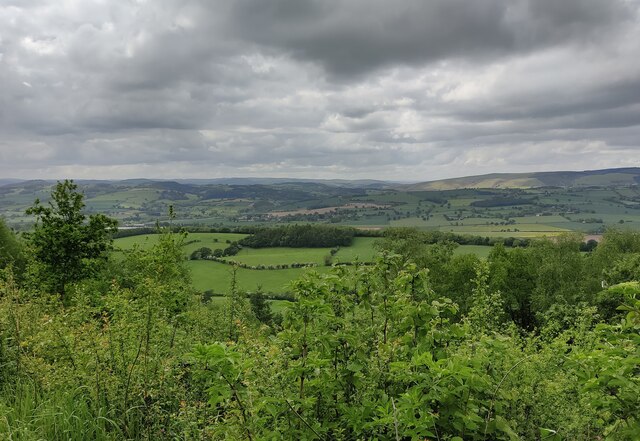
Affcot Coppice is a picturesque woodland located in the county of Shropshire, England. Situated near the village of Westhope, this enchanting forest covers an area of approximately 30 hectares, making it a popular destination for nature lovers and outdoor enthusiasts.

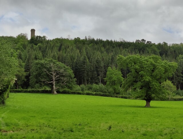
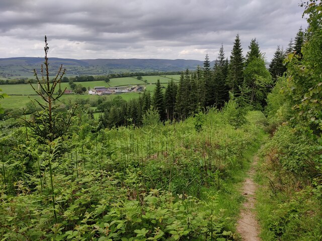
The coppice is primarily made up of deciduous trees, including oak, birch, and beech, which create a diverse and vibrant ecosystem. The dense canopy of the trees provides a haven for a wide variety of bird species, such as woodpeckers, nuthatches, and song thrushes, making it a haven for birdwatchers.

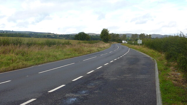
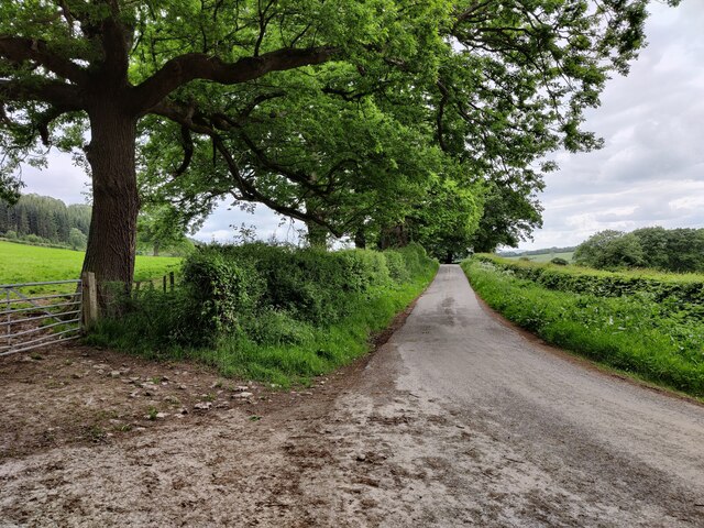
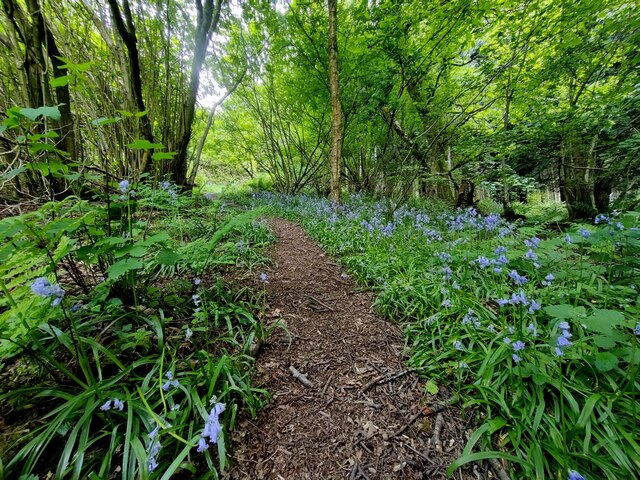
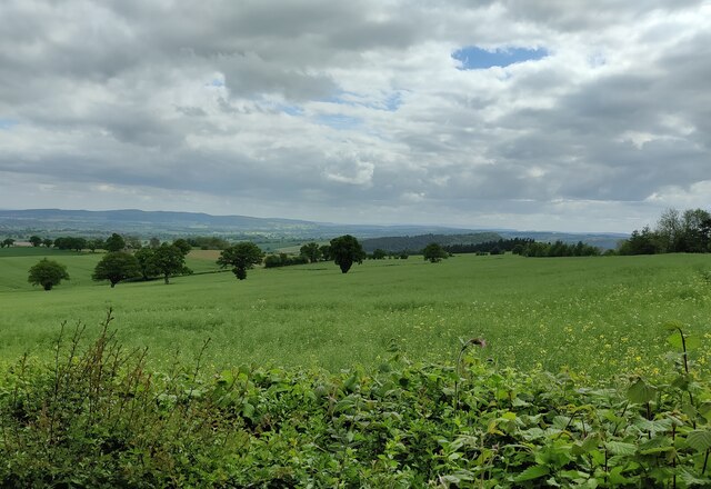
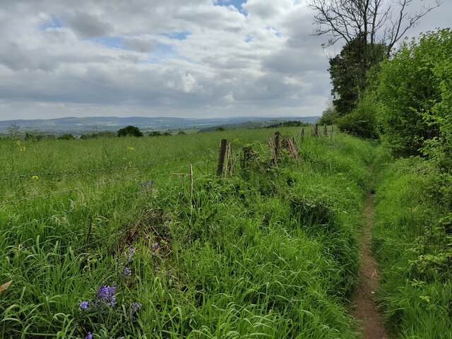
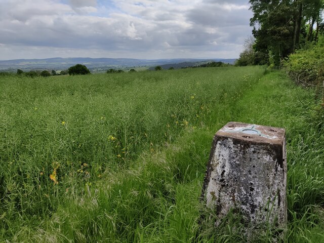
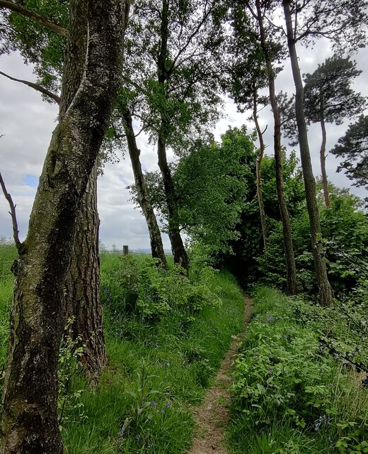
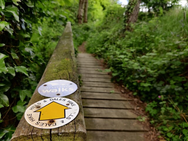
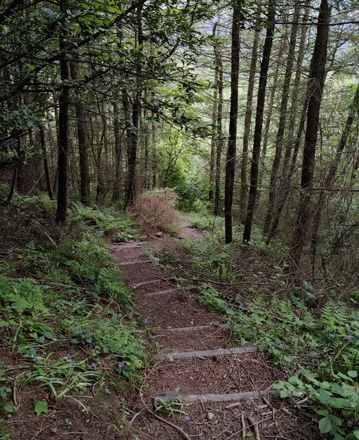
A network of well-maintained footpaths winds its way through the woods, allowing visitors to explore the tranquil surroundings and take in the natural beauty of the area. The paths are suitable for walkers of all abilities, offering a peaceful escape from the hustle and bustle of everyday life.

In addition to its natural beauty, Affcot Coppice is also known for its historical significance. The woodland has a rich history of traditional woodland management, with evidence of charcoal production and timber extraction dating back centuries. This heritage is celebrated through interpretive signs and information boards located throughout the forest, providing visitors with an insight into the area's past.

Overall, Affcot Coppice is a hidden gem in the heart of Shropshire, offering visitors a chance to immerse themselves in the beauty of nature and connect with the history of the land. Whether you're a keen hiker, birdwatcher, or simply seeking a peaceful retreat, this charming woodland is a must-visit destination.

If you have any feedback on the listing, please let us know in the comments section below.

Affcot Coppice Images

Images are sourced within 2km of 52.469846/-2.8028599 or Grid Reference SO4586. Thanks to Geograph Open Source API. All images are credited.

A49 Near Upper Affcot Looking north from lay-by on southbound side
A49 Near Upper Affcot
Looking north from lay-by on southbound side
Lower Dinchope residence The building on the right is the old chapel, with a date plate of 1862 and an original stained glass window.
Lower Dinchope residence
The building on the right is the old chapel, with a date plate of 1862 and an original stained glass window.
Lane near Callow Hill
Woodland at Callow Hill Callow Hill, 336m (1,102 ft), is the highest point of Wenlock Edge, Flounders' Folly is a tower on the summit.
Woodland at Callow Hill
Callow Hill, 336m (1,102 ft), is the highest point of Wenlock Edge, Flounders' Folly is a tower on the summit.
Track and bridleway at Callow Hill Callow Hill, 336m (1,102 ft), is the highest point of Wenlock Edge, Flounders' Folly is a tower on the summit.
Track and bridleway at Callow Hill
Callow Hill, 336m (1,102 ft), is the highest point of Wenlock Edge, Flounders' Folly is a tower on the summit.
Path through Frizland Coppice at Callow Hill
Corve Dale viewed from Callow Hill Callow Hill, 336m (1,102 ft), is the highest point of Wenlock Edge, Flounders' Folly is a tower on the summit.
Corve Dale is the valley formed by the River Corve, it lies between Wenlock Edge and the Clee Hills in Shropshire.
Corve Dale viewed from Callow Hill
Callow Hill, 336m (1,102 ft), is the highest point of Wenlock Edge, Flounders' Folly is a tower on the summit. Corve Dale is the valley formed by the River Corve, it lies between Wenlock Edge and the Clee Hills in Shropshire.
Flounders' Folly on Callow Hill Callow Hill, 336m (1,102 ft), is the highest point of Wenlock Edge.
Flounders' Folly is a tower on the summit of Callow Hill, it is 80 feet (24 m) tall and 16 feet (4.9 m) square. It was built in 1838 by Benjamin Flounders (1768–1846), an industrial entrepreneur and philanthropic Yorkshireman. It has had several owners down the years, and was owned for a time by the actress Julie Christie. It is now owned by the Flounders Folly Trust and is occasionally open to the public.
Flounders' Folly on Callow Hill
Callow Hill, 336m (1,102 ft), is the highest point of Wenlock Edge. Flounders' Folly is a tower on the summit of Callow Hill, it is 80 feet (24 m) tall and 16 feet (4.9 m) square. It was built in 1838 by Benjamin Flounders (1768–1846), an industrial entrepreneur and philanthropic Yorkshireman. It has had several owners down the years, and was owned for a time by the actress Julie Christie. It is now owned by the Flounders Folly Trust and is occasionally open to the public.
Wenlock Edge viewed from Callow Hill Callow Hill, 336m (1,102 ft), is the highest point of Wenlock Edge, Flounders' Folly is a tower on the summit.
Wenlock Edge viewed from Callow Hill
Callow Hill, 336m (1,102 ft), is the highest point of Wenlock Edge, Flounders' Folly is a tower on the summit.
Flounders' Folly on Callow Hill Callow Hill, 336m (1,102 ft), is the highest point of Wenlock Edge.
Flounders' Folly is a tower on the summit of Callow Hill, it is 80 feet (24 m) tall and 16 feet (4.9 m) square. It was built in 1838 by Benjamin Flounders (1768–1846), an industrial entrepreneur and philanthropic Yorkshireman. It has had several owners down the years, and was owned for a time by the actress Julie Christie. It is now owned by the Flounders Folly Trust and is occasionally open to the public.
Flounders' Folly on Callow Hill
Callow Hill, 336m (1,102 ft), is the highest point of Wenlock Edge. Flounders' Folly is a tower on the summit of Callow Hill, it is 80 feet (24 m) tall and 16 feet (4.9 m) square. It was built in 1838 by Benjamin Flounders (1768–1846), an industrial entrepreneur and philanthropic Yorkshireman. It has had several owners down the years, and was owned for a time by the actress Julie Christie. It is now owned by the Flounders Folly Trust and is occasionally open to the public.
Farmland south of Callow Hill
Path on Callow Hill Callow Hill, 336m (1,102 ft), is the highest point of Wenlock Edge.
Path on Callow Hill
Callow Hill, 336m (1,102 ft), is the highest point of Wenlock Edge.
Bluebells near Flounders' Folly Flounders' Folly is a tower on the summit of Callow Hill, it is 80 feet (24 m) tall and 16 feet (4.9 m) square. It was built in 1838 by Benjamin Flounders (1768–1846), an industrial entrepreneur and philanthropic Yorkshireman. It has had several owners down the years, and was owned for a time by the actress Julie Christie. It is now owned by the Flounders Folly Trust and is occasionally open to the public.
Bluebells near Flounders' Folly
Flounders' Folly is a tower on the summit of Callow Hill, it is 80 feet (24 m) tall and 16 feet (4.9 m) square. It was built in 1838 by Benjamin Flounders (1768–1846), an industrial entrepreneur and philanthropic Yorkshireman. It has had several owners down the years, and was owned for a time by the actress Julie Christie. It is now owned by the Flounders Folly Trust and is occasionally open to the public.
Triangulation pillar on Callow Hill Callow Hill, 336m (1,102 ft), is the highest point of Wenlock Edge.
Triangulation pillar on Callow Hill
Callow Hill, 336m (1,102 ft), is the highest point of Wenlock Edge.
Path on Callow Hill Callow Hill, 336m (1,102 ft), is the highest point of Wenlock Edge.
Path on Callow Hill
Callow Hill, 336m (1,102 ft), is the highest point of Wenlock Edge.
Footbridge and path at Callow Hill Callow Hill, 336m (1,102 ft), is the highest point of Wenlock Edge.
Footbridge and path at Callow Hill
Callow Hill, 336m (1,102 ft), is the highest point of Wenlock Edge.
Steps descending Callow Hill Callow Hill, 336m (1,102 ft), is the highest point of Wenlock Edge.
Steps descending Callow Hill
Callow Hill, 336m (1,102 ft), is the highest point of Wenlock Edge.
Path on Callow Hill Callow Hill, 336m (1,102 ft), is the highest point of Wenlock Edge.
Path on Callow Hill
Callow Hill, 336m (1,102 ft), is the highest point of Wenlock Edge.
Show me another place!

Affcot Coppice is located at Grid Ref: SO4586 (Lat: 52.469846, Lng: -2.8028599)

Unitary Authority: Shropshire

Police Authority: West Mercia

What 3 Words

///full.thickens.crab. Near Craven Arms, Shropshire

Nearby Locations

Affcot Coppice

Related Wikis

Alcaston

Alcaston is a village in Shropshire, England. == See also == Listed buildings in Acton Scott == External links == Media related to Alcaston at Wikimedia...
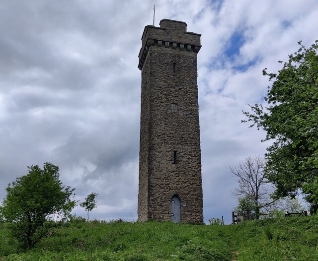
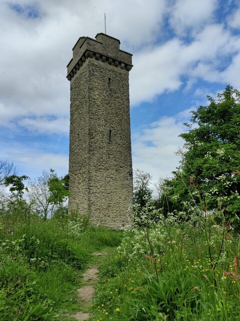
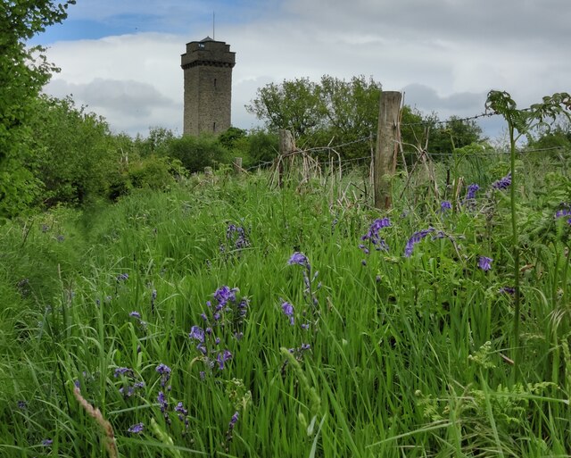
Flounders' Folly

Flounders' Folly is a tower, built in 1838, on Callow Hill, near Craven Arms at the western end of Wenlock Edge in Shropshire, England. The tower is approximately...

Upper Affcot

Upper Affcot is a hamlet in Shropshire, England. It is located on the A49 north of Craven Arms and south of Church Stretton, between the hamlets of Strefford...

Strefford

Strefford is a historic hamlet in Shropshire, England. It lies in the civil parish of Wistanstow and is situated just off the A49 road 2 miles (3.2 km...

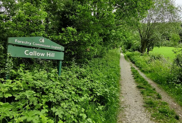
Callow Hill, Shropshire

Callow Hill is a hill near the village of Lower Dinchope between Craven Arms and Ludlow in the English county of Shropshire. Its summit marks the highest...

Felhampton

Felhampton is a hamlet in Shropshire, England. It is around 3.5 miles (5.6 km) north of Craven Arms, and 17 miles (27 km) south of Shrewsbury. The hamlet...

Wistanstow Halt railway station

Wistanstow Halt railway station was a station in Wistanstow, Shropshire, England. The station was opened in 1934 and closed in 1956. == References... ==

Wistanstow

Wistanstow is a village and parish in Shropshire, England. Wistanstow is located about 5 miles (8.0 km) south of Church Stretton and 8+1⁄2 miles (13.7...

Have you been to Affcot Coppice?

Leave your review of Affcot Coppice below (or comments, questions and feedback).