Coldham

Settlement in Cambridgeshire Fenland

England

Coldham

Coldham: Long Drove
Coldham: Long Drove Credit: Michael Garlick

Coldham is a small village located in the county of Cambridgeshire, England. Situated in the eastern part of the county, it lies approximately 10 miles northeast of the city of Peterborough. With a population of around 200 residents, Coldham is a close-knit and tight community.

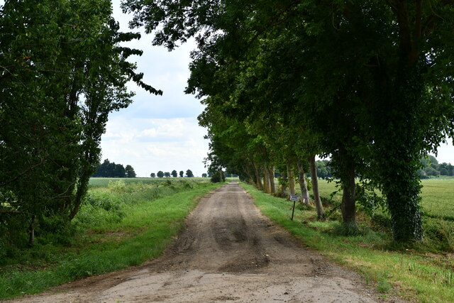
The village is primarily known for its picturesque countryside, featuring rolling hills and scenic landscapes. The surrounding area is predominantly agricultural, with vast fields of crops and grazing livestock. Coldham has managed to maintain its rural charm and remains untouched by urbanization.

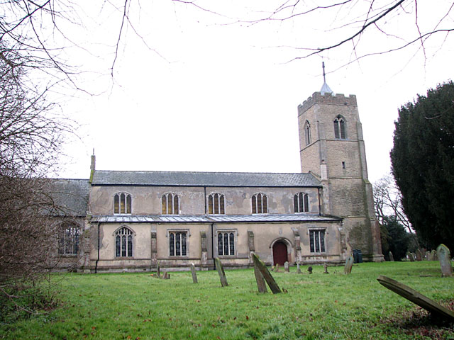
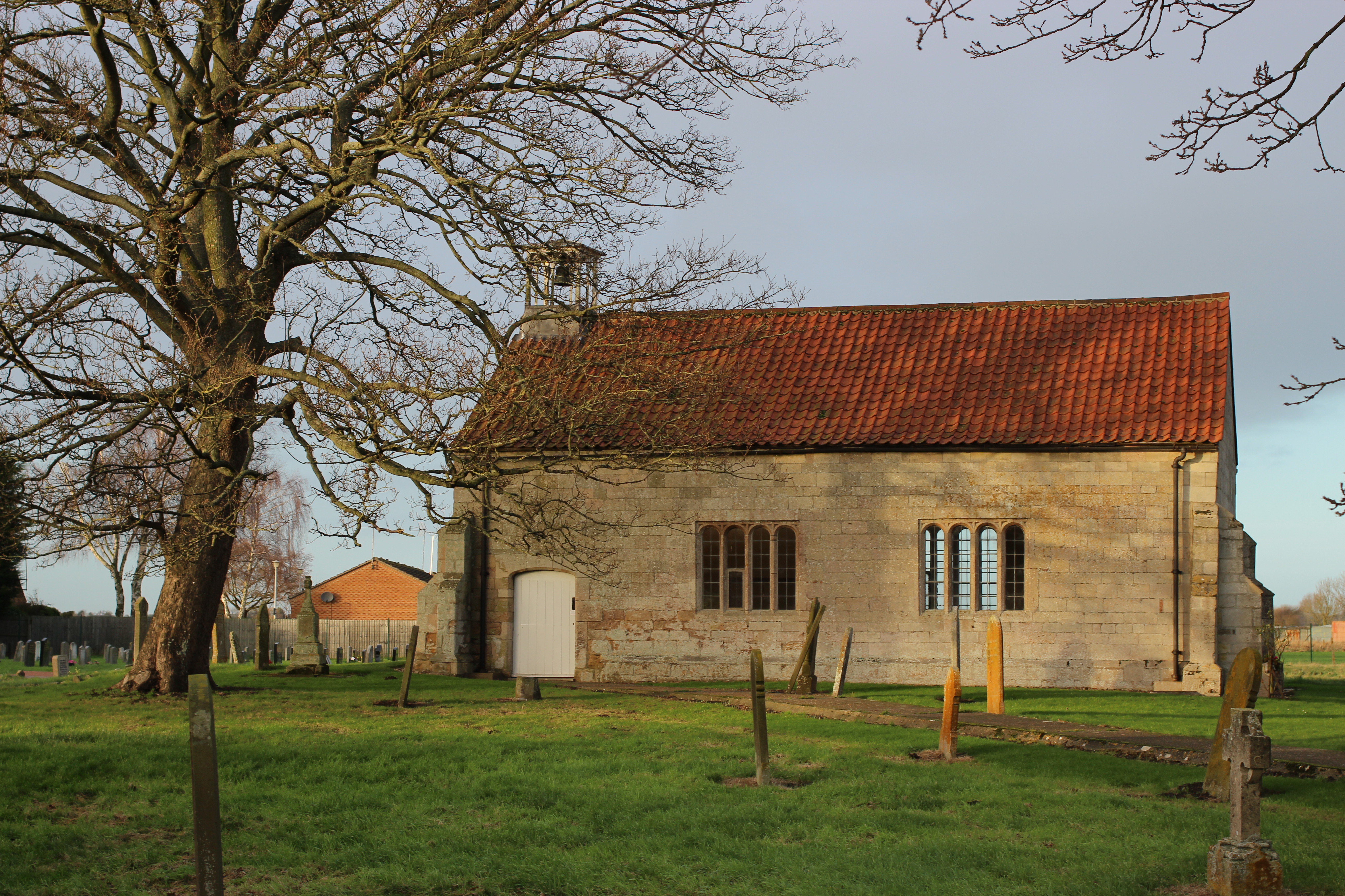
The village itself is characterized by its charming cottages and traditional architecture. The local church, St. Etheldreda’s, is a focal point of the community and dates back to the 12th century. The church's historic features, including stained glass windows and a beautiful spire, attract visitors and locals alike.

Coldham benefits from its proximity to the nearby city of Peterborough. This allows residents to access a wider range of amenities and services, including schools, healthcare facilities, and shopping centers. Additionally, the village is well-connected to major transportation routes, with good road links to nearby towns and cities.

Despite its small size, Coldham boasts a strong sense of community spirit. Regular events and gatherings, such as village fairs and fundraisers, are organized throughout the year, fostering a close bond among residents. The tranquil and idyllic surroundings make Coldham an attractive place to live for those seeking a peaceful rural lifestyle.

If you have any feedback on the listing, please let us know in the comments section below.

Coldham Images

Images are sourced within 2km of 52.604483/0.116142 or Grid Reference TF4302. Thanks to Geograph Open Source API. All images are credited.

Coldham: Long Drove
Coldham: Long Drove
Coldham: Private Road
Coldham: Farm track
Coldham: Farm track
Coldham: Percival Farm
Coldham: Station Road
Coldham: March Road
Coldham: March Road
Coldham: Wheat field
Coldham: Private farm track
Coldham: Field with potato crop
Coldham: Farm track
Coldham: Farm track
Coldham: Farm track
Coldham: Farm track
Coldham: Crop at Rutland Farm
Potatoes Ready for Planting How time flies.
I can remember as a 12 year old lad planting potatoes in this very field..using horses! This was one of the last farms in Cambridgeshire to use horses.
Potatoes Ready for Planting
How time flies. I can remember as a 12 year old lad planting potatoes in this very field..using horses! This was one of the last farms in Cambridgeshire to use horses.
Coldham Windfarm expansion Seven wind turbines are being added to the existing eight (which are contiguous with eight more in the Stags Holt cluster). the positions of the turbines and access routes have been fenced off with the crop sprayed. See <span class="nowrap"><a title="http://www.guardian.co.uk/vestas/coldham.wind.farm" rel="nofollow ugc noopener" href="http://www.guardian.co.uk/vestas/coldham.wind.farm">Link</a><img style="margin-left:2px;" alt="External link" title="External link - shift click to open in new window" src="https://s1.geograph.org.uk/img/external.png" width="10" height="10"/></span> and <span class="nowrap"><a title="http://www.co-operative.coop/corporate/ethicsinaction/climatechange/climate-change-projects/our-wind-farms/" rel="nofollow ugc noopener" href="http://www.co-operative.coop/corporate/ethicsinaction/climatechange/climate-change-projects/our-wind-farms/">Link</a><img style="margin-left:2px;" alt="External link" title="External link - shift click to open in new window" src="https://s1.geograph.org.uk/img/external.png" width="10" height="10"/></span> for details of the project and <a href="https://www.geograph.org.uk/photo/2839424">TF4401 : Giant yellow crane building wind turbine at Coldham</a> for a view of the construction of the new turbines in March 2012
Coldham Windfarm expansion
Seven wind turbines are being added to the existing eight (which are contiguous with eight more in the Stags Holt cluster). the positions of the turbines and access routes have been fenced off with the crop sprayed. See LinkExternal link and LinkExternal link for details of the project and TF4401 : Giant yellow crane building wind turbine at Coldham for a view of the construction of the new turbines in March 2012
Small strip of woodland A spring version of <a href="https://www.geograph.org.uk/photo/1694899">TF4401 : Small strip of woodland</a>
Small strip of woodland
A spring version of TF4401 : Small strip of woodland
Footpath and ditch to Rutlands Farm With a short culvert to allow farm access across the ditch.
Footpath and ditch to Rutlands Farm
With a short culvert to allow farm access across the ditch.
Ditch near Rutlands Farm With lots of foreshortening a gradient is just discernible.
Ditch near Rutlands Farm
With lots of foreshortening a gradient is just discernible.
Rutlands Farm
Rutlands Farm
Show me another place!

Coldham is located at Grid Ref: TF4302 (Lat: 52.604483, Lng: 0.116142)

Division: Isle of Ely

Administrative County: Cambridgeshire

District: Fenland

Police Authority: Cambridgeshire

What 3 Words

///snored.bulky.afflict. Near March, Cambridgeshire

Nearby Locations

Coldham

Related Wikis

March Elm Road railway station

March Elm Road railway station is a proposed station in March, Cambridgeshire, which if successful, the Bramley Line will make as the southern terminus...

Coldham railway station

Coldham railway station was a station in Coldham, Cambridgeshire. It was on the branch of the Great Eastern Railway which ran from March to Watlington...

Waldersea railway station

Waldersea railway station is a proposed station situated on the former Wisbech line from March to Wisbech, and will be the proposed terminal of the railway...

Coldham, Cambridgeshire

Coldham is a hamlet in Elm civil parish, part of the Fenland district of the Isle of Ely, Cambridgeshire, England. Coldham is the site of a wind farm on...

Wisbech and March line

The Wisbech and March line is a railway line between March and Wisbech in Cambridgeshire, England. A number of proposals are currently being investigated...

Wisbech St Mary

Wisbech St Mary is a village in the Fenland District of Cambridgeshire, England. It is 2 miles (3 km) west of the town of Wisbech. It lies between two...

Begdale

Begdale is a hamlet between Wisbech, Elm and Friday Bridge in Cambridgeshire, England. == References ==

Guyhirn Chapel of Ease

Guyhirn Chapel of Ease, also known as Guyhirn Old Church, is a small rectangular chapel in Guyhirn, Cambridgeshire noted for being built during the Puritan...

Nearby Amenities

Located within 500m of 52.604483,0.116142
Bus Stop
Station Road
Bus: yes
Naptan AtcoCode: 0500FELMM007
Naptan Bearing: NE
Naptan BusStopType: CUS
Naptan CommonName: Station Road
Naptan Indicator: near
Naptan Landmark: Station Road
Naptan NaptanCode: cmbdjtam
Naptan ShortCommonName: Station Road
Naptan Street: March Road
Naptan Verified: no
Public Transport: platform
Source: naptan_import
Lat/Long: 52.6043794/0.1165258
Bus Stop
Station Road
Bus: yes
Naptan AtcoCode: 0500FELMM009
Naptan Bearing: SW
Naptan BusStopType: CUS
Naptan CommonName: Station Road
Naptan Indicator: opp
Naptan Landmark: Station Road
Naptan NaptanCode: cmbdjtat
Naptan ShortCommonName: Station Road
Naptan Street: March Road
Naptan Verified: no
Public Transport: platform
Source: naptan_import
Lat/Long: 52.6042997/0.1166044
Railway: level_crossing
Lat/Long: 52.6046193/0.1143195
Coldham
Place: hamlet
Source: survey
Wikidata: Q2332359
Lat/Long: 52.6050429/0.1171297
Post Box
Lat/Long: 52.6046544/0.1172865
Bench
Lat/Long: 52.6046855/0.116973
Power: pole
Lat/Long: 52.6035069/0.1133741
Power: pole
Lat/Long: 52.6022756/0.1183927
Power: pole
Lat/Long: 52.6015586/0.121496
Power: pole
Lat/Long: 52.6034517/0.117695
Power: pole
Lat/Long: 52.6042384/0.1185482
Power: pole
Lat/Long: 52.6025133/0.1130496
Power: pole
Lat/Long: 52.6028423/0.1113092
Power: pole
Lat/Long: 52.600982/0.1172712
Power: pole
Lat/Long: 52.6021225/0.114133
Power: pole
Lat/Long: 52.6025932/0.1127974
Power: pole
Lat/Long: 52.6031161/0.1098231
Power: pole
Lat/Long: 52.6019105/0.1199858
Power: pole
Lat/Long: 52.6015358/0.1156836
Power: pole
Lat/Long: 52.6033799/0.1138916
Power: pole
Lat/Long: 52.6028593/0.1158986
Power: pole
Lat/Long: 52.6030736/0.1150801
Power: pole
Lat/Long: 52.6003305/0.1183015
Power: pole
Lat/Long: 52.6026307/0.1168367
Power: pole
Lat/Long: 52.6057711/0.1093296
Power: pole
Lat/Long: 52.6048686/0.1108938
Power: pole
Lat/Long: 52.6041777/0.1121112
Power: pole
Lat/Long: 52.6055152/0.1098741
Building: yes
Lat/Long: 52.604716/0.1229726
The data included in this document is from www.openstreetmap.org. The data is made available under ODbL.

Have you been to Coldham?

Leave your review of Coldham below (or comments, questions and feedback).