Coldeaton

Settlement in Derbyshire Derbyshire Dales

England

Coldeaton

Single Arched Viaduct over the Tissington Trail A grand structure supporting a track that gives access between fields - spanning the Tissington Trail as it passes through a cutting.
Single Arched Viaduct over the Tissington Trail Credit: Chris Heaton

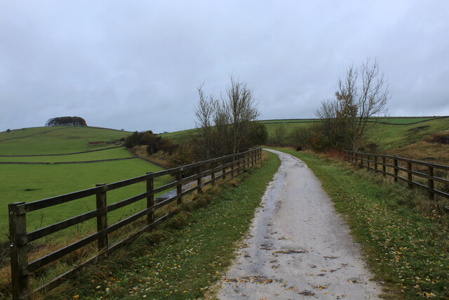
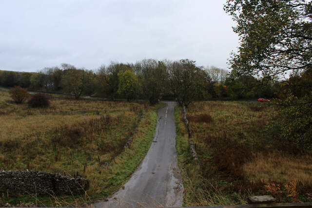
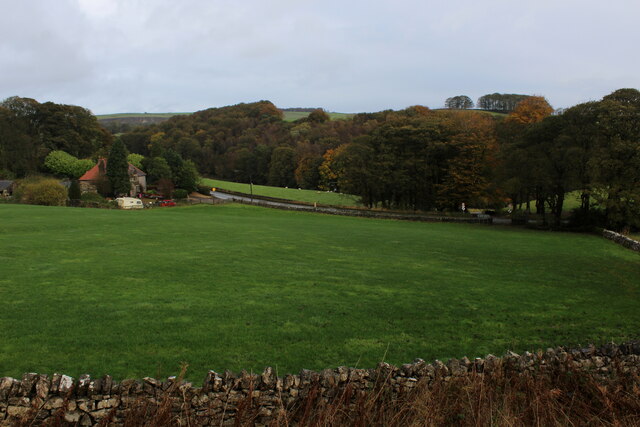
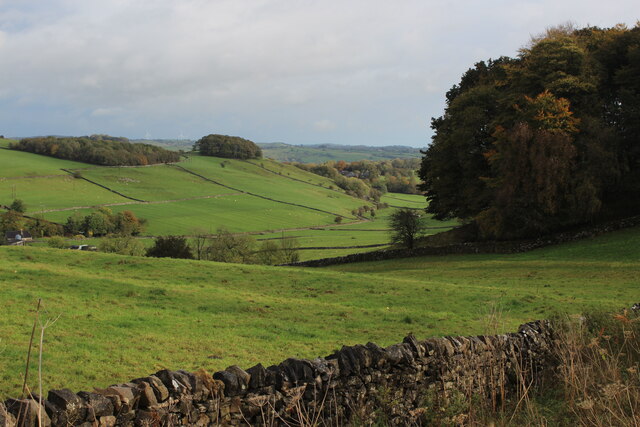
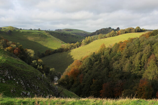
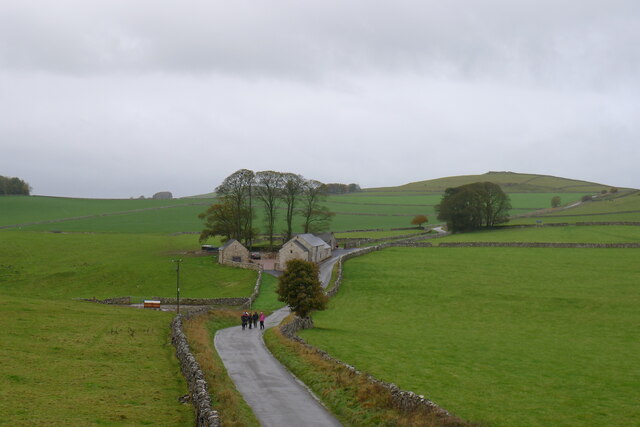
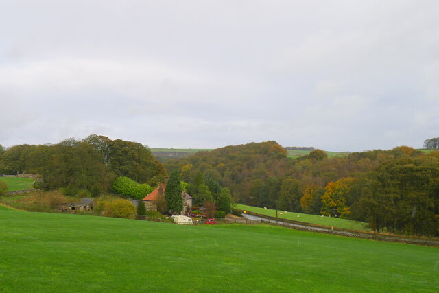
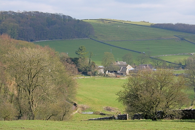
Coldeaton is a small village located in the county of Derbyshire, England. Situated in the East Midlands region, it is nestled amidst the picturesque countryside, surrounded by rolling hills and lush green fields. The village is part of the South Derbyshire district and lies approximately 10 miles southwest of the city of Derby.

With a population of around 200 residents, Coldeaton exudes a quaint and peaceful atmosphere. The village boasts a rich history, dating back to medieval times. It is home to various historic buildings, including Coldeaton Hall, a Grade II listed manor house that dates back to the 16th century. The hall's architecture reflects the Tudor style, with its timber-framed structure and characteristic gabled roofs.

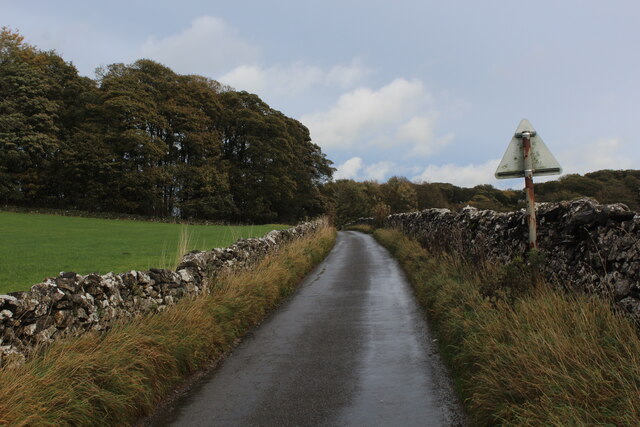
Despite its small size, Coldeaton is well-connected to nearby towns and cities. The village benefits from good transportation links, with the A50 road passing close by, providing easy access to major cities such as Derby and Stoke-on-Trent. This convenient location allows residents to enjoy the tranquility of rural living while having amenities and opportunities within reach.

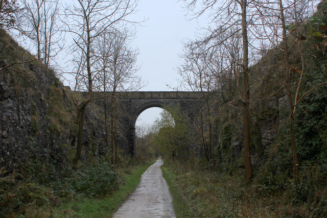
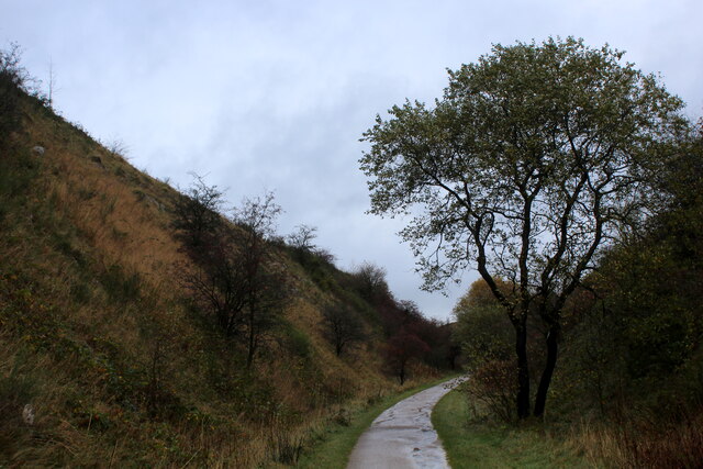
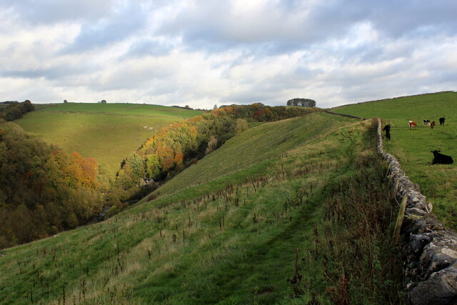
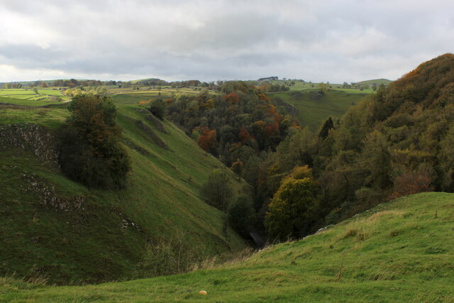
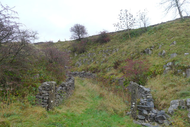
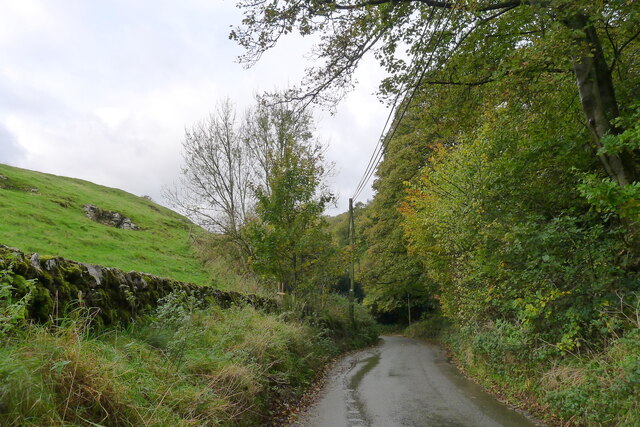
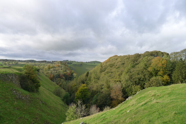
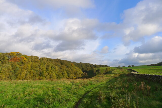
The village is surrounded by beautiful natural landscapes, making it an ideal destination for outdoor enthusiasts. There are numerous walking and cycling paths that crisscross the area, allowing visitors to explore the stunning countryside and enjoy panoramic views. The nearby Trent and Mersey Canal also offers opportunities for boating and fishing.

In summary, Coldeaton is a charming and historic village in Derbyshire, offering a peaceful setting amidst beautiful countryside, with easy access to nearby towns and cities.

If you have any feedback on the listing, please let us know in the comments section below.

Coldeaton Images

Images are sourced within 2km of 53.106376/-1.781881 or Grid Reference SK1456. Thanks to Geograph Open Source API. All images are credited.

Single Arched Viaduct over the Tissington Trail A grand structure supporting a track that gives access between fields - spanning the Tissington Trail as it passes through a cutting.
Single Arched Viaduct over the Tissington Trail
A grand structure supporting a track that gives access between fields - spanning the Tissington Trail as it passes through a cutting.
Cutting on the Tissington Trail Section of the leisure trail, popular among cyclists, horse riders and the walking fraternity - once part of the railway link between Buxton and Ashbourne
Cutting on the Tissington Trail
Section of the leisure trail, popular among cyclists, horse riders and the walking fraternity - once part of the railway link between Buxton and Ashbourne
Tissington Trail crossing Liffs Road The former railway heading north towards Johnson's Knoll - topped by a stand of trees.
Tissington Trail crossing Liffs Road
The former railway heading north towards Johnson's Knoll - topped by a stand of trees.
Liffs Road approaching the A515 As seen from the former railway bridge that carries the Tissington Trail across Liffs Road
Liffs Road approaching the A515
As seen from the former railway bridge that carries the Tissington Trail across Liffs Road
Looking towards Greenlowfield and the A515 As seen from the Tissington Trail, slightly to the north of the former Alsop station.
Looking towards Greenlowfield and the A515
As seen from the Tissington Trail, slightly to the north of the former Alsop station.
Countryside near Alsop en le Dale As seen from the Tissington Trail beside Stonepit Plantation
Countryside near Alsop en le Dale
As seen from the Tissington Trail beside Stonepit Plantation
Oxclose Lane Climbing out of the trench of Dovedale towards the A515
Oxclose Lane
Climbing out of the trench of Dovedale towards the A515
View from Above Shining Tor Overlooks the deep trench that is Dovedale
View from Above Shining Tor
Overlooks the deep trench that is Dovedale
Footpath High above Milldale The public footpath follows the wall, with ground falling away sharply to the left towards Milldale
Footpath High above Milldale
The public footpath follows the wall, with ground falling away sharply to the left towards Milldale
Looking over Mill Dale
Bridge over the former Ashbourne to Buxton railway Looking at old OS maps this bridge, built at the end of the 19th century, has never carried any substantial road or track. It seems to be a very expensive structure if its only purpose was to connect farmland on either side of the railway.
Bridge over the former Ashbourne to Buxton railway
Looking at old OS maps this bridge, built at the end of the 19th century, has never carried any substantial road or track. It seems to be a very expensive structure if its only purpose was to connect farmland on either side of the railway.
Entrance to old track leading off the former Ashbourne to Buxton railway line The track gave access to a quarry on the other side of the line
Entrance to old track leading off the former Ashbourne to Buxton railway line
The track gave access to a quarry on the other side of the line
Walkers on the road past Lees Barn The group was on its way to join the Tissington Trail
Walkers on the road past Lees Barn
The group was on its way to join the Tissington Trail
Greenlowfield from the Tissington Trail Semi-detached cottages on the A515
Greenlowfield from the Tissington Trail
Semi-detached cottages on the A515
The road down to Mill Dale Aptly named 'The Pinch'
The road down to Mill Dale
Aptly named 'The Pinch'
Mill Dale
Mill Dale
The path above Mill Dale After a steep climb up from the village of Milldale, the path here is running east on more level ground towards the A515 and the Tissington Trail
The path above Mill Dale
After a steep climb up from the village of Milldale, the path here is running east on more level ground towards the A515 and the Tissington Trail
Alstonefield, St. Peter's Church
Show me another place!

Coldeaton is located at Grid Ref: SK1456 (Lat: 53.106376, Lng: -1.781881)

Administrative County: Derbyshire

District: Derbyshire Dales

Police Authority: Derbyshire

What 3 Words

///cascaded.graceful.chains. Near Newhaven, Derbyshire

Nearby Locations

Coldeaton

Related Wikis

Eaton and Alsop

Eaton and Alsop is a civil parish within the Derbyshire Dales district, in the county of Derbyshire, England. Largely rural, in 2021 Eaton and Alsop had...
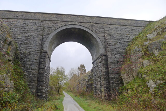
Tissington Trail

The Tissington Trail is a bridleway, footpath and cycleway in Derbyshire, England, along part of the trackbed of the former railway line connecting Ashbourne...

Alsop en le Dale railway station

Alsop en le Dale railway station was opened in 1899 near Alsop en le Dale and Alstonefield, villages in Derbyshire southeast of Buxton. It was on the...

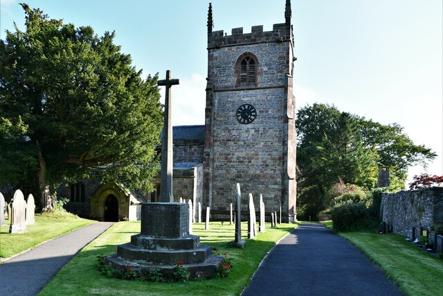
St Peter's Church, Alstonefield

The Church of St Peter in Alstonefield, Staffordshire Moorlands, England is a grade I listed Anglican parish church. The oldest parts are 12th century...

Nearby Amenities

Located within 500m of 53.106376,-1.781881
Barrier: stile
Material: stone
Source: survey;gps
Stile: stepover
Lat/Long: 53.1048558/-1.7750845
Ford: yes
Lat/Long: 53.1087404/-1.7870721
Natural: cave_entrance
Lat/Long: 53.1090763/-1.7871787
Dove Top Farm
Addr City: Ashbourne
Addr Postcode: DE6 1QR
Addr Street: Cold Eaton
Addr Village: Alsop en le Dale
Phone: +44 1335 310472
Source: survey
Tourism: guest_house
Lat/Long: 53.1069627/-1.7803862
Cold Eaton
Place: hamlet
Lat/Long: 53.1075424/-1.7803433
The data included in this document is from www.openstreetmap.org. The data is made available under ODbL.

Have you been to Coldeaton?

Leave your review of Coldeaton below (or comments, questions and feedback).