Baye's Wood

Wood, Forest in Somerset

England

Baye's Wood

Church of St Quiricus and St Juliet, Tickenham The church is separated from the main part of the village which is on slightly higher ground to the north.
Church of St Quiricus and St Juliet, Tickenham Credit: Linda Bailey

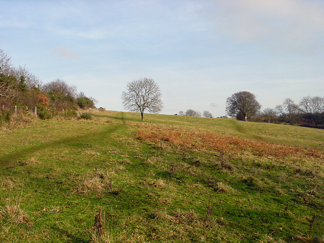
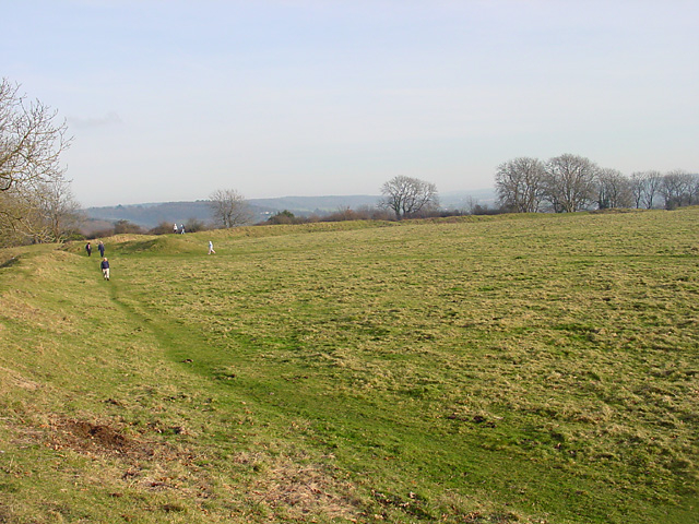
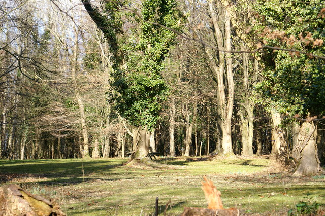
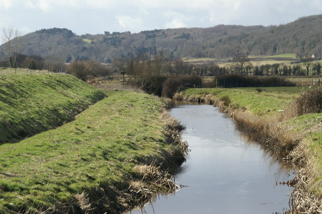
Baye's Wood is a picturesque forest located in Somerset, England. Covering an area of approximately 200 hectares, it is a popular destination for nature lovers and outdoor enthusiasts. The wood is known for its diverse range of tree species, including oak, beech, and birch, which create a stunning canopy of greenery throughout the year.

The wood is home to a rich variety of wildlife, making it an ideal spot for birdwatching and animal spotting. Visitors may have the chance to see deer, foxes, badgers, and a variety of bird species, including woodpeckers and owls. There are also numerous walking trails and pathways that wind their way through the wood, providing a peaceful and tranquil setting for a leisurely stroll or a more challenging hike.

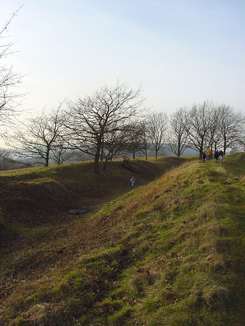
Baye's Wood has a long history, with evidence of human occupation dating back to the Iron Age. There are several archaeological sites within the wood, including ancient earthworks and burial mounds, which offer a fascinating glimpse into the area's past.

The wood is managed by a local conservation group, which is dedicated to preserving its natural beauty and protecting its wildlife. They organize regular events and activities, such as guided walks and educational programs, to engage the local community and raise awareness about the importance of conservation.

In summary, Baye's Wood in Somerset is a beautiful and diverse forest that offers a peaceful retreat for nature lovers. With its stunning tree species, abundant wildlife, and rich history, it is a must-visit destination for anyone seeking to connect with nature and explore the natural wonders of Somerset.

If you have any feedback on the listing, please let us know in the comments section below.
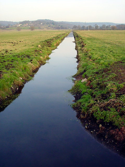
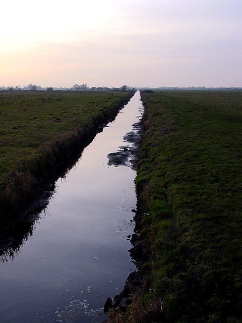
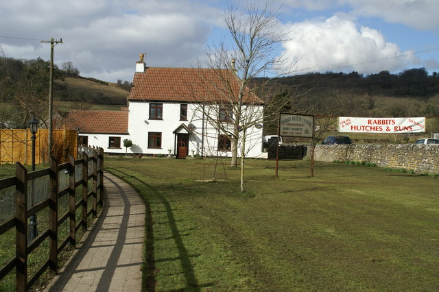
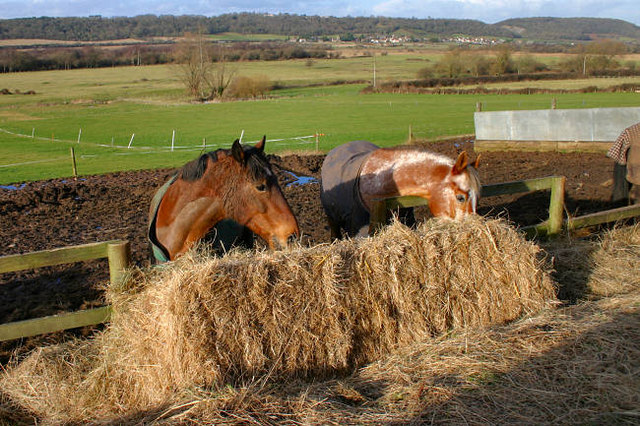
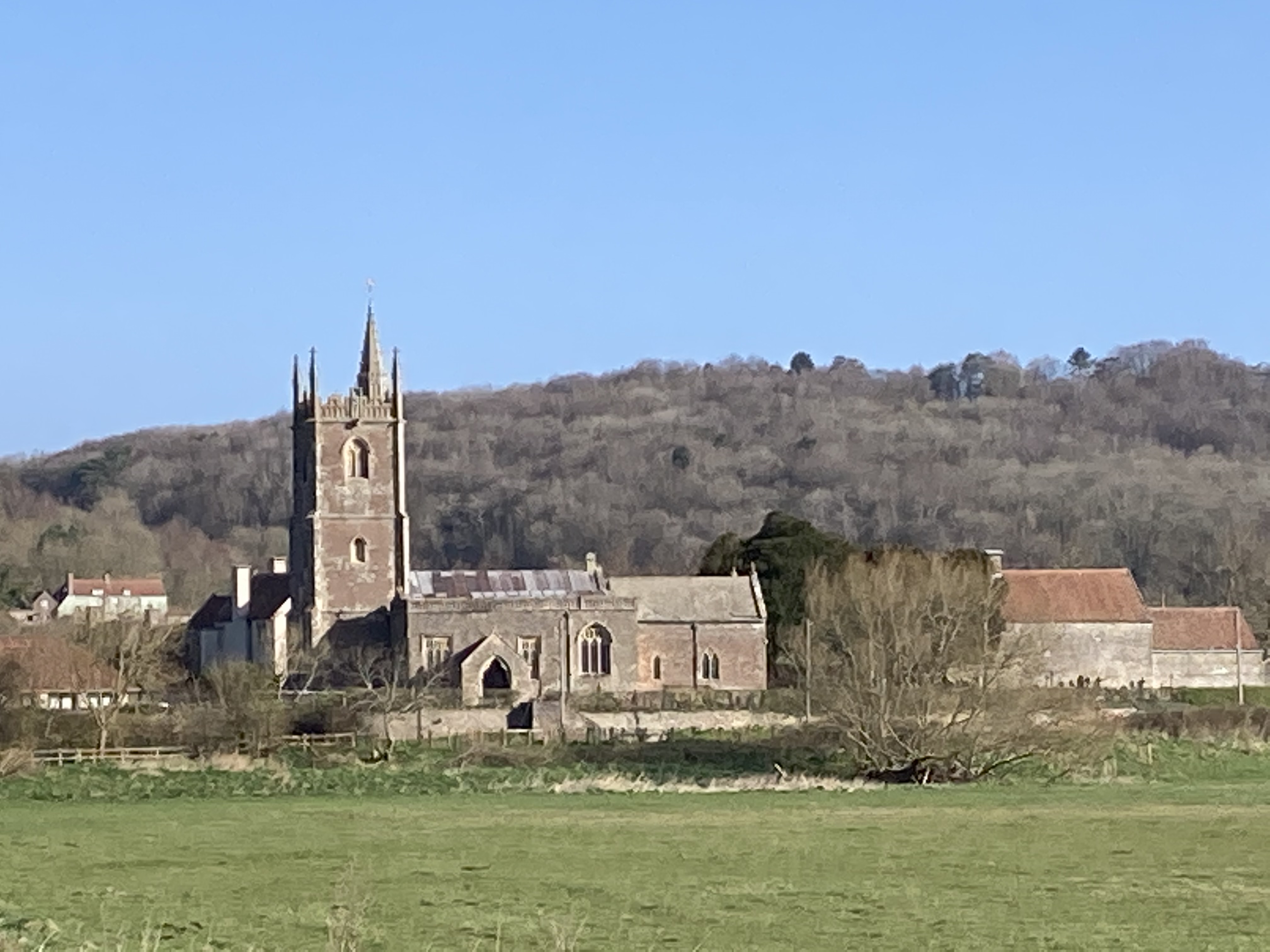
Baye's Wood Images

Images are sourced within 2km of 51.446447/-2.7913105 or Grid Reference ST4572. Thanks to Geograph Open Source API. All images are credited.

Church of St Quiricus and St Juliet, Tickenham The church is separated from the main part of the village which is on slightly higher ground to the north.
Church of St Quiricus and St Juliet, Tickenham
The church is separated from the main part of the village which is on slightly higher ground to the north.
Cadbury Camp, National Trust Cadbury Camp was built in the late Iron Age, probably by the Dobunni Tribe who lived in the Somerset area. They dug out the ditches and used the soil to make the banks which would protect them from invading sources. On top of the bank would have been a timber fence. It is in a high position over the land below which would have been a boggy marsh. It is managed by the National Trust.
Cadbury Camp, National Trust
Cadbury Camp was built in the late Iron Age, probably by the Dobunni Tribe who lived in the Somerset area. They dug out the ditches and used the soil to make the banks which would protect them from invading sources. On top of the bank would have been a timber fence. It is in a high position over the land below which would have been a boggy marsh. It is managed by the National Trust.
Climb up to Cadbury Camp Just inside the National Trust maintained land parallel to the Cadbury Camp Lane West (the other side of the fence) looking to the East. Cadbury Camp is beyond the horizon.
Climb up to Cadbury Camp
Just inside the National Trust maintained land parallel to the Cadbury Camp Lane West (the other side of the fence) looking to the East. Cadbury Camp is beyond the horizon.
Nailsea Moor Standing on "The Causeway" looking to the South West across the Moor - low lying land separated by drainage channels known as Rhynes. Without the Rhynes it would be marshland, but is now good agricultural land.
Nailsea Moor
Standing on "The Causeway" looking to the South West across the Moor - low lying land separated by drainage channels known as Rhynes. Without the Rhynes it would be marshland, but is now good agricultural land.
M5 - Split Level section between J19 and J20 The motorway is split on two levels for a large part of this section between Junction 19 (Portishead) and Junction 20 (Clevedon), which has created a very long contraflow during road repairs.
M5 - Split Level section between J19 and J20
The motorway is split on two levels for a large part of this section between Junction 19 (Portishead) and Junction 20 (Clevedon), which has created a very long contraflow during road repairs.
Tickenham Boundary Rhyne looking NE Standing on Causeway Bridge, looking NE towards Stone-edge Batch. Land is about 5 metres above sea-level.
Tickenham Boundary Rhyne looking NE
Standing on Causeway Bridge, looking NE towards Stone-edge Batch. Land is about 5 metres above sea-level.
Tickenham Boundary Rhyne looking SW Standing on Causeway Bridge looking across Nailsea Moor along the Tickenham Boundary Rhyne.
Tickenham Boundary Rhyne looking SW
Standing on Causeway Bridge looking across Nailsea Moor along the Tickenham Boundary Rhyne.
Cadbury Camp, Tickenham The ring is very large and I was unable to photograph the entire ring.
Cadbury Camp, Tickenham
The ring is very large and I was unable to photograph the entire ring.
Lime Breach Wood
Lime Breach Wood
Rhyne on  Weston Moor
Rhyne on Weston Moor
Bridleway Bridge Foot and bridleway over the M5 between junctions 19 & 20. Riders must dismount before crossing.
Bridleway Bridge
Foot and bridleway over the M5 between junctions 19 & 20. Riders must dismount before crossing.
Cadbury Court Farm Tickenham
Garden Park Nursery Tickenham
Tickenham Rabbit Centre
Stay Out. Entrance to bridleway over the Motorway
Stay Out.
Entrance to bridleway over the Motorway
Horses in the Gordano Valley
Tickenham: the Land Yeo The embanked man-made course of the river can clearly be seen here. It does not run in the valley floor. Before Tickenham church – seen on the skyline – the river dog-legs to the right and then to the left, keeping to its contour to reach Tickenham Mill, at one time belonging to the canons of St Augustine's Abbey, Bristol, and thus probably a medieval site
Tickenham: the Land Yeo
The embanked man-made course of the river can clearly be seen here. It does not run in the valley floor. Before Tickenham church – seen on the skyline – the river dog-legs to the right and then to the left, keeping to its contour to reach Tickenham Mill, at one time belonging to the canons of St Augustine's Abbey, Bristol, and thus probably a medieval site
Bridge over Motorway
Show me another place!

Baye's Wood is located at Grid Ref: ST4572 (Lat: 51.446447, Lng: -2.7913105)

Unitary Authority: North Somerset

Police Authority: Avon and Somerset

What 3 Words

///probe.muddy.fantastic. Near Nailsea, Somerset

Related Wikis

Cadbury Camp

Cadbury Camp is an Iron Age hill fort in Somerset, England, near the village of Tickenham. It is a scheduled monument. Although primarily known as a fort...

Tickenham

Tickenham is a village and civil parish near Clevedon and Nailsea in North Somerset, England. The parish has a population of 910. It has a primary school...

Court Hill

Court Hill (grid reference ST436722) is a 10.45 hectare geological Site of Special Scientific Interest near the town of Clevedon, North Somerset, England...

Limebreach Wood

Limebreach Wood (sometimes written as Lime Breach Wood) is a woodland on the south side of the Tickenham Ridge, between Clevedon and Bristol. It is very...

Nailsea & Tickenham F.C.

Nailsea & Tickenham Football Club is a football club based in Nailsea, England. They are currently members of the Western League Premier Division and play...

Gordano Valley

Gordano (or the Gordano Valley; ) is an area of North Somerset, in England. It has been designated as a National Nature Reserve.The name Gordano comes...

Weston in Gordano

Weston in Gordano is a village and civil parish in Somerset, England. It is situated in the middle of the Gordano valley on the north side, and in the...

Cadbury Road railway station

Cadbury Road railway station served the village of Weston in Gordano, Somerset, England from 1907 to 1940 on the Weston, Clevedon and Portishead Railway...

Nearby Amenities

Located within 500m of 51.446447,-2.7913105
Tickenham
Is In: North Somerset, England, UK
Place: village
Source: npe
Wikidata: Q3360890
Lat/Long: 51.4424526/-2.7941957
Crossing
Crossing: traffic_signals
Crossing Ref: puffin
Tactile Paving: yes
Lat/Long: 51.4429542/-2.7908886
Barrier: stile
Lat/Long: 51.4465285/-2.7874995
Bus Stop
Elm Tree Avenue
Bus: yes
Naptan AtcoCode: 0190NSC30747
Naptan Bearing: W
Naptan CommonName: Tickenham Post Office
Naptan NaptanCode: wsmgdtg
Naptan Street: Clevedon Road
Public Transport: platform
Shelter: no
Source: naptan_import
Lat/Long: 51.4429286/-2.79043
Bus Stop
Clevedon Road
Bench: no
Bin: no
Bus: yes
Naptan AtcoCode: 0190NSC30748
Naptan Bearing: E
Naptan CommonName: Tickenham Post Office
Naptan NaptanCode: wsmgdwm
Naptan Street: Clevedon Road
Public Transport: platform
Shelter: no
Source: naptan_import
Lat/Long: 51.4428568/-2.7872202
Bus Stop
Tickenham School
Bench: no
Bin: no
Bus: yes
Lit: yes
Naptan AtcoCode: 0190NSC30749
Naptan Bearing: W
Naptan CommonName: Tickenham School
Naptan Crossing: Moor Lane
Naptan NaptanCode: wsmgdmt
Naptan Street: Clevedon Road
Public Transport: platform
Shelter: no
Source: naptan_import
Tactile Paving: no
Lat/Long: 51.4428701/-2.7939236
Bus Stop
Tickenham School
Bus: yes
Naptan AtcoCode: 0190NSC30750
Naptan Bearing: E
Naptan CommonName: Tickenham School
Naptan NaptanCode: wsmgdpm
Naptan Street: Clevedon Road
Public Transport: platform
Source: naptan_import
Lat/Long: 51.4430539/-2.791946
Board Type: history
Check Date: 2023-02-04
Information: board
Tourism: information
Lat/Long: 51.4497935/-2.7867304
Speed Camera
Maxspeed: 30 mph
Lat/Long: 51.4429532/-2.7950571
Man Made: manhole
Manhole: telecom
Lat/Long: 51.4429371/-2.7885021
Man Made: street_cabinet
Utility: television
Lat/Long: 51.4429432/-2.7885013
Waste Basket
Lat/Long: 51.4429909/-2.789483
Defibrillator
Emergency: defibrillator
Ref GB The Circuit: ECAA6395-AD21-4CF4-BFBB-AEF3009FD375
Lat/Long: 51.4432352/-2.7895209
Tickenham Parish Council
Information: board
Tourism: information
Lat/Long: 51.4430007/-2.7893136
Post Box
Brand: Royal Mail
Brand Wikidata: Q638098
Brand Wikipedia: en:Royal Mail
Operator: Royal Mail
Operator Wikidata: Q638098
Post Box Type: pillar
Lat/Long: 51.4430136/-2.7894779
Waste Basket
Lat/Long: 51.4430546/-2.7920274
Man Made: street_cabinet
Utility: television
Lat/Long: 51.4430538/-2.7919938
Post Box
Post Box Type: wall
Lat/Long: 51.4428647/-2.7938129
Tickenham Parish Council
Board Type: notice
Check Date: 2023-03-26
Information: board
Tourism: information
Lat/Long: 51.4428586/-2.7940042
Fire Hydrant
Emergency: fire_hydrant
Fire Hydrant Diameter: 100
Fire Hydrant Position: sidewalk
Fire Hydrant Type: underground
Lat/Long: 51.4428972/-2.7936779
Fire Hydrant
Emergency: fire_hydrant
Fire Hydrant Diameter: 100
Fire Hydrant Position: sidewalk
Fire Hydrant Type: underground
Lat/Long: 51.4429075/-2.7955444
Post Office
Tickenham Post Office
Location: indoor
Ref Pol Id: 24487
Lat/Long: 51.4435106/-2.7893847
Brand: National Grid
Brand Wikidata: Q1465461
Material: wood
Operator: National Grid Electricity Distribution
Operator Old: Western Power Distribution
Operator Wikidata: Q7988183
Owner: National Grid Electricity Distribution (South West) Plc
Owner Wikidata: Q114397866
Power: pole
Lat/Long: 51.4422207/-2.7904973
Brand: National Grid
Brand Wikidata: Q1465461
Material: wood
Operator: National Grid Electricity Distribution
Operator Old: Western Power Distribution
Operator Wikidata: Q7988183
Owner: National Grid Electricity Distribution (South West) Plc
Owner Wikidata: Q114397866
Power: pole
Substation: transformer
Lat/Long: 51.4427217/-2.7907458
Bench
Backrest: no
Lat/Long: 51.4472149/-2.7875541
Watering Place
Lat/Long: 51.4480032/-2.7886091
Bench
Lat/Long: 51.4451139/-2.7877332
Barrier: kissing_gate
Lat/Long: 51.4479192/-2.7959052
The data included in this document is from www.openstreetmap.org. The data is made available under ODbL.

Have you been to Baye's Wood?

Leave your review of Baye's Wood below (or comments, questions and feedback).