Barn Coppice

Wood, Forest in Herefordshire

England

Barn Coppice

Mortimer Trail at Bircher Common
Mortimer Trail at Bircher Common Credit: Row17

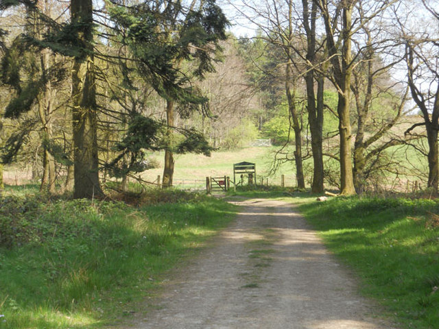
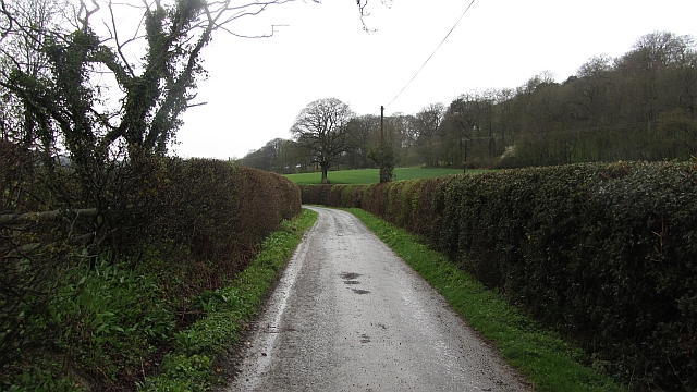
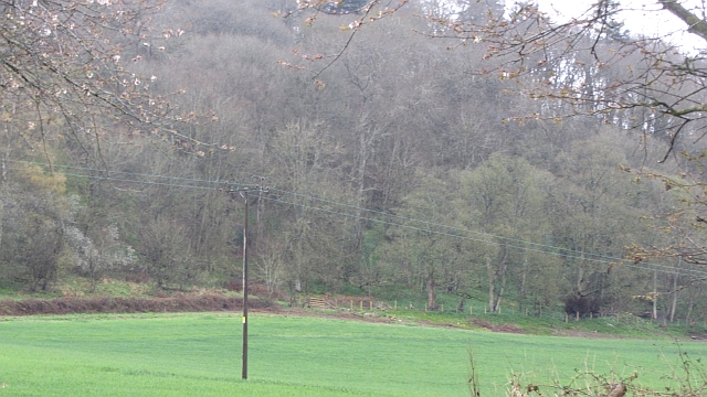
Barn Coppice is a picturesque woodland located in Herefordshire, England. Spread across an area of approximately 50 acres, this forested area is known for its natural beauty and tranquil atmosphere. It is situated in close proximity to the village of Barn, which lends its name to the coppice.

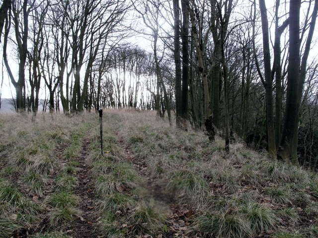
The woodland consists predominantly of mixed deciduous trees, including oak, ash, beech, and birch, creating a diverse and vibrant ecosystem. The trees are well-established, with some dating back several centuries. Their dense canopy provides shelter and shade, making it an ideal habitat for a variety of wildlife species.

The forest floor is adorned with a rich carpet of seasonal wildflowers and ferns, adding to the area's aesthetic appeal. In spring, the woodland bursts into life with a riot of color as bluebells, primroses, and wood anemones bloom in abundance.

Visitors to Barn Coppice can enjoy a network of well-maintained footpaths, allowing for leisurely strolls or more challenging hikes through the enchanting woodland. The trails wind through the trees, offering glimpses of sun-dappled glades and secluded clearings along the way. Birdwatchers will be delighted by the presence of various avian species, including woodpeckers, nuthatches, and tawny owls.

Barn Coppice is a cherished natural gem in Herefordshire, attracting nature enthusiasts, walkers, and those seeking solace in the great outdoors. Its timeless beauty and serene ambiance make it a popular destination for both locals and visitors alike.

If you have any feedback on the listing, please let us know in the comments section below.
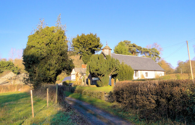
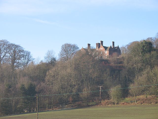
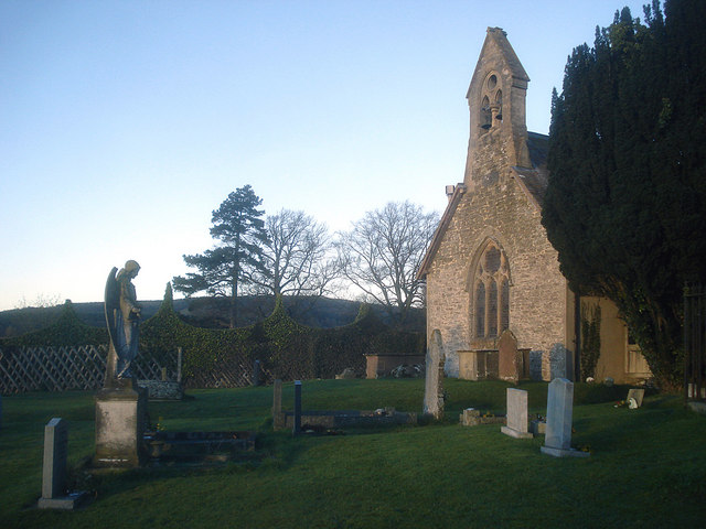
Barn Coppice Images

Images are sourced within 2km of 52.314697/-2.8085862 or Grid Reference SO4468. Thanks to Geograph Open Source API. All images are credited.

Mortimer Trail at Bircher Common
Road passing Gatley Park The road between The Goggin and Leinthall Earls in limestone country.
Road passing Gatley Park
The road between The Goggin and Leinthall Earls in limestone country.
Barn Coppice Gatley Park woodland.
Barn Coppice
Gatley Park woodland.
Gatley Hill Parked at entrance to forest to SW and followed over grown tracks to gain summit ridge early so gentle ridge walk from there. Dry and occasionally windy.
Name: Gatley Hill
Hill number: 5363
Height: 338m / 1109ft
Area: 38B: West Gloucestershire, Hereford & Worcester
Class: Hu
Grid ref: SO446693 (est)
Drop: 110m
Col: 228m  SO462698
Gatley Hill
Parked at entrance to forest to SW and followed over grown tracks to gain summit ridge early so gentle ridge walk from there. Dry and occasionally windy. Name: Gatley Hill Hill number: 5363 Height: 338m / 1109ft Area: 38B: West Gloucestershire, Hereford & Worcester Class: Hu Grid ref: SO446693 (est) Drop: 110m Col: 228m SO462698
Un-named lane junction in Leinthall Starkes
The Almshouse, Leinthall Earls In the centre of this charming small hamlet at the gate to Gatley Park and bathed in early winter sunshine, this 17th century cottage was formerly the village almshouse.
The Almshouse, Leinthall Earls
In the centre of this charming small hamlet at the gate to Gatley Park and bathed in early winter sunshine, this 17th century cottage was formerly the village almshouse.
Hall Farm, Leinthall Earls At the centre of this charming hamlet, with the old school house beyond.
Hall Farm, Leinthall Earls
At the centre of this charming hamlet, with the old school house beyond.
Old School House, Leinthall Earls Delightful 17th century building by the lane that leads to the church.
Old School House, Leinthall Earls
Delightful 17th century building by the lane that leads to the church.
St Andrew, Leinthall Earls  'A humble chapel' says Pevsner, which hardly does this lovely little building justice. Some churches are just magical and in my view this is one.
St Andrew, Leinthall Earls
'A humble chapel' says Pevsner, which hardly does this lovely little building justice. Some churches are just magical and in my view this is one.
St Andrew, Leinthall Earls A simple but utterly charming country chapel at the gate to Gatley Park.
St Andrew, Leinthall Earls
A simple but utterly charming country chapel at the gate to Gatley Park.
St Andrew, Leinthall Earls
St Andrew, Leinthall Earls The delightful interior with its wealth of ancient woodwork.
St Andrew, Leinthall Earls
The delightful interior with its wealth of ancient woodwork.
St Andrew, Leinthall Earls A fine medieval roof and 17th/18th century furnishings in this plain, humble and completely beguiling little church at the gates to Gatley Park.
St Andrew, Leinthall Earls
A fine medieval roof and 17th/18th century furnishings in this plain, humble and completely beguiling little church at the gates to Gatley Park.
Court Farm, Leinthall Earls A near neighbour to St Andrew's church.
Court Farm, Leinthall Earls
A near neighbour to St Andrew's church.
Sasel Wood Road into Gatley Long Coppice.  You are never far from a wood in Northwest Herefordshire.
Sasel Wood
Road into Gatley Long Coppice. You are never far from a wood in Northwest Herefordshire.
Croft Ambrey Croft Ambrey is an Iron-Age hillfort dating back to around 550BCE.  It is situated about 1000ft above sea level on a wooded hill top near Croft Castle.
Croft Ambrey
Croft Ambrey is an Iron-Age hillfort dating back to around 550BCE. It is situated about 1000ft above sea level on a wooded hill top near Croft Castle.
The valley above Leinthall Earls Oaker Wood in the centre. The photo was taken from the hillfort at Croft Ambrey
The valley above Leinthall Earls
Oaker Wood in the centre. The photo was taken from the hillfort at Croft Ambrey
Valley to the east of High Cullis This was taken looking west towards Oldfield Farm from about SO469696
Valley to the east of High Cullis
This was taken looking west towards Oldfield Farm from about SO469696
Show me another place!

Barn Coppice is located at Grid Ref: SO4468 (Lat: 52.314697, Lng: -2.8085862)

Unitary Authority: County of Herefordshire

Police Authority: West Mercia

What 3 Words

///overture.gentle.noisy. Near Elton, Herefordshire

Related Wikis

Gatley Park

Gatley Park is an English 17th-century park and country house lying near Leinthall Earls, Herefordshire. Both the park and the house are separately listed...

Leinthall Starkes

Leinthall Starkes is a small village and civil parish in north-western Herefordshire, England. It is about 7 miles south-west of Ludlow, and near the larger...

Leinthall Earls

Leinthall Earls or Leinthall Earles is a village in Aymestrey civil parish, Herefordshire, England. == Parish church == The earliest parts of the Church...

Croft Ambrey

Croft Ambrey is an Iron Age hill fort in Herefordshire, England. == Location == Croft Ambrey, on Yatton Hill, is in the civil parish of Aymestrey, 6 miles...

Yatton, Aymestrey

Yatton is a hamlet in the civil parish of Aymestrey in north-western Herefordshire, England. In 1870–72 the township had a population of 214.The hamlet...

Elton, Herefordshire

Elton is a hamlet and civil parish in the far north of Herefordshire. It is situated on the Wigmore to Ludlow road. The village is northeast of Leinthall...

Bircher Common

Bircher Common is an area of lowland heath in the civil parish of Croft and Yarpole in Herefordshire, England, and 6 miles (10 km) north from Leominster...

Aymestrey burial

The Aymestrey burial was a beaker cist at Aymestrey, Herefordshire, England. The remains and objects are now in a recreated cist, at Leominster Museum...

Nearby Amenities

Located within 500m of 52.314697,-2.8085862
Building: yes
Lat/Long: 52.3176809/-2.8092708
The data included in this document is from www.openstreetmap.org. The data is made available under ODbL.

Have you been to Barn Coppice?

Leave your review of Barn Coppice below (or comments, questions and feedback).