Birkmoss Plantation

Wood, Forest in Westmorland South Lakeland

England

Birkmoss Plantation

Helicopter at The Broom A recently-arrived helicopter below <a href="https://www.geograph.org.uk/photo/2936950">SD4592 : Barn at The Broom</a> which now looks to have been converted to a dwelling since 2012.
Helicopter at The Broom Credit: Karl and Ali

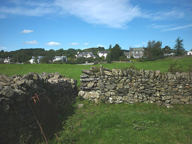
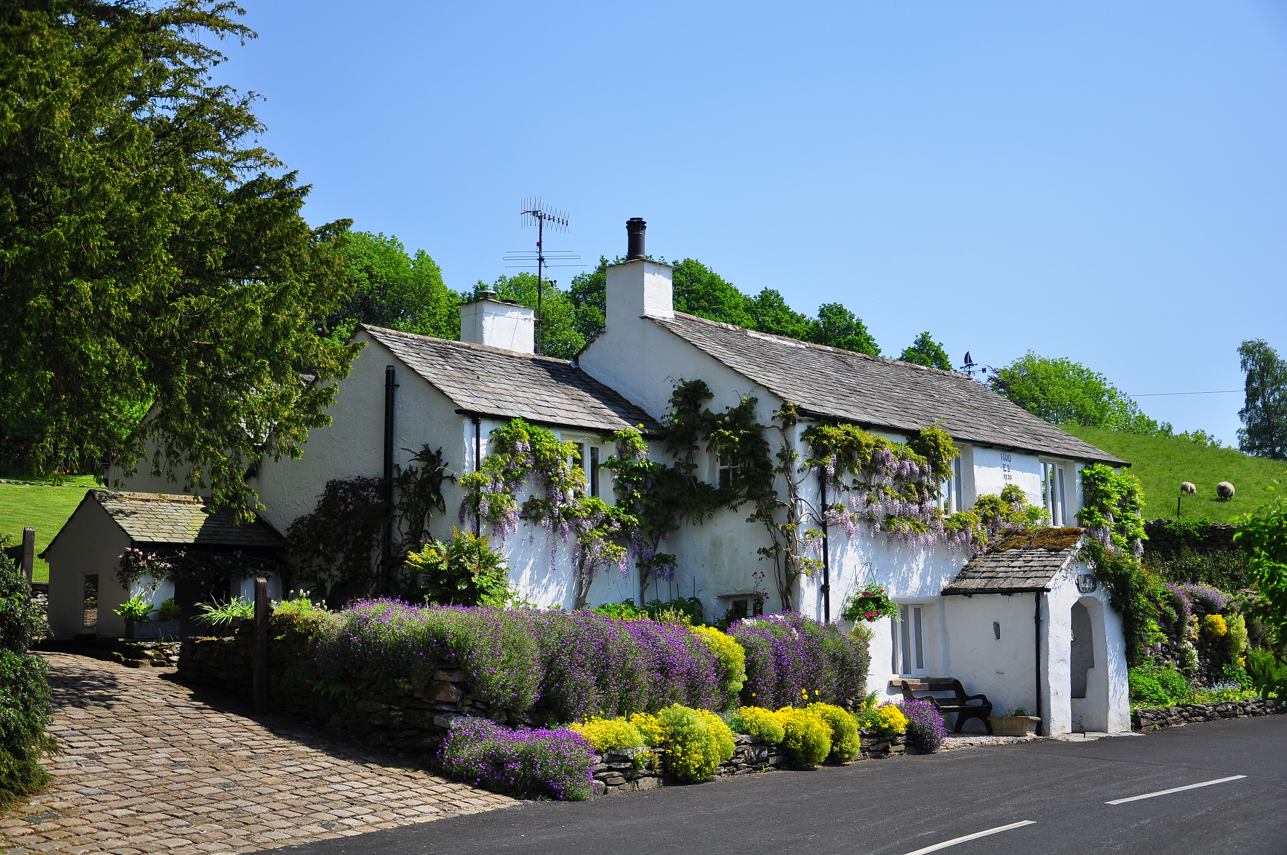
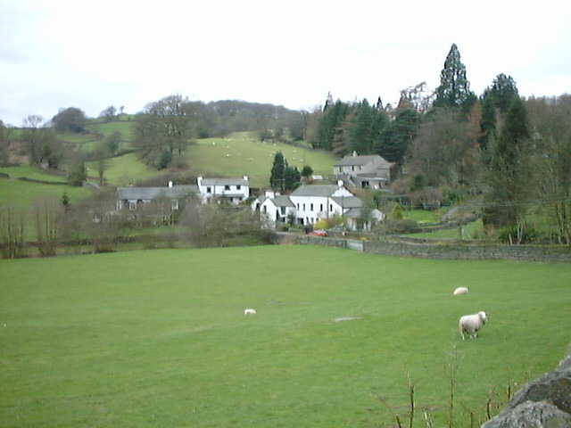
Birkmoss Plantation is a picturesque woodland area located in Westmorland, a historic county in the northwest of England. Nestled amidst the lush landscape of the Lake District, this plantation boasts a rich history and natural beauty that attracts visitors from near and far.

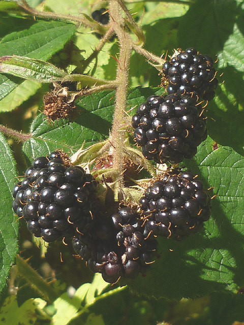
Covering an expansive area of land, Birkmoss Plantation is predominantly composed of a variety of tree species, creating a diverse and vibrant forest ecosystem. The plantation is home to towering oak, beech, and ash trees, which provide a habitat for numerous birds, small mammals, and insects. The dense canopy formed by these trees offers a cool and shaded environment, perfect for leisurely walks and exploring nature.

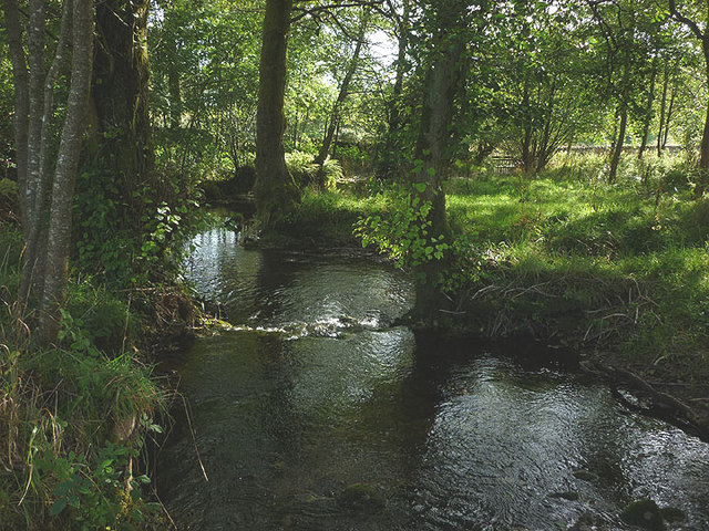
Visitors to Birkmoss Plantation can enjoy a network of well-maintained walking trails that wind their way through the woodland. These paths allow nature enthusiasts to immerse themselves in the tranquility of the forest, while also providing opportunities for birdwatching and wildlife spotting. Additionally, the plantation offers designated picnic areas, allowing visitors to relax and enjoy the peaceful surroundings.

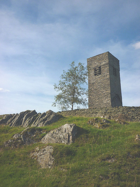
Birkmoss Plantation has a long and fascinating history, with records dating back several centuries. Once part of a larger estate, the plantation has witnessed various changes in ownership and land use over time. Today, it is managed by a local conservation organization, ensuring the preservation of its natural heritage and protecting the diverse ecosystem it supports.

In conclusion, Birkmoss Plantation is a captivating woodland area in Westmorland, renowned for its scenic beauty and rich biodiversity. Whether it's a leisurely stroll, a picnic with loved ones, or an opportunity to connect with nature, this plantation offers a serene and picturesque escape for all who visit.

If you have any feedback on the listing, please let us know in the comments section below.

Birkmoss Plantation Images

Images are sourced within 2km of 54.330301/-2.8571457 or Grid Reference SD4493. Thanks to Geograph Open Source API. All images are credited.

Helicopter at The Broom A recently-arrived helicopter below <a href="https://www.geograph.org.uk/photo/2936950">SD4592 : Barn at The Broom</a> which now looks to have been converted to a dwelling since 2012.
Helicopter at The Broom
A recently-arrived helicopter below SD4592 : Barn at The Broom which now looks to have been converted to a dwelling since 2012.
2015 - a great year for blackberries The hedgerows this autumn have been full of juicy blackberries, the best I can recall for some time. This particular bunch near Crosthwaite did not long survive the photograph!
2015 - a great year for blackberries
The hedgerows this autumn have been full of juicy blackberries, the best I can recall for some time. This particular bunch near Crosthwaite did not long survive the photograph!
Outbuildings at Hardriggs, Crosthwaite Former farm buildings, they look too clean and tidied-up to be still used as such. A planning application has been passed for its conversion to a dwelling <span class="nowrap"><a title="http://www.lakedistrict.gov.uk/swiftlg/apas/run/WPHAPPDETAIL.DisplayUrl?theApnID=7/2015/5225&theTabNo=3&backURL=%3Ca%20href=wphappcriteria.display%3ESearch%20Criteria%3C/a%3E%20%3E%20%3Ca%20href=%27wphappsearchres.displayResultsURL?ResultID=1044769%26StartIndex=41%26SortOrder=apnkey%20desc%26DispResultsAs=WPHAPPSEARCHRES%26BackURL=%3Ca%20href=wphappcriteria.display%3ESearch%20Criteria%3C/a%3E%27%3ESearch%20Results%3C/a%3E" rel="nofollow ugc noopener" href="http://www.lakedistrict.gov.uk/swiftlg/apas/run/WPHAPPDETAIL.DisplayUrl?theApnID=7/2015/5225&theTabNo=3&backURL=%3Ca%20href=wphappcriteria.display%3ESearch%20Criteria%3C/a%3E%20%3E%20%3Ca%20href=%27wphappsearchres.displayResultsURL?ResultID=1044769%26StartIndex=41%26SortOrder=apnkey%20desc%26DispResultsAs=WPHAPPSEARCHRES%26BackURL=%3Ca%20href=wphappcriteria.display%3ESearch%20Criteria%3C/a%3E%27%3ESearch%20Results%3C/a%3E">Link</a><img style="margin-left:2px;" alt="External link" title="External link - shift click to open in new window" src="https://s1.geograph.org.uk/img/external.png" width="10" height="10"/></span>
Outbuildings at Hardriggs, Crosthwaite
Former farm buildings, they look too clean and tidied-up to be still used as such. A planning application has been passed for its conversion to a dwelling LinkExternal link
Birk Moss A zoom shot of the cattle and sheep farm from high ground to the south east. The shot shows the contrast between the rolling Silurian slate country near Windermere and the more rugged volcanic rocks of the higher central fells. The Langdale Pikes, particularly, stand out on the skyline.
Birk Moss
A zoom shot of the cattle and sheep farm from high ground to the south east. The shot shows the contrast between the rolling Silurian slate country near Windermere and the more rugged volcanic rocks of the higher central fells. The Langdale Pikes, particularly, stand out on the skyline.
Sheep passing through a gate near Crook Hall A group of Rough Fell ewes changing fields. Beyond, are the cottages and farm at Crook Hall. On the skyline are the fells above Kentmere.
Sheep passing through a gate near Crook Hall
A group of Rough Fell ewes changing fields. Beyond, are the cottages and farm at Crook Hall. On the skyline are the fells above Kentmere.
The River Gilpin below Foxhole Bank Viewed from the bridge that carries the access track/footpath.
The River Gilpin below Foxhole Bank
Viewed from the bridge that carries the access track/footpath.
Thornyfields in the Gilpin Valley Typical Lakeland cottages below the steep, wooded bank of Bowmabble Breast. From the heights of Hart Howe it is possible to see the distant Coniston fells beyond.
Thornyfields in the Gilpin Valley
Typical Lakeland cottages below the steep, wooded bank of Bowmabble Breast. From the heights of Hart Howe it is possible to see the distant Coniston fells beyond.
Footbridge over the Gilpin at Dodds Howe, Crosthwaite This simple stone slab bridge is possibly 18th or 19th century and is a Grade II listed structure <span class="nowrap"><a title="http://www.britishlistedbuildings.co.uk/en-77098-footbridge-approximately-70-metres-to-wes#.VglcRH06tI4" rel="nofollow ugc noopener" href="http://www.britishlistedbuildings.co.uk/en-77098-footbridge-approximately-70-metres-to-wes#.VglcRH06tI4">Link</a><img style="margin-left:2px;" alt="External link" title="External link - shift click to open in new window" src="https://s1.geograph.org.uk/img/external.png" width="10" height="10"/></span>
Footbridge over the Gilpin at Dodds Howe, Crosthwaite
This simple stone slab bridge is possibly 18th or 19th century and is a Grade II listed structure LinkExternal link
Mirk Howe Large house above the River Gilpin near Crosthwaite.
Mirk Howe
Large house above the River Gilpin near Crosthwaite.
Mossy drystone wall An indicator of the often damp climate up here.
Mossy drystone wall
An indicator of the often damp climate up here.
Birk Moss (2) A zoom shot of the cattle and sheep farm from high ground to the south east. The shot shows the contrast between the rolling Silurian slate country near Windermere and the more rugged volcanic rocks of the higher fells (left to right: Wetherlam, Crinkle Crags, Bow Fell and Great Gable).
Birk Moss (2)
A zoom shot of the cattle and sheep farm from high ground to the south east. The shot shows the contrast between the rolling Silurian slate country near Windermere and the more rugged volcanic rocks of the higher fells (left to right: Wetherlam, Crinkle Crags, Bow Fell and Great Gable).
Track to Crook Hall The path through Crook Hall is flanked by two stone pillars topped with fierce lions. The effect is such as to completely demoralise the traveller, thinking what awful fate awaits within?
Track to Crook Hall
The path through Crook Hall is flanked by two stone pillars topped with fierce lions. The effect is such as to completely demoralise the traveller, thinking what awful fate awaits within?
Tower of Old Parish Church of St Catherine, Crook This free-standing tower, built in 1620, is all that remains of the church which stood here from 1512 to its demolition in 1887. It is a most unusual and odd sight to see, sitting on a rocky knoll set back from roads and surrounded by grazing land and drystone walls. It is a Grade II listed structure <span class="nowrap"><a title="http://www.britishlistedbuildings.co.uk/en-76395-tower-of-old-parish-church-of-st-catherin#.VgrfV306tI4" rel="nofollow ugc noopener" href="http://www.britishlistedbuildings.co.uk/en-76395-tower-of-old-parish-church-of-st-catherin#.VgrfV306tI4">Link</a><img style="margin-left:2px;" alt="External link" title="External link - shift click to open in new window" src="https://s1.geograph.org.uk/img/external.png" width="10" height="10"/></span> and was restored in 1993 <a href="https://www.geograph.org.uk/photo/2525828">SD4494 : Plaque on the tower of old St Catherine's Church, Crook</a>
Tower of Old Parish Church of St Catherine, Crook
This free-standing tower, built in 1620, is all that remains of the church which stood here from 1512 to its demolition in 1887. It is a most unusual and odd sight to see, sitting on a rocky knoll set back from roads and surrounded by grazing land and drystone walls. It is a Grade II listed structure LinkExternal link and was restored in 1993 SD4494 : Plaque on the tower of old St Catherine's Church, Crook
The old and the new, Church of St Catherine, Crook This free-standing tower, built in 1620, is all that remains of the church which stood here from 1512 to its demolition in 1887. It is a most unusual and odd sight to see, sitting on a rocky knoll set back from roads and surrounded by grazing land and drystone walls. It is a Grade II listed structure <span class="nowrap"><a title="http://www.britishlistedbuildings.co.uk" rel="nofollow ugc noopener" href="http://www.britishlistedbuildings.co.uk">Link</a><img style="margin-left:2px;" alt="External link" title="External link - shift click to open in new window" src="https://s1.geograph.org.uk/img/external.png" width="10" height="10"/></span>
In the middle distance is the 'new' Victorian parish church which was built to replace it.
The old and the new, Church of St Catherine, Crook
This free-standing tower, built in 1620, is all that remains of the church which stood here from 1512 to its demolition in 1887. It is a most unusual and odd sight to see, sitting on a rocky knoll set back from roads and surrounded by grazing land and drystone walls. It is a Grade II listed structure LinkExternal link In the middle distance is the 'new' Victorian parish church which was built to replace it.
Sheep entering a field near Crook Hall A group of Rough Fell ewes changing fields. Beyond, are the cottages and farm at Crook Hall. On the skyline are the fells above Kentmere.
Sheep entering a field near Crook Hall
A group of Rough Fell ewes changing fields. Beyond, are the cottages and farm at Crook Hall. On the skyline are the fells above Kentmere.
Nameless beck by the footpath to Mirk Howe Somewhat swollen by recent prolonged rain which made the adjacent pastureland squelchy underfoot.
Nameless beck by the footpath to Mirk Howe
Somewhat swollen by recent prolonged rain which made the adjacent pastureland squelchy underfoot.
Squeeze stile, Crosthwaite On the footpath leading south towards Oak Lane.
Squeeze stile, Crosthwaite
On the footpath leading south towards Oak Lane.
St Catherine's Church Tower St Catherine's Church Tower north west of Crook Hall
St Catherine's Church Tower
St Catherine's Church Tower north west of Crook Hall
Show me another place!

Birkmoss Plantation is located at Grid Ref: SD4493 (Lat: 54.330301, Lng: -2.8571457)

Administrative County: Cumbria

District: South Lakeland

Police Authority: Cumbria

What 3 Words

///awaited.plea.mows. Near Staveley, Cumbria

Related Wikis

Crosthwaite

Crosthwaite is a small village located in the Parish of Crosthwaite and Lyth, South Lakeland, Cumbria, England. It is in the Lake District National Park...

Winster, Cumbria

Winster is a village in the South Lakeland District of Cumbria, in North West England. Historically within the county of Westmorland, it is situated less...

South Lakeland

South Lakeland was a local government district in Cumbria, England, from 1974 to 2023. Its council was based in Kendal. The district covered the southern...

Westmorland and Lonsdale (UK Parliament constituency)

Westmorland and Lonsdale is a constituency in the south of Cumbria, represented in the House of Commons of the UK Parliament since 2005 by Tim Farron,...

Sedbergh Rural District

Sedbergh Rural District was a rural district in the West Riding of Yorkshire in England from 1894 to its abolition in 1974. The district consisted of the...

Underbarrow

Underbarrow is a small village in Cumbria, England, located 3 miles (4.8 km) west of Kendal. The village is in the Lake District National Park. It is in...

Crook, Cumbria

Crook is a village and civil parish in the South Lakeland district of the English county of Cumbria, located on the B5284 road between Kendal and Windermere...

Lyth Valley

The Lyth Valley is on the edge of the Lake District National Park in Cumbria, England. It gives its name to an electoral ward (one of 45 in South Lakeland...

Nearby Amenities

Located within 500m of 54.330301,-2.8571457
Lord's Lot
Natural: peak
Lat/Long: 54.3284903/-2.8539213
Barrier: stile
Lat/Long: 54.3317522/-2.852508
The data included in this document is from www.openstreetmap.org. The data is made available under ODbL.

Have you been to Birkmoss Plantation?

Leave your review of Birkmoss Plantation below (or comments, questions and feedback).