Cold Aston

Settlement in Gloucestershire Cotswold

England

Cold Aston

North end of the village green, Notgrove This small estate village houses holidaymakers and estate workers.
North end of the village green, Notgrove Credit: Christine Johnstone

Cold Aston is a small village located in the Cotswold district of Gloucestershire, England. Situated about 6 miles to the northeast of Cheltenham, the village is nestled amidst picturesque countryside and rolling hills, which are characteristic of the Cotswold Area of Outstanding Natural Beauty.

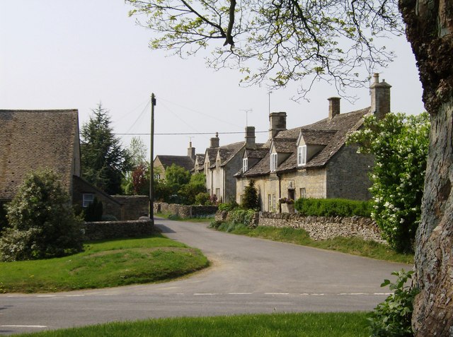
With a population of around 300, Cold Aston has a charming and tranquil atmosphere that attracts visitors seeking a peaceful retreat. The village is known for its traditional Cotswold stone houses and cottages, which contribute to its timeless appeal. Many of these buildings date back several centuries and add to the village's rich historical heritage.

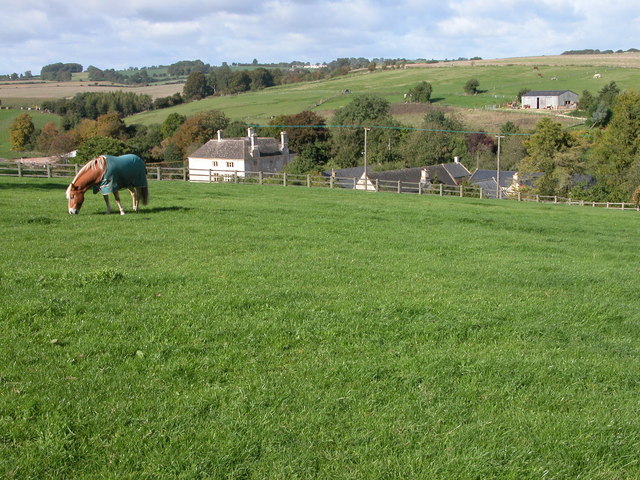
Cold Aston is surrounded by lush green fields and offers stunning views of the surrounding countryside. The village is also home to a beautiful 12th-century church, St. Andrew's, which stands as a testament to its long-standing presence in the area.

Despite its small size, Cold Aston has a strong sense of community and is known for its vibrant social scene. The village hosts various events throughout the year, including fairs, festivals, and community gatherings, which bring residents together and foster a sense of belonging.

For outdoor enthusiasts, Cold Aston provides ample opportunities for walking, hiking, and exploring the Cotswold landscape. The village is conveniently located near popular tourist destinations such as Bourton-on-the-Water and Stow-on-the-Wold, making it an ideal base for those looking to explore the wider Cotswold region.

Overall, Cold Aston offers a tranquil and idyllic setting for residents and visitors alike, with its natural beauty, historic charm, and strong community spirit.

If you have any feedback on the listing, please let us know in the comments section below.

Cold Aston Images

Images are sourced within 2km of 51.87681/-1.817776 or Grid Reference SP1219. Thanks to Geograph Open Source API. All images are credited.

North end of the village green, Notgrove This small estate village houses holidaymakers and estate workers.
North end of the village green, Notgrove
This small estate village houses holidaymakers and estate workers.
Post-box in Notgrove A small estate village housing holidaymakers and estate workers.
Post-box in Notgrove
A small estate village housing holidaymakers and estate workers.
Spring flowers, Notgrove A small estate village housing holidaymakers and estate workers.
Spring flowers, Notgrove
A small estate village housing holidaymakers and estate workers.
Flying the flag at the village hall, Notgrove A small estate village housing holidaymakers and estate workers.
Flying the flag at the village hall, Notgrove
A small estate village housing holidaymakers and estate workers.
The Old Post Office, Notgrove At the southern exit from this small estate village, housing holidaymakers and estate workers.
The Old Post Office, Notgrove
At the southern exit from this small estate village, housing holidaymakers and estate workers.
Glamping pods, Notgrove Estate Installed 2016-17 at Village Farm. A profitable crop in the Cotswolds.
Glamping pods, Notgrove Estate
Installed 2016-17 at Village Farm. A profitable crop in the Cotswolds.
Tree is a field called Scholars London, Notgrove Estate In a sea of winter wheat.
Tree is a field called Scholars London, Notgrove Estate
In a sea of winter wheat.
The Gloucestershire Way near Cold Aston The Gloucestershire Way follows this belt of trees to the village of Not grove.  I photographed a similar view in December 2005 <a href="https://www.geograph.org.uk/photo/92969">SP1220 : The Gloucestershire Way near Cold Aston</a>.
The Gloucestershire Way near Cold Aston
The Gloucestershire Way follows this belt of trees to the village of Not grove. I photographed a similar view in December 2005 SP1220 : The Gloucestershire Way near Cold Aston.
The Gloucestershire Way passing through trees The Gloucestershire Way passing through trees between Cold Aston and Notgrove.  Here is a similar view five years ago <a href="https://www.geograph.org.uk/photo/3808341">SP1220 : Beech trees on the Cotswold Way</a>.
The Gloucestershire Way passing through trees
The Gloucestershire Way passing through trees between Cold Aston and Notgrove. Here is a similar view five years ago SP1220 : Beech trees on the Cotswold Way.
Road to Notgrove Road to Notgrove at turn to Cold Aston
Road to Notgrove
Road to Notgrove at turn to Cold Aston
Road heading into Cold Aston Road heading into Cold Aston passing the path to Folly Farm and the Gloucestershire Way
Road heading into Cold Aston
Road heading into Cold Aston passing the path to Folly Farm and the Gloucestershire Way
Road heading to the A436 By Claylodge Coppice the road heading to the A436
Road heading to the A436
By Claylodge Coppice the road heading to the A436
Hedgerow at the end of the landing strip
Airstrip at Upper Harford
Footpath into Upper Harford
Paths diverge It looks like the tree has gone since <a href="https://www.geograph.org.uk/photo/1856677">SP1221 : Two ways to go</a> was taken
Paths diverge
It looks like the tree has gone since SP1221 : Two ways to go was taken
Footpath to Cold Aston
Coldmoor Coppice
Coldmoor Coppice
Show me another place!

Cold Aston is located at Grid Ref: SP1219 (Lat: 51.87681, Lng: -1.817776)

Administrative County: Gloucestershire

District: Cotswold

Police Authority: Gloucestershire

What 3 Words

///fastening.adapt.slime. Near Westfield, Gloucestershire

Nearby Locations

Aston Blank Cold Aston

Related Wikis

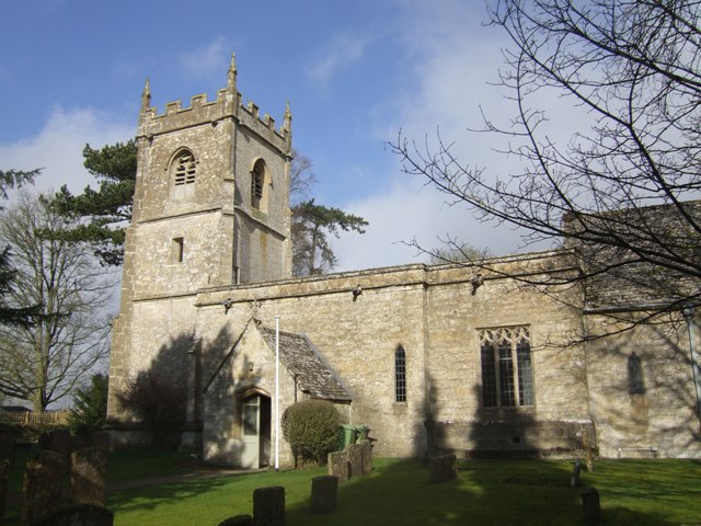
Church of St Andrew, Cold Aston

The Anglican St Andrew's Church at Cold Aston in the Cotswold District of Gloucestershire, England was built in the 12th century. It is a grade I listed...

Cold Aston

Cold Aston (also known as Aston Blank) is a village and civil parish in Gloucestershire, England, approximately 18 miles (29 km) to the east of Gloucester...

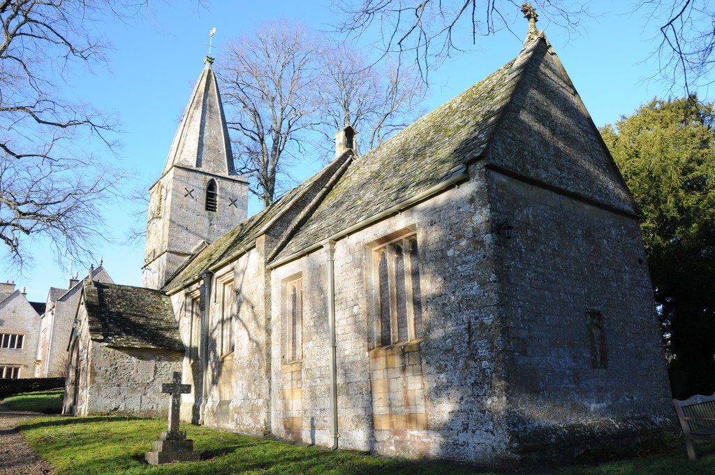
Church of St Bartholomew, Notgrove

The Anglican Church of St Bartholomew at Notgrove in the Cotswold District of Gloucestershire, England was built in the 12th century. It is a grade I listed...

Notgrove

Notgrove is a village and civil parish in Gloucestershire, England, approximately 28.5 (17.8 miles) to the east of Gloucester. It lies in the Cotswolds...

Harford Railway Cutting

Harford Railway Cutting (SP135218 to SP141215) is a 1.2-hectare (3.0-acre) geological Site of Special Scientific Interest in Gloucestershire, notified...

Aylworth

Aylworth is a village in Gloucestershire, England. == References == == External links == Media related to Aylworth at Wikimedia Commons Aylworth in the...

Naunton

Naunton is a village in Gloucestershire, England. It lies on the River Windrush in the Cotswolds, an area of outstanding natural beauty. Stow-on-the-Wold...

Brassey SSSI

Brassey (grid reference SP139223) is a 2.1-hectare (5.2-acre) biological Site of Special Scientific Interest in Gloucestershire, notified in 1954 and renotified...

Nearby Amenities

Located within 500m of 51.87681,-1.817776
Bus Stop
Plough Inn
Bench: no
Bin: no
Bus: yes
Lit: no
Naptan AtcoCode: 1600GL1389
Naptan Bearing: SE
Naptan CommonName: Plough Inn
Naptan Indicator: Opp
Naptan NaptanCode: glogdmdg
Naptan Street: Main Street
Naptan Verified: no
Public Transport: platform
Shelter: no
Source: naptan_import
Tactile Paving: no
Lat/Long: 51.8763359/-1.814017
Bus Stop
Plough Inn
Bench: no
Bin: no
Bus: yes
Lit: no
Naptan AtcoCode: 1600GL1390
Naptan Bearing: NW
Naptan CommonName: Plough Inn
Naptan NaptanCode: glogdmda
Naptan Street: Main Street
Naptan Verified: no
Public Transport: platform
Shelter: no
Source: naptan_import
Tactile Paving: no
Lat/Long: 51.8762101/-1.8140756
Bus Stop
St Andrew's Church
Bench: no
Bin: no
Bus: yes
Lit: no
Naptan AtcoCode: 1600GLC445
Naptan Bearing: E
Naptan CommonName: St Andrew's Church
Naptan NaptanCode: glogdmaw
Naptan Street: Main Street
Naptan Verified: no
Public Transport: platform
Shelter: no
Source: naptan_import
Tactile Paving: no
Lat/Long: 51.8770141/-1.8157671
Bus Stop
St Andrew's Church
Bench: no
Bin: no
Bus: yes
Lit: no
Naptan AtcoCode: 1600GLC446
Naptan Bearing: W
Naptan CommonName: St Andrew's Church
Naptan Indicator: Opp
Naptan NaptanCode: glogdmat
Naptan Street: Main Street
Naptan Verified: no
Public Transport: platform
Shelter: no
Source: naptan_import
Tactile Paving: no
Lat/Long: 51.8769506/-1.8161499
Barrier: stile
Lat/Long: 51.8752459/-1.8147506
Barrier: stile
Lat/Long: 51.8740822/-1.8161918
Barrier: stile
Lat/Long: 51.8735655/-1.8180264
Defibrillator
Booth: K6
Covered: booth
Defibrillator Location: inside old red phone box next to Village Hall in Cold Aston
Disused Amenity: telephone
Emergency: defibrillator
Man Made: telephone_box
Source: survey
Lat/Long: 51.8759561/-1.8136069
Post Box
Collection Times: Mo-Fr 15:30; Sa 09:00
Ref: GL54 207
Royal Cypher: EVIIR
Royal Cypher Wikidata: Q33102324
Source: survey
Lat/Long: 51.8761943/-1.8141001
Entrance: main
Lat/Long: 51.877505/-1.8156506
Barrier: kissing_gate
Lat/Long: 51.8807382/-1.8169729
Advertising: board
Lat/Long: 51.8759853/-1.8135953
Addr Postcode: The Garden House
Lat/Long: 51.8754295/-1.8140914
Horse Stables
Lat/Long: 51.8748117/-1.8184422
The data included in this document is from www.openstreetmap.org. The data is made available under ODbL.

Have you been to Cold Aston?

Leave your review of Cold Aston below (or comments, questions and feedback).