The Rookery

Wood, Forest in Shropshire

England

The Rookery

Disused Airfield Disused Airfield north of Forton, view to the North East towards Forton Heath, north of Shrewsbury, Shropshire
Disused Airfield Credit: Keith Havercroft

The Rookery is a picturesque woodland located in the heart of Shropshire, England. Covering an area of approximately 50 acres, this enchanting forest offers a serene and tranquil escape for nature enthusiasts and outdoor adventurers alike.

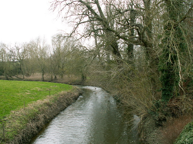
The Rookery boasts a diverse range of tree species, including oak, beech, and birch, creating a rich and vibrant tapestry of colors throughout the seasons. The dense foliage provides a haven for a variety of wildlife, making it a popular destination for birdwatchers and animal lovers.

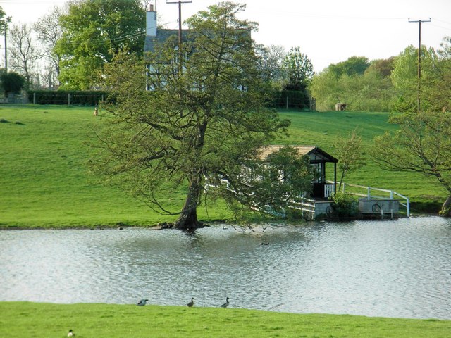
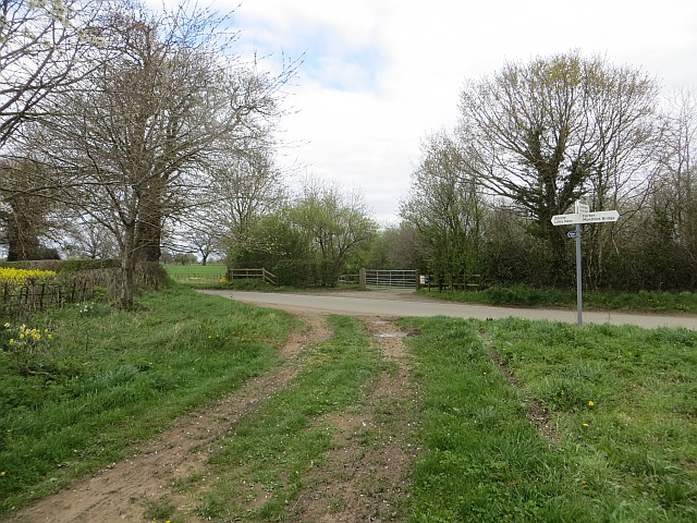
Visitors to The Rookery can explore a network of well-maintained walking trails, allowing them to immerse themselves in the natural beauty of the woodland. Along the way, they may encounter charming streams, small waterfalls, and even a hidden pond, adding to the sense of discovery and exploration.

For those seeking a more active experience, The Rookery offers opportunities for recreational activities such as hiking, cycling, and picnicking. The well-marked trails cater to all levels of fitness, making it an accessible destination for families and individuals of all ages.

The Rookery is also home to a variety of rare plant species, some of which are protected under conservation laws. This makes it a significant site for botanists and researchers interested in studying and preserving the region's unique flora.

Overall, The Rookery in Shropshire is a captivating woodland destination that showcases the beauty and diversity of nature. Whether visitors seek peaceful contemplation or an adrenaline-filled adventure, this forest offers something for everyone.

If you have any feedback on the listing, please let us know in the comments section below.

The Rookery Images

Images are sourced within 2km of 52.757196/-2.8414308 or Grid Reference SJ4318. Thanks to Geograph Open Source API. All images are credited.

Disused Airfield Disused Airfield north of Forton, view to the North East towards Forton Heath, north of Shrewsbury, Shropshire
Disused Airfield
Disused Airfield north of Forton, view to the North East towards Forton Heath, north of Shrewsbury, Shropshire
Near Forton Heath From The Gorse - the avenue to Grafton Lodge
Near Forton Heath
From The Gorse - the avenue to Grafton Lodge
River Perry The River Perry in a view south from the bridge at Fitz Mill.
River Perry
The River Perry in a view south from the bridge at Fitz Mill.
Old road-side pump An old pump by the side of the lane at Mytton House. Mytton, north of Montford Bridge, near Shrewsbury, Shropshire
Old road-side pump
An old pump by the side of the lane at Mytton House. Mytton, north of Montford Bridge, near Shrewsbury, Shropshire
Fitz Church Fitz is a village above the meandering River Severn, north of Shrewsbury, Shropshire
Fitz Church
Fitz is a village above the meandering River Severn, north of Shrewsbury, Shropshire
Towards Cutbury Wood Sheep grazing near Cutbury Wood, with the far bank of the River Severn.
Towards Cutbury Wood
Sheep grazing near Cutbury Wood, with the far bank of the River Severn.
River Perry west of Mytton River Perry west of Mytton, Shropshire
River Perry west of Mytton
River Perry west of Mytton, Shropshire
River Perry, south of Mytton River Perry, south of Mytton, North of Montford Bridge, near Shrewsbury, Shropshire
River Perry, south of Mytton
River Perry, south of Mytton, North of Montford Bridge, near Shrewsbury, Shropshire
Disused Airfield A view to the north west along a former landing strip of a disused airfield, north of Forton, near Montford Bridge, Shropshire
Disused Airfield
A view to the north west along a former landing strip of a disused airfield, north of Forton, near Montford Bridge, Shropshire
Cottage Pool
Cottage Pool
Summer/boat house at  Cottage Pool
Summer/boat house at Cottage Pool
River Perry at Yeaton A small tributary of the Severn pictured about 3 miles upstream from the confluence.
River Perry at Yeaton
A small tributary of the Severn pictured about 3 miles upstream from the confluence.
River Perry - view upstream from Yeaton Bridge The water levels are up after a wet couple of days.
River Perry - view upstream from Yeaton Bridge
The water levels are up after a wet couple of days.
Dairy cattle out in December Probably not milkers at the moment. This is pasture land west of Grafton Farm.
Dairy cattle out in December
Probably not milkers at the moment. This is pasture land west of Grafton Farm.
The Rough The name of the piece of woodland west of Grafton, Shropshire. The indication of a public footpath shows across the field to the left.
The Rough
The name of the piece of woodland west of Grafton, Shropshire. The indication of a public footpath shows across the field to the left.
Sheep pasture near Grafton Lodge The wood is known as The Common.
Sheep pasture near Grafton Lodge
The wood is known as The Common.
Public footpath from Forton Heath to Mytton Bridge Just by the road from Forton Heath to Montford Bridge.
Public footpath from Forton Heath to Mytton Bridge
Just by the road from Forton Heath to Montford Bridge.
Forton Heath The first building is a converted chapel.
Forton Heath
The first building is a converted chapel.
Show me another place!

The Rookery is located at Grid Ref: SJ4318 (Lat: 52.757196, Lng: -2.8414308)

Unitary Authority: Shropshire

Police Authority: West Mercia

What 3 Words

///wimp.bystander.patching. Near Great Ness, Shropshire

Related Wikis

Forton Heath

Forton Heath is a hamlet in Shropshire, England. It is located north of Montford Bridge, near to the small village of Fitz and near to the hamlets of Broomfields...

Grafton, Shropshire

Grafton is a hamlet in Shropshire, England. Its name probably refers to a coppiced wood.It is situated in the parish of Pimhill, to the northwest of Shrewsbury...

Broomfields

Broomfields is a hamlet in Shropshire, England. It is located north of Montford Bridge and near to the hamlets of Forton Heath and Grafton. It is in the...

RAF Montford Bridge

Royal Air Force Montford Bridge, or more simply RAF Montford Bridge, is a former Royal Air Force satellite station, located near Shrewsbury, Shropshire...

Related Videos

Nearby Amenities

Located within 500m of 52.757196,-2.8414308
Give Way
Direction: forward
Lat/Long: 52.7595473/-2.8367651
The data included in this document is from www.openstreetmap.org. The data is made available under ODbL.

Have you been to The Rookery?

Leave your review of The Rookery below (or comments, questions and feedback).