Beechenbank Wood

Wood, Forest in Herefordshire

England

Beechenbank Wood

St. John the Baptist and St Alkmund church (Aymestrey) Cf. <a href="https://www.geograph.org.uk/photo/7572086">SO4265 : St. John the Baptist and St Alkmund church (Aymestrey)</a>. My brother Dylan is seen taking a picture of the church on my old camera, the Canon PowerShot A2600. The concept here was reused in my photo of Ledbury parish church two months later <a href="https://www.geograph.org.uk/photo/5860242">SO7137 : St. Michael & All Angels Church (Ledbury)</a>.
St. John the Baptist and St Alkmund church (Aymestrey) Credit: Fabian Musto

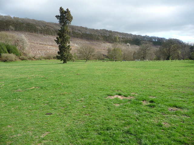
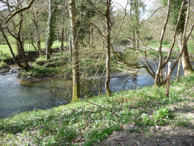
Beechenbank Wood is a picturesque woodland located in Herefordshire, England. Covering an area of approximately 50 acres, it is a natural treasure that attracts nature enthusiasts, hikers, and wildlife lovers alike.

The woodland is primarily composed of beech trees, which lend their name to the area. These majestic trees create a dense canopy, providing shade and shelter for a diverse range of flora and fauna. As visitors explore the wood, they can expect to encounter a variety of plant species, including bluebells, wood anemones, and ferns. The forest floor is often carpeted with vibrant wildflowers during the spring and summer months.

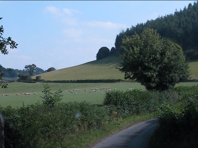
Beechenbank Wood is a haven for wildlife, with many species calling it home. Birdwatchers will be delighted to spot various avian residents, such as woodpeckers, nuthatches, and owls. Small mammals, such as squirrels and hedgehogs, are also commonly sighted within the woodland. Additionally, the area is known for its abundance of butterflies and insects, adding to its biodiversity.

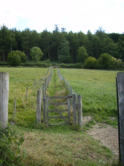
The wood features well-maintained walking trails that wind through its enchanting landscape. These paths provide visitors with the opportunity to immerse themselves in the tranquility of nature, offering a peaceful respite from the hustle and bustle of everyday life. The wood is a popular destination for leisurely walks, family outings, and dog walking.

Overall, Beechenbank Wood is a captivating natural gem in Herefordshire, offering visitors an escape into a serene and enchanting woodland environment.

If you have any feedback on the listing, please let us know in the comments section below.

Beechenbank Wood Images

Images are sourced within 2km of 52.284579/-2.854538 or Grid Reference SO4165. Thanks to Geograph Open Source API. All images are credited.

St. John the Baptist and St Alkmund church (Aymestrey) Cf. <a href="https://www.geograph.org.uk/photo/7572086">SO4265 : St. John the Baptist and St Alkmund church (Aymestrey)</a>. My brother Dylan is seen taking a picture of the church on my old camera, the Canon PowerShot A2600. The concept here was reused in my photo of Ledbury parish church two months later <a href="https://www.geograph.org.uk/photo/5860242">SO7137 : St. Michael & All Angels Church (Ledbury)</a>.
St. John the Baptist and St Alkmund church (Aymestrey)
Cf. SO4265 : St. John the Baptist and St Alkmund church (Aymestrey). My brother Dylan is seen taking a picture of the church on my old camera, the Canon PowerShot A2600. The concept here was reused in my photo of Ledbury parish church two months later SO7137 : St. Michael & All Angels Church (Ledbury).
The Mortimer Trail coming down from Shobdon Hill Wood The Mortimer Trail is a 30 mile trail from Kington to Ludlow.
The Mortimer Trail coming down from Shobdon Hill Wood
The Mortimer Trail is a 30 mile trail from Kington to Ludlow.
Bridge over the river Lugg
River Lugg near Upper Lye just a few yards down from the holiday cottage...
River Lugg near Upper Lye
just a few yards down from the holiday cottage...
The view south from Lyepole Bridge
Straight lines near Lyepole Bridge
Ordnance Survey Cut Mark This OS cut mark can be found on the west parapet of Lyepole Bridge. It marks a point 115.552m above mean sea level. <a title="https://www.geograph.org.uk/photo/3862468" href="https://www.geograph.org.uk/photo/3862468">Link</a>
Ordnance Survey Cut Mark
This OS cut mark can be found on the west parapet of Lyepole Bridge. It marks a point 115.552m above mean sea level. Link
Lyepole Bridge There is an OS cut mark on the west parapet. <a title="https://www.geograph.org.uk/photo/3862461" href="https://www.geograph.org.uk/photo/3862461">Link</a>
Lyepole Bridge
There is an OS cut mark on the west parapet. Link
Little wagon caravan at Aymestrey This little horse drawn caravan is parked up behind an old orchard. I wonder if it gets out.
Little wagon caravan at Aymestrey
This little horse drawn caravan is parked up behind an old orchard. I wonder if it gets out.
Part of Yatton Court This wonderful looking house is usually well screened by trees but you get a glimpse in early Spring.
Part of Yatton Court
This wonderful looking house is usually well screened by trees but you get a glimpse in early Spring.
Pokeshouse Wood NT woodland The National Trust have felled an old pine plantation and replaced it with native broad leaved woodland here recently. When I last walked here in late '07 the plantation was mature but gloomy and dark. This lone fir tree has seen it all happen.
Pokeshouse Wood NT woodland
The National Trust have felled an old pine plantation and replaced it with native broad leaved woodland here recently. When I last walked here in late '07 the plantation was mature but gloomy and dark. This lone fir tree has seen it all happen.
Little islet in the River Lugg The river forks here around a little islet of a gravel bank held together with tree roots.
Little islet in the River Lugg
The river forks here around a little islet of a gravel bank held together with tree roots.
Footpath beside the River Lugg The clear felling of the old Pokeshouse Wood plantation has opened up this footpath into a very light broad track.
Footpath beside the River Lugg
The clear felling of the old Pokeshouse Wood plantation has opened up this footpath into a very light broad track.
A ploughed field in Herefordshire Herefordshire has been blessed with a fine landscape adapted over many centuries for agriculture and it's always a pleasure to walk past its ploughed fields and admire its natural propensity for bounty, fruitfulness and rich returns.
A ploughed field in Herefordshire
Herefordshire has been blessed with a fine landscape adapted over many centuries for agriculture and it's always a pleasure to walk past its ploughed fields and admire its natural propensity for bounty, fruitfulness and rich returns.
Herefordshire ploughsoil in Spring A fine tilth has been sculpted by the massive plough ready for the year's bounty to emerge.
Herefordshire ploughsoil in Spring
A fine tilth has been sculpted by the massive plough ready for the year's bounty to emerge.
Old stonework each side of the lane I assumed that this may have been an old bridge for a disused railway line but none is marked so I assume that it was once a gatehouse style arch associated with the Croft Castle estate. I didn't stop to investigate...
Old stonework each side of the lane
I assumed that this may have been an old bridge for a disused railway line but none is marked so I assume that it was once a gatehouse style arch associated with the Croft Castle estate. I didn't stop to investigate...
Mortimer Trail waymarker near Hill Farm A lovely waymarked trail, of which I have done many sections but never the whole in one go. Must do it soon.
Mortimer Trail waymarker near Hill Farm
A lovely waymarked trail, of which I have done many sections but never the whole in one go. Must do it soon.
Entrance to the National Trust Croft Castle estate The barn is a reconstruction of a medieval barn type specific to this region.
Entrance to the National Trust Croft Castle estate
The barn is a reconstruction of a medieval barn type specific to this region.
Show me another place!

Beechenbank Wood is located at Grid Ref: SO4165 (Lat: 52.284579, Lng: -2.854538)

Unitary Authority: County of Herefordshire

Police Authority: West Mercia

What 3 Words

///weeknight.snatched.perusing. Near Wigmore, Herefordshire

Related Wikis

Aymestrey burial

The Aymestrey burial was a beaker cist at Aymestrey, Herefordshire, England. The remains and objects are now in a recreated cist, at Leominster Museum...

Aymestrey

Aymestrey ( AYM-stree) is a village and civil parish in north-western Herefordshire, England. The population of this civil parish, including the hamlet...

Mortimer's Cross Water Mill

Mortimer's Cross Water Mill is an 18th-century watermill located on the River Lugg, 11 km (7 mi) northwest of Leominster, Herefordshire, England. It is...

Lucton School

Lucton School, is a private, co-educational, day and boarding school in Lucton near Leominster, Herefordshire, England. It was founded in 1708 as a boys...

Have you been to Beechenbank Wood?

Leave your review of Beechenbank Wood below (or comments, questions and feedback).