Knowsley Wood

Wood, Forest in Lancashire

England

Knowsley Wood

Houses on Midhurst Road, L12
Houses on Midhurst Road, L12 Credit: JThomas

Knowsley Wood is a picturesque forest located in the county of Lancashire, England. Covering an area of approximately 100 acres, it is a popular destination for nature enthusiasts and outdoor lovers alike. The woodland is situated in the village of Knowsley, near the town of Prescot.

Knowsley Wood is predominantly made up of native broadleaf trees, including oak, birch, and beech, creating a diverse and vibrant ecosystem. The forest is home to a wide variety of wildlife, including deer, foxes, badgers, and a plethora of bird species, making it an ideal spot for birdwatchers. The peaceful atmosphere of the Wood provides a tranquil retreat from the hustle and bustle of everyday life.

The forest offers a network of well-maintained walking trails, allowing visitors to explore its natural beauty at their own pace. These trails range in difficulty, catering to both casual walkers and more experienced hikers. Along the way, visitors can enjoy breathtaking views, discover hidden ponds, and stumble upon ancient ruins, adding to the allure of the wood.

Knowsley Wood also provides opportunities for recreational activities such as picnicking, orienteering, and photography. The forest is equipped with picnic areas, providing a peaceful setting for families and friends to enjoy a day out surrounded by nature. Orienteering courses are available for those seeking a more adventurous experience, challenging participants to navigate their way through the wood using a map and compass.

Overall, Knowsley Wood in Lancashire offers a haven of natural beauty and tranquility, providing visitors with the chance to connect with nature and experience the wonders of the British countryside.

If you have any feedback on the listing, please let us know in the comments section below.

Knowsley Wood Images

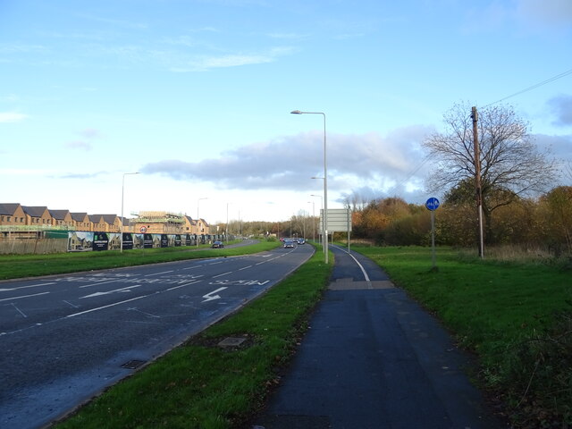
Images are sourced within 2km of 53.461516/-2.8871079 or Grid Reference SJ4196. Thanks to Geograph Open Source API. All images are credited.

Houses on Midhurst Road, L12
Fir Tree Drive South, L12
Bungalows on Strand Farm Road
Fir Tree Drive South, L12
Langley Close, L12
Langley Close, L12
Bus stop and shelter on Fir Tree Drive South, L12
Fir Tree Drive South, L12
Grayling Drive, L12
Grayling Drive, L12
Houses, Countess Park
Bus stop and shelter on Oak Lane North
Business units off East Lancashire Road (A580)
East Lancashire Road (A580)
M57 Motorway bridge over the A506, Junction 6
Slip road onto the M57 Motorway, Junction 6
Valley Road (A506)
Valley Road (A506)
Houses on Whitefield Drive
The Johnny Todd public house
Bus stop and shelter on Whitefield Drive (B5192)
Show me another place!

Knowsley Wood is located at Grid Ref: SJ4196 (Lat: 53.461516, Lng: -2.8871079)

Unitary Authority: Knowsley

Police Authority: Merseyside

What 3 Words

///guides.shades.valley. Near Kirkby, Merseyside

Related Wikis

Stonebridge Park, Liverpool

Stonebridge Park is a new business park under construction in Gillmoss on the outskirts of Liverpool, created by St. Modwen Properties with the help of...

Home Bargains

Home Bargains is a British variety store chain founded in 1976 by Tom Morris in Liverpool, England, as Home and Bargain. It is the trading name of TJ Morris...

Gillmoss

Gillmoss is an area in north Liverpool, Merseyside, England, located between Croxteth, Fazakerley and Kirkby. == Description == Gillmoss is a predominantly...

Croxteth (Liverpool ward)

Croxteth ward is an electoral division of Liverpool City Council. Ward in the Liverpool West Derby Parliamentary constituency. == Background == The ward...

Nearby Amenities

Located within 500m of 53.461516,-2.8871079
Motorway Junction
Knowsley Wood Interchange
Lat/Long: 53.464024/-2.8813893
Bus Stop
EAST LANCS ROAD/M57
Bus: yes
Naptan AtcoCode: 2800S52034A
Naptan Bearing: E
Naptan CommonName: EAST LANCS ROAD/M57
Naptan Indicator: EAST LANCS ROAD/M57
Naptan Landmark: CLOSE TO KWSLEY WOOD ROAD
Naptan NaptanCode: merdwpwm
Naptan Notes: No Notes
Naptan PlusbusZoneRef: LVRPLCH
Naptan ShortCommonName: East Lancs Rd/M57
Naptan Street: East Lancashire Road
Naptan Verified: no
Public Transport: platform
Source: naptan_import
Lat/Long: 53.4638566/-2.885939
Motorway Junction
Randles Farm Interchange
Ref: 4
Lat/Long: 53.4639252/-2.8832038
Man Made: tower
Lat/Long: 53.4645431/-2.8882469
Crossing
Crossing: unmarked
Crossing Island: no
Kerb: lowered
Tactile Paving: yes
Lat/Long: 53.4641745/-2.8823973
Crossing
Crossing: unmarked
Crossing Island: no
Kerb: lowered
Tactile Paving: no
Lat/Long: 53.4639203/-2.8850737
Crossing
Crossing: unmarked
Crossing Island: no
Kerb: lowered
Tactile Paving: yes
Lat/Long: 53.4638324/-2.8861879
Crossing
Crossing: unmarked
Crossing Island: no
Kerb: lowered
Tactile Paving: yes
Lat/Long: 53.4631988/-2.8939642
Crossing
Crossing: unmarked
Crossing Island: no
Kerb: lowered
Tactile Paving: yes
Lat/Long: 53.4636737/-2.8841622
Crossing
Crossing: unmarked
Crossing Island: no
Kerb: lowered
Tactile Paving: yes
Lat/Long: 53.4632279/-2.8897814
Generator Method: photovoltaic
Generator Output Electricity: yes
Generator Source: solar
Generator Type: solar_photovoltaic_panel
Location: roof
Power: generator
Lat/Long: 53.4619752/-2.8932299
Generator Method: photovoltaic
Generator Output Electricity: yes
Generator Source: solar
Generator Type: solar_photovoltaic_panel
Location: roof
Power: generator
Lat/Long: 53.4614179/-2.8943645
Generator Method: photovoltaic
Generator Output Electricity: yes
Generator Source: solar
Generator Type: solar_photovoltaic_panel
Location: roof
Power: generator
Lat/Long: 53.4612902/-2.8941499
Generator Method: photovoltaic
Generator Output Electricity: yes
Generator Source: solar
Generator Type: solar_photovoltaic_panel
Location: roof
Power: generator
Lat/Long: 53.4612598/-2.8940748
Generator Method: photovoltaic
Generator Output Electricity: yes
Generator Source: solar
Generator Type: solar_photovoltaic_panel
Location: roof
Power: generator
Lat/Long: 53.4608829/-2.8941982
Generator Method: photovoltaic
Generator Output Electricity: yes
Generator Source: solar
Generator Type: solar_photovoltaic_panel
Location: roof
Power: generator
Lat/Long: 53.4595128/-2.8936054
Generator Method: photovoltaic
Generator Output Electricity: yes
Generator Source: solar
Generator Type: solar_photovoltaic_panel
Location: roof
Power: generator
Lat/Long: 53.4600126/-2.8925486
Generator Method: photovoltaic
Generator Output Electricity: yes
Generator Source: solar
Generator Type: solar_photovoltaic_panel
Location: roof
Power: generator
Lat/Long: 53.4592525/-2.8923689
Generator Method: photovoltaic
Generator Output Electricity: yes
Generator Source: solar
Generator Type: solar_photovoltaic_panel
Location: roof
Power: generator
Lat/Long: 53.4587398/-2.8927391
Generator Method: photovoltaic
Generator Output Electricity: yes
Generator Source: solar
Generator Type: solar_photovoltaic_panel
Location: roof
Power: generator
Lat/Long: 53.4599778/-2.8903719
Generator Method: photovoltaic
Generator Output Electricity: yes
Generator Source: solar
Generator Type: solar_photovoltaic_panel
Location: roof
Power: generator
Lat/Long: 53.4598772/-2.8901198
Generator Method: photovoltaic
Generator Output Electricity: yes
Generator Source: solar
Generator Type: solar_photovoltaic_panel
Location: roof
Power: generator
Lat/Long: 53.4600769/-2.8896236
Generator Method: photovoltaic
Generator Output Electricity: yes
Generator Source: solar
Generator Type: solar_photovoltaic_panel
Location: roof
Power: generator
Lat/Long: 53.4613767/-2.8914475
Generator Method: photovoltaic
Generator Output Electricity: yes
Generator Source: solar
Generator Type: solar_photovoltaic_panel
Location: roof
Power: generator
Lat/Long: 53.4614773/-2.8917667
Post Box
Collection Times: Mo-Fr 09:00; Sa 07:00
Description: GVIR type B post box L11 661 by Carron Company at Malpas Road, Gillmoss.
Manufacturer: Carron Company
Operator: Royal Mail
Operator Wikidata: Q638098
Post Box Design: type_b
Post Box Type: pillar
Ref: L11 661
Royal Cypher: GVIR
Royal Cypher Wikidata: Q33102169
Wikimedia Commons: File:Post box at Malpas Road, Gillmoss.jpg
Lat/Long: 53.4604664/-2.8939527
Generator Method: photovoltaic
Generator Output Electricity: yes
Generator Source: solar
Generator Type: solar_photovoltaic_panel
Location: roof
Power: generator
Lat/Long: 53.458944/-2.8814114
Generator Method: photovoltaic
Generator Output Electricity: yes
Generator Source: solar
Generator Type: solar_photovoltaic_panel
Location: roof
Power: generator
Lat/Long: 53.4589926/-2.8812305
The data included in this document is from www.openstreetmap.org. The data is made available under ODbL.

Have you been to Knowsley Wood?

Leave your review of Knowsley Wood below (or comments, questions and feedback).