Cowhead Wood

Wood, Forest in Lancashire South Lakeland

England

Cowhead Wood

Hampsfield Snow covered farmland in the Cartmel Valley at Hampsfield.
Hampsfield Credit: Adrian Taylor

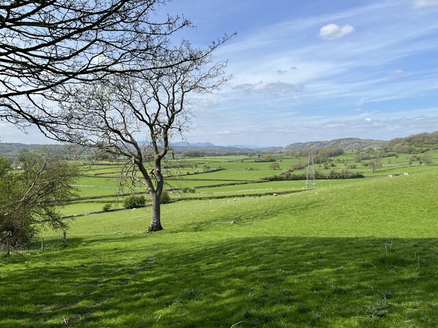
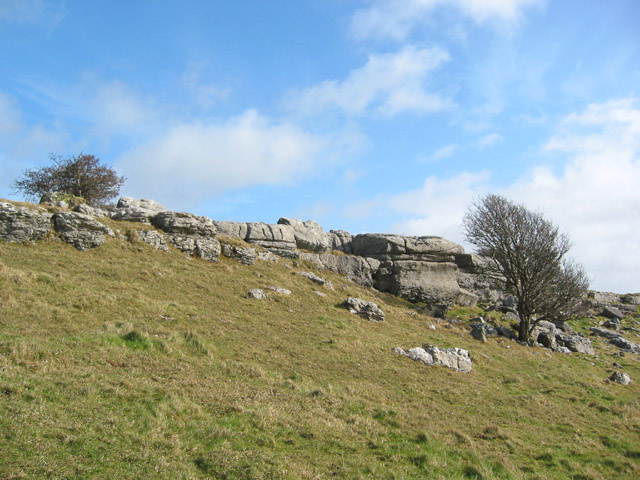
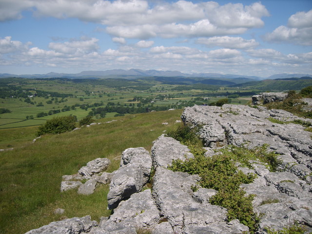
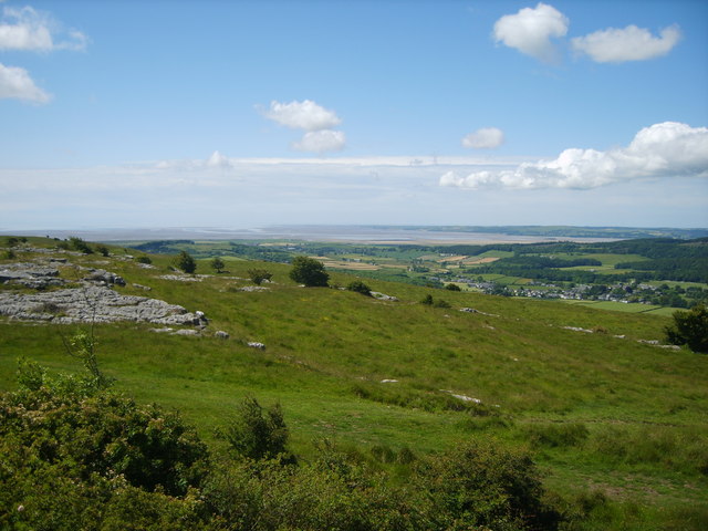
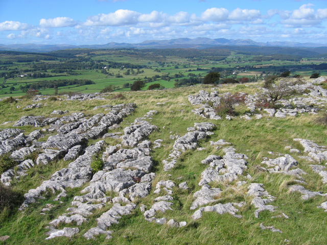
Cowhead Wood is a picturesque woodland located in Lancashire, England. Spread across an area of approximately 50 acres, this enchanting forest is situated near the village of Cowhead, hence its name. The wood is renowned for its natural beauty and diversity, attracting nature enthusiasts and hikers alike.

The wood is predominantly composed of native broadleaf trees, such as oak, birch, and beech, creating a dense canopy that provides a haven for an array of wildlife. This thriving ecosystem is home to various species of birds, including great tits, woodpeckers, and tawny owls, which can often be spotted flitting among the branches. Small mammals like squirrels, voles, and hedgehogs are also commonly spotted scurrying through the undergrowth.

The forest features well-maintained walking trails that wind through its peaceful surroundings, offering visitors the opportunity to explore its hidden treasures. Along these paths, one can admire the vibrant wildflowers, ferns, and mosses that carpet the forest floor, creating a magical atmosphere.

Cowhead Wood is not only a haven for nature enthusiasts but also for those seeking tranquility and relaxation. Its serene ambiance, punctuated by the gentle rustling of leaves and birdsong, provides a peaceful escape from the hustle and bustle of everyday life.

Despite its secluded location, the wood is easily accessible, with a small parking area available for visitors. It is advisable to wear appropriate footwear and carry insect repellent during visits to Cowhead Wood to fully enjoy the experience and protect against ticks and other insects.

Overall, Cowhead Wood is a captivating destination for nature lovers, offering a serene escape into Lancashire's natural beauty.

If you have any feedback on the listing, please let us know in the comments section below.

Cowhead Wood Images

Images are sourced within 2km of 54.220361/-2.9151096 or Grid Reference SD4080. Thanks to Geograph Open Source API. All images are credited.

Hampsfield Snow covered farmland in the Cartmel Valley at Hampsfield.
Hampsfield
Snow covered farmland in the Cartmel Valley at Hampsfield.
Hampsfield Farmland in the Cartmel Valley at Hampsfield.  The Lake District fells are in the background.
Hampsfield
Farmland in the Cartmel Valley at Hampsfield. The Lake District fells are in the background.
Hampsfield Allotment gate This gate is on the public footpath from Hampsfell to Hampsfield Hall where it leaves the woodland of Hampsfield Allotment, managed by Forestry England.
Hampsfield Allotment gate
This gate is on the public footpath from Hampsfell to Hampsfield Hall where it leaves the woodland of Hampsfield Allotment, managed by Forestry England.
Rough pasture on Hampsfell At one time known as Hampsfield Fell this limestone upland northwest of  Grange-over-Sands is now referred to simply as Hampsfell, the shortened name is used by the Ordnance Survey.
Lying just within the Lake District National Park, trees and scrub are becoming established in and around the limestone outcrops.
Rough pasture on Hampsfell
At one time known as Hampsfield Fell this limestone upland northwest of Grange-over-Sands is now referred to simply as Hampsfell, the shortened name is used by the Ordnance Survey. Lying just within the Lake District National Park, trees and scrub are becoming established in and around the limestone outcrops.
The "Hospice" on Hampsfell
Limestone pavement and stunted trees Limestone pavement at the top of low crags on the northern summit on Hampsfell, just south of the Hospice
Limestone pavement and stunted trees
Limestone pavement at the top of low crags on the northern summit on Hampsfell, just south of the Hospice
Northern top on Hampsfell Boulder-strewn rough grass and stunted trees on the northern top of Hampsfell. The low limestone crags just south of the Hospice can be seen on the right. View on a sunny afternoon in early March
Northern top on Hampsfell
Boulder-strewn rough grass and stunted trees on the northern top of Hampsfell. The low limestone crags just south of the Hospice can be seen on the right. View on a sunny afternoon in early March
Crags on northern top of Hampsfell Stunted trees and low limestone crags on the northern top on Hampsfell, just south of the Hospice, on a sunny afternoon in early March
Crags on northern top of Hampsfell
Stunted trees and low limestone crags on the northern top on Hampsfell, just south of the Hospice, on a sunny afternoon in early March
Inscription on Hampsfell Hospice Hampsfell Hospice was constructed in 1846 by the vicar of Cartmel. The Greek inscription above the entrance translates 'rosy-fingered dawn'. Inside the stone building there are also four panels inscribed in English
Inscription on Hampsfell Hospice
Hampsfell Hospice was constructed in 1846 by the vicar of Cartmel. The Greek inscription above the entrance translates 'rosy-fingered dawn'. Inside the stone building there are also four panels inscribed in English
Hospice on Hampsfell
Steps to the roof of the hospice The way up to the roof of the hospice on Hampsfell
Steps to the roof of the hospice
The way up to the roof of the hospice on Hampsfell
Limestone Pavement On the top of Hampsfell looking towards the southern fells
Limestone Pavement
On the top of Hampsfell looking towards the southern fells
On Hampsfell Looking towards Field Broughton
On Hampsfell
Looking towards Field Broughton
On Hampsfell Looking towards Morecambe Bay from the top
On Hampsfell
Looking towards Morecambe Bay from the top
The Hospice at Hampsfell (interior) Verse on the Western wall -

This Hospice as an open door,
A like to welcome rich and poor;
A roomy seat for young and old,
Where they may screen them from the cold.

Three windows that command a view,
To North, to West and Southward too;
A flight of steps requireth care,
The roof will show a prospect rare:

Mountain and vale you thence survey,
The winding streams and noble bay;
The sun at noon the shadow hides,
Along the East and Western sides:

A lengthened chain holds guard around,
To keep the cattle from the ground;
Kind reader freely take your pleasure,
But do no mischief to my treasure.
The Hospice at Hampsfell (interior)
Verse on the Western wall - This Hospice as an open door, A like to welcome rich and poor; A roomy seat for young and old, Where they may screen them from the cold. Three windows that command a view, To North, to West and Southward too; A flight of steps requireth care, The roof will show a prospect rare: Mountain and vale you thence survey, The winding streams and noble bay; The sun at noon the shadow hides, Along the East and Western sides: A lengthened chain holds guard around, To keep the cattle from the ground; Kind reader freely take your pleasure, But do no mischief to my treasure.
The Hospice at Hampsfell (viewpoint) On the top of the hospice is a rotatable pointer (not in the photo).
This notice gives the magnetic bearings of various landmarks, which enables them to be identified by lining up the pointer.
Interestingly, Snaefell (SC3988), 621m high and 100km away, is included.  I believe the summit will be obscured by Black Combe (SD1385), 600m high and 27km away.  However, it is probably possible to see the southern parts of the Isle of Man on a clear day.
The Hospice at Hampsfell (viewpoint)
On the top of the hospice is a rotatable pointer (not in the photo). This notice gives the magnetic bearings of various landmarks, which enables them to be identified by lining up the pointer. Interestingly, Snaefell (SC3988), 621m high and 100km away, is included. I believe the summit will be obscured by Black Combe (SD1385), 600m high and 27km away. However, it is probably possible to see the southern parts of the Isle of Man on a clear day.
Hampsfell - looking NNW A typical limestone fell top, looking NNW from the roof of the Hospice.
The Coniston Fells are in the background, dominated by Coniston Old Man (SD2797).
Hampsfell - looking NNW
A typical limestone fell top, looking NNW from the roof of the Hospice. The Coniston Fells are in the background, dominated by Coniston Old Man (SD2797).
Hampsfell Hospice
Hampsfell Hospice
Show me another place!

Cowhead Wood is located at Grid Ref: SD4080 (Lat: 54.220361, Lng: -2.9151096)

Administrative County: Cumbria

District: South Lakeland

Police Authority: Cumbria

What 3 Words

///indoors.excuse.relegate. Near Grange-over-Sands, Cumbria

Related Wikis

Hampsfield House

Hampsfield House is a country house located to the west of the village of Lindale, Cumbria, England. It was built between 1880 and 1882, and designed...

Low Newton, Cumbria

Low Newton (originally Nether Newton) is a hamlet in the South Lakeland District, in the county of Cumbria, England and in the Lake District also commonly...

Broughton East

Broughton East is a civil parish in the South Lakeland district of Cumbria, England. In the 2001 census the parish had a population of 173, increasing...

Barber Green

Barber Green is a village in Cumbria, England.

Nearby Amenities

Located within 500m of 54.220361,-2.9151096
Power: tower
Lat/Long: 54.2192973/-2.9102704
Power: tower
Lat/Long: 54.2205895/-2.9176465
Power: tower
Lat/Long: 54.2195388/-2.9142562
Power: tower
Lat/Long: 54.2216025/-2.921006
Barrier: stile
Lat/Long: 54.2190816/-2.9218574
Post Box
Collection Times: Mo-Fr 14:45; Sa 08:45
Post Box Design: hovis
Post Box Mounting: pier
Post Box Type: lamp
Ref: LA11 138
Royal Cypher: EVIIR
Royal Cypher Wikidata: Q33102324
Lat/Long: 54.2159/-2.9141881
The data included in this document is from www.openstreetmap.org. The data is made available under ODbL.

Have you been to Cowhead Wood?

Leave your review of Cowhead Wood below (or comments, questions and feedback).