Norway Plantation

Wood, Forest in Cumberland Eden

England

Norway Plantation

Field and boundary of Greystoke Forest
Field and boundary of Greystoke Forest Credit: Steven Brown

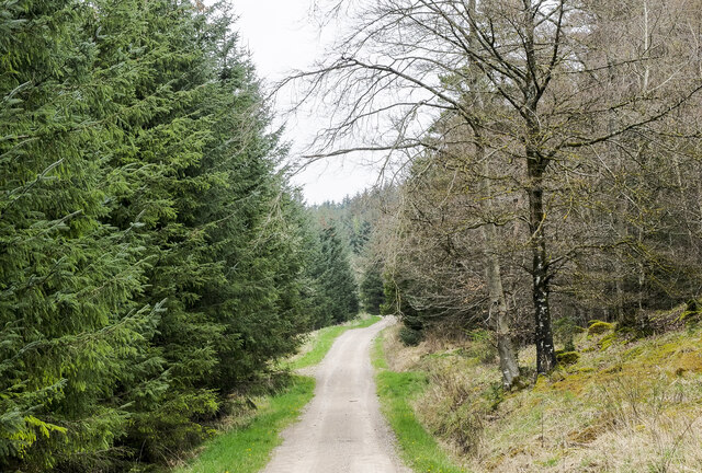
Norway Plantation, located in Cumberland, is a picturesque woodland area known for its dense forests and diverse array of plant life. Covering an expansive area, the plantation is home to a wide variety of tree species, with Norway spruce being the most prominent and giving the site its name. The plantation's primary purpose is to serve as a sustainable source of timber, with the trees being carefully managed and harvested to ensure the continued health and productivity of the forest.

The woodland is characterized by its tall, straight trees that provide a dense canopy, creating a serene and peaceful environment. The Norway spruce trees, with their dark green needles and conical shape, dominate the landscape, but other species like beech, oak, and pine can also be found throughout the plantation. These trees not only contribute to the aesthetic beauty of the area but also support a rich ecosystem, providing habitats for various wildlife species.

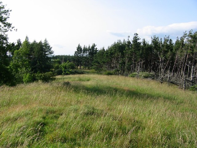
Norway Plantation is open to the public, offering visitors the opportunity to explore its natural wonders and enjoy recreational activities such as walking, hiking, and birdwatching. The well-maintained trails wind through the forest, allowing visitors to immerse themselves in the tranquil surroundings and experience the beauty of nature. The plantation also provides educational programs and guided tours, offering visitors the chance to learn about forestry management practices and the importance of sustainable timber production.

Overall, Norway Plantation in Cumberland is a remarkable woodland area, showcasing the beauty of nature and serving as a responsible source of timber. Its dense forests, diverse tree species, and recreational opportunities make it an ideal destination for nature enthusiasts and those seeking solace in the outdoors.

If you have any feedback on the listing, please let us know in the comments section below.

Norway Plantation Images

Images are sourced within 2km of 54.676801/-2.9328853 or Grid Reference NY3931. Thanks to Geograph Open Source API. All images are credited.
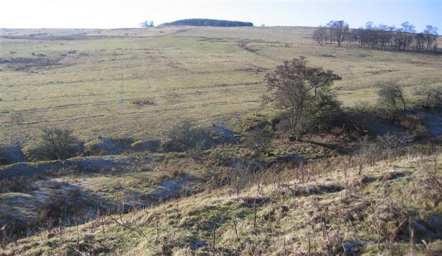
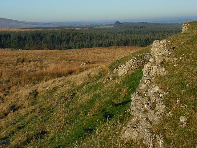
Field and boundary of Greystoke Forest
Farm track near Greystoke Forest
Outcrops of limestone on Highbanks [Murrah Hill] Highbanks and Murrah Hill are names which do not appear on OS maps and have been created perhaps as the hill feature qualifies as a TuMP - a hill with at least 30 metres or more prominence. There are several surface outcrops of limestone on the hill, almost in the form of pavement; this is one of the examples. There's surely a rogue boulder perched beside the outcrop, presumably an erratic.
The distant trees seen through thin mist are in the Greystoke Forest.
Outcrops of limestone on Highbanks [Murrah Hill]
Highbanks and Murrah Hill are names which do not appear on OS maps and have been created perhaps as the hill feature qualifies as a TuMP - a hill with at least 30 metres or more prominence. There are several surface outcrops of limestone on the hill, almost in the form of pavement; this is one of the examples. There's surely a rogue boulder perched beside the outcrop, presumably an erratic. The distant trees seen through thin mist are in the Greystoke Forest.
Forest road through Speaker Gully plantation A relatively light duty road heading north-north-east through the plantation which is part of Greystoke Forest.
Forest road through Speaker Gully plantation
A relatively light duty road heading north-north-east through the plantation which is part of Greystoke Forest.
Rough vegetation beside forest road Tussocks close to the western edge of Greystoke Forest seen in dull lighting with Carrock Fell the distant hill beyond the plantations.
Rough vegetation beside forest road
Tussocks close to the western edge of Greystoke Forest seen in dull lighting with Carrock Fell the distant hill beyond the plantations.
Forest road at the heart of Greystoke Forest Gillcambon Beck and its tributaries drain Greystoke Forest carrying water to the north. The road is seen heading near to north having climbed away from the main stream and will cross side streams as it continues towards the minor feature named as Tippy Hills.
Forest road at the heart of Greystoke Forest
Gillcambon Beck and its tributaries drain Greystoke Forest carrying water to the north. The road is seen heading near to north having climbed away from the main stream and will cross side streams as it continues towards the minor feature named as Tippy Hills.
Greystoke Forest A butterfly infested clearing in Greystoke Forest
Greystoke Forest
A butterfly infested clearing in Greystoke Forest
Berrier Hill View of Greystoke Forest to the north
Berrier Hill
View of Greystoke Forest to the north
Parkland with escarpment. Fine parkland with sheep grazing near to lambing time.
Parkland with escarpment.
Fine parkland with sheep grazing near to lambing time.
Across the old wood site and up to the new wood. The maps show a wood in the ditch area in the foreground but I do not think there have been trees here for a long time.
Across the old wood site and up to the new wood.
The maps show a wood in the ditch area in the foreground but I do not think there have been trees here for a long time.
Rolling Parkland in Greystoke Park. A shepherds work building lies at the top of the photo barely visible.
Rolling Parkland in Greystoke Park.
A shepherds work building lies at the top of the photo barely visible.
Limekiln and quad bike tracks. Such is diversity although to be fair the limekilns have not been used for some time.
Limekiln and quad bike tracks.
Such is diversity although to be fair the limekilns have not been used for some time.
Pasture and forest, Berrier Hill This is just outside of the Lake District National Park. In the background are Great Dodd and Clough Head.
Pasture and forest, Berrier Hill
This is just outside of the Lake District National Park. In the background are Great Dodd and Clough Head.
Pastures above Greystoke A view across the Petteril and Eden valleys to the highest of the Pennines. The scant remains of snow can just be made out on the tops of Cross Fell and the Dun Fells.
Pastures above Greystoke
A view across the Petteril and Eden valleys to the highest of the Pennines. The scant remains of snow can just be made out on the tops of Cross Fell and the Dun Fells.
Gillcambon Tarn The frozen waters of the tarn sit amid sparse deciduous woodland and low altitude moorland.
Gillcambon Tarn
The frozen waters of the tarn sit amid sparse deciduous woodland and low altitude moorland.
Berrier Hill These rough pastures are the site of a proposed windfarm. The view takes in the hazy Eden valley. The Pennines beyond could be mistaken for a cloud.
Berrier Hill
These rough pastures are the site of a proposed windfarm. The view takes in the hazy Eden valley. The Pennines beyond could be mistaken for a cloud.
Limestone outcrops, Berrier Hill Two parallel outcrops cross Berrier Hill which is rough pasture beside Greystoke Forest. In the distance you can just make out the two Caldbeck transmitters.
Limestone outcrops, Berrier Hill
Two parallel outcrops cross Berrier Hill which is rough pasture beside Greystoke Forest. In the distance you can just make out the two Caldbeck transmitters.
Pastures above Greystoke Blencathra appears beyond this southern part of Greystoke Forest.
Pastures above Greystoke
Blencathra appears beyond this southern part of Greystoke Forest.
Show me another place!

Norway Plantation is located at Grid Ref: NY3931 (Lat: 54.676801, Lng: -2.9328853)

Administrative County: Cumbria

District: Eden

Police Authority: Cumbria

What 3 Words

///escapades.luckier.tomb. Near Penrith, Cumbria

Related Wikis

Berrier

Berrier is a hamlet in Cumbria, England. It is in the civil parish of Mungrisdale, which is made up of eight hamlets and had a population of 297 in the...

Hutton Roof, Eden

Hutton Roof is a hamlet and former civil parish, now in the parish of Mungrisdale, in the Westmorland and Furness district, in the ceremonial county of...
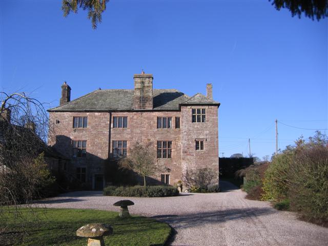
Johnby Hall

Johnby Hall is a fortified manor house near Greystoke, Cumbria. It was built in 1583, incorporating the fabric of a medieval tower house, and has been...
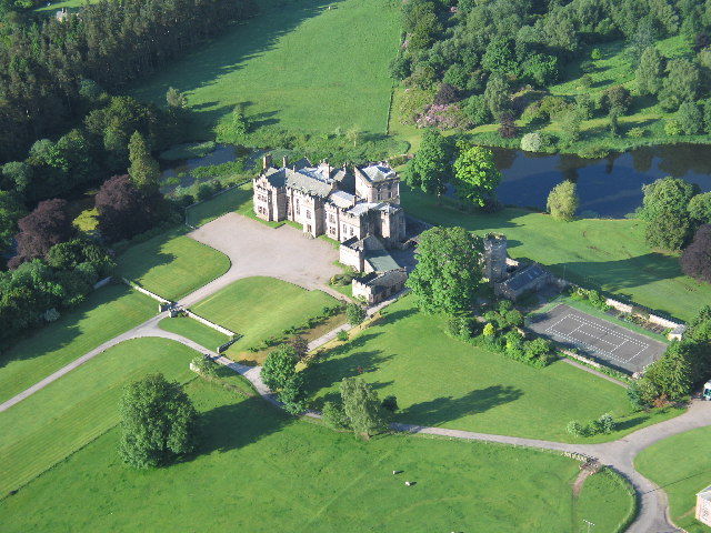
Greystoke Castle

Greystoke Castle is in the village of Greystoke 8 kilometres (5.0 mi) west of Penrith in the county of Cumbria in northern England. (grid reference NY435309...

Have you been to Norway Plantation?

Leave your review of Norway Plantation below (or comments, questions and feedback).