Honeythwaite Wood

Wood, Forest in Lancashire South Lakeland

England

Honeythwaite Wood

Rough pasture on Hampsfell At one time known as Hampsfield Fell this limestone upland northwest of  Grange-over-Sands is now referred to simply as Hampsfell, the shortened name is used by the Ordnance Survey.
Lying just within the Lake District National Park, trees and scrub are becoming established in and around the limestone outcrops.
Rough pasture on Hampsfell Credit: Adrian Taylor

Honeythwaite Wood is a picturesque woodland situated in Lancashire, England. Covering an area of approximately 50 acres, it is a popular destination for nature enthusiasts and outdoor lovers. The wood is nestled within the rural countryside, providing a tranquil and peaceful environment for visitors to enjoy.

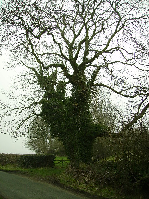
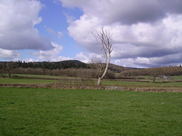
As one ventures into Honeythwaite Wood, they are greeted by a diverse range of flora and fauna. Towering oak, beech, and ash trees dominate the landscape, creating a dense canopy that filters the sunlight, casting a gentle dappled light on the forest floor. Bluebells, primroses, and wild garlic carpet the ground during spring, adding a burst of color and fragrance to the surroundings.

The wood is also home to a variety of wildlife. Visitors may spot squirrels busily gathering nuts or glimpse a shy deer darting through the undergrowth. Birdwatchers will be delighted to know that Honeythwaite Wood is a haven for numerous bird species, including woodpeckers, owls, and warblers. The mellifluous sounds of birdsong provide a harmonious soundtrack to one's exploration of the woodland.

Tranquil footpaths wind through Honeythwaite Wood, offering visitors the opportunity to immerse themselves in the natural beauty of the area. The paths lead to a small, picturesque lake, where visitors can relax and admire the serene waters surrounded by the lush greenery.

Honeythwaite Wood is a true gem of Lancashire, offering a peaceful retreat from the hustle and bustle of everyday life. Whether it's a leisurely stroll, a picnic, or birdwatching, this woodland provides a wonderful escape into nature.

If you have any feedback on the listing, please let us know in the comments section below.

Honeythwaite Wood Images

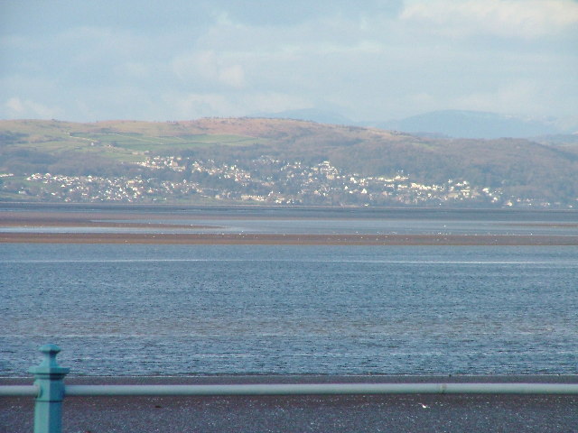
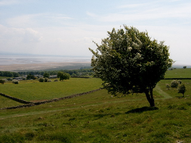
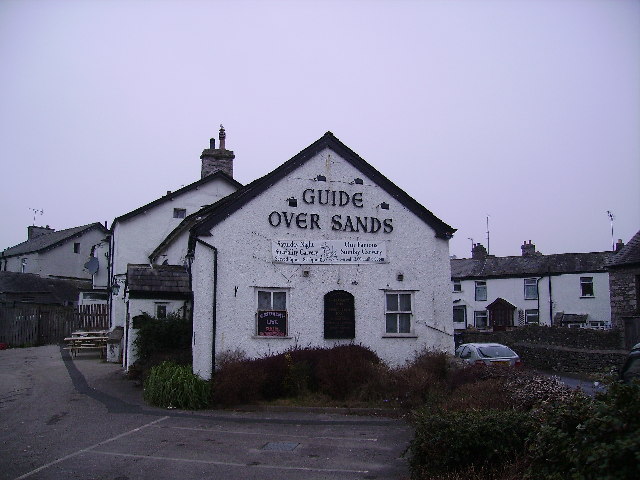
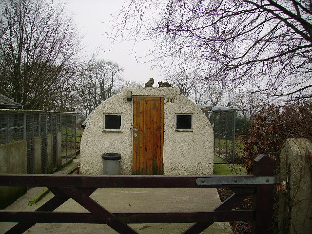
Images are sourced within 2km of 54.195711/-2.9392732 or Grid Reference SD3878. Thanks to Geograph Open Source API. All images are credited.

Rough pasture on Hampsfell At one time known as Hampsfield Fell this limestone upland northwest of  Grange-over-Sands is now referred to simply as Hampsfell, the shortened name is used by the Ordnance Survey.
Lying just within the Lake District National Park, trees and scrub are becoming established in and around the limestone outcrops.
Rough pasture on Hampsfell
At one time known as Hampsfield Fell this limestone upland northwest of Grange-over-Sands is now referred to simply as Hampsfell, the shortened name is used by the Ordnance Survey. Lying just within the Lake District National Park, trees and scrub are becoming established in and around the limestone outcrops.
Fingerpost by Ashmount Road Beside Ashmount Road, the fingerpost directs walkers up the public footpath to Spring Bank and Hampsfell or alternatively to Eden Mount and Yewbarrow.
Fingerpost by Ashmount Road
Beside Ashmount Road, the fingerpost directs walkers up the public footpath to Spring Bank and Hampsfell or alternatively to Eden Mount and Yewbarrow.
Cartmel Priory The construction of Cartmel Priory began in c 1188. The priory church was saved from destruction by King Henry VIII, during the Reformation, because the villagers of Cartmel had nowhere else to worship.

The village of Cartmel has, therefore, one of the finest churches in England. A rare example of a medieval monastic place of worship. The village contains relics of other monastic buildings, most significantly the priory gatehouse. As a consequence Cartmel is visited by tourists from all over the world.
Cartmel Priory
The construction of Cartmel Priory began in c 1188. The priory church was saved from destruction by King Henry VIII, during the Reformation, because the villagers of Cartmel had nowhere else to worship. The village of Cartmel has, therefore, one of the finest churches in England. A rare example of a medieval monastic place of worship. The village contains relics of other monastic buildings, most significantly the priory gatehouse. As a consequence Cartmel is visited by tourists from all over the world.
Cartmel village
Cartmel village
Kents Bank, Cumbria Kents Bank and Hampsfield Fell across Morecambe Bay
Kents Bank, Cumbria
Kents Bank and Hampsfield Fell across Morecambe Bay
Footpath Under Fell End Taken close to Fell End looking back over Morecambe Bay.
Footpath Under Fell End
Taken close to Fell End looking back over Morecambe Bay.
Geese Near Aynsome Mill farm
Geese
Near Aynsome Mill farm
Cartmel Priory The modern OS map puts  this lovely old church just in the square.
Cartmel Priory
The modern OS map puts this lovely old church just in the square.
Guide Over Sands Allithwaite Perhaps not a good idea for a guide to visit the pub before crossing Morecambe Bay's notorious sands.
Guide Over Sands Allithwaite
Perhaps not a good idea for a guide to visit the pub before crossing Morecambe Bay's notorious sands.
Cattery Near Templand
Cattery
Near Templand
Tree Middle Fell Gate One good thing about winter is the shapes of old roadside trees like this one.
Tree Middle Fell Gate
One good thing about winter is the shapes of old roadside trees like this one.
The "Hospice" on Hampsfell
The final straight at Cartmel The grandstand at Cartmel racecourse allows the punters an execellent view down the final straight with the winning line just inside gridsquare SD2779.
The final straight at Cartmel
The grandstand at Cartmel racecourse allows the punters an execellent view down the final straight with the winning line just inside gridsquare SD2779.
Cartmel Village Cross and Priory Gatehouse This building is in the care of the National Trust,
Cartmel Village Cross and Priory Gatehouse
This building is in the care of the National Trust,
Tree near Cartmel From the road leaving Cartmel for Holker
Tree near Cartmel
From the road leaving Cartmel for Holker
Entrance to Hard Crag Near the racecourse at Cartmel
Entrance to Hard Crag
Near the racecourse at Cartmel
The Cavendish Arms in Cartmel
Cartmel. A building, once part of the priory This building was once part of Cartmel Priory but is now used as a craft/workshop.
Cartmel. A building, once part of the priory
This building was once part of Cartmel Priory but is now used as a craft/workshop.
Show me another place!

Honeythwaite Wood is located at Grid Ref: SD3878 (Lat: 54.195711, Lng: -2.9392732)

Administrative County: Cumbria

District: South Lakeland

Police Authority: Cumbria

What 3 Words

///surprised.belong.shaver. Near Grange-over-Sands, Cumbria

Related Wikis

Cartmel Priory School

Cartmel Priory CofE School is a mixed 11-16 secondary school and academy in Cartmel, Cumbria, England. == History == The school was opened in 1958 on land...

Cartmel

Cartmel is a village in Cumbria, England, 2+1⁄4 miles (3.5 kilometres) northwest of Grange-over-Sands close to the River Eea. The village takes its name...

Cartmel Priory

Cartmel Priory church serves as the parish church of Cartmel, Cumbria, England (formerly in Lancashire). == Priory == === Foundation === The priory was founded...
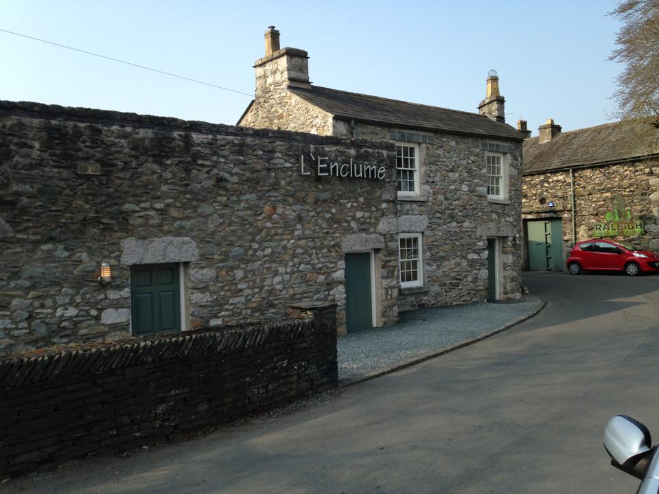
L'Enclume

L'Enclume (pronounced [lɑ̃.klym], French for "the anvil") is a restaurant opened in 2002 in Cartmel, Cumbria, England, run by chef Simon Rogan and his...

Nearby Amenities

Located within 500m of 54.195711,-2.9392732
Barrier: stile
Lat/Long: 54.1977389/-2.9389072
Barrier: stile
Lat/Long: 54.1947214/-2.9318364
Barrier: stile
Lat/Long: 54.1967735/-2.936486
Power: pole
Lat/Long: 54.1918953/-2.9416081
Power: pole
Lat/Long: 54.1917077/-2.939799
Power: pole
Lat/Long: 54.1915728/-2.9383989
Post Box
Post Box Type: wall
Ref: LA11 136
Lat/Long: 54.1977736/-2.9389784
Power: pole
Lat/Long: 54.1933634/-2.9458171
Power: pole
Lat/Long: 54.1934264/-2.9441157
Power: pole
Lat/Long: 54.1934748/-2.9424719
Power: pole
Lat/Long: 54.1942518/-2.9409409
Power: pole
Lat/Long: 54.194885/-2.9396605
Power: pole
Lat/Long: 54.1959713/-2.9370445
Power: pole
Lat/Long: 54.196716/-2.9373101
Power: pole
Lat/Long: 54.197509/-2.9375682
Power: pole
Lat/Long: 54.1985776/-2.937924
Power: pole
Lat/Long: 54.1993375/-2.9388506
Power: pole
Lat/Long: 54.2000448/-2.9397131
Power: pole
Lat/Long: 54.1984588/-2.9399487
Power: pole
Lat/Long: 54.1992328/-2.9398359
The data included in this document is from www.openstreetmap.org. The data is made available under ODbL.

Have you been to Honeythwaite Wood?

Leave your review of Honeythwaite Wood below (or comments, questions and feedback).