Cocks Green

Settlement in Suffolk West Suffolk

England

Cocks Green

A134 looking north, Bradfield Combust A route from Colchester to King's Lynn, next major place, Bury St Edmunds. Parts of its route are on a Roman alignment, as here, although the A134 pulls off the Roman line just ahead.
A134 looking north, Bradfield Combust Credit: Robin Webster

Cocks Green is a small village located in the county of Suffolk, England. Situated approximately 10 miles south-west of the county town of Ipswich, it falls under the district of Mid Suffolk. The village is nestled amidst picturesque countryside, characterized by rolling hills, meadows, and patches of woodland.

With a population of around 150 residents, Cocks Green offers a tranquil and close-knit community atmosphere. The village comprises a mix of residential properties, including quaint cottages and modern homes, blending traditional charm with contemporary living.

Despite its small size, Cocks Green benefits from several amenities and services. These include a village hall, which serves as a hub for social gatherings, community events, and various local clubs and societies. Additionally, the village has a well-maintained playground, providing a safe and enjoyable space for children.

Cocks Green boasts easy access to nearby towns and cities, making it an ideal location for commuters. The A140 road passes close by, connecting the village to major transport links. The nearby town of Stowmarket, located approximately 6 miles to the west, offers a wider range of amenities, including shops, supermarkets, schools, and healthcare facilities.

The surrounding countryside provides ample opportunities for outdoor activities and exploration. The village is surrounded by idyllic walking and cycling routes, allowing residents to enjoy the beauty of the Suffolk landscape. The nearby River Gipping also offers opportunities for fishing and boating enthusiasts.

In summary, Cocks Green offers a peaceful and picturesque village setting, with a strong sense of community and convenient access to nearby amenities. Its rural location and natural beauty make it an attractive destination for those seeking a tranquil lifestyle in the heart of Suffolk.

If you have any feedback on the listing, please let us know in the comments section below.
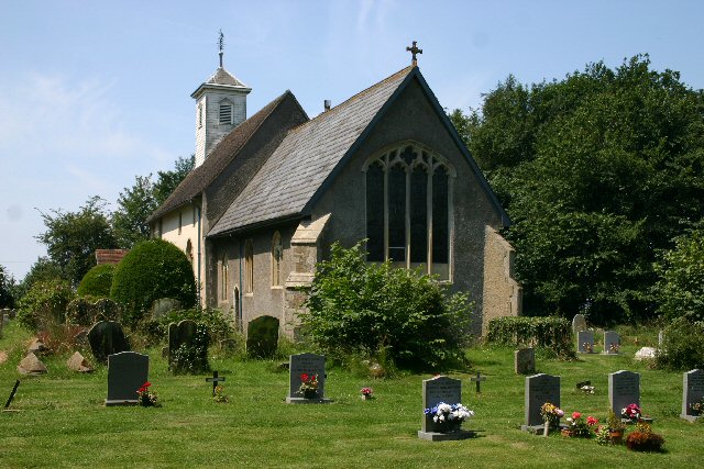
Cocks Green Images

Images are sourced within 2km of 52.194987/0.75469428 or Grid Reference TL8858. Thanks to Geograph Open Source API. All images are credited.

A134 looking north, Bradfield Combust A route from Colchester to King's Lynn, next major place, Bury St Edmunds. Parts of its route are on a Roman alignment, as here, although the A134 pulls off the Roman line just ahead.
A134 looking north, Bradfield Combust
A route from Colchester to King's Lynn, next major place, Bury St Edmunds. Parts of its route are on a Roman alignment, as here, although the A134 pulls off the Roman line just ahead.
A134 looking north A route from Colchester to King's Lynn, next major place, Bury St Edmunds.
A134 looking north
A route from Colchester to King's Lynn, next major place, Bury St Edmunds.
Bend and junction on A134 The A134 heads for Bury St Edmunds, Water Lane goes right for Little Whelnetham.
Bend and junction on A134
The A134 heads for Bury St Edmunds, Water Lane goes right for Little Whelnetham.
Harvested field east of Linkwood Road The tower of Bradfield St George church is just visible in the distance.
Harvested field east of Linkwood Road
The tower of Bradfield St George church is just visible in the distance.
Lodge, Bradfield Combust Dated 1865. Surprisingly by William Eden Nesfield. Grade II listed.
On the other side of the entrance to Bradfield Hall stands a K6 phone box. Grade II listed.
Lodge, Bradfield Combust
Dated 1865. Surprisingly by William Eden Nesfield. Grade II listed. On the other side of the entrance to Bradfield Hall stands a K6 phone box. Grade II listed.
Country road near Little Welnetham Heading east.
Country road near Little Welnetham
Heading east.
Bury To Sudbury Old milestone on the A134 near to Little Welnetham, Suffolk. For close up view see <a title="https://www.geograph.org.uk/photo/2736626" href="https://www.geograph.org.uk/photo/2736626">Link</a>
Bury To Sudbury
Old milestone on the A134 near to Little Welnetham, Suffolk. For close up view see Link
Old Milestone Old milestone on the A134 near to Little Welnetham, Suffolk. For overall view see <a title="https://www.geograph.org.uk/photo/2736614" href="https://www.geograph.org.uk/photo/2736614">Link</a>
Old Milestone
Old milestone on the A134 near to Little Welnetham, Suffolk. For overall view see Link
St Thomas A Becket Great Whelnetham The church of St Thomas a Becket Great Whelnetham, Suffolk for more info see <span class="nowrap"><a title="http://www.suffolkchurches.co.uk/gwhelnetham.html" rel="nofollow ugc noopener" href="http://www.suffolkchurches.co.uk/gwhelnetham.html">Link</a><img style="margin-left:2px;" alt="External link" title="External link - shift click to open in new window" src="https://s1.geograph.org.uk/img/external.png" width="10" height="10"/></span> for other view of the church see <a title="https://www.geograph.org.uk/photo/2892221" href="https://www.geograph.org.uk/photo/2892221">Link</a>
St Thomas A Becket Great Whelnetham
The church of St Thomas a Becket Great Whelnetham, Suffolk for more info see LinkExternal link for other view of the church see Link
St Thomas A Becket Great Whelnetham The church of St Thomas a Becket Great Whelnetham, Suffolk for more info see <span class="nowrap"><a title="http://www.suffolkchurches.co.uk/gwhelnetham.html" rel="nofollow ugc noopener" href="http://www.suffolkchurches.co.uk/gwhelnetham.html">Link</a><img style="margin-left:2px;" alt="External link" title="External link - shift click to open in new window" src="https://s1.geograph.org.uk/img/external.png" width="10" height="10"/></span> for other view of the church see <a title="https://www.geograph.org.uk/photo/2892106" href="https://www.geograph.org.uk/photo/2892106">Link</a>
St Thomas A Becket Great Whelnetham
The church of St Thomas a Becket Great Whelnetham, Suffolk for more info see LinkExternal link for other view of the church see Link
School Safety Zone School safety zone Great Welnetham, Suffolk.
School Safety Zone
School safety zone Great Welnetham, Suffolk.
20s Plenty School safety zone road sign Great Welnetham, Suffolk.
20s Plenty
School safety zone road sign Great Welnetham, Suffolk.
Old Windmill Old windmill at Great Welneatham, Suffolk.
Old Windmill
Old windmill at Great Welneatham, Suffolk.
Mill Lane This track is marked on the map as Mill Lane near to Stanningfield, Suffolk.
Mill Lane
This track is marked on the map as Mill Lane near to Stanningfield, Suffolk.
Footpath Part of the St Edmund Way crossing the Bury Road near to Stanningfield, Suffolk.
Footpath
Part of the St Edmund Way crossing the Bury Road near to Stanningfield, Suffolk.
Part Of The St Edmund Way Part of the St Edmund Way near to Bradfield Combust, Suffolk.
Part Of The St Edmund Way
Part of the St Edmund Way near to Bradfield Combust, Suffolk.
Reduce Speed Now Warning sign and marking on road near to Bradfield Combust, Suffolk.
Reduce Speed Now
Warning sign and marking on road near to Bradfield Combust, Suffolk.
Road Junction Road junction of Bury Road and Bell's Lane at Great Welnetham, Suffolk.
Road Junction
Road junction of Bury Road and Bell's Lane at Great Welnetham, Suffolk.
Show me another place!

Cocks Green is located at Grid Ref: TL8858 (Lat: 52.194987, Lng: 0.75469428)

Administrative County: Suffolk

District: West Suffolk

Police Authority: Suffolk

What 3 Words

///swing.workroom.dispenser. Near Bury St Edmunds, Suffolk

Nearby Locations

Cocks Green

Related Wikis

Tutelina Mill, Great Welnetham

Tutelina Mill, also known as Clarke's Mill, is a Grade II listed tower mill at Great Welnetham, Suffolk, England which has been conserved. == History... ==

Great Whelnetham

Great Whelnetham (sometimes Great Welnetham) is a village and civil parish in the West Suffolk district of Suffolk in eastern England. Located around two...

Little Whelnetham

Little Whelnetham (well-NEE-thum) (sometimes Little Welnetham) is a village and civil parish in the West Suffolk district of Suffolk in eastern England...

Welnetham railway station

Welnetham railway station was on the Long Melford-Bury St Edmunds branch line, serving Great Whelnetham, Little Whelnetham and Sicklesmere in Suffolk....

Nearby Amenities

Located within 500m of 52.194987,0.75469428
Power: pole
Lat/Long: 52.195973/0.7485079
Power: pole
Lat/Long: 52.1910437/0.7539259
Power: pole
Lat/Long: 52.1924594/0.7509701
Power: pole
Lat/Long: 52.1949125/0.7495003
Power: pole
Lat/Long: 52.1933259/0.7510077
Power: pole
Lat/Long: 52.1992956/0.7552027
Power: pole
Lat/Long: 52.1932157/0.7538347
Power: pole
Lat/Long: 52.1973787/0.7554843
Power: pole
Lat/Long: 52.1923246/0.7532098
Power: pole
Lat/Long: 52.1916488/0.7530167
Power: pole
Lat/Long: 52.1941825/0.7545589
Power: pole
Lat/Long: 52.1925877/0.7494842
Power: pole
Lat/Long: 52.1982796/0.7553556
Power: pole
Lat/Long: 52.1924841/0.7517882
Power: pole
Lat/Long: 52.1915666/0.7526251
Power: pole
Lat/Long: 52.1962656/0.7551517
Power: pole
Lat/Long: 52.1941348/0.7502433
The data included in this document is from www.openstreetmap.org. The data is made available under ODbL.

Have you been to Cocks Green?

Leave your review of Cocks Green below (or comments, questions and feedback).