Cockfield

Settlement in Suffolk Babergh

England

Cockfield

A134 looking north A route from Colchester to King's Lynn, next major place, Bury St Edmunds.
A134 looking north Credit: Robin Webster

Cockfield is a small village located in the county of Suffolk, England. Situated approximately 5 miles south of Bury St Edmunds, it is nestled within the picturesque countryside of East Anglia. With a population of around 1,200 residents, Cockfield is known for its close-knit community and tranquil atmosphere.

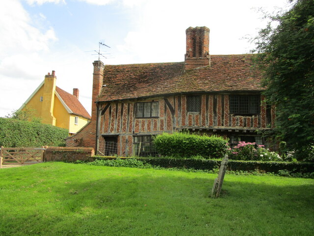
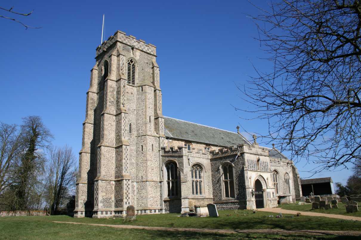
The village boasts a rich history, with evidence of human settlement dating back to the Neolithic period. Today, visitors can explore various historical landmarks, including the 12th-century St Peter's Church, which showcases stunning architecture and serves as a focal point for local religious activities.

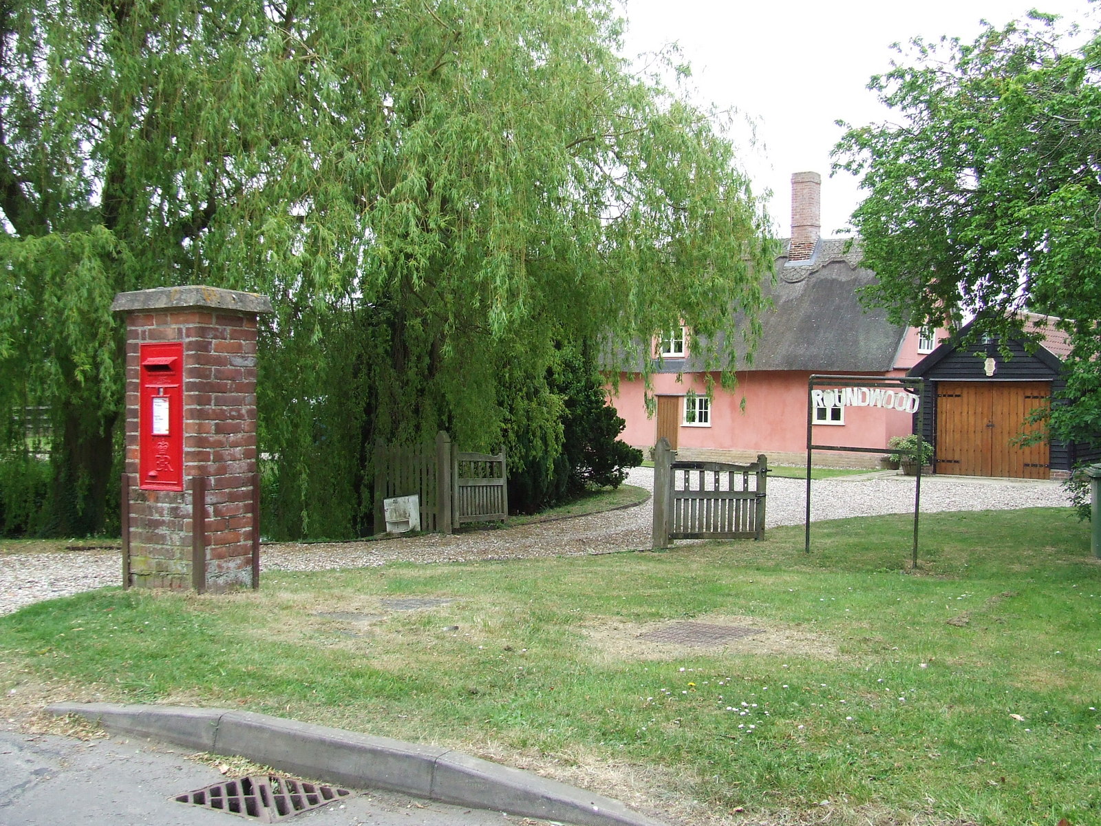
Cockfield offers a range of amenities to cater to the needs of its residents. These include a primary school, village hall, post office, and a local pub, where locals and visitors can enjoy traditional British cuisine and a friendly atmosphere. The village also hosts regular community events, such as fairs and festivals, which bring everyone together and contribute to the vibrant social fabric of the area.

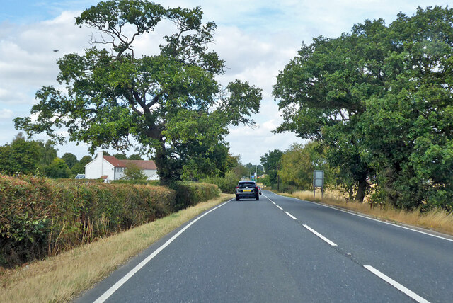
Nature enthusiasts will appreciate Cockfield's beautiful surroundings, as it is surrounded by rolling hills, meadows, and woodland. The village provides ample opportunities for outdoor activities, including scenic walks, cycling routes, and birdwatching. Moreover, Cockfield is conveniently located near popular tourist destinations, such as the historic town of Lavenham and the picturesque Dedham Vale, both within easy reach for day trips.

Overall, Cockfield offers a peaceful and idyllic countryside setting, combined with a strong sense of community and a range of amenities, making it an attractive place to live and visit in the heart of Suffolk.

If you have any feedback on the listing, please let us know in the comments section below.

Cockfield Images

Images are sourced within 2km of 52.157264/0.78459 or Grid Reference TL9054. Thanks to Geograph Open Source API. All images are credited.

A134 looking north A route from Colchester to King's Lynn, next major place, Bury St Edmunds.
A134 looking north
A route from Colchester to King's Lynn, next major place, Bury St Edmunds.
A134 looking north A route from Colchester to King's Lynn, next major place, Bury St Edmunds.
A134 looking north
A route from Colchester to King's Lynn, next major place, Bury St Edmunds.
A134 looking north A route from Colchester to King's Lynn, next major place, Bury St Edmunds. Parts of its route are on a Roman alignment, as here.
A134 looking north
A route from Colchester to King's Lynn, next major place, Bury St Edmunds. Parts of its route are on a Roman alignment, as here.
Church Cottage, Cockfield Partly of medieval origin <span class="nowrap"><a title="https://historicengland.org.uk/listing/the-list/list-entry/1194237?section=official-listing" rel="nofollow ugc noopener" href="https://historicengland.org.uk/listing/the-list/list-entry/1194237?section=official-listing">Link</a><img style="margin-left:2px;" alt="External link" title="External link - shift click to open in new window" src="https://s1.geograph.org.uk/img/external.png" width="10" height="10"/></span>
Church Cottage, Cockfield
Partly of medieval origin LinkExternal link
Church Cottage, Cockfield Of medieval origin <span class="nowrap"><a title="https://historicengland.org.uk/listing/the-list/list-entry/1194237?section=official-listing" rel="nofollow ugc noopener" href="https://historicengland.org.uk/listing/the-list/list-entry/1194237?section=official-listing">Link</a><img style="margin-left:2px;" alt="External link" title="External link - shift click to open in new window" src="https://s1.geograph.org.uk/img/external.png" width="10" height="10"/></span>
Church Farm (on the left) dates from the sixteenth century <span class="nowrap"><a title="https://historicengland.org.uk/listing/the-list/list-entry/1037334?section=official-listing" rel="nofollow ugc noopener" href="https://historicengland.org.uk/listing/the-list/list-entry/1037334?section=official-listing">Link</a><img style="margin-left:2px;" alt="External link" title="External link - shift click to open in new window" src="https://s1.geograph.org.uk/img/external.png" width="10" height="10"/></span>
Church Cottage, Cockfield
Of medieval origin LinkExternal link Church Farm (on the left) dates from the sixteenth century LinkExternal link
St. Peter's church, Cockfield Dates from the fourteenth and fifteenth centuries <span class="nowrap"><a title="https://historicengland.org.uk/listing/the-list/list-entry/1037333?section=official-listing" rel="nofollow ugc noopener" href="https://historicengland.org.uk/listing/the-list/list-entry/1037333?section=official-listing">Link</a><img style="margin-left:2px;" alt="External link" title="External link - shift click to open in new window" src="https://s1.geograph.org.uk/img/external.png" width="10" height="10"/></span>
St. Peter's church, Cockfield
Dates from the fourteenth and fifteenth centuries LinkExternal link
Monument to James Harvey, St. Peter's church, Cockfield James Harvey died in 1723 aged 20 years while sill a student at the University in Cambridge.
Monument to James Harvey, St. Peter's church, Cockfield
James Harvey died in 1723 aged 20 years while sill a student at the University in Cambridge.
Pond near the church at Cockfield
The churchyard at Cockfield Part of the churchyard is left uncut to encourage wildlife.
The churchyard at Cockfield
Part of the churchyard is left uncut to encourage wildlife.
Cockfield Village Hall Dates from 1975-6.
Cockfield Village Hall
Dates from 1975-6.
Barley field at Cockfield Nearly ready for harvesting.
Barley field at Cockfield
Nearly ready for harvesting.
Footpath To Bulls Wood Footpath looking south leading to Bulls Wood near to Great Green, Suffolk.
Footpath To Bulls Wood
Footpath looking south leading to Bulls Wood near to Great Green, Suffolk.
Post Box Public Post Box outside Roundwood Windsor Green, Suffolk.
Post Box
Public Post Box outside Roundwood Windsor Green, Suffolk.
Road Junction Road junction at Windsor Green, Suffolk.
Road Junction
Road junction at Windsor Green, Suffolk.
The Three Horseshoes, Stows Hill
Thatch on the Green, Cockfield
Steps Going Down And Up This is the point that the now long gone Bury to Sudbury railway line crosses the footpath at Cockfield, Suffolk.
Steps Going Down And Up
This is the point that the now long gone Bury to Sudbury railway line crosses the footpath at Cockfield, Suffolk.
St.Peter Cockfield The church of St.Peter Cockfield, Suffolk for info on the church see <span class="nowrap"><a title="http://www.suffolkchurches.co.uk/cockfield.htm" rel="nofollow ugc noopener" href="http://www.suffolkchurches.co.uk/cockfield.htm">Link</a><img style="margin-left:2px;" alt="External link" title="External link - shift click to open in new window" src="https://s1.geograph.org.uk/img/external.png" width="10" height="10"/></span>
St.Peter Cockfield
The church of St.Peter Cockfield, Suffolk for info on the church see LinkExternal link
Show me another place!

Cockfield is located at Grid Ref: TL9054 (Lat: 52.157264, Lng: 0.78459)

Administrative County: Suffolk

District: Babergh

Police Authority: Suffolk

What 3 Words

///elbow.trifling.slam. Near Lavenham, Suffolk

Nearby Locations

Cockfield Cockfield

Related Wikis

Cockfield, Suffolk

Cockfield is a village and civil parish located approximately 3+1⁄2 miles (5.6 km) from Lavenham in Suffolk, England. The village consists of a central...

Cockfield railway station

Cockfield railway station was on the Long Melford-Bury St Edmunds branch line in Cockfield, Suffolk. The station building still stands, but is in a semi...

Cockfield Windmill

Cockfield Mill is a tower mill at Cockfield, Suffolk, England, which has been converted to residential accommodation. == History == Cockfield Mill was...

Windsor Green

Windsor Green is a hamlet in the civil parish of Cockfield, in the Babergh district of the county of Suffolk, England. It is about four miles away from...

Nearby Amenities

Located within 500m of 52.157264,0.78459
Cockfield
Place: village
Wikidata: Q2571768
Lat/Long: 52.1559118/0.7864055
Cockfield
Historic Railway: station
Railway: site
Source: OS7
Wikidata: Q5139606
Wikipedia: en:Cockfield railway station
Lat/Long: 52.1559079/0.7826556
Bus Stop
Memorial
Naptan AtcoCode: 390010766
Naptan Bearing: W
Naptan BusStopType: CUS
Naptan CommonName: Memorial
Naptan Indicator: adj
Naptan Landmark: Memorial
Naptan NaptanCode: sufjdpgw
Naptan Street: Stows Hill
Naptan Verified: no
Source: naptan_import
Lat/Long: 52.1572861/0.7844779
Bus Stop
Memorial
Naptan AtcoCode: 390010767
Naptan Bearing: E
Naptan BusStopType: CUS
Naptan CommonName: Memorial
Naptan Indicator: opp
Naptan Landmark: Memorial
Naptan NaptanCode: sufjdpja
Naptan Street: Stows Hill
Naptan Verified: no
Source: naptan_import
Lat/Long: 52.15735/0.784438
Booth: K6
Covered: booth
Disused Amenity: telephone
Man Made: telephone_box
Old Phone: +44 1284 828438
Lat/Long: 52.157995/0.7872678
Power: pole
Lat/Long: 52.1604904/0.7888317
Power: pole
Lat/Long: 52.1595806/0.7893844
Historic: memorial
Lat/Long: 52.1573137/0.7843314
Post Box
Collection Times: Mo-Fr 17:00; Sa 11:15
Post Box Mounting: building
Post Box Type: wall
Ref: IP30 2198
Royal Cypher: EIIR
Royal Cypher Wikidata: Q33102113
Lat/Long: 52.1579274/0.7871844
Post Office
Cockfield Stores & Post Office
Addr City: Bury St Edmunds
Addr Postcode: IP30 0HA
Addr Street: Howe Lane
Addr Village: Cockfield
Fhrs Id: 1394800
Opening Hours: Mo,Tu,Th,Fr 07:45-18:00; We,Sa 07:45-13:00
Opening Hours Post Office: Mo,Tu,Th,Fr 07:45-17:30; We 07:45-12:30; Sa 07:45-13:00
Phone: +441284 828201
Ref Pol Id: 241
Shop: convenience
Source Addr: pol_branch_list_2018-01
Source Opening Hours: url
Source Opening Hours Post Office: pol_branch_list_2018-01
Url: http://www.cockfield.org.uk/amenities/post-office/
Lat/Long: 52.1579122/0.787232
Power: pole
Lat/Long: 52.155507/0.7911588
Power: pole
Lat/Long: 52.1564942/0.7907442
Power: pole
Lat/Long: 52.1589755/0.7897941
Post Box
Collection Times: Mo-Fr 09:00; Sa 07:30
Note: Set into end of bridge parapet facing road
Post Box Mounting: wall
Post Box Type: wall
Ref: IP30 2068
Royal Cypher: VR
Royal Cypher Wikidata: Q33102356
Lat/Long: 52.15616/0.7823952
Recycling
Lat/Long: 52.1593782/0.7825877
Fixme: incomplete
Lat/Long: 52.1605286/0.7816653
Craufurd House B & B
Addr Country: GB
Addr Housename: Craufurd House
Addr Postcode: IP30 0HA
Addr Street: Howe Lane
Fhrs Id: 1394974
Guest House: bed_and_breakfast
Tourism: guest_house
Lat/Long: 52.1581312/0.788261
Defibrillator
Defibrillator Location: On the Northern wall of the village hall, adjacent to the car park.
Emergency: defibrillator
Indoor: no
Not Ref GB The Circuit: 804756BB-0625-4B46-8136-B03400CB40E6
Operator: Community Heartbeat Trust
Ref: CHT-9909
Lat/Long: 52.1590783/0.7825549
The data included in this document is from www.openstreetmap.org. The data is made available under ODbL.

Have you been to Cockfield?

Leave your review of Cockfield below (or comments, questions and feedback).