Grindell Wood

Wood, Forest in Herefordshire

England

Grindell Wood

Trig pillar above Byton Common. Situated not at the summit, but where there is  a view.
Trig pillar above Byton Common. Credit: Richard Webb

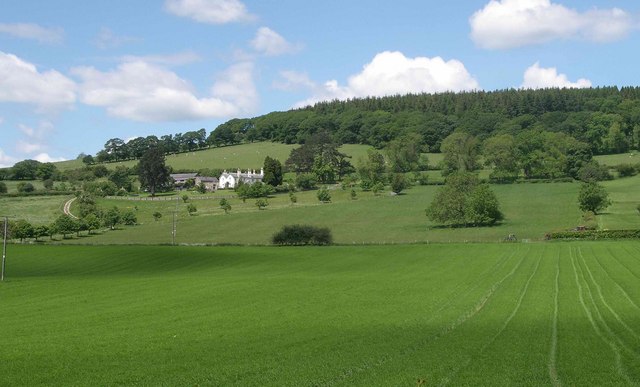
Grindell Wood is a picturesque woodland located in the county of Herefordshire, England. Covering an area of approximately 150 acres, it is nestled in the heart of the countryside, providing a tranquil retreat for nature enthusiasts and outdoor enthusiasts alike.

The wood is predominantly made up of native broadleaf trees, such as oak, ash, beech, and birch, creating a rich and diverse ecosystem. The dense canopy formed by these trees provides a sheltered habitat for a variety of wildlife, including birds, mammals, and insects.

Walking through Grindell Wood, visitors are greeted by a diverse array of plant species that thrive in the wood's fertile soil. Bluebells, primroses, and wild garlic carpet the forest floor in spring, creating a breathtaking display of color and fragrance.

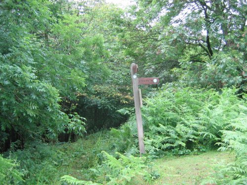
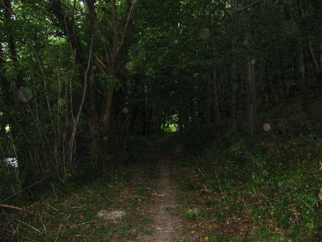
The wood is crisscrossed by a network of well-maintained footpaths, making it easily accessible to visitors. These pathways wind through the wood, allowing visitors to explore its natural beauty at their own pace. Along the way, benches and picnic areas offer opportunities to rest and take in the tranquil surroundings.

Grindell Wood is also home to a small stream that meanders through the woodland, adding to its scenic charm. The babbling sounds of the water provide a soothing backdrop to the peaceful atmosphere of the wood.

Overall, Grindell Wood is a haven for those seeking solace in nature. Its lush vegetation, diverse wildlife, and well-maintained paths make it a perfect destination for walking, photography, or simply enjoying the beauty of the English countryside.

If you have any feedback on the listing, please let us know in the comments section below.

Grindell Wood Images

Images are sourced within 2km of 52.276808/-2.9149663 or Grid Reference SO3764. Thanks to Geograph Open Source API. All images are credited.

Trig pillar above Byton Common. Situated not at the summit, but where there is  a view.
Trig pillar above Byton Common.
Situated not at the summit, but where there is a view.
Byton Common Some years ago, grazing ceased on Byton Common, although there were ponies on the common when this picture was taken. The common has now changed from downland to dense woodland complete with the dreaded bracken. The first trees to appear were hawthorn followed by oak ash and hazel.
Byton Common
Some years ago, grazing ceased on Byton Common, although there were ponies on the common when this picture was taken. The common has now changed from downland to dense woodland complete with the dreaded bracken. The first trees to appear were hawthorn followed by oak ash and hazel.
Shobdon Hill A long straight forest road near the top of Shobdon Hill. A lot of the forest has been recently felled, the trees being just over 30 years old. (I can remember the last time the felled the woods in Shobdon)
Shobdon Hill
A long straight forest road near the top of Shobdon Hill. A lot of the forest has been recently felled, the trees being just over 30 years old. (I can remember the last time the felled the woods in Shobdon)
The lane between Cadwell and Upper Kinsham looking south-east towards the junction
The lane between Cadwell and Upper Kinsham
looking south-east towards the junction
Fields, Limebrook Wood and the hill beyond looking north-east from the road between Kinsham and Lingen
Fields, Limebrook Wood and the hill beyond
looking north-east from the road between Kinsham and Lingen
The turning for Limebrook on the road between Kinsham and Lingen looking north-east towards Limebrook
The turning for Limebrook on the road between Kinsham and Lingen
looking north-east towards Limebrook
Upper Lugg valley Looking West towards the Welsh border along the upper Lugg valley from about SO367643 just to the north of Byton. The closest point of the border is only a mile or so from here
Upper Lugg valley
Looking West towards the Welsh border along the upper Lugg valley from about SO367643 just to the north of Byton. The closest point of the border is only a mile or so from here
The Lugg Valley to the West of Byton The river is just out of shot to the left - Byton in the distance
The Lugg Valley to the West of Byton
The river is just out of shot to the left - Byton in the distance
Field near Upper Lye Looking west towards Wales
Field near Upper Lye
Looking west towards Wales
Ford at Lower Yeld There is an old footbridge just to the right
Ford at Lower Yeld
There is an old footbridge just to the right
Byton Common Ponies on the Mortimer Trail
Byton Common
Ponies on the Mortimer Trail
Shobdon Hill Wood The Mortimer Trail runs along the forestry road which runs along the top of the long ridge which extends across two full squares. Large areas of conifers cleared but broadleaves left.
Shobdon Hill Wood
The Mortimer Trail runs along the forestry road which runs along the top of the long ridge which extends across two full squares. Large areas of conifers cleared but broadleaves left.
Combe Moor and Byton Moor Taken on a wet July day looking west from the hill above Park Wood just outside the square - Wapley Hill on the left
Combe Moor and Byton Moor
Taken on a wet July day looking west from the hill above Park Wood just outside the square - Wapley Hill on the left
Ryland's Wood
Ryland's Wood
Yeld Wood
Yeld Wood
View from bench seat above Byton The bench is located on the Mortimer Trail, the view is quite obscured by trees, as many views are in the Marches.
View from bench seat above Byton
The bench is located on the Mortimer Trail, the view is quite obscured by trees, as many views are in the Marches.
Belgate Farm and Shobdon Hill Wood Mixed farm on slopes of Shobdon Hill.
Belgate Farm and Shobdon Hill Wood
Mixed farm on slopes of Shobdon Hill.
Gathering pens, Deerfold A typical dry valley in the soft chalk like Silurian Limestone. Beyond the pens, a farmer is inspecting his flock.
Gathering pens, Deerfold
A typical dry valley in the soft chalk like Silurian Limestone. Beyond the pens, a farmer is inspecting his flock.
Show me another place!

Grindell Wood is located at Grid Ref: SO3764 (Lat: 52.276808, Lng: -2.9149663)

Unitary Authority: County of Herefordshire

Police Authority: West Mercia

What 3 Words

///envoy.bookshop.empty. Near Kinsham, Herefordshire

Nearby Locations

Grindell Wood

Related Wikis

Kinsham Grange

Kinsham Grange may have been a priory near the River Lugg in Herefordshire, England at grid reference SO380652. It now seems likely that an error by John...

Byton, Herefordshire

Byton is a village and civil parish in Herefordshire, England. Byton is situated on the River Lugg, near the border with Wales. According to the 2001...

Limebrook Priory

Limebrook Priory was a priory in Lingen, Herefordshire, England at grid reference SO37386604. == History == === Origins === Situated in Lingen, Herefordshire...

Kinsham

Kinsham is a civil parish which lies in the wooded hills of Herefordshire, England in the Marches near to the border with Wales, about 3 miles (5 km) east...

Have you been to Grindell Wood?

Leave your review of Grindell Wood below (or comments, questions and feedback).