Friesland Wood

Wood, Forest in Shropshire

England

Friesland Wood

A lane leading to Upper Lea
A lane leading to Upper Lea Credit: Ian S

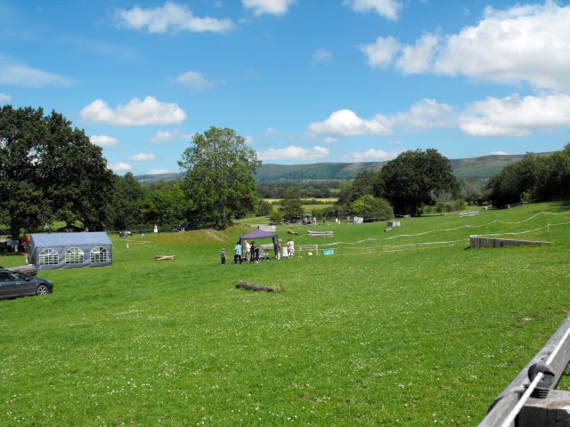
Friesland Wood is a pristine forest located in the county of Shropshire, England. Spanning over an area of approximately 50 acres, it is a cherished natural reserve that attracts nature enthusiasts and visitors alike. The wood is situated near the village of Friesland, which lies just south of the town of Ellesmere.

The woodland is characterized by its diverse ecosystem and rich biodiversity. It consists primarily of broadleaf trees, including oak, ash, birch, and beech, which create a lush and verdant canopy. The dense undergrowth is adorned with a variety of ferns, mosses, and wildflowers, adding to the wood's natural beauty.

Friesland Wood is renowned for its tranquil ambiance and serene walking trails, making it a popular destination for hikers and nature lovers. The well-maintained paths wind through the woodland, offering visitors the opportunity to explore its hidden corners and discover its natural wonders. The wood is also home to an abundance of wildlife, including deer, foxes, badgers, and a myriad of bird species, making it a haven for wildlife enthusiasts and bird watchers.

The wood is open to the public year-round, and its accessibility is enhanced by the provision of car parks and picnic areas. Additionally, there are information boards scattered throughout the wood, providing educational insights into the local flora and fauna.

Friesland Wood is not only a valuable natural asset but also a testament to the importance of conservation efforts. It serves as a reminder of the beauty and tranquility that can be found within the British countryside.

If you have any feedback on the listing, please let us know in the comments section below.

Friesland Wood Images

Images are sourced within 2km of 52.487263/-2.9301382 or Grid Reference SO3688. Thanks to Geograph Open Source API. All images are credited.

A lane leading to Upper Lea
The farm road to Blue Barn
A minor road leading to Five Turnings
The entrance to Totterton Hall
A minor road leading to Eyton
Folly Farm near Five Turnings
The way to Park Cottage off the A489
Park Cottage and garden
The A489 at the Eyton turnoff
The River Onny taken from the A489
The A489 towards Lydham
The A489 at the road to Eaton Bridge
Eaton Bridge
Eaton Bridge
Bishop's Castle Stone Skimming Championship - the site The 4th annual Bishop's Castle Stone Skimming Championship took place at Bow House Equestrian Centre on Sunday 26 June 2011, all profits going to support prostate cancer charities. 
The rules state that stones must bounce three times to count and are only measured within the marked 'lane'. A marshal raises her red oven glove if the throw fails on this. The course is marked by two ropes with plastic bottles attached as floats. The left-hand rope has numbered bottles attached at 1 metre intervals to aid other marshals in reckoning the length of the throw.
As well as the stone skimming, there were many side-shows including Stone the Crows, Roll the Stone, Toss the Boulder, No Stone Unturned and Pile the Stones.
Controversy about this event <span class="nowrap"><a title="http://www.bbc.co.uk/news/uk-england-shropshire-13900782" rel="nofollow ugc noopener" href="http://www.bbc.co.uk/news/uk-england-shropshire-13900782">Link</a><img style="margin-left:2px;" alt="External link" title="External link - shift click to open in new window" src="https://s1.geograph.org.uk/img/external.png" width="10" height="10"/></span>

The ill-fated Bishop's Castle railway <span class="nowrap"><a title="http://www.bbc.co.uk/shropshire/content/articles/2008/10/01/bishops_castle_railway_feature.shtml" rel="nofollow ugc noopener" href="http://www.bbc.co.uk/shropshire/content/articles/2008/10/01/bishops_castle_railway_feature.shtml">Link</a><img style="margin-left:2px;" alt="External link" title="External link - shift click to open in new window" src="https://s1.geograph.org.uk/img/external.png" width="10" height="10"/></span> (open for just 70 years, for 69 of which it was in receivership) ran through the site of this event very close to the lake where the stone-skimming took place but there is no sign of its existence here these days. 
Further east near Cheyney Longville (<a href="https://www.geograph.org.uk/gridref/SO4284">SO4284</a>) the trackbed forms the Onny Geological Trail <span class="nowrap"><a title="http://www.shropshiregeology.org.uk/shropgeol/onnyvalley/onnymain.html" rel="nofollow ugc noopener" href="http://www.shropshiregeology.org.uk/shropgeol/onnyvalley/onnymain.html">Link</a><img style="margin-left:2px;" alt="External link" title="External link - shift click to open in new window" src="https://s1.geograph.org.uk/img/external.png" width="10" height="10"/></span> 

Bishop's Castle Railway Society <span class="nowrap"><a title="http://www.bcrailway.co.uk/" rel="nofollow ugc noopener" href="http://www.bcrailway.co.uk/">Link</a><img style="margin-left:2px;" alt="External link" title="External link - shift click to open in new window" src="https://s1.geograph.org.uk/img/external.png" width="10" height="10"/></span>
BBC Shropshire article <span class="nowrap"><a title="http://www.bbc.co.uk/shropshire/content/articles/2008/10/01/bishops_castle_railway_feature.shtml" rel="nofollow ugc noopener" href="http://www.bbc.co.uk/shropshire/content/articles/2008/10/01/bishops_castle_railway_feature.shtml">Link</a><img style="margin-left:2px;" alt="External link" title="External link - shift click to open in new window" src="https://s1.geograph.org.uk/img/external.png" width="10" height="10"/></span>
Bishop's Castle website <span class="nowrap"><a title="http://www.bishops-castle.co.uk/railway.htm" rel="nofollow ugc noopener" href="http://www.bishops-castle.co.uk/railway.htm">Link</a><img style="margin-left:2px;" alt="External link" title="External link - shift click to open in new window" src="https://s1.geograph.org.uk/img/external.png" width="10" height="10"/></span>
Wikipedia article <span class="nowrap"><a title="http://en.wikipedia.org/wiki/Bishops_Castle_Railway" rel="nofollow ugc noopener" href="http://en.wikipedia.org/wiki/Bishops_Castle_Railway">Link</a><img style="margin-left:2px;" alt="External link" title="External link - shift click to open in new window" src="https://s1.geograph.org.uk/img/external.png" width="10" height="10"/></span>

Update April 2012 - British Stone Skimming Championship website <span class="nowrap"><a title="http://www.jollypages.co.uk/stoneskimming/" rel="nofollow ugc noopener" href="http://www.jollypages.co.uk/stoneskimming/">Link</a><img style="margin-left:2px;" alt="External link" title="External link - shift click to open in new window" src="https://s1.geograph.org.uk/img/external.png" width="10" height="10"/></span>
Bishop's Castle Stone Skimming Championship - the site
The 4th annual Bishop's Castle Stone Skimming Championship took place at Bow House Equestrian Centre on Sunday 26 June 2011, all profits going to support prostate cancer charities. The rules state that stones must bounce three times to count and are only measured within the marked 'lane'. A marshal raises her red oven glove if the throw fails on this. The course is marked by two ropes with plastic bottles attached as floats. The left-hand rope has numbered bottles attached at 1 metre intervals to aid other marshals in reckoning the length of the throw. As well as the stone skimming, there were many side-shows including Stone the Crows, Roll the Stone, Toss the Boulder, No Stone Unturned and Pile the Stones. Controversy about this event LinkExternal link The ill-fated Bishop's Castle railway LinkExternal link (open for just 70 years, for 69 of which it was in receivership) ran through the site of this event very close to the lake where the stone-skimming took place but there is no sign of its existence here these days. Further east near Cheyney Longville (SO4284) the trackbed forms the Onny Geological Trail LinkExternal link Bishop's Castle Railway Society LinkExternal link BBC Shropshire article LinkExternal link Bishop's Castle website LinkExternal link Wikipedia article LinkExternal link Update April 2012 - British Stone Skimming Championship website LinkExternal link
Bishop's Castle Stone Skimming Championship - the site The Long Mynd in the background.
Bishop's Castle Stone Skimming Championship - the site
The Long Mynd in the background.
The wild cherries are ripe The birds are obviously enjoying the crop of cherries at the moment. Seen on a fence post at Bow House Equestrian Centre.
The wild cherries are ripe
The birds are obviously enjoying the crop of cherries at the moment. Seen on a fence post at Bow House Equestrian Centre.
Bow House Equestrian Centre The centre is between the A489 and the River Onny.
The Bishop's Castle Stone Skimming Championship <a title="https://www.geograph.org.uk/snippet/5416" href="https://www.geograph.org.uk/snippet/5416">Link</a> took place here.
Bow House Equestrian Centre
The centre is between the A489 and the River Onny. The Bishop's Castle Stone Skimming Championship Link took place here.
Bishop's Castle Stone Skimming Championship - the site I gather from the signage that this small pool had been used as a children's practice pool in previous years.
Bishop's Castle Stone Skimming Championship - the site
I gather from the signage that this small pool had been used as a children's practice pool in previous years.
Show me another place!

Friesland Wood is located at Grid Ref: SO3688 (Lat: 52.487263, Lng: -2.9301382)

Unitary Authority: Shropshire

Police Authority: West Mercia

What 3 Words

///polo.shielding.swung. Near Lydham, Shropshire

Related Wikis

Plowden, Shropshire

Plowden is a hamlet in the parish of Lydbury North, Shropshire, England. It is in the valley of the River Onny and lies 3 miles east of Bishop's Castle...

Plowden railway station

Plowden railway station was a station in Plowden, Shropshire, England. The station was opened in February 1866 and closed on 20 April 1935. == See also... ==

Eaton railway station

Eaton railway station was a station in Eaton, Bishop's Castle, Shropshire, England. The station was opened in March 1866 and closed on 20 April 1935....

Clun and Bishop's Castle Rural District

Clun and Bishop's Castle was a rural district in Shropshire, England from 1894 to 1974. It was created by the Local Government Act 1894 as the Clun Rural...

Nearby Amenities

Located within 500m of 52.487263,-2.9301382
Ele: 277
Natural: peak
Lat/Long: 52.4862276/-2.9284985
The data included in this document is from www.openstreetmap.org. The data is made available under ODbL.

Have you been to Friesland Wood?

Leave your review of Friesland Wood below (or comments, questions and feedback).