Bankfield Plantation
Wood, Forest in Lancashire
England
Bankfield Plantation

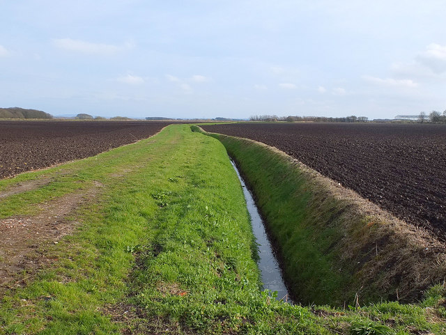
Bankfield Plantation is a picturesque woodland located in the county of Lancashire, England. This enchanting forest stretches over an area of approximately 100 acres and is known for its diverse range of tree species and abundant wildlife.
The plantation is predominantly made up of native broadleaf trees, including oak, beech, and birch, which create a lush and vibrant canopy during the summer months. This woodland also boasts a variety of understory vegetation, such as bluebells, wild garlic, and ferns, adding to its natural beauty and ecological significance.
Bankfield Plantation is home to an array of wildlife, making it a popular destination for nature enthusiasts and wildlife photographers. Visitors can spot a range of bird species, including woodpeckers, thrushes, and owls, as well as small mammals like squirrels and rabbits. The forest also provides a habitat for a variety of insects, including butterflies and dragonflies, which thrive in the diverse ecosystem created by the woodland.
In addition to its ecological value, Bankfield Plantation offers recreational opportunities for visitors. There are well-maintained walking trails that wind through the forest, allowing visitors to explore its beauty at their own pace. Picnic areas and benches are strategically placed throughout the plantation, providing ample spots for relaxation and enjoying the tranquility of the surroundings.
Overall, Bankfield Plantation is a cherished natural gem in Lancashire, offering a serene escape from the hustle and bustle of daily life. Its diverse flora and fauna, coupled with its recreational amenities, make it a beloved destination for both locals and tourists alike.
If you have any feedback on the listing, please let us know in the comments section below.
Bankfield Plantation Images
Images are sourced within 2km of 53.659661/-2.9559867 or Grid Reference SD3618. Thanks to Geograph Open Source API. All images are credited.


Bankfield Plantation is located at Grid Ref: SD3618 (Lat: 53.659661, Lng: -2.9559867)
Unitary Authority: Sefton
Police Authority: Merseyside
What 3 Words
///towns.live.scrap. Near Southport, Merseyside
Nearby Locations
Related Wikis
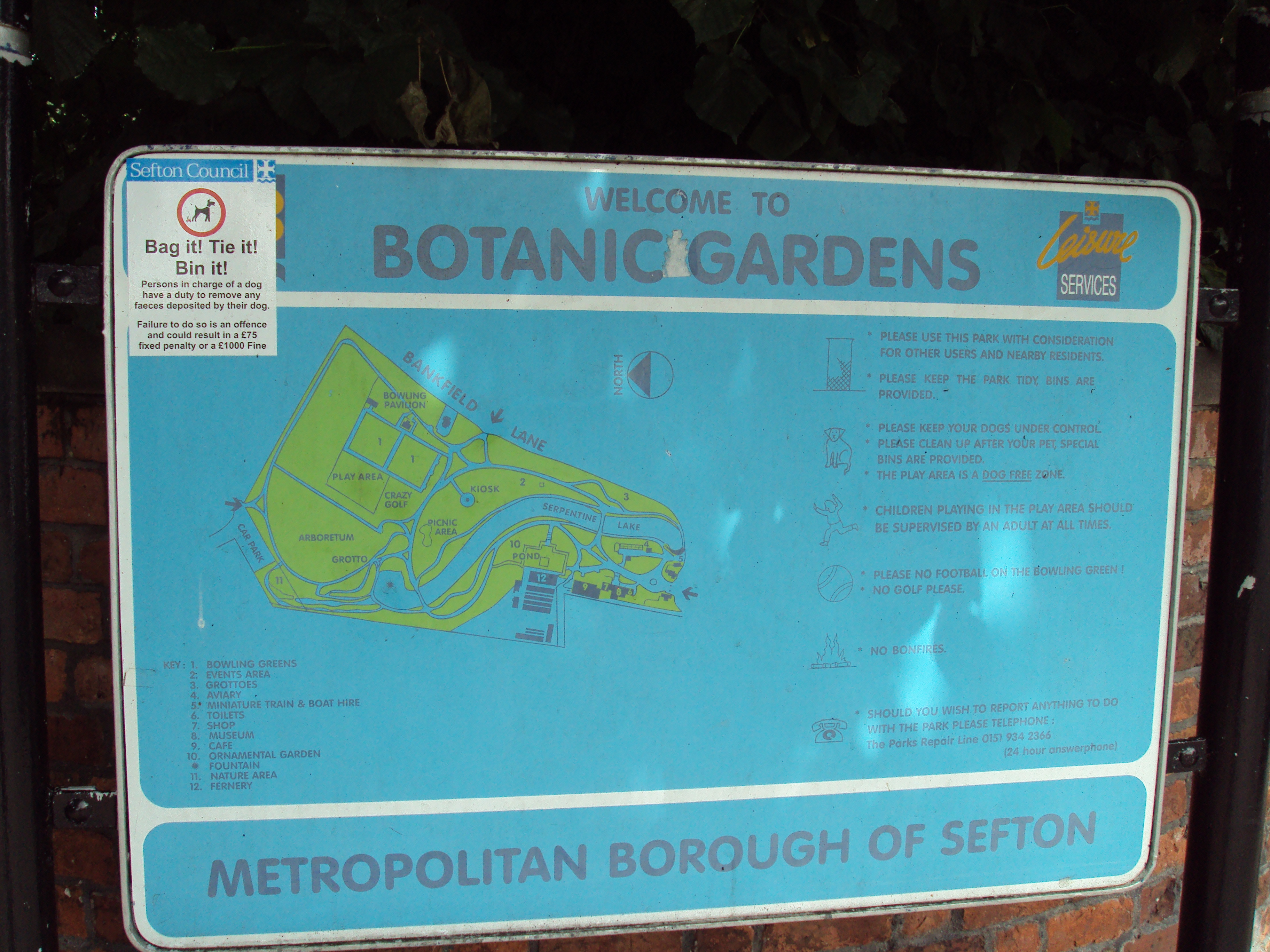
Southport Botanic Gardens
Southport Botanic Gardens is a botanical garden situated in the suburban village of Churchtown, Southport, in Merseyside, England. It is often called...

St Cuthbert's Church, Churchtown
St Cuthbert's Church is an Anglican church in Churchtown, Merseyside, a village that is now a suburb of Southport in the English county of Merseyside....
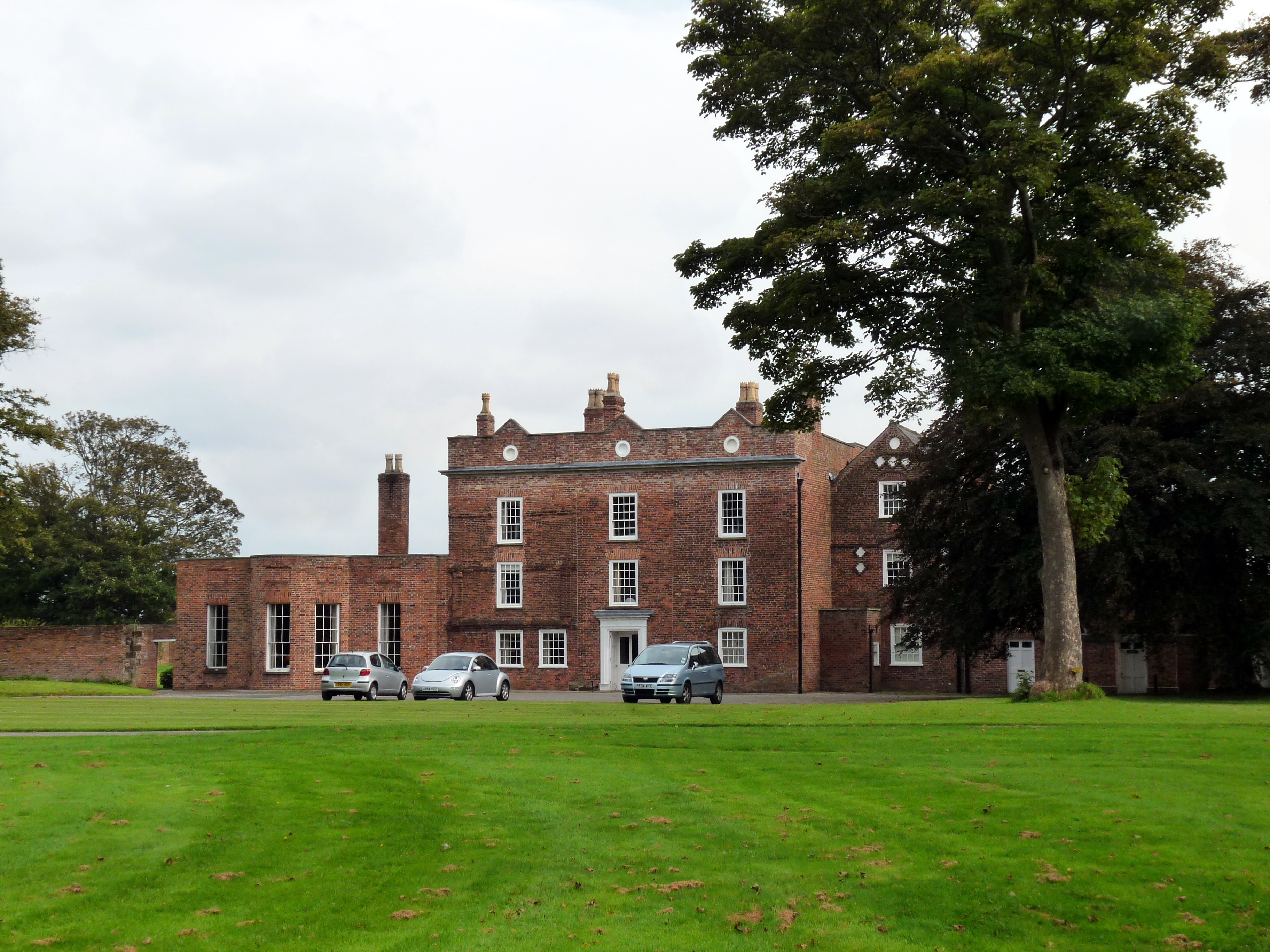
Meols Hall
Meols Hall is a historical manor house in Churchtown, Merseyside, dating from the 12th century with a 16th-century tithe barn restored for wedding receptions...

Churchtown railway station
Churchtown railway station was on the West Lancashire Railway (WLR) in England. It opened in 1878 and served the Southport suburb of Churchtown. ��2�...
Nearby Amenities
Located within 500m of 53.659661,-2.9559867Have you been to Bankfield Plantation?
Leave your review of Bankfield Plantation below (or comments, questions and feedback).