Browtop Wood

Wood, Forest in Cumberland Eden

England

Browtop Wood

Driveway to Sebergham Hall Driveway with status of bridleway which leads through to St Mary's Church, Sebergham at the far end.
Driveway to Sebergham Hall Credit: Oliver Dixon

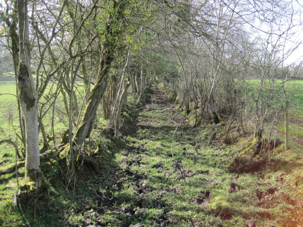
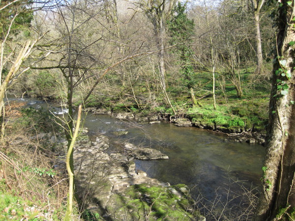
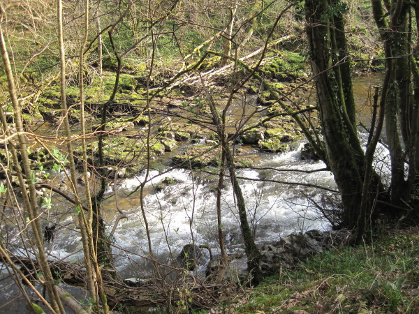
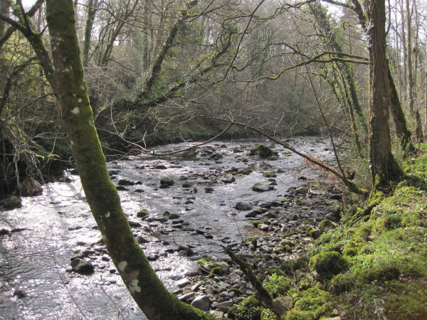
Browtop Wood is a picturesque woodland located in Cumberland, England. Covering an area of approximately 100 acres, it is known for its captivating beauty and diverse range of flora and fauna. Situated on the slopes of Browtop Fell, the wood offers breathtaking views of the surrounding countryside and is a popular destination for nature enthusiasts and hikers.

The wood is predominantly composed of native tree species, including oak, beech, and birch, which create a dense and vibrant canopy. The forest floor is adorned with a rich carpet of wildflowers, such as bluebells and primroses, adding a splash of color to the landscape during spring and summer.

Browtop Wood is home to a variety of wildlife, providing a sanctuary for many species. Visitors may be fortunate enough to spot red squirrels darting between the trees or catch a glimpse of deer grazing in the clearings. The wood also attracts a wide range of bird species, including woodpeckers and owls, making it a haven for birdwatchers.

Traversing the wood, visitors can explore a network of well-maintained trails that meander through the ancient woodland. These trails offer the opportunity to immerse oneself in the peaceful ambiance of the forest and provide a chance to observe the woodland's natural wonders up close.

Browtop Wood is not only a natural gem but also holds historical significance. It is believed to have been an important source of timber during the medieval period, contributing to the local economy and development of the region.

Overall, Browtop Wood in Cumberland offers a tranquil and captivating experience, allowing visitors to connect with nature and discover the beauty of the English countryside.

If you have any feedback on the listing, please let us know in the comments section below.

Browtop Wood Images

Images are sourced within 2km of 54.76064/-2.9962449 or Grid Reference NY3541. Thanks to Geograph Open Source API. All images are credited.

Driveway to Sebergham Hall Driveway with status of bridleway which leads through to St Mary's Church, Sebergham at the far end.
Driveway to Sebergham Hall
Driveway with status of bridleway which leads through to St Mary's Church, Sebergham at the far end.
Bell Bridge near Sebergham
Remains of a Lime Kiln
High Hartrigg Ruined farm building
High Hartrigg
Ruined farm building
High Hartrigg Ruined farm building
High Hartrigg
Ruined farm building
Footpath above Warnell
Warnell Hall Fortified house now farmhouse. Early or mid C16 incorporating part of a C14
tower with alterations, dated and inscribed over entrance T & M D 1683 with
Denton coat-of-arms. Large blocks of mixed calciferous and pink sandstone with
graduated greenslate roof and stone chimney stacks. 2 storeys, 5 bays with
stair projection to rear making shape; originally a fortified courtyard plan.
Top-glazed panelled door in alternate-block surround under cornice and voussoir
frieze. 2-light stone-mullioned windows under cornices are of 1683. Confined
fenestration is explained by adjoining courtyard range, that to right listed
separately, but that to left now demolished, leaving blank wall. Rear 2- and
3-light stone-mullioned windows under hoodmoulds could be C16. Wall at left
rear has earlier blocked window and is said to contain the remains of a newel
staircase of the C14 tower, now demolished. Further single-storey rear
extension is probably early C18. Interior has large segmental-arched stone
fireplace in principal ground-floor room. Late C17 oak staircase with twisted
balusters and broad moulded handrail. House of Dacre family which was exchanged
with the Denton family for Denton Hall in 1507; sold by the Dentons to Sir James
Lowther in 1774 and still in the possession of that family. See W.T. McIntyre,
Warnell Hall, Cumberland News, 4 August 1934; Transactions Cumberland &
Westmorland Antiquarian & Archaeological Society, new series, xx, p238.
<span class="nowrap"><a title="http://www.britishlistedbuildings.co.uk/en-72486-warnell-hall-sebergham" rel="nofollow ugc noopener" href="http://www.britishlistedbuildings.co.uk/en-72486-warnell-hall-sebergham">Link</a><img style="margin-left:2px;" alt="External link" title="External link - shift click to open in new window" src="https://s1.geograph.org.uk/img/external.png" width="10" height="10"/></span>
Warnell Hall
Fortified house now farmhouse. Early or mid C16 incorporating part of a C14 tower with alterations, dated and inscribed over entrance T & M D 1683 with Denton coat-of-arms. Large blocks of mixed calciferous and pink sandstone with graduated greenslate roof and stone chimney stacks. 2 storeys, 5 bays with stair projection to rear making shape; originally a fortified courtyard plan. Top-glazed panelled door in alternate-block surround under cornice and voussoir frieze. 2-light stone-mullioned windows under cornices are of 1683. Confined fenestration is explained by adjoining courtyard range, that to right listed separately, but that to left now demolished, leaving blank wall. Rear 2- and 3-light stone-mullioned windows under hoodmoulds could be C16. Wall at left rear has earlier blocked window and is said to contain the remains of a newel staircase of the C14 tower, now demolished. Further single-storey rear extension is probably early C18. Interior has large segmental-arched stone fireplace in principal ground-floor room. Late C17 oak staircase with twisted balusters and broad moulded handrail. House of Dacre family which was exchanged with the Denton family for Denton Hall in 1507; sold by the Dentons to Sir James Lowther in 1774 and still in the possession of that family. See W.T. McIntyre, Warnell Hall, Cumberland News, 4 August 1934; Transactions Cumberland & Westmorland Antiquarian & Archaeological Society, new series, xx, p238. LinkExternal link
Footpath towards Lonningfoot An old green lane.  
We decided not to "plodge" through the mud.
Footpath towards Lonningfoot
An old green lane. We decided not to "plodge" through the mud.
Warnell Beck
Warnell Beck
Former Mill at Lonningfoot, Sebergham
Old Mill Race, Lonningfoot, Sebergham
River Caldew at Sebergham
Farm Building near Sebergham
River Caldew near Sebergham
River Caldew
River Caldew
River Caldew
River Caldew
River Caldew
River Caldew
Show me another place!

Browtop Wood is located at Grid Ref: NY3541 (Lat: 54.76064, Lng: -2.9962449)

Administrative County: Cumbria

District: Eden

Police Authority: Cumbria

What 3 Words

///manliness.directive.outreach. Near Dalston, Cumbria

Nearby Locations

Browtop Wood

Related Wikis

Sebergham

Sebergham is a small village and civil parish in the English county of Cumbria. It is located on the B5305, south of Carlisle and south-east of Wigton...

Cumberland

Cumberland ( KUM-bər-lənd) is a historic county in North West England, covering part of the Lake District as well as the northern Pennines and the coast...

Brothybeck

Brothybeck is a village in Cumbria, England.

Castle Sowerby

Castle Sowerby is a civil parish in the Eden District of Cumbria, England. In 2001 it had a population of 337, increasing to 344 at the 2011 Census, and...

Nearby Amenities

Located within 500m of 54.76064,-2.9962449
Bus Stop
Churchtown Road End (W bound)
Naptan AtcoCode: 090002481456
Naptan Bearing: W
Naptan CommonName: Churchtown Road End (W bound)
Naptan Indicator: opp
Naptan Landmark: junction to Churchtown-o/s Hall
Naptan NaptanCode: cumagmgw
Naptan Street: B5305
Naptan Verified: no
Shelter: yes
Source: naptan_import
Lat/Long: 54.7640922/-2.9924419
Churchtown Road End (E bound)
Local Ref: AT
Naptan AtcoCode: 090002483344
Naptan Bearing: SE
Naptan BusStopType: CUS
Naptan CommonName: Churchtown Road End (E bound)
Naptan Indicator: at
Naptan Landmark: junction to Churchtown opposite hall
Naptan NaptanCode: cumagmja
Naptan Street: B5305
Naptan Verified: no
Source: naptan_import
Lat/Long: 54.7642011/-2.9923047
Power: pole
Lat/Long: 54.7641651/-2.991642
The data included in this document is from www.openstreetmap.org. The data is made available under ODbL.

Have you been to Browtop Wood?

Leave your review of Browtop Wood below (or comments, questions and feedback).