Aeksea Coppice

Wood, Forest in Shropshire

England

Aeksea Coppice

Ordnance Survey Flush Bracket 2765 This can be found on the wall of a house - a private dwelling - at The Prill. There is also a 'cancelled' Cut Mark at the same location which this bracket presumably supersedes.
For more detail see : <span class="nowrap"><a title="http://www.bench-marks.org.uk/bm2285" rel="nofollow ugc noopener" href="http://www.bench-marks.org.uk/bm2285">Link</a><img style="margin-left:2px;" alt="External link" title="External link - shift click to open in new window" src="https://s1.geograph.org.uk/img/external.png" width="10" height="10"/></span>
Ordnance Survey Flush Bracket 2765 Credit: Peter Wood

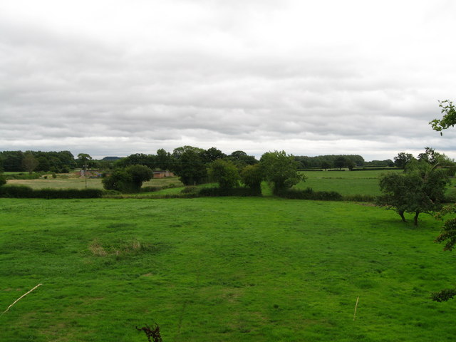
Aeksea Coppice is a stunning woodland area located in the county of Shropshire, England. Situated near the town of Ludlow, this ancient forest covers an approximate area of 100 hectares and is a popular destination for nature enthusiasts and hikers alike.

The coppice is predominantly composed of native broadleaf trees, such as oak, ash, and beech, which create a diverse and vibrant ecosystem. The forest floor is adorned with a rich carpet of wildflowers, including bluebells, primroses, and wood anemones, adding a burst of color to the landscape during the spring months.

The woodland is crisscrossed with a network of well-maintained trails, making it easily accessible for visitors of all ages and abilities. Along these paths, one can find various species of wildlife, including deer, foxes, and a wide array of bird species. The tranquil atmosphere and lush greenery make Aeksea Coppice an ideal spot for birdwatching and wildlife photography.

In addition to its natural beauty, the coppice also holds historical significance. It is believed that the area has been used for timber production since medieval times, with evidence of ancient carpentry and charcoal production still visible today.

Aeksea Coppice offers a peaceful retreat from the hustle and bustle of everyday life, providing a haven for both wildlife and visitors seeking solace in nature. Whether exploring the woodland trails, admiring the vibrant flora, or simply enjoying a picnic amidst the trees, Aeksea Coppice is undoubtedly a hidden gem in the heart of Shropshire.

If you have any feedback on the listing, please let us know in the comments section below.

Aeksea Coppice Images

Images are sourced within 2km of 52.772766/-2.9519858 or Grid Reference SJ3519. Thanks to Geograph Open Source API. All images are credited.

Ordnance Survey Flush Bracket 2765 This can be found on the wall of a house - a private dwelling - at The Prill. There is also a 'cancelled' Cut Mark at the same location which this bracket presumably supersedes.
For more detail see : <span class="nowrap"><a title="http://www.bench-marks.org.uk/bm2285" rel="nofollow ugc noopener" href="http://www.bench-marks.org.uk/bm2285">Link</a><img style="margin-left:2px;" alt="External link" title="External link - shift click to open in new window" src="https://s1.geograph.org.uk/img/external.png" width="10" height="10"/></span>
Ordnance Survey Flush Bracket 2765
This can be found on the wall of a house - a private dwelling - at The Prill. There is also a 'cancelled' Cut Mark at the same location which this bracket presumably supersedes. For more detail see : LinkExternal link
Road (the former A5) at The Prill Looking north-westward.
Road (the former A5) at The Prill
Looking north-westward.
A5 north of Kinton
A5 north of Kinton
Bridge Cottage by the way - Edgerley, Shropshire A party of Railway Ramblers on a day walk making their way along the B-road from Pentre to Kinnerley at Edgerley towards the road bridge overlooking the site of Kinnerley Junction. The walk started at the village of Shrawardine <a href="https://www.geograph.org.uk/gridref/SJ3915">SJ3915</a> 'Shraden' to the locals, and was to end at Argoed <a href="https://www.geograph.org.uk/gridref/SJ3220">SJ3220</a>. Time taken 3.06 pm BST (British Summer Time).
Bridge Cottage by the way - Edgerley, Shropshire
A party of Railway Ramblers on a day walk making their way along the B-road from Pentre to Kinnerley at Edgerley towards the road bridge overlooking the site of Kinnerley Junction. The walk started at the village of Shrawardine SJ3915 'Shraden' to the locals, and was to end at Argoed SJ3220. Time taken 3.06 pm BST (British Summer Time).
Towards Kinnerley Junction - Edgerley, Shropshire A party of Railway Ramblers at Edgerley on the B-road between Pentre and Kinnerley as they approach the road bridge overlooking the site of Kinnerley Junction. The now-vanished Shropshire and Montgomeryshire Railway once ran this way and at Kinnerley Junction a 5-mile branch led off  to the basalt quarry at Criggion <a href="https://www.geograph.org.uk/gridref/SJ2814">SJ2814</a>. Time taken 3.07 pm BST (British Summer Time).

<a href="https://www.geograph.org.uk/photo/5319315">SJ3319 : Bridge over Kinnerley Junction - Edgerley, Shropshire</a>
Towards Kinnerley Junction - Edgerley, Shropshire
A party of Railway Ramblers at Edgerley on the B-road between Pentre and Kinnerley as they approach the road bridge overlooking the site of Kinnerley Junction. The now-vanished Shropshire and Montgomeryshire Railway once ran this way and at Kinnerley Junction a 5-mile branch led off to the basalt quarry at Criggion SJ2814. Time taken 3.07 pm BST (British Summer Time). SJ3319 : Bridge over Kinnerley Junction - Edgerley, Shropshire
Bridge over Kinnerley Junction - Edgerley, Shropshire Some of the group of Railway Ramblers at Edgerley stopping for a look from the bridge at the site of Kinnerley Junction, from where a 5-mile branch left the Shropshire and Montgomeryshire Railway for the basalt quarry at Criggion <a href="https://www.geograph.org.uk/gridref/SJ2814">SJ2814</a>. The sign on the left shows a 22 ton weight limit on the bridge. Time taken 3.07 pm BST (British Summer Time).
Bridge over Kinnerley Junction - Edgerley, Shropshire
Some of the group of Railway Ramblers at Edgerley stopping for a look from the bridge at the site of Kinnerley Junction, from where a 5-mile branch left the Shropshire and Montgomeryshire Railway for the basalt quarry at Criggion SJ2814. The sign on the left shows a 22 ton weight limit on the bridge. Time taken 3.07 pm BST (British Summer Time).
Subway at the Services
A5 approaching Nesscliffe Services The A5 is a major trunk road that runs 260 miles from London to Holyhead. It follows the course of an old Roman Road (Watling Street).
Wikipedia: <span class="nowrap"><a title="http://en.wikipedia.org/wiki/A5_road_(Great_Britain)" rel="nofollow ugc noopener" href="http://en.wikipedia.org/wiki/A5_road_(Great_Britain)">Link</a><img style="margin-left:2px;" alt="External link" title="External link - shift click to open in new window" src="https://s1.geograph.org.uk/img/external.png" width="10" height="10"/></span>
A5 approaching Nesscliffe Services
The A5 is a major trunk road that runs 260 miles from London to Holyhead. It follows the course of an old Roman Road (Watling Street). Wikipedia: LinkExternal link
A5 passing Nesscliffe Services The A5 is a major trunk road that runs 260 miles from London to Holyhead. It follows the course of an old Roman Road (Watling Street).
Wikipedia: <span class="nowrap"><a title="http://en.wikipedia.org/wiki/A5_road_(Great_Britain)" rel="nofollow ugc noopener" href="http://en.wikipedia.org/wiki/A5_road_(Great_Britain)">Link</a><img style="margin-left:2px;" alt="External link" title="External link - shift click to open in new window" src="https://s1.geograph.org.uk/img/external.png" width="10" height="10"/></span>
A5 passing Nesscliffe Services
The A5 is a major trunk road that runs 260 miles from London to Holyhead. It follows the course of an old Roman Road (Watling Street). Wikipedia: LinkExternal link
A bridge there was - Edgerley, Shropshire The embankment ahead in this picture was the filled-in road bridgehole over the Shropshire & Montgomeryshire Railway at Edgerley. This line was intended to make a link between The Potteries at Stoke on Trent and Dublin, hence it's nickname the Potts, but this plan never came to fruition. Somewhat confusingly, there are two places named Edgerley on the OS map here, but whether they are separate or the same place named twice is not clear. Time taken 3.02 pm BST (British Summer Time).
<a href="https://www.geograph.org.uk/photo/3607444">SJ3419 : Rails once ran - Edgerley, Shropshire</a> <a href="https://www.geograph.org.uk/photo/3607850">SJ3319 : The road to Kynaston - Edgerley, Shropshire</a>
A bridge there was - Edgerley, Shropshire
The embankment ahead in this picture was the filled-in road bridgehole over the Shropshire & Montgomeryshire Railway at Edgerley. This line was intended to make a link between The Potteries at Stoke on Trent and Dublin, hence it's nickname the Potts, but this plan never came to fruition. Somewhat confusingly, there are two places named Edgerley on the OS map here, but whether they are separate or the same place named twice is not clear. Time taken 3.02 pm BST (British Summer Time). SJ3419 : Rails once ran - Edgerley, Shropshire SJ3319 : The road to Kynaston - Edgerley, Shropshire
Rails once ran - Edgerley, Shropshire Looking eastwards from the bridge in Edgerley 1, the long-abandoned former route of the Shropshire & Montgomeryshire Railway - nicknamed the Potts - can be seen. Passing through the gate which is seen ahead in the centre of the picture, the line ran through the present Nesscliffe Military Training Area - no public access - to the station house, a rebuilt one, at Shrawardine (locally pronounced Shraden). There are a number of books available which give a history of this former line. Time taken 3.08 pm BST (British Summer Time). <a href="https://www.geograph.org.uk/photo/3607429">SJ3319 : A bridge there was - Edgerley, Shropshire</a> <a href="https://www.geograph.org.uk/photo/3607850">SJ3319 : The road to Kynaston - Edgerley, Shropshire</a>
Rails once ran - Edgerley, Shropshire
Looking eastwards from the bridge in Edgerley 1, the long-abandoned former route of the Shropshire & Montgomeryshire Railway - nicknamed the Potts - can be seen. Passing through the gate which is seen ahead in the centre of the picture, the line ran through the present Nesscliffe Military Training Area - no public access - to the station house, a rebuilt one, at Shrawardine (locally pronounced Shraden). There are a number of books available which give a history of this former line. Time taken 3.08 pm BST (British Summer Time). SJ3319 : A bridge there was - Edgerley, Shropshire SJ3319 : The road to Kynaston - Edgerley, Shropshire
The road to Kynaston - Edgerley, Shropshire Just to the west of here, behind the photographer, lies the site of Kinnerley Junction where the Shropshire & Montgomeryshire Railway, the 'Potts', diverged, one branch turning southwards to Criggion and the other westwards to Llanymynech. In existence from 1866 to 1962, the line had a very chequered history and there are a number of books published on the story of it. The trackbed these days is private land, with no public access. The lower sign reads 'TRAINING AREAS 1 TO 6' and the signpost arms 'Kinnerley Knockin' 'Pentre Wilcott' and 'Kynaston'. Time taken 3.13 pm BST (British Summer Time).    

<a href="https://www.geograph.org.uk/photo/3607429">SJ3319 : A bridge there was - Edgerley, Shropshire</a> <a href="https://www.geograph.org.uk/photo/3607444">SJ3419 : Rails once ran - Edgerley, Shropshire</a>
The road to Kynaston - Edgerley, Shropshire
Just to the west of here, behind the photographer, lies the site of Kinnerley Junction where the Shropshire & Montgomeryshire Railway, the 'Potts', diverged, one branch turning southwards to Criggion and the other westwards to Llanymynech. In existence from 1866 to 1962, the line had a very chequered history and there are a number of books published on the story of it. The trackbed these days is private land, with no public access. The lower sign reads 'TRAINING AREAS 1 TO 6' and the signpost arms 'Kinnerley Knockin' 'Pentre Wilcott' and 'Kynaston'. Time taken 3.13 pm BST (British Summer Time). SJ3319 : A bridge there was - Edgerley, Shropshire SJ3419 : Rails once ran - Edgerley, Shropshire
A5 Southbound at Nesscliffe Services The A5 is a major trunk road which runs for about 181 miles from London, in England, to Holyhead, in Wales. For part of its route, it follows a section of the Roman route which later took the Anglo-Saxon name Watling Street.  At Oswestry, the A5 joins the A483 and becomes the bypass to the east of the town. It continues to multiplex with the A483 until it reaches Halton, where it diverges towards Llangollen and Holyhead.
A5 Southbound at Nesscliffe Services
The A5 is a major trunk road which runs for about 181 miles from London, in England, to Holyhead, in Wales. For part of its route, it follows a section of the Roman route which later took the Anglo-Saxon name Watling Street. At Oswestry, the A5 joins the A483 and becomes the bypass to the east of the town. It continues to multiplex with the A483 until it reaches Halton, where it diverges towards Llangollen and Holyhead.
Oak tree in pastureland north of Kinton Seemingly standing guard over a field full of contented, munching, recently shorn sheep.
Oak tree in pastureland north of Kinton
Seemingly standing guard over a field full of contented, munching, recently shorn sheep.
Kinton House in the tiny village west of Nesscliffe Substantial house in this quiet small village. I wonder why this huge side of the house only has one tiny window and a side entrance?
Kinton House in the tiny village west of Nesscliffe
Substantial house in this quiet small village. I wonder why this huge side of the house only has one tiny window and a side entrance?
Old ammunition storage units on the Nesscliffe Training Area MOD land Second World War structures. The Shropshire Way traverses eerily through this still used training ground, with many notices warning walkers to keep to the footpaths and not to touch any military debris or it might explode!!
Old ammunition storage units on the Nesscliffe Training Area MOD land
Second World War structures. The Shropshire Way traverses eerily through this still used training ground, with many notices warning walkers to keep to the footpaths and not to touch any military debris or it might explode!!
Former Primitive Methodist chapel at The Firs, west of Nesscliffe One of many former Primitive Methodists chapels in the Shropshire borders transformed into cosy dwelling houses. This one dates from the 1850s, as most of them do.
Former Primitive Methodist chapel at The Firs, west of Nesscliffe
One of many former Primitive Methodists chapels in the Shropshire borders transformed into cosy dwelling houses. This one dates from the 1850s, as most of them do.
Exit to Knockin
Exit to Knockin
Show me another place!

Aeksea Coppice is located at Grid Ref: SJ3519 (Lat: 52.772766, Lng: -2.9519858)

Unitary Authority: Shropshire

Police Authority: West Mercia

What 3 Words

///thinker.fearfully.sands. Near Great Ness, Shropshire

Nearby Locations

Aeksea Coppice New Covert

Related Wikis

Kynaston, Shropshire

Kynaston is an English hamlet in the parish of Kinnerley, Shropshire. It was described in 1870 as "KYNASTONE, a township in Kinnerley parish, Salop; 7½...

Nesscliffe Training Area

The Nesscliffe Training Area is a military training facility located near Nesscliffe in Shropshire. == History == The training area is located on and around...

Kinton, Shropshire

Kinton is a hamlet in Shropshire, England. It is part of the civil parish of Great Ness, and is situated to the west of the A5 road. Richard Mathews, the...

Edgerley Halt railway station

Edgerley Halt railway station was a station to the southeast of Kinnerley, Shropshire, England. The station was opened in 1927 and closed in 1933. ��2...

Kinnerley Junction railway station

Kinnerley Junction railway station was a station to the north of Kinnerley, Shropshire, England. The station was opened in 1866 and closed in 1933. �...

Kinnerley

Kinnerley (historic Welsh name: Generdinlle) is a small village in Shropshire, England. It lies between the neighbouring villages of Dovaston and Pentre...

Nesscliffe

Nesscliffe is a village in Shropshire, England, located north of the River Severn. The village comes under the Great Ness parish. The A5 road, which previously...

Nesscliffe and Pentre railway station

Nesscliffe and Pentre railway station was a station in Nesscliffe, Shropshire, England. The station was opened in 1866 and closed in 1933. == References... ==

Related Videos

COULD WE SEE THROUGH THE MIST? NESCLIFFE HILL - SHROPSHIRE // CHILLSEEKERS UK

summer #follow #traveler #love #life #tourism #traveller #beautyspot #mountains #happy #chillseekers #sea #architecture ...

DD Frontline hammock and tarp review after 4 years swinging in the trees.

After almost five years of use, I thought it was about time to review my hammock setup. Hope this video helps when you're looking ...

10 Tips for Hammock Camping

Hopefully there us a tip here you could use on your next camp, in a hammock or a tent. Probably my favourite spot to hammock ...

Nescliffe Hills and the Cliffe Heritage site Walk, Shropshire

Amazing cliff-top views and caves on this great scenic trail with rope swings and rock climb for the braver explorers. Follow the link ...

Have you been to Aeksea Coppice?

Leave your review of Aeksea Coppice below (or comments, questions and feedback).