Barryatt's Copse

Wood, Forest in Somerset South Somerset

England

Barryatt's Copse

Pretwood Hill Trees newly in leaf on the permissive path along the crest of Pretwood Hill, overlooking Ilminster.
Pretwood Hill Credit: Derek Harper

Barryatt's Copse is a picturesque wood located in the county of Somerset, England. This enchanting forest covers an area of approximately 50 acres and is situated in the heart of the Somerset countryside, providing a tranquil and serene escape for nature enthusiasts and outdoor adventurers alike.

The copse is characterized by its dense canopy of towering oak, beech, and ash trees, which create a cool and shaded environment below. The forest floor is adorned with a vibrant carpet of bluebells in the spring, offering a breathtaking sight for visitors. Additionally, the copse boasts a diverse array of native flora and fauna, including foxes, badgers, and numerous species of birds.

There are several well-maintained walking trails that wind their way through the copse, allowing visitors to explore its natural beauty at their own pace. These trails offer a chance to immerse oneself in the peaceful ambiance of the wood, while also providing opportunities for wildlife spotting and birdwatching.

Barryatt's Copse is a popular destination for both locals and tourists seeking to reconnect with nature. Its secluded location and unspoiled surroundings create an ideal setting for outdoor activities such as picnicking, photography, and nature walks. The copse is also a haven for artists and writers, who are drawn to its tranquil atmosphere and stunning scenery.

Overall, Barryatt's Copse is a hidden gem in Somerset, offering a captivating woodland experience with its ancient trees, abundant wildlife, and scenic beauty. It is a place where one can escape the hustle and bustle of everyday life and find solace in the serenity of nature.

If you have any feedback on the listing, please let us know in the comments section below.

Barryatt's Copse Images

Images are sourced within 2km of 50.906187/-2.9158462 or Grid Reference ST3512. Thanks to Geograph Open Source API. All images are credited.

Pretwood Hill Trees newly in leaf on the permissive path along the crest of Pretwood Hill, overlooking Ilminster.
Pretwood Hill
Trees newly in leaf on the permissive path along the crest of Pretwood Hill, overlooking Ilminster.
Dowlish Wake from the churchyard Looking SSW from the churchyard down the village street. A reverse view of <a href="https://www.geograph.org.uk/photo/3715773">ST3712 : Entrance to churchyard, Dowlish Wake</a>; on the right is the scene in <a href="https://www.geograph.org.uk/photo/3715820">ST3712 : Lane at Dowlish Wake</a>.
Dowlish Wake from the churchyard
Looking SSW from the churchyard down the village street. A reverse view of ST3712 : Entrance to churchyard, Dowlish Wake; on the right is the scene in ST3712 : Lane at Dowlish Wake.
Oxenford House Attractive buildings in Ham stone near Dowlish Wake, the main C17-C18 house and cottage described at <span class="nowrap"><a title="http://webapp1.somerset.gov.uk/her/details.asp?prn=57238" rel="nofollow ugc noopener" href="http://webapp1.somerset.gov.uk/her/details.asp?prn=57238">Link</a><img style="margin-left:2px;" alt="External link" title="External link - shift click to open in new window" src="https://s1.geograph.org.uk/img/external.png" width="10" height="10"/></span>
Oxenford House
Attractive buildings in Ham stone near Dowlish Wake, the main C17-C18 house and cottage described at LinkExternal link
Remains of Chard Canal near Dowlish Ford The wooded line of the canal has here been made into a nature reserve.
Remains of Chard Canal near Dowlish Ford
The wooded line of the canal has here been made into a nature reserve.
Herne Hill Fields climb the southern slopes of Herne Hill, seen here from the Ilminster-Chard road.
Herne Hill
Fields climb the southern slopes of Herne Hill, seen here from the Ilminster-Chard road.
Thatched farmhouse at Sea The grid line runs along the road at Sea, and this farmhouse is on the south side. Sea probably means island, and the presence of sandbags at some doorways indicates the likelihood of flooding here.
Thatched farmhouse at Sea
The grid line runs along the road at Sea, and this farmhouse is on the south side. Sea probably means island, and the presence of sandbags at some doorways indicates the likelihood of flooding here.
Ilminster Library On Ditton Road, south of the town centre. The tablet in the gable reads "The Reading Room, 1889".
Ilminster Library
On Ditton Road, south of the town centre. The tablet in the gable reads "The Reading Room, 1889".
St Andrew's church, Dowlish Wake <span class="nowrap"><a title="http://webapp1.somerset.gov.uk/her/details.asp?prn=57228" rel="nofollow ugc noopener" href="http://webapp1.somerset.gov.uk/her/details.asp?prn=57228">Link</a><img style="margin-left:2px;" alt="External link" title="External link - shift click to open in new window" src="https://s1.geograph.org.uk/img/external.png" width="10" height="10"/></span>
St Andrew's church, Dowlish Wake
Dower House , Dowlish Wake Fine 1664 house in Ham stone, with a five-light mullioned window, at the centre of the charming village. Details at <span class="nowrap"><a title="http://webapp1.somerset.gov.uk/her/details.asp?prn=57233" rel="nofollow ugc noopener" href="http://webapp1.somerset.gov.uk/her/details.asp?prn=57233">Link</a><img style="margin-left:2px;" alt="External link" title="External link - shift click to open in new window" src="https://s1.geograph.org.uk/img/external.png" width="10" height="10"/></span> .
Dower House , Dowlish Wake
Fine 1664 house in Ham stone, with a five-light mullioned window, at the centre of the charming village. Details at LinkExternal link .
Packhorse Bridge, Dowlish Wake The 2-arch bridge was widened in the 1990s as part of flood relief work - quite cleverly (can you see the joins?). <span class="nowrap"><a title="http://webapp1.somerset.gov.uk/her/details.asp?prn=17080" rel="nofollow ugc noopener" href="http://webapp1.somerset.gov.uk/her/details.asp?prn=17080">Link</a><img style="margin-left:2px;" alt="External link" title="External link - shift click to open in new window" src="https://s1.geograph.org.uk/img/external.png" width="10" height="10"/></span>
Packhorse Bridge, Dowlish Wake
The 2-arch bridge was widened in the 1990s as part of flood relief work - quite cleverly (can you see the joins?). LinkExternal link
Not St George's Day In Dowlish Wake village on St George's Eve. Hope it won whatever competition it was in for.
Not St George's Day
In Dowlish Wake village on St George's Eve. Hope it won whatever competition it was in for.
Perry's Cider Mill, Dowlish Wake Offering a tea room and shop as well as producing cider. <span class="nowrap"><a title="http://webapp1.somerset.gov.uk/her/details.asp?prn=57240" rel="nofollow ugc noopener" href="http://webapp1.somerset.gov.uk/her/details.asp?prn=57240">Link</a><img style="margin-left:2px;" alt="External link" title="External link - shift click to open in new window" src="https://s1.geograph.org.uk/img/external.png" width="10" height="10"/></span>
Perry's Cider Mill, Dowlish Wake
Offering a tea room and shop as well as producing cider. LinkExternal link
Squash Withy Bed Now effective as a shelter belt, this woodland near Dowlish Wake presumably once consisted of willows.
Squash Withy Bed
Now effective as a shelter belt, this woodland near Dowlish Wake presumably once consisted of willows.
Cottage at Oxenford With some modern conversions on the left. Seen from the lane from Dowlish Wake.
Cottage at Oxenford
With some modern conversions on the left. Seen from the lane from Dowlish Wake.
C18 screen wall, Cricket Malherbie <span class="nowrap"><a title="http://webapp1.somerset.gov.uk/her/details.asp?prn=57263" rel="nofollow ugc noopener" href="http://webapp1.somerset.gov.uk/her/details.asp?prn=57263">Link</a><img style="margin-left:2px;" alt="External link" title="External link - shift click to open in new window" src="https://s1.geograph.org.uk/img/external.png" width="10" height="10"/></span> . Impressive finials and brickwork for a farm wall. The Manor Farm is opposite St Mary Magdalene church.
C18 screen wall, Cricket Malherbie
LinkExternal link . Impressive finials and brickwork for a farm wall. The Manor Farm is opposite St Mary Magdalene church.
Widgery Farm Farm buildings by the lane between Dowlish Wake and Knowle St. Giles.
Widgery Farm
Farm buildings by the lane between Dowlish Wake and Knowle St. Giles.
Malherbie Court Smart modern dwellings from farm buildings on Pinkham Hill, near Knowle St. Giles
Malherbie Court
Smart modern dwellings from farm buildings on Pinkham Hill, near Knowle St. Giles
Holly Farm Another view, a little more in close-up, of the buildings shown in <a href="https://www.geograph.org.uk/photo/480826">ST3312 : Peasmarsh</a>, from another part of the same (quite long) layby.
Holly Farm
Another view, a little more in close-up, of the buildings shown in ST3312 : Peasmarsh, from another part of the same (quite long) layby.
Show me another place!

Barryatt's Copse is located at Grid Ref: ST3512 (Lat: 50.906187, Lng: -2.9158462)

Administrative County: Somerset

District: South Somerset

Police Authority: Avon and Somerset

What 3 Words

///prune.buffoon.humble. Near Ilminster, Somerset

Related Wikis

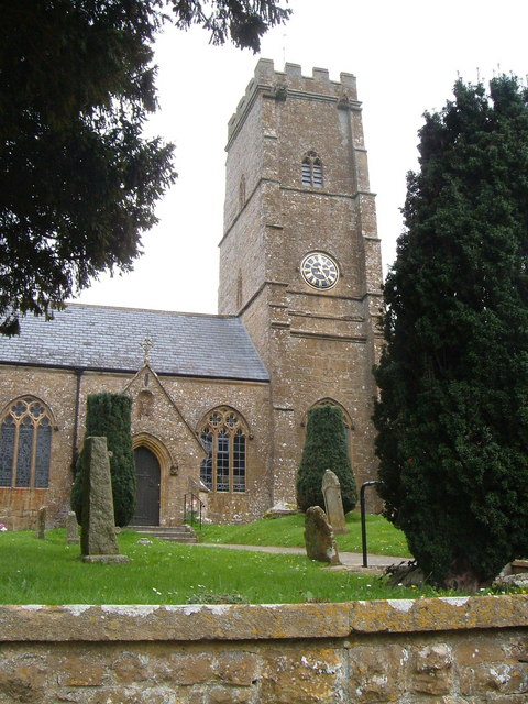
Church of St Mary Magdalene, Cricket Malherbie

The Anglican Church of St Mary Magdalene in Cricket Malherbie, Somerset, England was built in the 12th century and rebuilt in 1855. It is a Grade II* listed...

Knowle St Giles

Knowle St Giles is a village and civil parish in the South Somerset district of Somerset, England, situated on the River Isle 2 miles (3 km) south of Ilminster...

Dowlish Wake

Dowlish Wake is a small village and civil parish in Somerset, England, 2 miles (3 km) south of Ilminster and 5 miles (8 km) northeast of Chard in the South...

Church of St Andrew, Dowlish Wake

The Anglican Church of St Andrew in Dowlish Wake, Somerset, England, was built in the 14th century. It is a Grade II* listed building. == History == The...

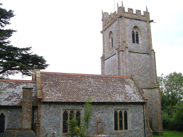
Church of St Michael and All Angels, Chaffcombe

The Anglican Church of St Michael and All Angels in Chaffcombe, Somerset, England was built in the 15th century. It is a Grade II* listed building. �...

Church of St Michael, Cudworth

The Anglican Church of St Michael in Cudworth, Somerset, England was built in the 12th century. It is a Grade II* listed building. == History == The church...

Chaffcombe

Chaffcombe is a village and civil parish in Somerset, England, situated 2 miles (3.2 km) north east of Chard in the South Somerset district. The village...

Kingstone, Somerset

Kingstone is a village and civil parish in Somerset, England, situated near Ilminster, 5 miles (8.0 km) north east of Chard in the South Somerset district...

Related Videos

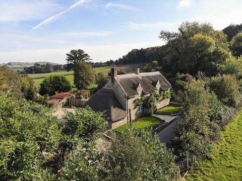
Wisteria Cottage. Ilminster. Somerset 4 bed luxury holiday cottage

Wisteria Cottage Somerset 4 bedrooms, 3 bathrooms Tucked away in the beautiful countryside of Somerset in Ilminster and down ...

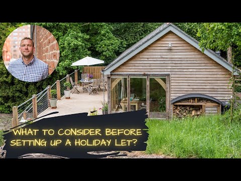
What to consider BEFORE setting up a holiday let

George Bannister is the owner of BlackOak Ltd, Otterhead House & The Old Chicken House based nearTaunton, Somerset UK ...

Hours 5 and 6 of 365 hours in nature together! It was a wet day! #raining #puddling ng

Spending 365 hours in nature together this time we went for a cold wet walk and jumped in some puddles.

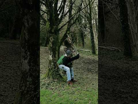
Hours 7-8 of 365 in nature together, we climbed some trees!

We had went for a walk in our local woods and climbed some trees! We had soooo much fun and really enjoyed ourselves.

Nearby Amenities

Located within 500m of 50.906187,-2.9158462
Power: pole
Lat/Long: 50.9099387/-2.9189086
Power: pole
Lat/Long: 50.9099269/-2.9191017
Power: pole
Lat/Long: 50.9088918/-2.9200405
Power: pole
Lat/Long: 50.9072478/-2.9214983
Power: pole
Lat/Long: 50.9062719/-2.9223726
Power: pole
Lat/Long: 50.9090542/-2.9196811
Power: pole
Lat/Long: 50.907269/-2.9212851
Power: pole
Lat/Long: 50.9062829/-2.922142
The data included in this document is from www.openstreetmap.org. The data is made available under ODbL.

Have you been to Barryatt's Copse?

Leave your review of Barryatt's Copse below (or comments, questions and feedback).