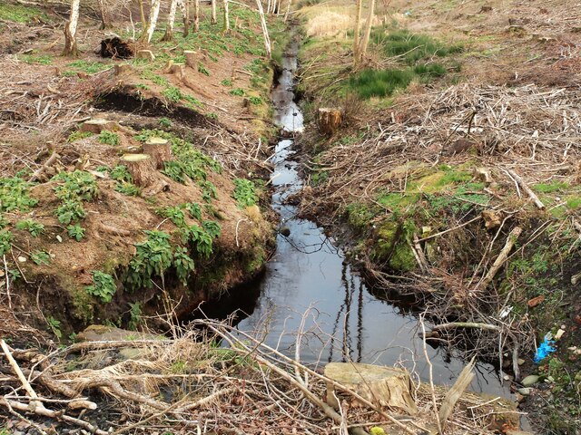
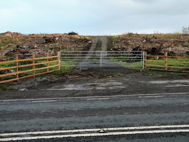
Greenmill Wood

Wood, Forest in Cumberland Carlisle

England

Greenmill Wood

The Lodge Longtown Situate off the A6071 on the left heading away from the A7 towards Gretna Green.
The Lodge Longtown Credit: Steve Houldsworth

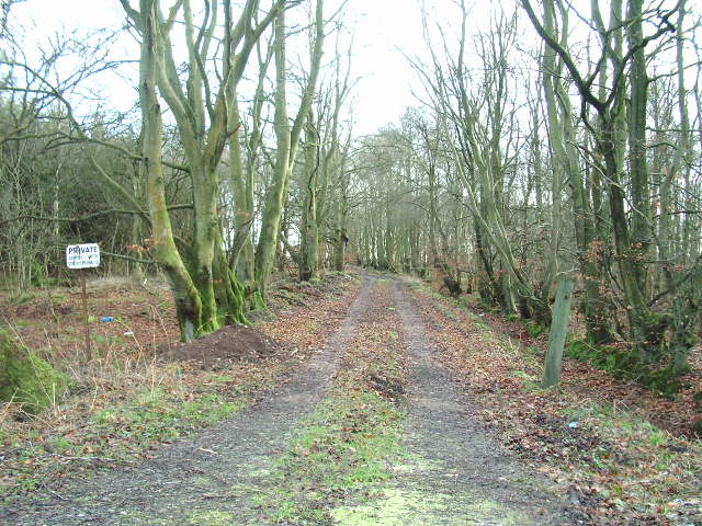
Greenmill Wood is a picturesque forest located in the rural area of Cumberland, England. Covering an expansive area of approximately 500 acres, this woodland is renowned for its natural beauty and diverse range of flora and fauna. It is a popular destination for nature enthusiasts, hikers, and wildlife photographers alike.

The wood is predominantly composed of native trees such as oak, beech, and birch, interspersed with patches of coniferous trees, creating a rich tapestry of colors throughout the year. The dense canopy provides a haven for various species of birds, including woodpeckers, owls, and thrushes, making it a birdwatcher's paradise.

The forest floor is adorned with an abundance of wildflowers, ferns, and mosses, creating a vibrant and delicate ecosystem. Visitors can expect to encounter a variety of woodland creatures, including squirrels, rabbits, and deer, which are commonly spotted grazing in the peaceful glades.

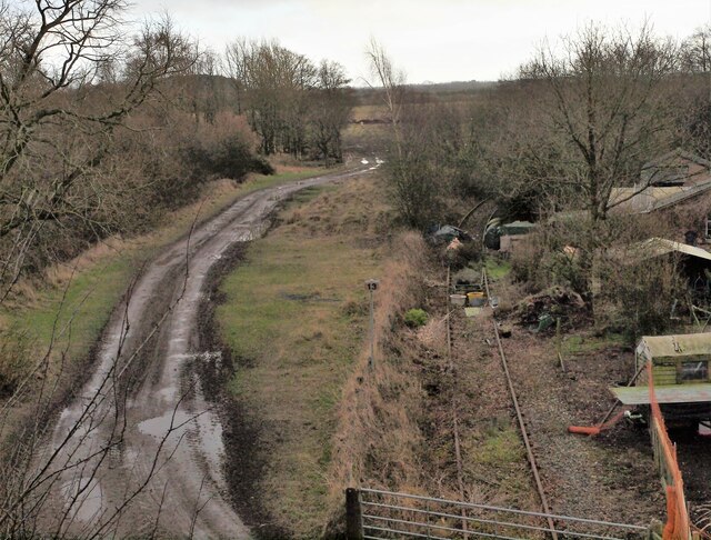
Several well-maintained trails wind their way through the wood, offering visitors the opportunity to explore and discover its hidden gems. The paths are suitable for all levels of fitness and provide ample opportunities for peaceful walks, picnics, and family outings.

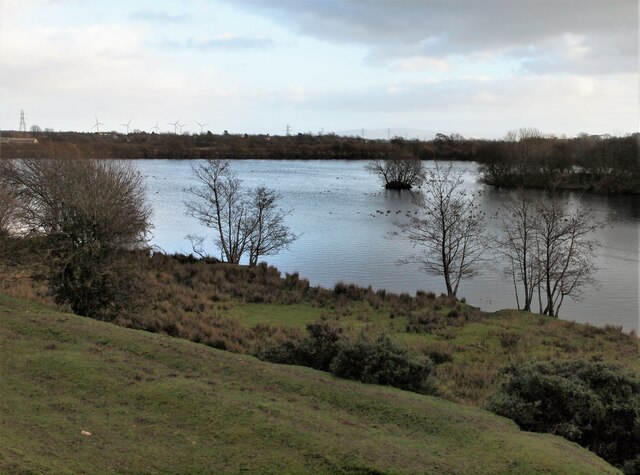
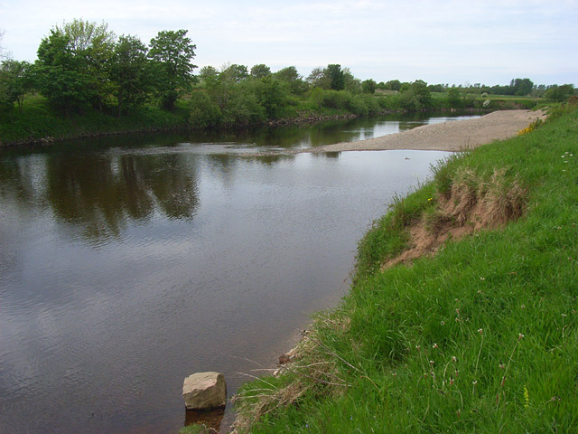
Greenmill Wood is also home to a small lake, which adds to the charm of the area. The tranquil waters attract a range of waterfowl, providing a serene backdrop for visitors to relax and enjoy the peaceful surroundings.

Overall, Greenmill Wood is a captivating natural haven that offers visitors a chance to immerse themselves in the beauty of the Cumberland countryside. Whether you are seeking solitude, a connection with nature, or simply a place to unwind, this enchanting forest is sure to leave a lasting impression.

If you have any feedback on the listing, please let us know in the comments section below.

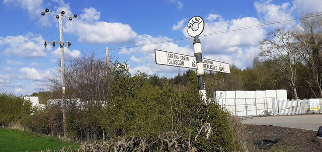
Greenmill Wood Images

Images are sourced within 2km of 55.003591/-3.0100757 or Grid Reference NY3568. Thanks to Geograph Open Source API. All images are credited.

The Lodge Longtown Situate off the A6071 on the left heading away from the A7 towards Gretna Green.
The Lodge Longtown
Situate off the A6071 on the left heading away from the A7 towards Gretna Green.
Old Railway line Looking down onto the remains of the track from the old railway bridge situated on the A6071. Image from 2014 <a title="https://www.geograph.org.uk/photo/3831017" href="https://www.geograph.org.uk/photo/3831017">Link</a>
Old Railway line
Looking down onto the remains of the track from the old railway bridge situated on the A6071. Image from 2014 Link
High Gaitle Caravan Park The entrance to the High Gaitle Caravan Park situated on the A6071 at Longtown.
High Gaitle Caravan Park
The entrance to the High Gaitle Caravan Park situated on the A6071 at Longtown.
Green Mill Road Entrance to Green Mill Road off the A6071 Longtown.
Green Mill Road
Entrance to Green Mill Road off the A6071 Longtown.
Drainage ditch Situated off the A6071 on the left just past Green Mill Road as you head towards Gretna Green.
Drainage ditch
Situated off the A6071 on the left just past Green Mill Road as you head towards Gretna Green.
Gateway A6071 What looks like a gateway to a logging track situated off the A6071. Woodland has recently been cleared from this site.
Gateway A6071
What looks like a gateway to a logging track situated off the A6071. Woodland has recently been cleared from this site.
Bus shelter at junction to Blackbank from A6071
Benchmark on top of milestone indicating 11 miles to Carlisle Ordnance Survey pivot benchmark levelled at 26.651m above Newlyn Datum verified 1974.
Benchmark on top of milestone indicating 11 miles to Carlisle
Ordnance Survey pivot benchmark levelled at 26.651m above Newlyn Datum verified 1974.
Carlisle 11 milestone on north side of road west of Mill Hill There is an Ordnance Survey benchmark <a href="https://www.geograph.org.uk/photo/7158173">NY3367 : Benchmark on top of milestone indicating 11 miles to Carlisle</a> on top of the milestone
Carlisle 11 milestone on north side of road west of Mill Hill
There is an Ordnance Survey benchmark NY3367 : Benchmark on top of milestone indicating 11 miles to Carlisle on top of the milestone
Gretna Loaning heading towards Longtown at Mill Hill There is an old milestone <a href="https://www.geograph.org.uk/photo/7158533">NY3367 : Carlisle 11 milestone on north side of road west of Mill Hill</a> on the verge at the left hand side of the image
Gretna Loaning heading towards Longtown at Mill Hill
There is an old milestone NY3367 : Carlisle 11 milestone on north side of road west of Mill Hill on the verge at the left hand side of the image
Sheep in field between minor road east of Mill Hill and A6071
Sheep and tree in field between Gretna Loaning and Borders east of Mill Hill
Old signpost and entrance to Solway Factory on north side of Gretna Loning at Mill Hill Cumberland County Council finger signpost <a href="https://www.geograph.org.uk/photo/7191194">NY3367 : Cumberland County Council finger signpost on north side of Gretna Loning at Mill Hill</a>
Old signpost and entrance to Solway Factory on north side of Gretna Loning at Mill Hill
Cumberland County Council finger signpost on north side of Gretna Loning at Mill Hill Interesting that the distance to Newcastle includes ¼
Cumberland County Council finger signpost on north side of Gretna Loning at Mill Hill
Interesting that the distance to Newcastle includes ¼
Track beside the River Esk A good track beside the River Esk near Longtown.
Track beside the River Esk
A good track beside the River Esk near Longtown.
Field of maize Waterlogged after a summer of exceptionally high rainfall.
Field of maize
Waterlogged after a summer of exceptionally high rainfall.
Road junction Junction of the road from Springfield with the A6071
Road junction
Junction of the road from Springfield with the A6071
Private road At the end of this road it's the MOD
Private road
At the end of this road it's the MOD
Show me another place!

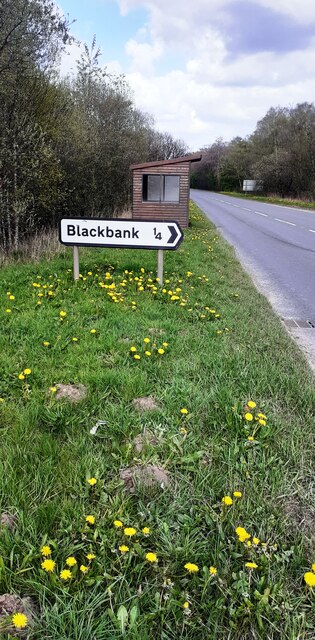
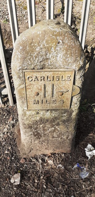
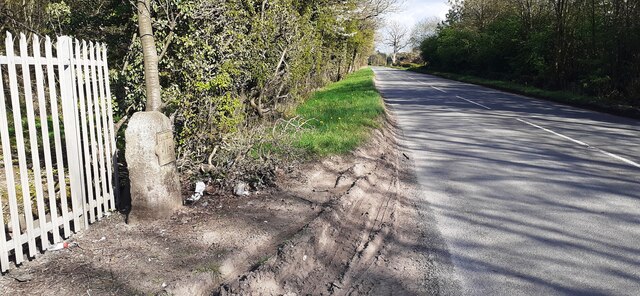
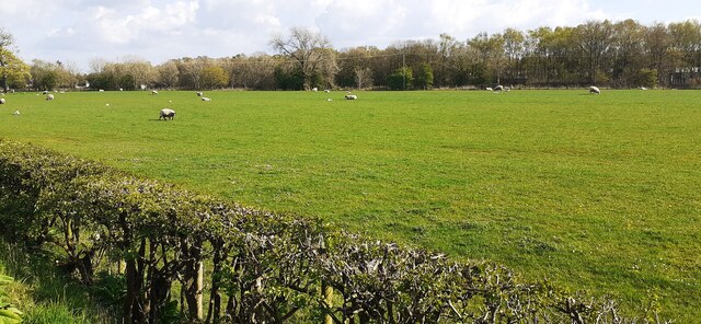
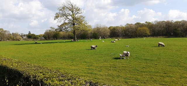
Greenmill Wood is located at Grid Ref: NY3568 (Lat: 55.003591, Lng: -3.0100757)

Administrative County: Cumbria

District: Carlisle

Police Authority: Cumbria

What 3 Words

///trek.robe.undercuts. Near Longtown, Cumbria

Related Wikis

2020s in United Kingdom political history

2020s political history refers to significant political and societal historical events in the United Kingdom in the 2020s, presented as a historical overview...

United Kingdom

The United Kingdom of Great Britain and Northern Ireland, commonly known as the United Kingdom (UK) or Britain, is a country in Northwestern Europe, off...

Battle of Solway Moss

The Battle of Solway Moss took place on Solway Moss near the River Esk on the English side of the Anglo-Scottish border in November 1542 between English...

Solway Moss

Solway Moss, also known as Solway Flow, is a moss (lowland peat bog), in the City of Carlisle in Cumbria, England near the Scottish border and less than...

Nearby Amenities

Located within 500m of 55.003591,-3.0100757
Post Box
Ref: CA6 365
Source: Dracos
Lat/Long: 55.0051423/-3.0042042
The data included in this document is from www.openstreetmap.org. The data is made available under ODbL.

Have you been to Greenmill Wood?

Leave your review of Greenmill Wood below (or comments, questions and feedback).