Coates

Settlement in Midlothian

Scotland

Coates

Path by the North Esk, Penicuik A path on the north side of the river to the surroundings of Penicuik House.
Path by the North Esk, Penicuik Credit: Jim Barton

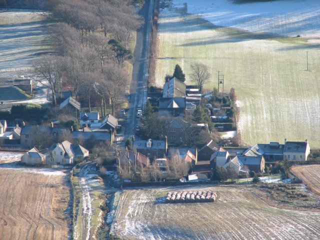
Coates is a small village located in the Midlothian region of Scotland. Situated approximately 10 miles southeast of the capital city of Edinburgh, it is surrounded by picturesque countryside, offering residents and visitors a tranquil and scenic environment.

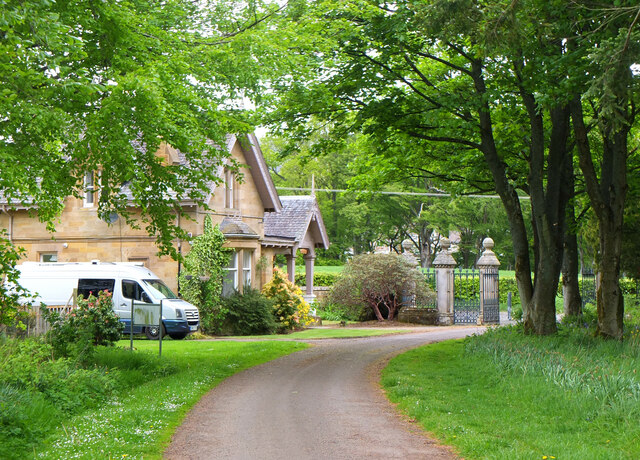
The village of Coates is known for its charming rural character, with traditional stone-built houses and narrow winding lanes. The area is predominantly residential, with a close-knit community that takes pride in preserving its historical heritage. The village is home to a small but beautiful church, which dates back several centuries and adds to its overall charm.

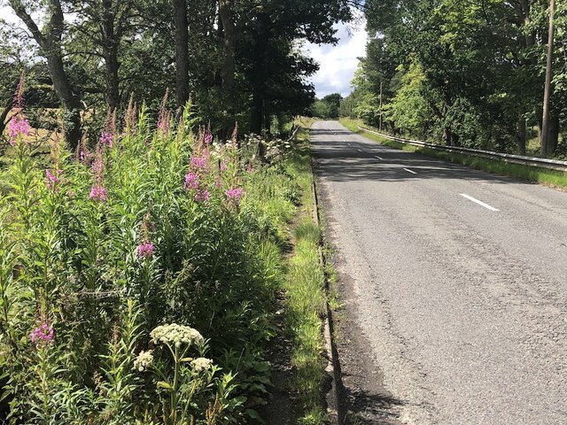
Despite its peaceful atmosphere, Coates benefits from its close proximity to the bustling city of Edinburgh. This allows residents easy access to a wide range of amenities and services, including shopping centers, restaurants, and cultural attractions. Additionally, the village is well-connected by road and public transportation, making it an attractive location for those who commute to Edinburgh for work or leisure.

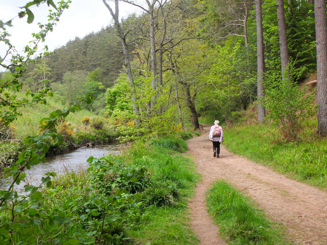
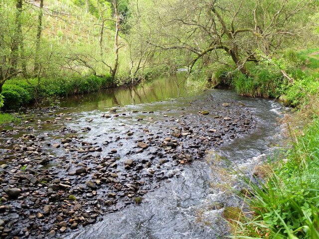
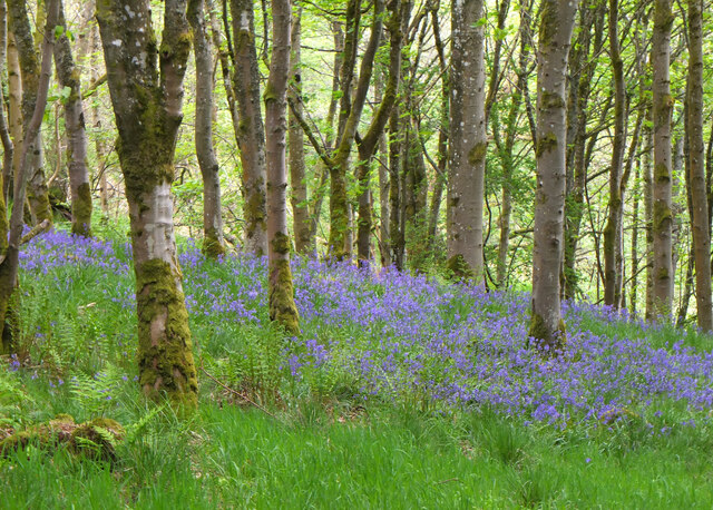
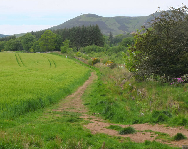
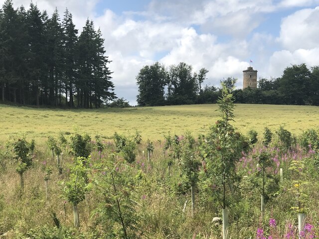
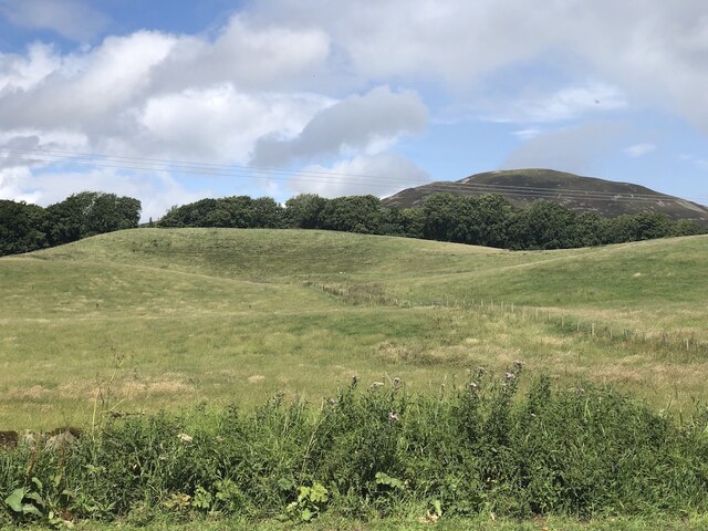
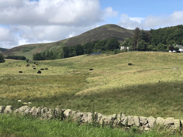
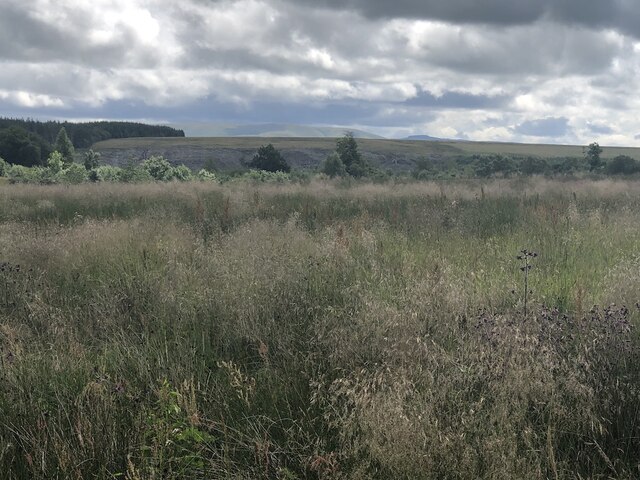
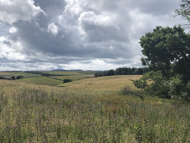
Coates enjoys a stunning natural setting, with rolling hills, lush green fields, and the nearby Pentland Hills Regional Park offering ample opportunities for outdoor activities such as hiking, cycling, and wildlife spotting. The village also benefits from its location near the River North Esk, which provides scenic walks and fishing opportunities.

In conclusion, Coates is a charming and peaceful village in Midlothian, Scotland, offering a rural lifestyle with easy access to the nearby city of Edinburgh. Its historical architecture, tranquil surroundings, and proximity to nature make it an appealing place to live or visit for those seeking a balance between countryside living and urban convenience.

If you have any feedback on the listing, please let us know in the comments section below.

Coates Images

Images are sourced within 2km of 55.826751/-3.2626145 or Grid Reference NT2160. Thanks to Geograph Open Source API. All images are credited.

Path by the North Esk, Penicuik A path on the north side of the river to the surroundings of Penicuik House.
Path by the North Esk, Penicuik
A path on the north side of the river to the surroundings of Penicuik House.
River North Esk near Penicuik The North Esk rises in the Pentland Hills above Carlops. It joins the South Esk, which starts life in the Lammermuir Hills, at Dalkeith.
River North Esk near Penicuik
The North Esk rises in the Pentland Hills above Carlops. It joins the South Esk, which starts life in the Lammermuir Hills, at Dalkeith.
Bluebells in Serpentine Wood, Penicuik
Farmland on Penicuik Estate South Black Hill is in the background.
Farmland on Penicuik Estate
South Black Hill is in the background.
Spear Gate Lodge, Penicuik Estate A lodge house where one of the estate access roads meets the A766.
Spear Gate Lodge, Penicuik Estate
A lodge house where one of the estate access roads meets the A766.
Field, Penicuik Estate The roadside conifers are long gone allowing a view of the folly.
Field, Penicuik Estate
The roadside conifers are long gone allowing a view of the folly.
Hummocky ground near Penicuik Glacial deposition beside the Pentland Hills.
Hummocky ground near Penicuik
Glacial deposition beside the Pentland Hills.
Pasture near Carsewell Beneath the Pentland Hills.
Pasture near Carsewell
Beneath the Pentland Hills.
Rough ground by the Carlops Road Appears not to have been grazed for some time.
Rough ground by the Carlops Road
Appears not to have been grazed for some time.
Rough ground by the Carlops Road The field above the Braidwood Burn appears to have been left ungrazed or unmown.
Rough ground by the Carlops Road
The field above the Braidwood Burn appears to have been left ungrazed or unmown.
Near Brunstane View from the very scenic Penicuik  to Carlops road.
Near Brunstane
View from the very scenic Penicuik to Carlops road.
A766, Braidwood
A766, Braidwood
Penicuik House restoration Like the Edinburgh trams project, the restoration of Penicuik House has been talked of for years and progress appears glacially slow on what is admittedly a mammoth project. The House was gutted by fire in June 1899, though the Clerk family was able to rescue most of its furniture and paintings over several days while the fire smouldered. The nearby stable block was redesigned as their new home.

The original Palladian villa, regarded as the finest of its type in Scotland, was built for Sir James Clerk between 1761 and 1778. The pavilion wings were added in 1857. The drawing room was famous for its painted ceiling by Alexander Runciman showing scenes from the life of Ossian. <span class="nowrap"><a title="http://www.penicuikhouse.co.uk/history.aspx" rel="nofollow ugc noopener" href="http://www.penicuikhouse.co.uk/history.aspx">Link</a><img style="margin-left:2px;" alt="External link" title="External link - shift click to open in new window" src="https://s1.geograph.org.uk/img/external.png" width="10" height="10"/></span>
Penicuik House restoration
Like the Edinburgh trams project, the restoration of Penicuik House has been talked of for years and progress appears glacially slow on what is admittedly a mammoth project. The House was gutted by fire in June 1899, though the Clerk family was able to rescue most of its furniture and paintings over several days while the fire smouldered. The nearby stable block was redesigned as their new home. The original Palladian villa, regarded as the finest of its type in Scotland, was built for Sir James Clerk between 1761 and 1778. The pavilion wings were added in 1857. The drawing room was famous for its painted ceiling by Alexander Runciman showing scenes from the life of Ossian. LinkExternal link
Penicuik House restoration
Venetian window at Penicuik House
New Penicuik House The stables block belonging to Penicuik House which provided the Clerk family with alternative accommodation after the fire of 1899 destroyed the old house.
New Penicuik House
The stables block belonging to Penicuik House which provided the Clerk family with alternative accommodation after the fire of 1899 destroyed the old house.
Show me another place!

Coates is located at Grid Ref: NT2160 (Lat: 55.826751, Lng: -3.2626145)

Unitary Authority: Midlothian

Police Authority: The Lothians and Scottish Borders

What 3 Words

///loans.gobbles.coast. Near Penicuik, Midlothian

Nearby Locations

Coates

Related Wikis

Silverburn, Midlothian

Silverburn is a small hamlet near Penicuik, in Midlothian, south-east Scotland. It has a small community centre, with a garden surrounding the hall, which...

Penicuik House

Penicuik House (alternative spellings in use until mid 19th century: Penycuik, Pennycuik) survives as the shell of a formerly grand estate house in Penicuik...

Eight Mile Burn

Eight Mile Burn is a small settlement in Midlothian, South East Scotland, at the base of Pentland Hills Regional Park. It is approximately 11 miles from...

Brunstane Castle

Brunstane Castle (alternatively Brunston, Brunstain or Brunstone Castle) is a ruined tower house, dating from the 16th century, around 2 miles (3.2 km...

Nearby Amenities

Located within 500m of 55.826751,-3.2626145
Post Box
Collection Times: Mo-Fr 16:00; Sa 07:45
Operator: Royal Mail
Post Box Type: wall
Ref: EH26 123
Royal Cypher: GVIR
Royal Cypher Wikidata: Q33102169
Lat/Long: 55.8245276/-3.2605382
Hopelands
Place: locality
Lat/Long: 55.8252013/-3.2684648
Power: pole
Lat/Long: 55.8225738/-3.2651616
Power: pole
Lat/Long: 55.8230651/-3.2641167
Power: pole
Lat/Long: 55.8235293/-3.263116
Power: pole
Lat/Long: 55.8242142/-3.2616128
Power: pole
Lat/Long: 55.8227628/-3.2654496
Power: pole
Lat/Long: 55.8231938/-3.2605847
Power: pole
Lat/Long: 55.8235966/-3.2616002
Power: pole
Lat/Long: 55.8239757/-3.2625757
Power: pole
Lat/Long: 55.8244799/-3.26176
Power: pole
Lat/Long: 55.8250763/-3.2608349
Power: pole
Lat/Long: 55.8252759/-3.2599057
Power: pole
Lat/Long: 55.825483/-3.2589933
Power: pole
Lat/Long: 55.8257684/-3.257736
Power: pole
Lat/Long: 55.8260471/-3.2564598
Power: pole
Lat/Long: 55.826197/-3.2557261
Power: pole
Lat/Long: 55.8249712/-3.2584992
Power: pole
Lat/Long: 55.8244103/-3.2579694
Power: pole
Lat/Long: 55.8249157/-3.2688555
Power: pole
Lat/Long: 55.8243949/-3.2680356
Power: pole
Lat/Long: 55.8239237/-3.2672976
Power: pole
Lat/Long: 55.8233261/-3.26636
Power: pole
Lat/Long: 55.8245083/-3.2677349
Power: pole
Lat/Long: 55.8247657/-3.2670243
Bus Stop
Carsewell
Bus: yes
Naptan AtcoCode: 6280000132
Naptan Bearing: SW
Naptan CommonName: Carsewell
Naptan Indicator: at
Naptan NaptanCode: 64329253
Naptan Street: Carlops Road
Public Transport: platform
Ref: 6280000132
Shelter: yes
Source: NaPTAN
Lat/Long: 55.8243374/-3.2613404
Bus Stop
Carsewell
Bus: yes
Naptan AtcoCode: 6280000133
Naptan Bearing: NE
Naptan CommonName: Carsewell
Naptan Indicator: opp
Naptan NaptanCode: 64329254
Naptan Street: Carlops Road
Public Transport: platform
Ref: 6280000133
Shelter: yes
Source: NaPTAN
Lat/Long: 55.8244276/-3.2613903
The data included in this document is from www.openstreetmap.org. The data is made available under ODbL.

Have you been to Coates?

Leave your review of Coates below (or comments, questions and feedback).