Ridge New Plantation

Wood, Forest in Dorset

England

Ridge New Plantation

St John the Baptist, Fishpond Bottom Dorset
St John the Baptist, Fishpond Bottom Dorset Credit: Ray Jennings

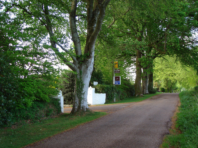
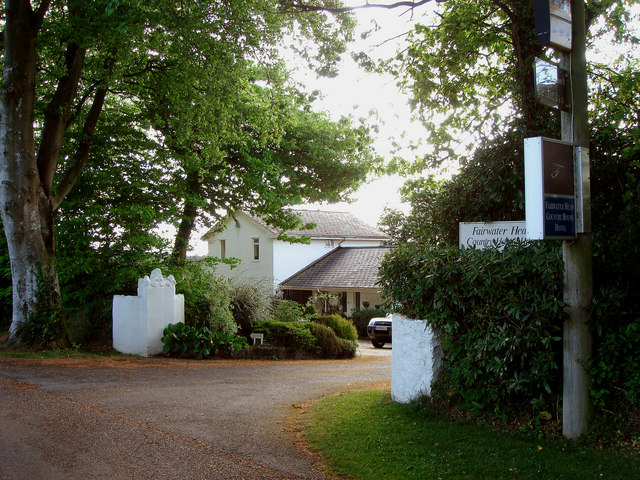
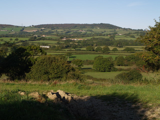
Ridge New Plantation, located in Dorset, is a picturesque woodland area known for its dense forest and scenic beauty. Spanning over a vast area, it offers a diverse range of flora and fauna, making it a popular destination for nature enthusiasts and hikers alike.

The woodland is predominantly composed of various types of trees, including oak, beech, and pine, which create a dense canopy and provide a habitat for a wide range of wildlife. The forest floor is covered in a thick layer of moss and ferns, adding to the enchanting atmosphere of the plantation.

Ridge New Plantation offers numerous trails and paths, allowing visitors to explore the woodland at their own pace. These trails are well-maintained and suitable for both experienced hikers and beginners. Along the way, visitors can enjoy breathtaking views of the surrounding countryside and may even spot some of the resident wildlife, such as deer, foxes, and a variety of bird species.

The plantation is also home to a small stream that meanders through the forest, adding to the tranquility of the surroundings. This stream not only provides a source of water for the wildlife but also adds an aesthetic appeal to the overall landscape.

With its natural beauty and peaceful atmosphere, Ridge New Plantation is a haven for those seeking a break from city life and a chance to reconnect with nature. Whether it's a leisurely stroll or an adventurous hike, this woodland offers something for everyone and is a must-visit destination for nature lovers in Dorset.

If you have any feedback on the listing, please let us know in the comments section below.

Ridge New Plantation Images

Images are sourced within 2km of 50.77907/-2.9210762 or Grid Reference SY3598. Thanks to Geograph Open Source API. All images are credited.

St John the Baptist, Fishpond Bottom Dorset
St John the Baptist, Fishpond Bottom, Dorset
St. John the Baptist, Fishpond Bottom, Whitchurch Canonicorum, Dorset Slightly better shot
St. John the Baptist, Fishpond Bottom, Whitchurch Canonicorum, Dorset
Slightly better shot
Converted railway carriage at West View
On Lambert's Castle Looking south to Coney's Castle.
On Lambert's Castle
Looking south to Coney's Castle.
Champernhayes Farm
Champernhayes Farm
Farmland and stream near Monkton Wylde
Woodland ride, Wylde Warren
Ridge Farm
Ridge Farm
Farmland west of Coney's Castle
Wootton Fitzpaine View to the sea from fields above Wootton Fitzpaine, Dorset.
Wootton Fitzpaine
View to the sea from fields above Wootton Fitzpaine, Dorset.
Farmland, Blackpool Corner, Devon The photo was taken at the junction of the road and a bridleway to New Park.
Farmland, Blackpool Corner, Devon
The photo was taken at the junction of the road and a bridleway to New Park.
Forest Farm, Highgate, West Dorset This is just north of Monkton Wyld, West Dorset
Forest Farm, Highgate, West Dorset
This is just north of Monkton Wyld, West Dorset
Farmland near to Blackpool Corner Farmland photographed from the Tilworth road.
Farmland near to Blackpool Corner
Farmland photographed from the Tilworth road.
Axminster National Grid Sub Station
Pylons Pylons a blot on the landscape
Pylons
Pylons a blot on the landscape
Fairwater Head Hotel
Show me another place!

Ridge New Plantation is located at Grid Ref: SY3598 (Lat: 50.77907, Lng: -2.9210762)

Unitary Authority: Dorset

Police Authority: Dorset

What 3 Words

///skylights.vintages.question. Near Charmouth, Dorset

Related Wikis

St John's Church, Fishpond Bottom

St John's Church is a Church of England church in Fishpond Bottom, Dorset, England. It was built in 1852 and has been a Grade II listed building since...

Lambert's Castle

Lambert's Castle is an Iron Age hillfort in the county of Dorset in southwest England. Since 1981 it has been designated as a Site of Special Scientific...

Coney's Castle

Coney's Castle is an Iron Age hillfort in Dorset, England. The name Coney is from the Old English for rabbit (Latin cuniculus), suggesting medieval use...

Lambert's Castle Hill

Lambert's Castle Hill (258 metres, 846 feet high) rises between the villages of Marshwood and Fishpond Bottom in the county of Dorset, England. It is...

Nearby Amenities

Located within 500m of 50.77907,-2.9210762
Poles: bipole
Power: pole
Source: bing
Lat/Long: 50.7832465/-2.9211241
Power: pole
Lat/Long: 50.7749251/-2.923306
Poles: bipole
Power: pole
Source: bing
Lat/Long: 50.776946/-2.9221192
Poles: bipole
Power: pole
Source: bing
Lat/Long: 50.7778992/-2.9219877
Poles: bipole
Power: pole
Source: bing
Lat/Long: 50.7800463/-2.9216471
Poles: bipole
Power: pole
Source: bing
Lat/Long: 50.7811165/-2.9214835
Power: pole
Source: bing
Lat/Long: 50.7749861/-2.9234804
Power: pole
Source: bing
Lat/Long: 50.7756816/-2.9229936
Power: pole
Source: bing
Lat/Long: 50.7774384/-2.9223047
Power: pole
Source: bing
Transformer: distribution
Lat/Long: 50.7766622/-2.9224164
Power: pole
Source: bing
Lat/Long: 50.7749022/-2.9236588
Power: pole
Source: bing
Lat/Long: 50.7756493/-2.9230633
Power: pole
Source: bing
Lat/Long: 50.7756095/-2.9228595
Poles: bipole
Power: pole
Source: bing
Lat/Long: 50.7764321/-2.922091
Poles: bipole
Power: pole
Source: bing
Lat/Long: 50.778726/-2.921859
Poles: bipole
Power: pole
Source: bing
Lat/Long: 50.7793544/-2.9217544
Power: pole
Source: bing
Lat/Long: 50.7826196/-2.9220083
Power: pole
Source: bing
Lat/Long: 50.7805028/-2.9220083
Power: pole
Source: bing
Lat/Long: 50.7813617/-2.9220297
Power: pole
Source: bing
Lat/Long: 50.7786755/-2.9221477
Power: pole
Source: bing
Lat/Long: 50.7797891/-2.9219976
Power: pole
Source: bing
Lat/Long: 50.7765585/-2.9222686
Power: pole
Source: bing
Lat/Long: 50.7831297/-2.92221
The data included in this document is from www.openstreetmap.org. The data is made available under ODbL.

Have you been to Ridge New Plantation?

Leave your review of Ridge New Plantation below (or comments, questions and feedback).