Bridge How Coppice

Wood, Forest in Lancashire South Lakeland

England

Bridge How Coppice

Rainbow and Loughrigg Fell - from Crag Head
Rainbow and Loughrigg Fell - from Crag Head Credit: Ian Cunliffe

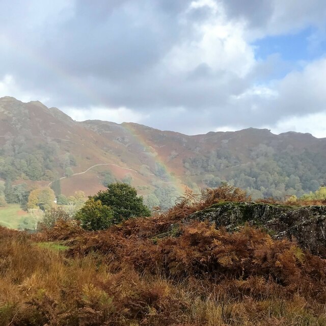
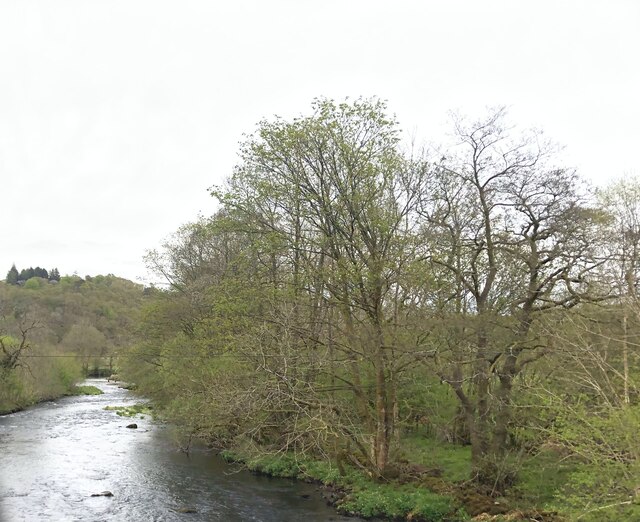
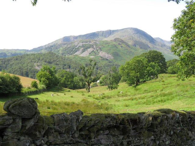
Bridge How Coppice is a woodland area located in Coppice, Lancashire, England. It is a tranquil and picturesque forest, renowned for its natural beauty and diverse flora and fauna. The coppice covers an area of approximately 50 acres, offering visitors a peaceful retreat from the bustling city life.

The woodland is predominantly composed of deciduous trees, including oak, ash, and birch, which provide a rich canopy and create a lush green environment. The forest floor is covered with a variety of wildflowers, such as bluebells, primroses, and foxgloves, adding vibrant splashes of color to the landscape.

Bridge How Coppice is home to a wide array of wildlife. Birdwatchers can spot various species, including woodpeckers, thrushes, and owls, while small mammals like squirrels and foxes are often seen scurrying through the undergrowth. The coppice also supports a diverse range of insects, butterflies, and bees, making it a haven for nature enthusiasts and photographers.

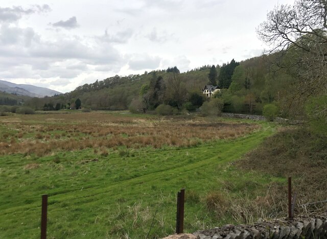
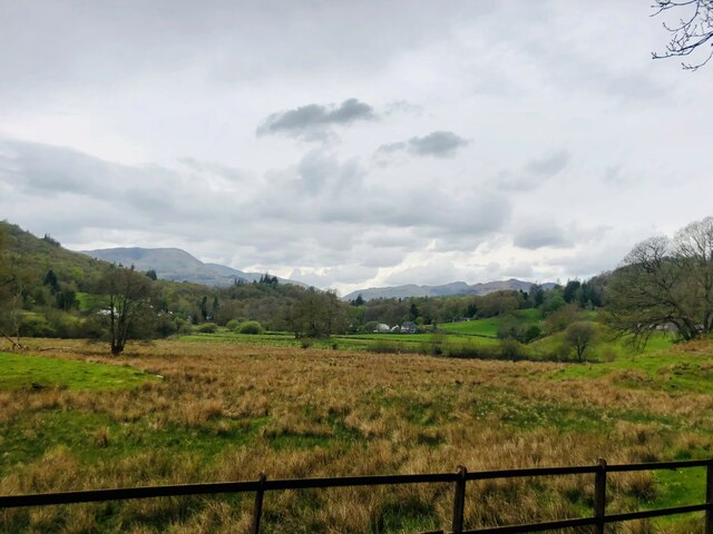
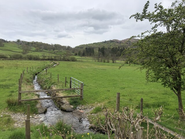
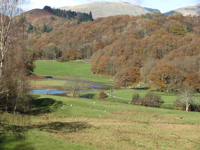
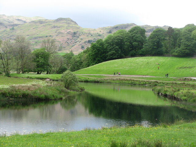
The forest offers a network of well-maintained walking trails, allowing visitors to explore the area at their own pace. These trails lead to hidden ponds, small streams, and charming picnic spots, providing opportunities for relaxation and connection with nature.

Bridge How Coppice is a popular destination for outdoor activities such as hiking, birdwatching, and photography. It offers a peaceful and serene atmosphere, making it an ideal place for nature lovers and those seeking a break from the hustle and bustle of everyday life.

If you have any feedback on the listing, please let us know in the comments section below.

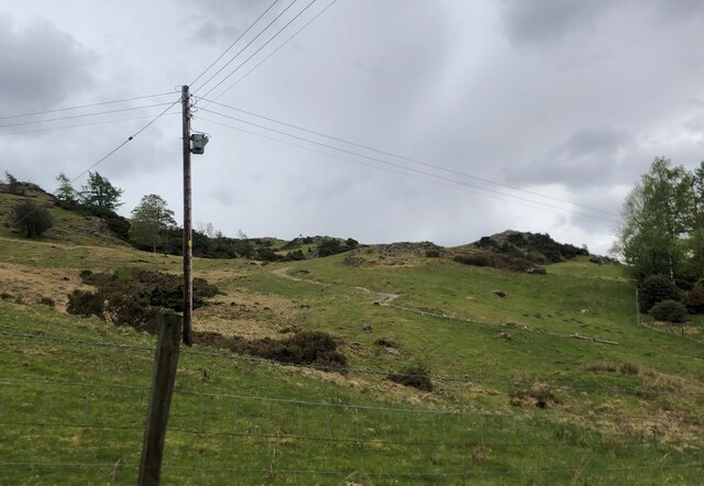
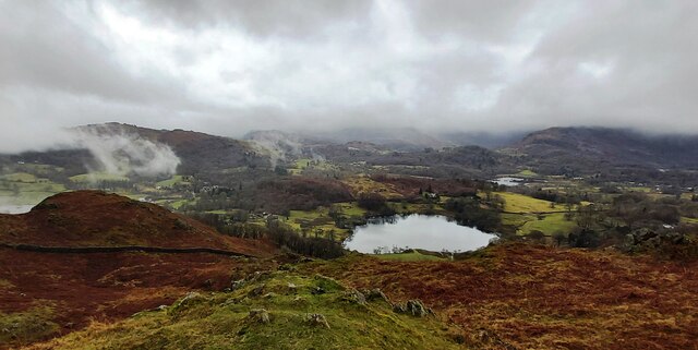
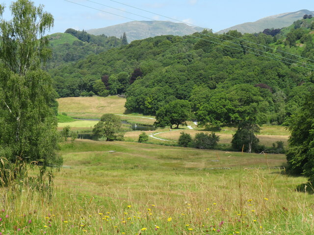
Bridge How Coppice Images

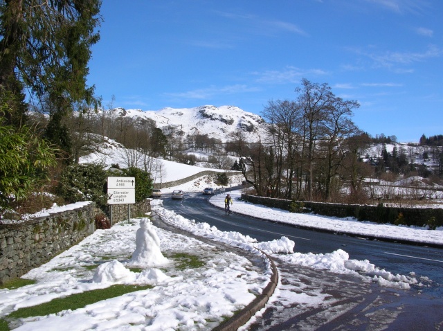
Images are sourced within 2km of 54.420482/-3.0157626 or Grid Reference NY3403. Thanks to Geograph Open Source API. All images are credited.

Rainbow and Loughrigg Fell - from Crag Head
View north towards Fairfield - from Barngates
Flood plain of the River Brathay West of Clappersgate
Flood plain of the River Brathay
West of Clappersgate
View to Skelwith Fold Flood plain of the River Brathay to the fore
View to Skelwith Fold
Flood plain of the River Brathay to the fore
River Brathay valley There is a large area of flood plain to the north of the river between Skelwith Bridge and Clappersgate
River Brathay valley
There is a large area of flood plain to the north of the river between Skelwith Bridge and Clappersgate
Marshy field near the River Brathay
Spring draining across the meadow to the River Brathay
River Brathay at Skelwith Bridge
Footpath to Tarn Hows From the A593 near Skelwith Bridge
Footpath to Tarn Hows
From the A593 near Skelwith Bridge
Loughrigg Tarn
Loughrigg Tarn
Trig point on Black Fell The triangulation column occupies the top of a rock plinth which is not quite the highest point of the hill; that's a short way beyond the wall and easily reached using a ladder stile, the top of which can be seen.
Peaks of the Fairfield Horseshoe lie in the distance.
Trig point on Black Fell
The triangulation column occupies the top of a rock plinth which is not quite the highest point of the hill; that's a short way beyond the wall and easily reached using a ladder stile, the top of which can be seen. Peaks of the Fairfield Horseshoe lie in the distance.
View north from trig point on Black Fell Black Fell is a minor hill among the Southern Fells of the Lake District. The view is from the hill's trig point set upon a rock outcrop which was regarded by Alfred Wainwright as the summit. Currently however in the opinion of those who assess such things, the highest point lies just beyond the wall, where it's one metre higher.
View north from trig point on Black Fell
Black Fell is a minor hill among the Southern Fells of the Lake District. The view is from the hill's trig point set upon a rock outcrop which was regarded by Alfred Wainwright as the summit. Currently however in the opinion of those who assess such things, the highest point lies just beyond the wall, where it's one metre higher.
View towards Elterwater from Cumbria Way View from Cumbria Way near to Park House looking towards River Brathay and the fells above Elterwater village
View towards Elterwater from Cumbria Way
View from Cumbria Way near to Park House looking towards River Brathay and the fells above Elterwater village
View towards Tilberthwaite from Steady climb on rough path from Elterwater village reaps the reward of fine views over Little Langdale towards the scarred landscape of Tilberthwaite
View towards Tilberthwaite from
Steady climb on rough path from Elterwater village reaps the reward of fine views over Little Langdale towards the scarred landscape of Tilberthwaite
The Langdale Pikes from above High Arnside
River Brathay from near Park House Autumn colours in Langdale - walking Cumbria Way between Colwith and Skelwith
River Brathay from near Park House
Autumn colours in Langdale - walking Cumbria Way between Colwith and Skelwith
River Brathay The easy access path provides passage for cyclists and wheelchair users following the river from Elterwater to Skelwith. Seen here from the Cumbria Way near Park House.
River Brathay
The easy access path provides passage for cyclists and wheelchair users following the river from Elterwater to Skelwith. Seen here from the Cumbria Way near Park House.
Outbuilding NE of Low Arnside
Show me another place!

Bridge How Coppice is located at Grid Ref: NY3403 (Lat: 54.420482, Lng: -3.0157626)

Administrative County: Cumbria

District: South Lakeland

Police Authority: Cumbria

What 3 Words

///refilled.auctioned.robe. Near Ambleside, Cumbria

Related Wikis

Skelwith Bridge

Skelwith Bridge is a small village in the southern area of the Lake District in Cumbria, England. Historically, Skelwith Bridge is part of Westmorland...

Skelwith

Skelwith is a civil parish in South Lakeland, Cumbria, England, which includes the village of Skelwith Bridge. In the 2001 census the parish had a population...

Elter Water

Elter Water is a small lake in the Lake District in North West England, half a mile southeast of the village of the same name. It has a length of 0.62...

Lakes, Cumbria

Lakes is a civil parish in the Westmorland and Furness district, in the ceremonial county of Cumbria, England. In the 2001 census the parish had a population...

Nearby Amenities

Located within 500m of 54.420482,-3.0157626
Barrier: kissing_gate
Lat/Long: 54.4197516/-3.0158642
Telephone
Skelwith Bridge
Booth: KX100
Covered: booth
Operator: BT
Operator Wikidata: Q593786
Lat/Long: 54.4229118/-3.0112438
Pub
The Talbot
Addr City: Skelwith Bridge
Lat/Long: 54.4223897/-3.0128156
Skelwith Bridge
Is In Country Code: GB
Is In County: Cumbria
Is In National Park: Lake District National Park
Place: village
Wikidata: Q7534537
Lat/Long: 54.4213779/-3.0118455
Cafe
Chesters by the River
Addr City: Skelwith Bridge
Addr Postcode: LA22 9NJ
Addr Street: Skelwith Bridge
Check Date Opening Hours: 2023-08-26
Delivery: no
Diet Vegan: yes
Diet Vegetarian: only
Email: info@chestersbytheriver.co.uk
Fhrs Id: 299254
Opening Hours: Mo-Su 09:00-16:00
Outdoor Seating: yes
Phone: +44 15394 34711
Reservation: no
Takeaway: only
Website: https://www.chestersbytheriver.co.uk
Lat/Long: 54.4213941/-3.0135518
Bus Stop
Foulstep crossroads
Bench: no
Bus: yes
Check Date Shelter: 2022-11-14
Local Ref: AT
Naptan AtcoCode: 090079411215
Naptan Bearing: SW
Naptan BusStopType: MKD
Naptan CommonName: Foulstep crossroads
Naptan Indicator: near
Naptan Landmark: crossroads
Naptan LocalityCode: E0006416
Naptan NaptanCode: cumdjwad
Naptan Street: A593
Naptan Verified: yes
Public Transport: platform
Ref: cumdjwad
Shelter: no
Lat/Long: 54.4227681/-3.0110441
Bus Stop
Foulstep crossroads
Bench: no
Bus: yes
Check Date Bench: 2022-11-14
Covered: yes
Local Ref: AT
Naptan AtcoCode: 090079413288
Naptan Bearing: NE
Naptan BusStopType: CUS
Naptan CommonName: Foulstep crossroads
Naptan Indicator: at
Naptan Landmark: crossroads opp Neaum Hurst
Naptan LocalityCode: E0006416
Naptan NaptanCode: cumdjwpd
Naptan Street: A593
Naptan Verified: yes
Public Transport: platform
Ref: cumdjwpd
Shelter: yes
Source: naptan_import
Lat/Long: 54.4228322/-3.0112172
Leisure: picnic_table
Lat/Long: 54.4217357/-3.0121541
Leisure: picnic_table
Lat/Long: 54.4217624/-3.0122776
Barrier: kissing_gate
Bicycle: no
Foot: yes
Horse: no
Motor Vehicle: no
Lat/Long: 54.4226331/-3.0176565
Noexit: yes
Lat/Long: 54.4211432/-3.0132311
Barrier: kissing_gate
Lat/Long: 54.4196082/-3.0206725
Entrance: yes
Lat/Long: 54.4246838/-3.0145223
Entrance: main
Lat/Long: 54.4247785/-3.014553
Skelwith Bridge Hotel
Addr City: Skelwith Bridge
Addr Postcode: LA22 9NJ
Fhrs Id: 299247
Phone: +44 15394 32115
Tourism: hotel
Website: https://www.skelwithbridgehotel.co.uk/
Lat/Long: 54.4223086/-3.0125367
Give Way
Direction: backward
Lat/Long: 54.4227957/-3.0114697
Chesters By The River
Addr City: Skelwith Bridge
Addr Street: Skelwith Bridge
Shop: gift
Lat/Long: 54.4215866/-3.0135115
Post Box
Post Box Type: wall
Ref: LA22 171
Royal Cypher: GVIR
Royal Cypher Wikidata: Q33102169
Lat/Long: 54.4221728/-3.0122376
Skelwith Force
Canoe Description: Grade 5 but disproportionately dangerous
Rapids: 5
Waterway: waterfall
Whitewater: hazard
Lat/Long: 54.4219593/-3.0164542
Foulstep crossroads
Bus: yes
Public Transport: stop_position
Lat/Long: 54.4227882/-3.0111799
Foulstep crossroads
Bus: yes
Public Transport: stop_position
Lat/Long: 54.4228187/-3.0111123
Hiking: yes
Information: guidepost
Source: GPS Survey
Tourism: information
Lat/Long: 54.4201925/-3.0150041
Hiking: yes
Information: guidepost
Source: GPS Survey
Tourism: information
Lat/Long: 54.4206763/-3.0132982
Hiking: yes
Information: guidepost
Source: GPS Survey
Tourism: information
Lat/Long: 54.4209752/-3.0124345
Hiking: yes
Information: guidepost
Source: GPS Survey
Tourism: information
Lat/Long: 54.4218569/-3.0122468
Generator Method: photovoltaic
Generator Output Electricity: yes
Generator Source: solar
Generator Type: solar_photovoltaic_panel
Power: generator
Lat/Long: 54.4228376/-3.0121154
Generator Method: photovoltaic
Generator Output Electricity: yes
Generator Source: solar
Generator Type: solar_photovoltaic_panel
Power: generator
Lat/Long: 54.4228089/-3.012271
Toilets
Access: customers
Fee: no
Unisex: yes
Lat/Long: 54.4215073/-3.0135688
Chesters Takeaway
Outdoor Seating: yes
Shop: bakery
Takeaway: only
Lat/Long: 54.4214161/-3.0135535
Barrier: stile
Material: stone
Step Count: 3
Stile: stepover
Lat/Long: 54.4242752/-3.0158277
Barrier: stile
Material: wood
Step Count: 1
Stile: stepover
Lat/Long: 54.4244337/-3.0167912
Crossing
Lat/Long: 54.4221569/-3.0141356
Give Way
Direction: backward
Lat/Long: 54.4210843/-3.0115642
Addr Housenumber: 5
Lat/Long: 54.4218143/-3.0129695
Addr Housenumber: 1
Lat/Long: 54.4219207/-3.0125976
Addr Housenumber: 1
Lat/Long: 54.4230111/-3.0115629
Addr Housenumber: 4
Lat/Long: 54.4230111/-3.0118637
Addr Housenumber: 5
Lat/Long: 54.4228881/-3.0120629
Addr Housenumber: 8
Lat/Long: 54.4228408/-3.0123353
Addr Housename: Neaum Brow
Lat/Long: 54.4235693/-3.0114836
Addr Housename: Neaum Hurst
Lat/Long: 54.4235942/-3.0113596
Power: pole
Lat/Long: 54.4241216/-3.0159333
Power: pole
Lat/Long: 54.4242108/-3.0160093
Power: pole
Lat/Long: 54.417527/-3.0109506
Power: pole
Lat/Long: 54.418242/-3.0120147
Power: pole
Lat/Long: 54.4184705/-3.0128848
Power: pole
Lat/Long: 54.4187921/-3.0141137
Power: pole
Lat/Long: 54.4190643/-3.0151148
Power: pole
Lat/Long: 54.4194648/-3.0158298
Power: pole
Lat/Long: 54.4196608/-3.0172647
Power: pole
Lat/Long: 54.4198837/-3.0188644
Power: pole
Lat/Long: 54.420122/-3.0205684
Power: pole
Lat/Long: 54.419902/-3.0213125
Give Way
Direction: backward
Lat/Long: 54.4227373/-3.0113785
Entrance: main
Lat/Long: 54.4192513/-3.0114632
The data included in this document is from www.openstreetmap.org. The data is made available under ODbL.

Have you been to Bridge How Coppice?

Leave your review of Bridge How Coppice below (or comments, questions and feedback).