Stricely Spring

Wood, Forest in Lancashire South Lakeland

England

Stricely Spring

Vernacular farm building
Vernacular farm building Credit: P Gaskell

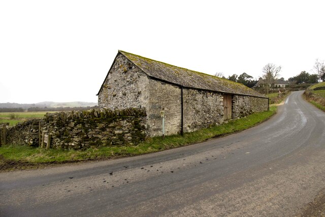
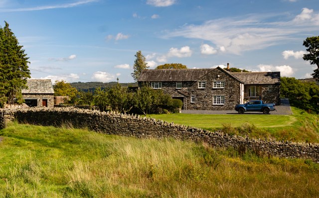
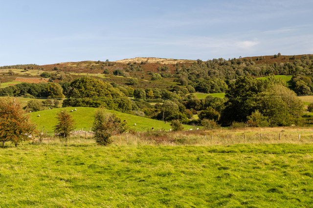
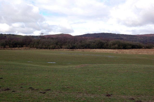
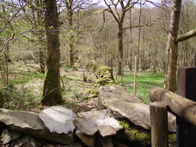
Strictly Spring is a small village located in the county of Lancashire, England. Situated amidst a stunning woodland area, it is renowned for its picturesque surroundings and natural beauty. The village is nestled within a dense forest, which adds to its charm and allure.

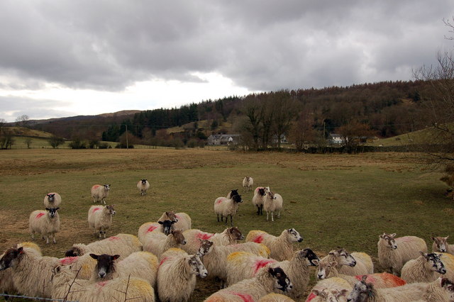
The woodlands of Strictly Spring are primarily composed of a diverse range of trees, including oak, beech, and ash. This rich variety of flora provides a haven for numerous species of wildlife, making it an ideal destination for nature enthusiasts and wildlife lovers. The forest is home to a plethora of bird species, small mammals, and insects, creating a vibrant ecosystem within the village.

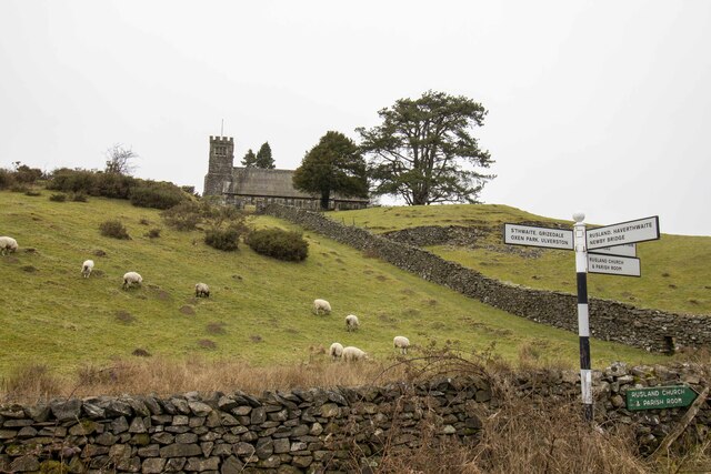
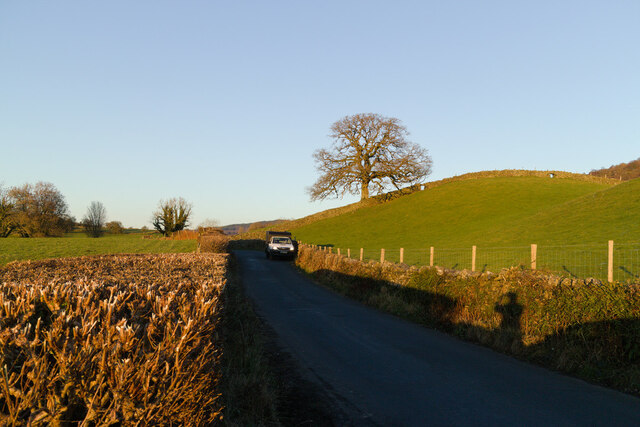
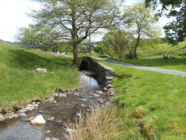
Visitors to Strictly Spring can enjoy a range of outdoor activities amidst the woodlands. There are several walking trails and hiking routes that crisscross through the forest, offering visitors an opportunity to explore the area and immerse themselves in nature. The village also boasts a well-maintained picnic area, where families and friends can gather to enjoy a peaceful day out surrounded by the beauty of the forest.

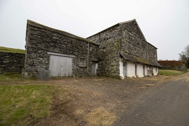
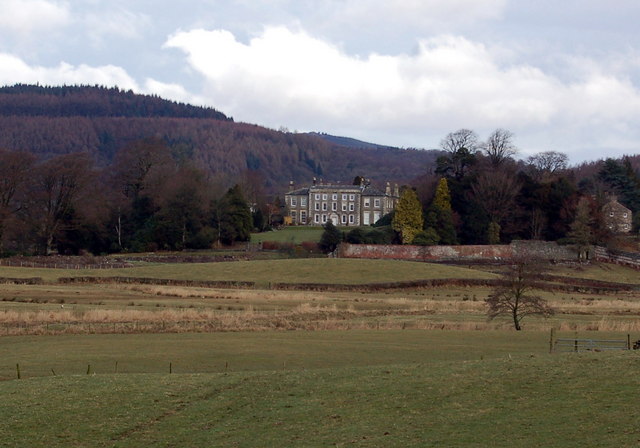
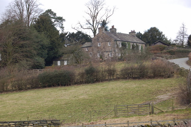
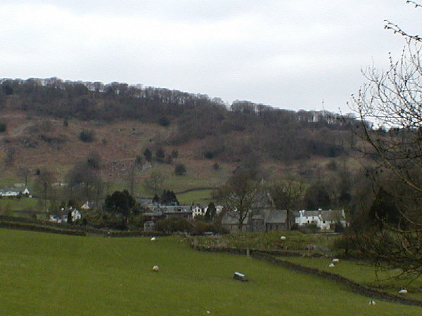
In addition to its natural attractions, Strictly Spring also has a close-knit community and a small number of residential properties. The village exudes a peaceful and tranquil atmosphere, with friendly locals who take pride in preserving the area's natural heritage.

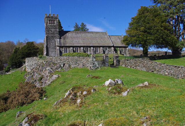
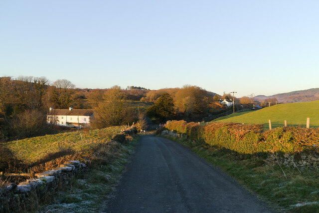
Overall, Strictly Spring in Lancashire is a hidden gem for those seeking a peaceful retreat amidst nature. With its lush woodlands and abundance of wildlife, it offers a serene and idyllic escape from the hustle and bustle of city life.

If you have any feedback on the listing, please let us know in the comments section below.

Stricely Spring Images

Images are sourced within 2km of 54.302249/-3.0201637 or Grid Reference SD3390. Thanks to Geograph Open Source API. All images are credited.

Vernacular farm building
Vernacular farm building at Rusland Cross
Rusland Church
Rusland Church
St Paul's Church, Rusland Built on a prominent rocky knoll. Grade II Listed Building. See <span class="nowrap"><a title="https://historicengland.org.uk/listing/the-list/list-entry/1225406" rel="nofollow ugc noopener" href="https://historicengland.org.uk/listing/the-list/list-entry/1225406">Link</a><img style="margin-left:2px;" alt="External link" title="External link - shift click to open in new window" src="https://s1.geograph.org.uk/img/external.png" width="10" height="10"/></span>
St Paul's Church, Rusland
Built on a prominent rocky knoll. Grade II Listed Building. See LinkExternal link
St Paul's St Paul's Church.
St Paul's
St Paul's Church.
Whitestock Hall
Whitestock Hall
Tractor Tractor near Danes How.
Tractor
Tractor near Danes How.
Ash Slack
Ash Slack
Thwaite Moss View across fields at Thwaite Moss.
Thwaite Moss
View across fields at Thwaite Moss.
Road and tree near Rusland Cross
Cinder Hill, Rusland Cross
Farm land just South of Rusland Cross
Rusland Hall
Rusland Hall
Across the fields to Thwaite Moss
Farmhouse at Rusland Cross
Woodland Rusland Leaving Rusland on the road to Satterthwaite
Woodland Rusland
Leaving Rusland on the road to Satterthwaite
Yew Beck Yew Beck where it flows under Corker Lane
Yew Beck
Yew Beck where it flows under Corker Lane
Show me another place!

Stricely Spring is located at Grid Ref: SD3390 (Lat: 54.302249, Lng: -3.0201637)

Administrative County: Cumbria

District: South Lakeland

Police Authority: Cumbria

What 3 Words

///monitors.yesterday.retract. Near Windermere, Cumbria

Related Wikis

Crosslands

Crosslands is a hamlet in the South Lakeland district of Cumbria, England. It is located just to the northeast of Rusland in the civil parish of Colton...

Satterthwaite & Rusland School

Satterthwaite & Rusland School was a Church of England Primary school near Force Forge in the Rusland Valley. The school was established in 1840 for children...

Rusland Hall

Rusland Hall is a country house in the English Lake District. The present building dates from about 1720. The Hall was owned by the Rawlinson family in...

Rusland, Cumbria

Rusland is a village in the South Lakeland district of Cumbria, England. It is located just to the southwest of Crosslands in the civil parish of Colton...

Satterthwaite

Satterthwaite is a small village (and civil parish) with around 50 dwellings situated in Grizedale, a valley in the Lake District, England, about four...

North Lonsdale Rural District

North Lonsdale was a rural district in the county of Lancashire, England from 1894 to 1974. It was created in 1894 as the Ulverston Rural District, and...

Finsthwaite Heights

Finsthwaite Heights is an upland area in the English Lake District, above Finsthwaite, Cumbria. It is the subject of a chapter of Wainwright's book The...

Top o'Selside

Top o'Selside is a hill in the Lake District in Cumbria, England. At 335 metres (1,099 ft), it is the highest point of the group of hills situated between...

Nearby Amenities

Located within 500m of 54.302249,-3.0201637
Bus Stop
Force Forge Farm (N bound)
Naptan AtcoCode: 090079592291
Naptan Bearing: E
Naptan BusStopType: CUS
Naptan CommonName: Force Forge Farm (N bound)
Naptan Indicator: o/s
Naptan Landmark: Force Forge Farm
Naptan NaptanCode: cumdmdtd
Naptan Street: No name
Naptan Verified: no
Source: naptan_import
Lat/Long: 54.3048858/-3.0253639
Bus Stop
Force Forge Farm (S bound)
Naptan AtcoCode: 090079594413
Naptan Bearing: S
Naptan BusStopType: CUS
Naptan CommonName: Force Forge Farm (S bound)
Naptan Indicator: opp
Naptan Landmark: Force Forge Farm
Naptan NaptanCode: cumdtjgd
Naptan Notes: Created for X30 - was on one side of road only.
Naptan Street: No Name
Naptan Verified: no
Source: naptan_import
Lat/Long: 54.3046781/-3.0254816
Barrier: stile
Lat/Long: 54.2984667/-3.0182844
Barrier: stile
Lat/Long: 54.2986497/-3.0184298
Grave of Arthur Ransome
Cemetery: grave
Lat/Long: 54.2980474/-3.0177144
Thwaite Moss
Place: hamlet
Lat/Long: 54.3006887/-3.0130926
Stony Hazel Forge
Archaeological Site: industrial
Historic: archaeological_site
Lat/Long: 54.2982828/-3.0226457
Post Box
Ref: LA12 72
Lat/Long: 54.3002589/-3.0138652
Ford: yes
Lat/Long: 54.2994608/-3.0143257
Board Type: notice
Information: board
Tourism: information
Lat/Long: 54.2984913/-3.0182909
Man Made: insect_hotel
Lat/Long: 54.2985039/-3.0183009
Entrance: main
Lat/Long: 54.2985379/-3.0186507
Entrance: yes
Lat/Long: 54.2986234/-3.0184671
Power: pole
Lat/Long: 54.3045975/-3.025554
Power: pole
Lat/Long: 54.3048534/-3.025053
Power: pole
Lat/Long: 54.3054504/-3.0245272
Power: pole
Lat/Long: 54.3059871/-3.0239745
The data included in this document is from www.openstreetmap.org. The data is made available under ODbL.

Have you been to Stricely Spring?

Leave your review of Stricely Spring below (or comments, questions and feedback).