Arklid Intake

Wood, Forest in Lancashire South Lakeland

England

Arklid Intake

New Barn
New Barn Credit: P Gaskell

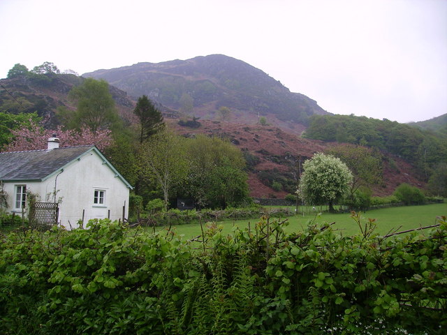
Arklid Intake, located in Lancashire, is a picturesque woodland area known for its abundant forest cover and natural beauty. Nestled in the heart of Lancashire, this serene destination attracts nature enthusiasts, hikers, and those seeking tranquility away from the hustle and bustle of city life.

The woodlands of Arklid Intake are spread across a vast area, offering visitors an opportunity to explore its diverse flora and fauna. The forest is predominantly composed of native tree species, including oak, beech, and birch, which create a dense canopy overhead. This thick vegetation provides a sheltered habitat for a variety of wildlife, such as deer, foxes, and a wide range of bird species.

Trails and footpaths wind their way through the woodland, offering visitors a chance to immerse themselves in its natural wonders. Hikers can enjoy a peaceful walk along the well-marked paths, breathing in the fresh air and enjoying the calming sounds of nature.

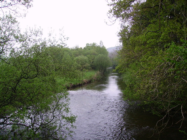
Arklid Intake is also home to a small river that meanders through the forest, enhancing the charm of the area. The river provides a habitat for various aquatic species and adds to the overall beauty of the landscape.

Visitors to Arklid Intake can take advantage of the designated picnic areas and enjoy a leisurely lunch surrounded by the tranquil surroundings. Nature photography enthusiasts will find ample opportunities to capture stunning shots of the forest's beauty.

Overall, Arklid Intake in Lancashire offers an idyllic escape into nature, providing a haven for wildlife and a peaceful retreat for visitors seeking solace in the beauty of the forest.

If you have any feedback on the listing, please let us know in the comments section below.

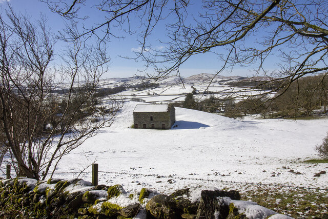
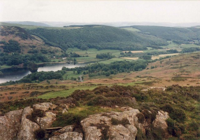
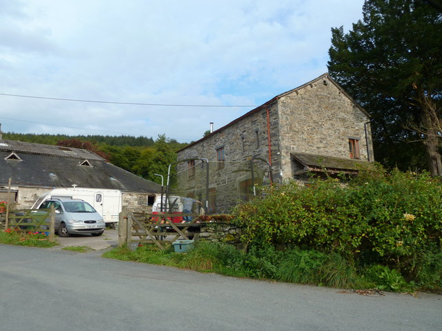
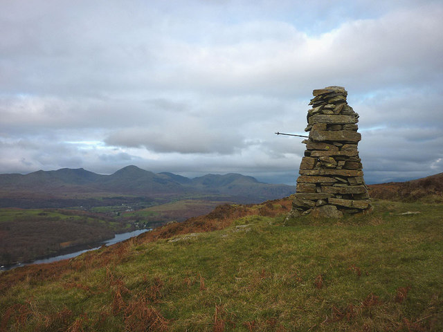
Arklid Intake Images

Images are sourced within 2km of 54.294842/-3.0610198 or Grid Reference SD3189. Thanks to Geograph Open Source API. All images are credited.

New Barn
New Barn
Brock Barrow From High Nibthwaite. Small Crag on the edge of Bethecar Moor
Brock Barrow
From High Nibthwaite. Small Crag on the edge of Bethecar Moor
River Crake at Bouthray Bridge Runs from Coniston Water.
River Crake at Bouthray Bridge
Runs from Coniston Water.
High Nibthwaite Lower end of Coniston Water taken from Beacon
High Nibthwaite
Lower end of Coniston Water taken from Beacon
Victorian post box at High Nibthwaite
Cairn on Brock Barrow The best cairn on the smallest hill. Wainwright describes this hill as 'nameless'
Cairn on Brock Barrow
The best cairn on the smallest hill. Wainwright describes this hill as 'nameless'
Cairn on Brock Barrow
Fence, Coniston Water
Flooded Shoreline, Coniston Water
Blentherbarrow Lane
Blentherbarrow Lane
High Nibthwaite
High Nibthwaite
View towards Coniston Water
High Nibthwaite
High Nibthwaite
House, Nibthwaite Grange
The track from High Nibthwaite to Selside
Antony Gormley statue at High Nibthwaite It would appear that one of the multitudes of <a href="https://www.geograph.org.uk/photo/869228">SJ3098 : Another Place</a> fell off the lorry and ended up by the shore of Coniston Water. He must feel quite lonely (unless he likes sheep) although, arguably he has a nicer view and no worries about barnacles latching onto his 'bits'.
Antony Gormley statue at High Nibthwaite
It would appear that one of the multitudes of SJ3098 : Another Place fell off the lorry and ended up by the shore of Coniston Water. He must feel quite lonely (unless he likes sheep) although, arguably he has a nicer view and no worries about barnacles latching onto his 'bits'.
Allan Tarn, Crake Valley The River Crake has barely made it out of Coniston Water before it expands again into a small, secluded tarn. This must be one of the least-known sheets of water in an area celebrated for them. I must confess that I was completely unaware of its existence before looking at the map. It is possible that the tarn was once a southern extension of the lake which has been separated from it by silt and soil brought down by Caws Beck.
Allan Tarn, Crake Valley
The River Crake has barely made it out of Coniston Water before it expands again into a small, secluded tarn. This must be one of the least-known sheets of water in an area celebrated for them. I must confess that I was completely unaware of its existence before looking at the map. It is possible that the tarn was once a southern extension of the lake which has been separated from it by silt and soil brought down by Caws Beck.
Daleks - Invasion High Nibthwaite 2113 Inspired by the 50th anniversary of Doctor Who we have used a trekking pole to convert this fine cairn on Brock Barrow into one of the galaxy's most feared menaces. Did you really think it was an actual dalek?
Daleks - Invasion High Nibthwaite 2113
Inspired by the 50th anniversary of Doctor Who we have used a trekking pole to convert this fine cairn on Brock Barrow into one of the galaxy's most feared menaces. Did you really think it was an actual dalek?
Show me another place!

Arklid Intake is located at Grid Ref: SD3189 (Lat: 54.294842, Lng: -3.0610198)

Administrative County: Cumbria

District: South Lakeland

Police Authority: Cumbria

What 3 Words

///foresight.drift.easy. Near Ulverston, Cumbria

Related Wikis

North Lonsdale Rural District

North Lonsdale was a rural district in the county of Lancashire, England from 1894 to 1974. It was created in 1894 as the Ulverston Rural District, and...

Nibthwaite

Nibthwaite is a village in the South Lakeland District in the county of Cumbria in the northwest of England. It is in the civil parish of Colton, and on...

Bandrake Head

Bandrake Head is a village in Cumbria, England. == External links == Media related to Bandrake Head at Wikimedia Commons

Oxen Park

Oxen Park is a hamlet in the English county of Cumbria. Oxen Park lies on the watershed between Rusland and Colton Beck valleys in South Lakeland, and...

Nearby Amenities

Located within 500m of 54.294842,-3.0610198
Low Bethecar
Place: hamlet
Source: OS OpenData StreetView
Lat/Long: 54.2964641/-3.0638528
Ford: yes
Lat/Long: 54.2934711/-3.0583395
Barrier: stile
Lat/Long: 54.2928573/-3.060784
Barrier: stile
Lat/Long: 54.2967347/-3.0614466
Barrier: stile
Lat/Long: 54.2975329/-3.0625203
Three Foot Oak
Place: locality
Lat/Long: 54.2930565/-3.0550569
Ford: yes
Lat/Long: 54.2977374/-3.0614085
The data included in this document is from www.openstreetmap.org. The data is made available under ODbL.

Have you been to Arklid Intake?

Leave your review of Arklid Intake below (or comments, questions and feedback).