Bailiff Wood

Wood, Forest in Lancashire South Lakeland

England

Bailiff Wood

Public footpath beside Torver Beck The footpath is the route of The Cumbria Way, a 74 mile long distance path from Ulverston to Carlisle (next photograph <a href="https://www.geograph.org.uk/photo/6957799">SD2892 : The Cumbria Way near Torver Beck</a>).
Public footpath beside Torver Beck Credit: Adrian Taylor

Bailiff Wood, located in Lancashire, England, is a picturesque forested area that boasts a rich history and natural beauty. Spanning over several acres, this woodland is a popular destination for nature enthusiasts and history buffs alike.

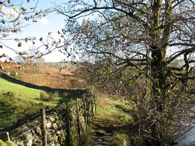
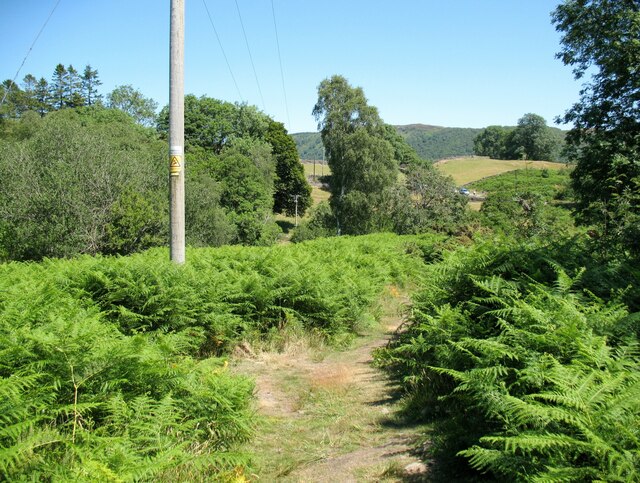
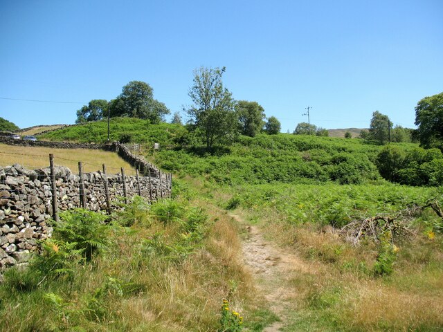
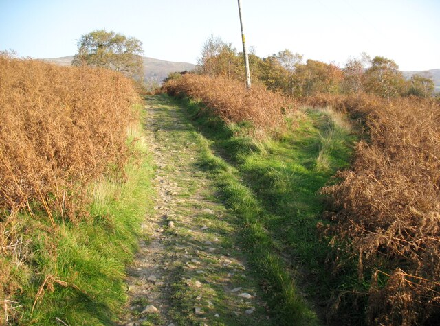
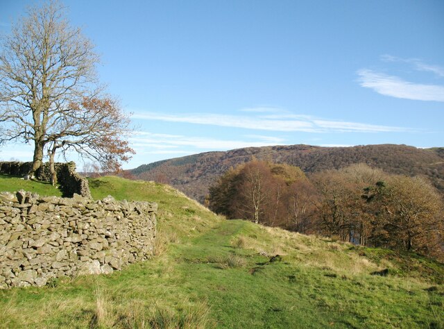
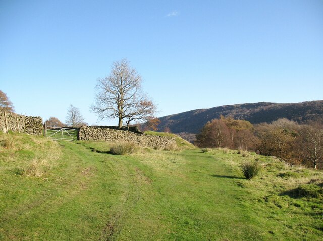
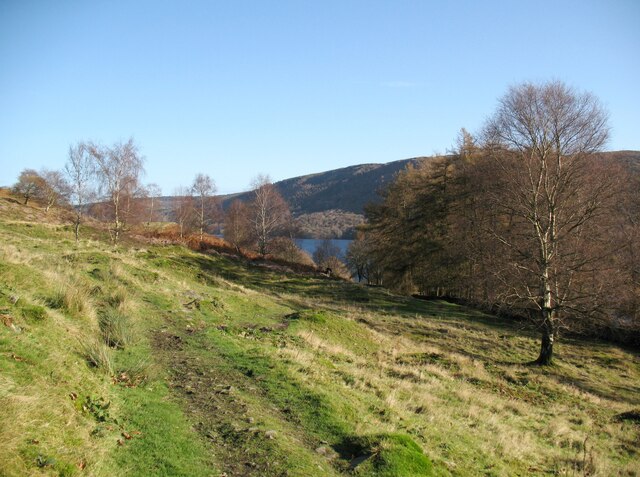
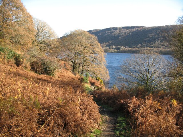
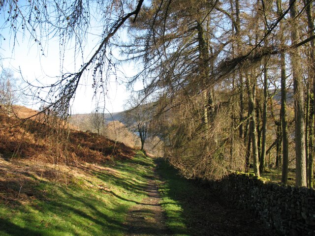
The wood is characterized by its dense tree cover, primarily consisting of oak, beech, and birch trees, which create a tranquil and serene environment. The forest floor is adorned with a variety of wildflowers, adding bursts of color to the landscape during the spring and summer months.

Steeped in history, Bailiff Wood is believed to have been a hunting ground for medieval nobility. The remnants of a medieval hunting lodge can still be found within the woodland, providing a tangible link to the past. Visitors can explore the ruins and imagine what life was like in this area centuries ago.

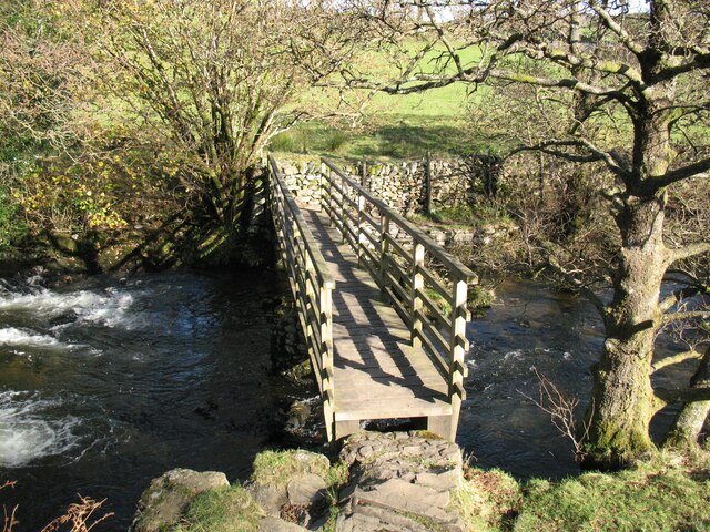
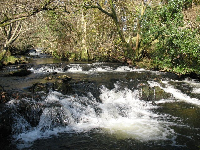
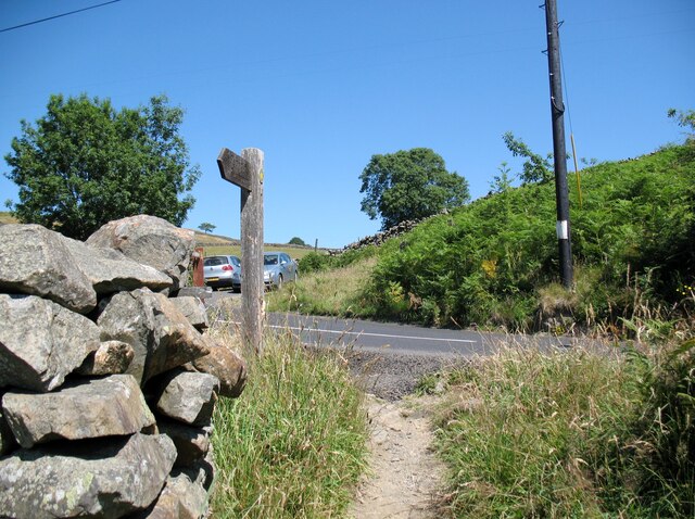
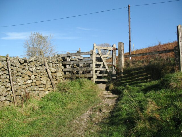
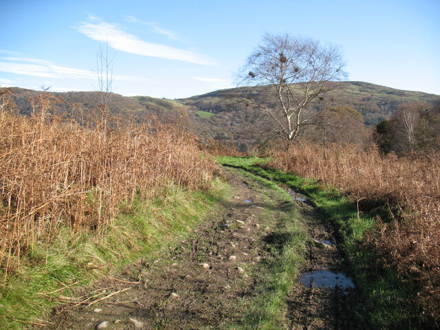
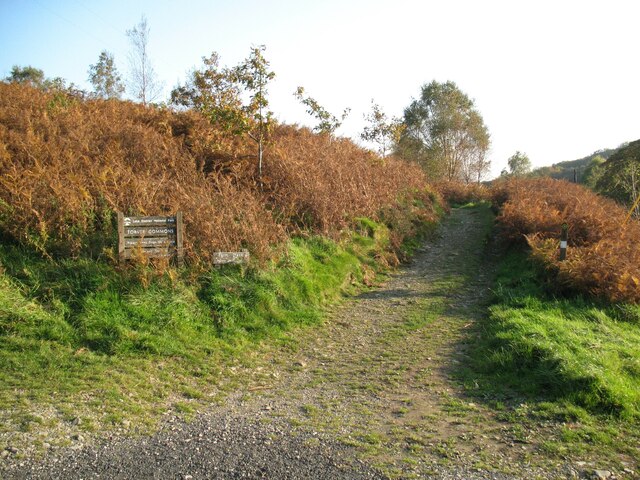
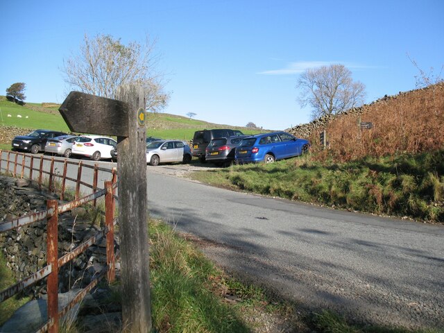
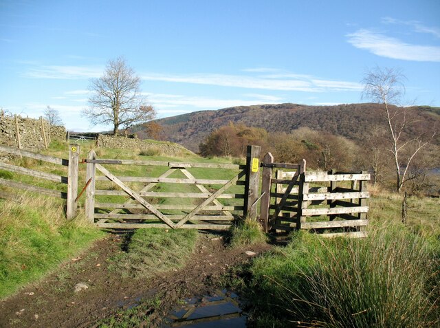
The wood is crisscrossed by a network of well-maintained footpaths, allowing visitors to easily navigate through the forest and discover its hidden treasures. These paths lead to charming glades, babbling brooks, and small ponds, providing opportunities for peaceful picnics or wildlife spotting.

Bailiff Wood is not only home to a diverse range of plant species but also provides a habitat for various woodland animals. Birdwatchers can spot woodpeckers, owls, and other avian species, while lucky visitors might catch a glimpse of deer, foxes, or squirrels.

Overall, Bailiff Wood offers a serene escape from the hustle and bustle of everyday life, inviting visitors to immerse themselves in the beauty of nature and connect with Lancashire's rich history.

If you have any feedback on the listing, please let us know in the comments section below.

Bailiff Wood Images

Images are sourced within 2km of 54.33107/-3.0712872 or Grid Reference SD3093. Thanks to Geograph Open Source API. All images are credited.

Public footpath beside Torver Beck The footpath is the route of The Cumbria Way, a 74 mile long distance path from Ulverston to Carlisle (next photograph <a href="https://www.geograph.org.uk/photo/6957799">SD2892 : The Cumbria Way near Torver Beck</a>).
Public footpath beside Torver Beck
The footpath is the route of The Cumbria Way, a 74 mile long distance path from Ulverston to Carlisle (next photograph SD2892 : The Cumbria Way near Torver Beck).
Footbridge over Torver Beck The bridge takes a public footpath across Torver Beck which drains Goat’s Water and the Coniston Fells and is one of the three main feeders of Coniston Water.
The Cumbria Way long distance path crosses the bridge (next photograph <a href="https://www.geograph.org.uk/photo/6939286">SD2892 : Public footpath beside Torver Beck</a>).
Footbridge over Torver Beck
The bridge takes a public footpath across Torver Beck which drains Goat’s Water and the Coniston Fells and is one of the three main feeders of Coniston Water. The Cumbria Way long distance path crosses the bridge (next photograph SD2892 : Public footpath beside Torver Beck).
Footpath near Torver Beck The Cumbria Way long distance path follows a public footpath off Torver Low Common on the approach to Torver Beck.  Northbound walkers following the route of The Cumbria Way keep right at this path junction (next photograph <a href="https://www.geograph.org.uk/photo/6939295">SD2892 : Footbridge over Torver Beck</a>).
Footpath near Torver Beck
The Cumbria Way long distance path follows a public footpath off Torver Low Common on the approach to Torver Beck. Northbound walkers following the route of The Cumbria Way keep right at this path junction (next photograph SD2892 : Footbridge over Torver Beck).
The Cumbria Way near Torver Beck The Cumbria Way follows a field boundary wall on the approach to the road at Delicars (next photograph <a href="https://www.geograph.org.uk/photo/6961731">SD2892 : Footpath gate near Delicars</a>).
The Cumbria Way near Torver Beck
The Cumbria Way follows a field boundary wall on the approach to the road at Delicars (next photograph SD2892 : Footpath gate near Delicars).
Torver Beck Torver Beck drains Goat’s Water and the Coniston Fells and is one of the three main feeders of Coniston Water.
These modest waterfalls are beside The Cumbria Way, a 74 mile long distance path from Ulverston to Carlisle.
Torver Beck
Torver Beck drains Goat’s Water and the Coniston Fells and is one of the three main feeders of Coniston Water. These modest waterfalls are beside The Cumbria Way, a 74 mile long distance path from Ulverston to Carlisle.
The Cumbria Way, Delicars A public footpath from Torver Low Common climbs to join the A5084 road at Delicars, it is the route of The Cumbria Way long distance trail from Ulverston to Carlisle (next photograph <a href="https://www.geograph.org.uk/photo/6965796">SD2892 : A5084 road and car park, Delicars</a>).
The Cumbria Way, Delicars
A public footpath from Torver Low Common climbs to join the A5084 road at Delicars, it is the route of The Cumbria Way long distance trail from Ulverston to Carlisle (next photograph SD2892 : A5084 road and car park, Delicars).
Footpath gate near Delicars A public footpath from Torver Low Common climbs to join the A5084 road at Delicars, passing through a wooden gate before it reaches the road.
This is the route of The Cumbria Way (next photograph <a href="https://www.geograph.org.uk/photo/6961724">SD2892 : The Cumbria Way, Delicars</a>).
Footpath gate near Delicars
A public footpath from Torver Low Common climbs to join the A5084 road at Delicars, passing through a wooden gate before it reaches the road. This is the route of The Cumbria Way (next photograph SD2892 : The Cumbria Way, Delicars).
The Cumbria Way, Delicars The Cumbria Way follows a farm track near Delicars.
The track is also a public footpath from Delicars to Coniston (next photograph <a href="https://www.geograph.org.uk/photo/6972041">SD2892 : Gate on The Cumbria Way</a>).
The Cumbria Way, Delicars
The Cumbria Way follows a farm track near Delicars. The track is also a public footpath from Delicars to Coniston (next photograph SD2892 : Gate on The Cumbria Way).
The Cumbria Way near Delicars The Cumbria Way follows a public footpath along a farm track near Delicars.
Northbound walkers following The Cumbria way should keep left where the track divides 55m (60 yards) after leaving the car park at Delicars (next photograph <a href="https://www.geograph.org.uk/photo/6964835">SD2892 : The Cumbria Way, Delicars</a>).
The Cumbria Way near Delicars
The Cumbria Way follows a public footpath along a farm track near Delicars. Northbound walkers following The Cumbria way should keep left where the track divides 55m (60 yards) after leaving the car park at Delicars (next photograph SD2892 : The Cumbria Way, Delicars).
Farm track, Delicars This farm track leaves the south end of the small roadside car park at Delicars to serve nearby fields.  The track is also the route of The Cumbria Way long distance footpath from Ulverston to Carlisle
(next photograph <a href="https://www.geograph.org.uk/photo/7428706">SD2892 : The Cumbria Way, Delicars</a>).
Farm track, Delicars
This farm track leaves the south end of the small roadside car park at Delicars to serve nearby fields. The track is also the route of The Cumbria Way long distance footpath from Ulverston to Carlisle (next photograph SD2892 : The Cumbria Way, Delicars).
A5084 road and car park, Delicars The public footpath sign points along The Cumbria Way which joins the A5084 road at this point.  Northbound walkers on The Cumbria Way long distance trail cross the road to the small car park at Delicars and turn right onto a track leading up the bank; this is the start of a public footpath along the shores of Coniston Water to Coniston (next photograph <a href="https://www.geograph.org.uk/photo/6965781">SD2892 : Farm track, Delicars</a>).
A5084 road and car park, Delicars
The public footpath sign points along The Cumbria Way which joins the A5084 road at this point. Northbound walkers on The Cumbria Way long distance trail cross the road to the small car park at Delicars and turn right onto a track leading up the bank; this is the start of a public footpath along the shores of Coniston Water to Coniston (next photograph SD2892 : Farm track, Delicars).
Gate on The Cumbria Way The gate is on the public footpath from Delicars to Coniston which is also the route of the Cumbria Way (next photograph <a href="https://www.geograph.org.uk/photo/6972052">SD2892 : Grassy Tracks</a>).
Gate on The Cumbria Way
The gate is on the public footpath from Delicars to Coniston which is also the route of the Cumbria Way (next photograph SD2892 : Grassy Tracks).
The Cumbria Way above Sunny Bank This grassy farmer’s track leads onto Torver Back Common; it is also the route of The Cumbria Way (next photograph <a href="https://www.geograph.org.uk/photo/6972253">SD2992 : The Cumbria Way near Coniston Water</a>).
The Cumbria Way above Sunny Bank
This grassy farmer’s track leads onto Torver Back Common; it is also the route of The Cumbria Way (next photograph SD2992 : The Cumbria Way near Coniston Water).
Grassy Tracks At the edge of Torver Back Common these tracks provide farmer’s access.  The lower track is the route of The Cumbria Way long distance path from Ulverston to Carlisle (next photograph <a href="https://www.geograph.org.uk/photo/6972047">SD2892 : The Cumbria Way above Sunny Bank</a>).
Grassy Tracks
At the edge of Torver Back Common these tracks provide farmer’s access. The lower track is the route of The Cumbria Way long distance path from Ulverston to Carlisle (next photograph SD2892 : The Cumbria Way above Sunny Bank).
The Cumbria Way near Boat House Wood The Cumbria Way long distance path leaves the grassy farmer’s track it has been following and descends towards Coniston Water (next photograph <a href="https://www.geograph.org.uk/photo/6974093">SD2992 : The Cumbria Way by Boat House Wood</a>).
The Cumbria Way near Boat House Wood
The Cumbria Way long distance path leaves the grassy farmer’s track it has been following and descends towards Coniston Water (next photograph SD2992 : The Cumbria Way by Boat House Wood).
The Cumbria Way near Coniston Water The Cumbria Way with Coniston Water is in the background.
Just beyond the rock outcrop The Cumbria Way path drops down to the right towards the lake (next photograph <a href="https://www.geograph.org.uk/photo/6972250">SD2992 : The Cumbria Way near Boat House Wood</a>).
The Cumbria Way near Coniston Water
The Cumbria Way with Coniston Water is in the background. Just beyond the rock outcrop The Cumbria Way path drops down to the right towards the lake (next photograph SD2992 : The Cumbria Way near Boat House Wood).
The Cumbria Way near Boat House Wood The Cumbria Way long distance path from Ulverston to Carlisle descends towards the shore of Coniston Water near Boat House Wood (next photograph <a href="https://www.geograph.org.uk/photo/6975744">SD2992 : The Cumbria Way near Sunny Bank Jetty</a>).
Out of sight at the bottom of the hill is Sunny Bank Jetty, used by Coniston Launch services during the summer months.
The Cumbria Way near Boat House Wood
The Cumbria Way long distance path from Ulverston to Carlisle descends towards the shore of Coniston Water near Boat House Wood (next photograph SD2992 : The Cumbria Way near Sunny Bank Jetty). Out of sight at the bottom of the hill is Sunny Bank Jetty, used by Coniston Launch services during the summer months.
The Cumbria Way by Boat House Wood The Cumbria Way follows a public footpath alongside Boat House Wood on the approach to Coniston Water (next photograph <a href="https://www.geograph.org.uk/photo/6974085">SD2992 : The Cumbria Way near Boat House Wood</a>).
The Cumbria Way by Boat House Wood
The Cumbria Way follows a public footpath alongside Boat House Wood on the approach to Coniston Water (next photograph SD2992 : The Cumbria Way near Boat House Wood).
Show me another place!

Bailiff Wood is located at Grid Ref: SD3093 (Lat: 54.33107, Lng: -3.0712872)

Administrative County: Cumbria

District: South Lakeland

Police Authority: Cumbria

What 3 Words

///crumb.outbursts.drove. Near Windermere, Cumbria

Related Wikis

Top o'Selside

Top o'Selside is a hill in the Lake District in Cumbria, England. At 335 metres (1,099 ft), it is the highest point of the group of hills situated between...

Kelly Hall Tarn

Kelly Hall Tarn is a pool in Cumbria, England, to the west of Coniston Water. It is located about one km south-south-east of the village of Torver, on...

Peel Island, Cumbria

Peel Island (formerly known as Montague Island or the Gridiron) is one of the three islands of Coniston Water in the English Lake District, Cumbria. The...

Torver

Torver is a village and civil parish in the South Lakeland district of Cumbria, England, 3 miles (4.8 km) south west of the village of Coniston and 1 mile...

Coniston Water

Coniston Water is a lake in the Lake District in North West England. It is the third largest by volume, after Windermere and Ullswater, and the fifth-largest...

Lawson Park

Lawson Park is a remote English Lake District hillfarm, leased by Grizedale Arts (a contemporary art commissioner) from the Forestry Commission. It is...

St Luke's Church, Torver

St Luke's Church is in the village of Torver, Cumbria, England. It is an active Anglican parish church in the deanery of Furness, the archdeaconry of...

Torver railway station

Torver railway station served the village of Torver, in Lancashire, England (now in Cumbria). It was on the branch line to Coniston. == History == Authorised...

Nearby Amenities

Located within 500m of 54.33107,-3.0712872
The Cabin
Natural: bay
Source: OS OpenData StreetView
Lat/Long: 54.3315636/-3.074539
Parking
Source: OS OpenData StreetView
Lat/Long: 54.3352625/-3.0701019
Parking
Source: OS OpenData StreetView
Lat/Long: 54.3326145/-3.0734232
The data included in this document is from www.openstreetmap.org. The data is made available under ODbL.

Have you been to Bailiff Wood?

Leave your review of Bailiff Wood below (or comments, questions and feedback).