Great Trill Coppice
Wood, Forest in Devon East Devon
England
Great Trill Coppice
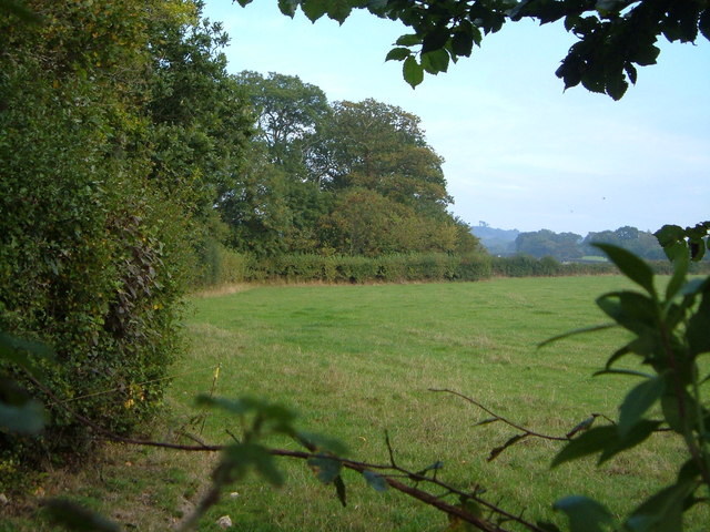
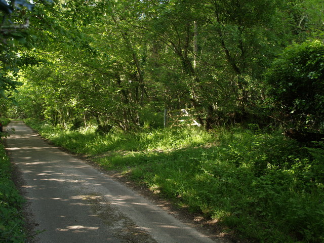
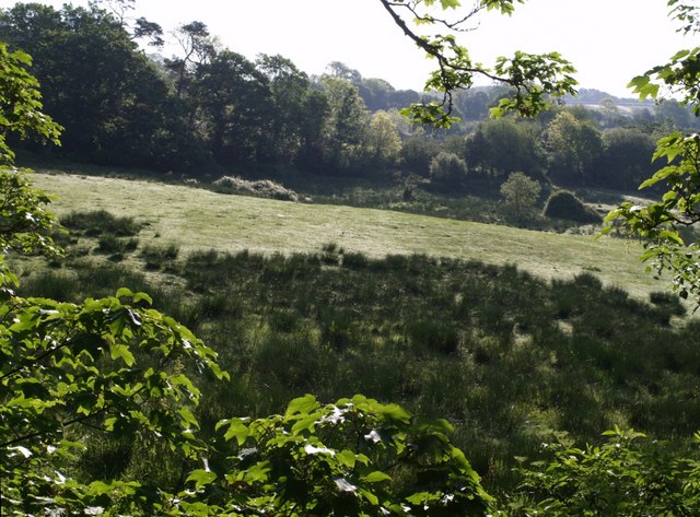
Great Trill Coppice is a picturesque woodland located in Devon, England. Stretching over an area of approximately 200 acres, it is known for its dense forest cover and diverse flora and fauna. The coppice is situated in the southern part of Devon, near the village of Trill, and is easily accessible by foot or by car.
The woodland is primarily composed of broadleaf trees, with a prominent presence of oak, beech, and ash trees. The dense canopy provides a cool and shaded environment, making it an ideal spot for leisurely walks and nature enthusiasts. The forest floor is adorned with a variety of wildflowers, including bluebells and primroses, creating a vibrant and colorful display during the spring season.
Great Trill Coppice is home to a wide range of wildlife, making it a popular destination for birdwatchers and animal lovers alike. Visitors may spot various bird species, such as woodpeckers, nuthatches, and tawny owls, as well as woodland mammals like badgers and foxes. The coppice also supports a diverse insect population, contributing to the overall biodiversity of the area.
The woodland offers several well-marked trails, allowing visitors to explore its natural beauty at their own pace. There are also designated picnic areas and benches strategically placed throughout the forest, providing visitors with opportunities to relax and enjoy the serene surroundings.
Great Trill Coppice is not only a haven for nature enthusiasts but also serves as an important ecological site, contributing to the preservation and conservation of Devon's natural heritage.
If you have any feedback on the listing, please let us know in the comments section below.
Great Trill Coppice Images
Images are sourced within 2km of 50.757723/-2.9973996 or Grid Reference SY2995. Thanks to Geograph Open Source API. All images are credited.


Great Trill Coppice is located at Grid Ref: SY2995 (Lat: 50.757723, Lng: -2.9973996)
Administrative County: Devon
District: East Devon
Police Authority: Devon and Cornwall
What 3 Words
///observer.afraid.winning. Near Axminster, Devon
Nearby Locations
Related Wikis

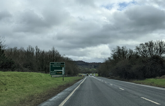
Abbey Gate, Devon
Abbey Gate is a hamlet just south of Axminster in Devon, England. Abbey Gate is at the junction between the A35 and A358 main roads, just west of Wyke...
Moridunum (Axminster)
Moridunum was a fort and small town in the Roman province of Britannia. Its remains are located at Woodbury Farm, immediately south of Axminster in the...
Newenham Abbey
Newenham Abbey (alias Newnham) was a Cistercian abbey founded in 1247 by Reginald II de Mohun (1206–1258) on land within his manor of Axminster in Devon...

River Yarty
The River Yarty is a river in east Devon, England, near the boundary with Somerset and Dorset. == Course == The river is about 26 kilometres (16 mi) long...
Raymond's Hill
Raymond's Hill is a village and residential area off the A35 road in Devon, England, right on the border with the county of Dorset. It is about 2 miles...

Musbury Castle
Musbury Castle is an Iron Age Hill fort situated above the Village of Musbury in Devon. The fort occupies a commanding hill top approx 175 Metres above...
Lands common to Axminster and Kilmington
The lands common to Axminster and Kilmington civil parishes are an area of meadowland on the banks of the River Axe that is shared between the civil parishes...
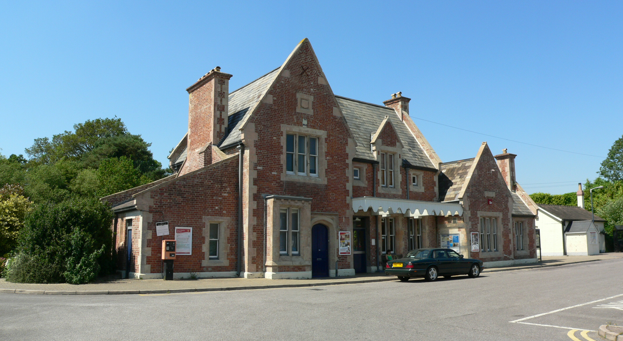
Axminster railway station
Axminster railway station serves the town of Axminster in Devon, England. It is operated by South Western Railway and is situated on the West of England...
Nearby Amenities
Located within 500m of 50.757723,-2.9973996Have you been to Great Trill Coppice?
Leave your review of Great Trill Coppice below (or comments, questions and feedback).