Clovenfords

Settlement in Selkirkshire

Scotland

Clovenfords

Clovenfords from the air Located 4 miles west of Galashiels at the crossroads of the A72 and B710 roads. Seen here from an Edinburgh bound flight from Prague.
Clovenfords from the air Credit: Thomas Nugent

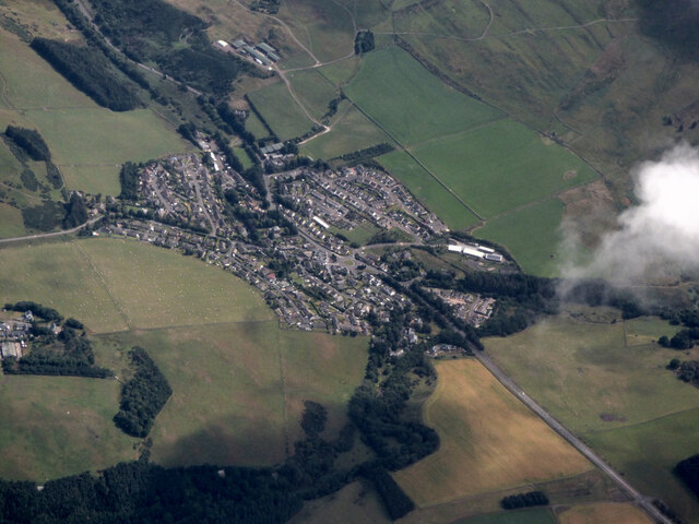
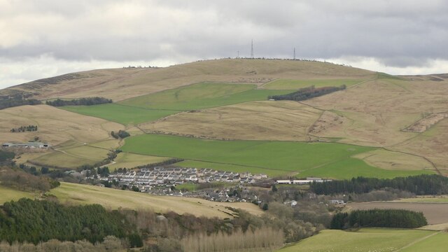
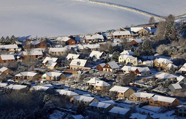
Clovenfords is a charming village located in the historic county of Selkirkshire, Scotland. Situated in the picturesque Tweed Valley, it lies approximately 3 miles southeast of the town of Galashiels. With a population of around 500 residents, Clovenfords offers a tranquil and close-knit community.

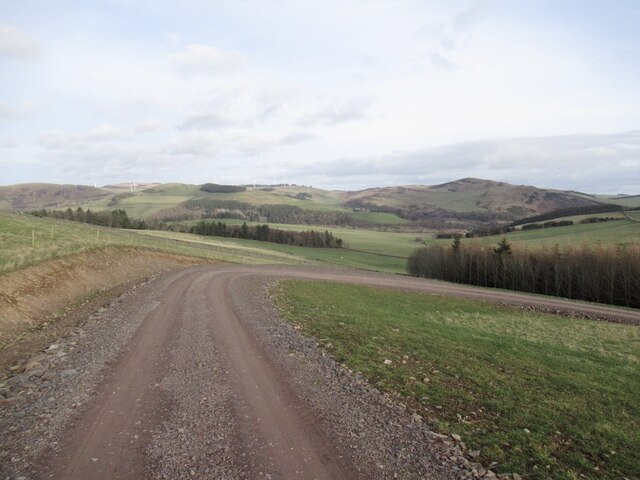
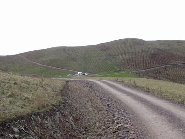
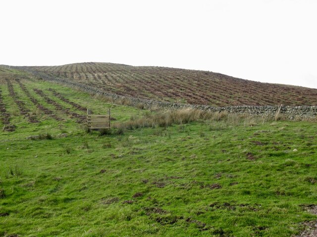
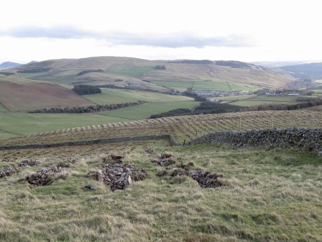
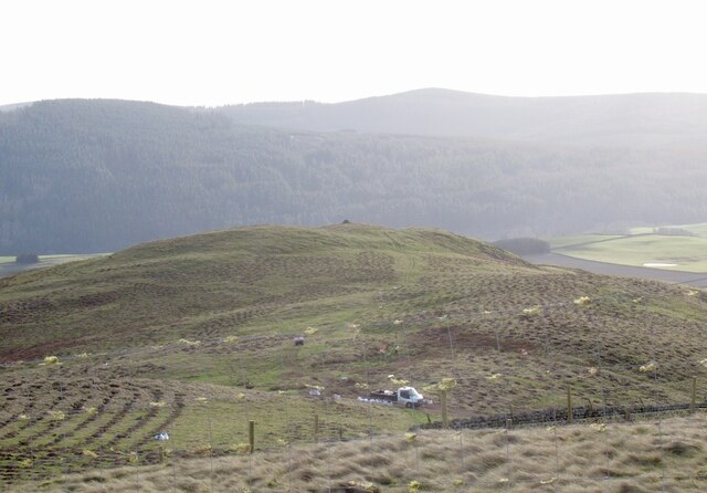
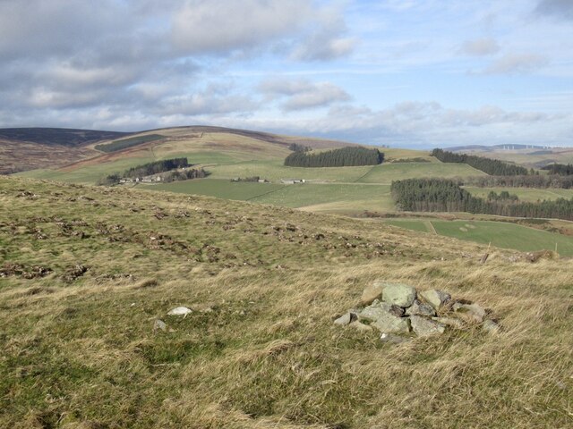
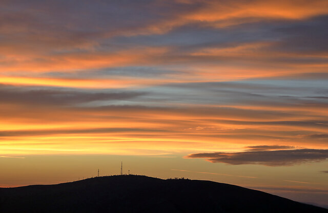
The village is surrounded by lush green hills and is known for its scenic beauty. The River Tweed flows nearby, providing opportunities for fishing and leisurely walks along its banks. Clovenfords is also well-connected, with the A72 road passing through the village, linking it to other major towns and cities in the region.

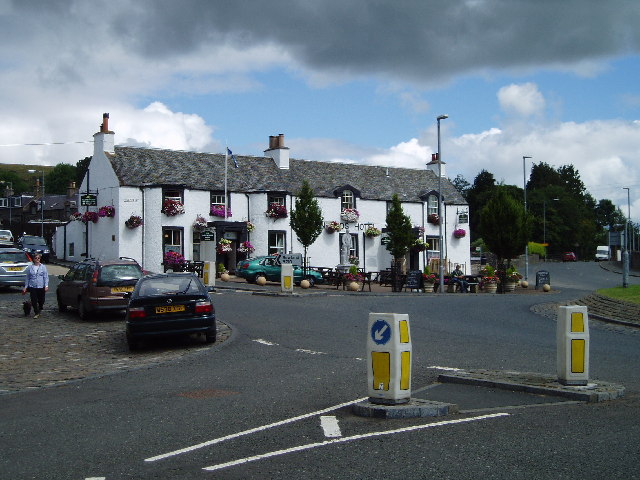
Facilities in Clovenfords include a primary school, a village hall, and a local pub, which serves as a social hub for residents. The village hall hosts various community events, such as ceilidhs, concerts, and meetings. Additionally, there is a small convenience store that caters to the daily needs of the locals.

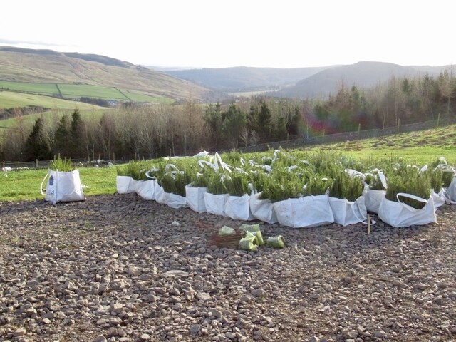
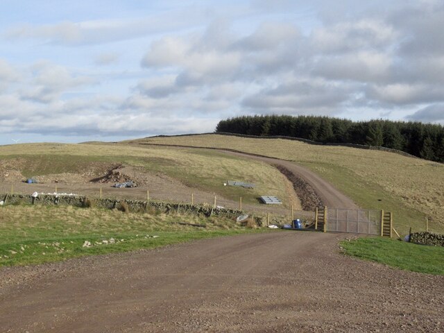
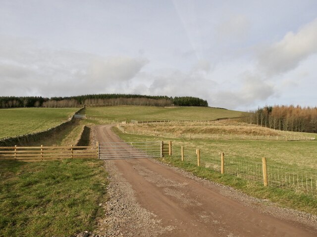
Outdoor enthusiasts will find plenty to explore in the surrounding area. The nearby Glentress Forest offers a range of walking and cycling trails, as well as a popular mountain biking centre. The forest attracts visitors from far and wide, seeking adventure and an escape into nature.

Clovenfords is steeped in history, with several historic landmarks in the vicinity. Neidpath Castle, a 14th-century fortress, is just a short drive away and offers tours to visitors. The village itself has a few traditional stone buildings that add to its character and charm.

Overall, Clovenfords is a delightful village that combines natural beauty, a strong sense of community, and a rich history, making it an attractive place to live or visit in Selkirkshire.

If you have any feedback on the listing, please let us know in the comments section below.

Clovenfords Images

Images are sourced within 2km of 55.620009/-2.8767211 or Grid Reference NT4436. Thanks to Geograph Open Source API. All images are credited.

Clovenfords from the air Located 4 miles west of Galashiels at the crossroads of the A72 and B710 roads. Seen here from an Edinburgh bound flight from Prague.
Clovenfords from the air
Located 4 miles west of Galashiels at the crossroads of the A72 and B710 roads. Seen here from an Edinburgh bound flight from Prague.
Communication masts on Meigle Hill at sunset This telephoto shot was taken from my back garden.
Communication masts on Meigle Hill at sunset
This telephoto shot was taken from my back garden.
Caddonfoot and Meigle Hill View from Laidlawstiel Hill.
Caddonfoot and Meigle Hill
View from Laidlawstiel Hill.
New road, Dunlee Hill Associated with tree planting on Knowes Hill, the road continues almost all the way to the summit. It is quite gently graded and easy to ride up. Tree planting was taking place at the time.
New road, Dunlee Hill
Associated with tree planting on Knowes Hill, the road continues almost all the way to the summit. It is quite gently graded and easy to ride up. Tree planting was taking place at the time.
Road, Dunlee Hill Associated with tree planting on Knowes Hill, the road continues almost all the way to the summit. It is quite gently graded and easy to ride up. Tree planting was taking place at the time.
Road, Dunlee Hill
Associated with tree planting on Knowes Hill, the road continues almost all the way to the summit. It is quite gently graded and easy to ride up. Tree planting was taking place at the time.
Knowes Hill Trees had just been planted here, the team were at work at the time a short distance to the south.
Knowes Hill
Trees had just been planted here, the team were at work at the time a short distance to the south.
Newly planted trees, Knowes Hill Supplied by Alba Nurseries, East Lothian.
Newly planted trees, Knowes Hill
Supplied by Alba Nurseries, East Lothian.
Tree planting, Knowes Hill
Summit, Knowes Hill Marked by a small cairn just inside the new plantation.
Summit, Knowes Hill
Marked by a small cairn just inside the new plantation.
Young trees awaiting planting Trees being planted on Knowes Hill. They are supplied by Alba nursery, East Lothian.
Young trees awaiting planting
Trees being planted on Knowes Hill. They are supplied by Alba nursery, East Lothian.
New road, Dunlee Hill Servicing the new woodland on Knowes Hill.
New road, Dunlee Hill
Servicing the new woodland on Knowes Hill.
New road up Knowes Hill View from the Bowland to Clovenfords road of the newly constructed forestry road.
New road up Knowes Hill
View from the Bowland to Clovenfords road of the newly constructed forestry road.
A November sunset over Meigle Hill The communication masts on Meigle Hill are visible in this photo taken from Blaikie’s Hill.
A November sunset over Meigle Hill
The communication masts on Meigle Hill are visible in this photo taken from Blaikie’s Hill.
Caddonlee Farm This telephoto shot was taken from Meigle Hill on a bitterly cold January day.
Caddonlee Farm
This telephoto shot was taken from Meigle Hill on a bitterly cold January day.
Torwoodlee Mains Farm This telephoto shot was taken from Meigle Hill on a bitterly cold January day.
Torwoodlee Mains Farm
This telephoto shot was taken from Meigle Hill on a bitterly cold January day.
A gate post and chain fastener on Meigle Hill The gate is on a Clovenfords Paths route.
A gate post and chain fastener on Meigle Hill
The gate is on a Clovenfords Paths route.
Houses at Clovenfords This telephoto shot was taken from Meigle Hill on a bitterly cold January day.
Houses at Clovenfords
This telephoto shot was taken from Meigle Hill on a bitterly cold January day.
Dead tree at Ashiestiel A skeletal tree in a frost hollow with Meigle Hill in the background.
Dead tree at Ashiestiel
A skeletal tree in a frost hollow with Meigle Hill in the background.
Show me another place!

Clovenfords is located at Grid Ref: NT4436 (Lat: 55.620009, Lng: -2.8767211)

Unitary Authority: The Scottish Borders

Police Authority: The Lothians and Scottish Borders

What 3 Words

///brightly.cowboys.submerged. Near Galashiels, Scottish Borders

Nearby Locations

Clovenfords

Related Wikis

Clovenfords

Clovenfords is a village in the Scottish Borders area of Scotland, 1 mile (2 kilometres) north of the hamlet of Caddonfoot and 4 miles (6 kilometres) west...

Clovenfords railway station

Clovenfords railway station served the village of Clovenfords, Scottish Borders, Scotland from 1866 to 1962 on the Peebles Railway. == History == The station...

Caddonfoot

Caddonfoot (Scottish Gaelic: Bun Chadain) is a village on the River Tweed, in the Scottish Borders area of Scotland, on the A707, near Galashiels. The...

Angling Club Cottage Platform railway station

Angling Club Cottage Platform served the Edinburgh Angling Club in Selkirk, Scottish Borders, Scotland from 1898 to the late 1940s. == History == The station...

Caddon Water

The Caddon Water (Scottish Gaelic: Cadan) is a small river by the village of Caddonfoot, in the Scottish Borders area of Scotland. It rises on Windlestraw...

Caddonlee

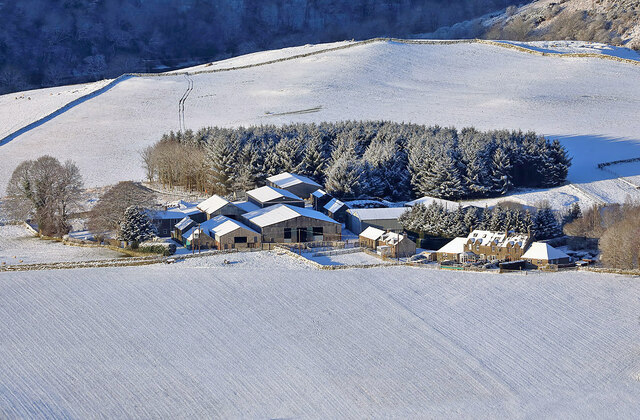
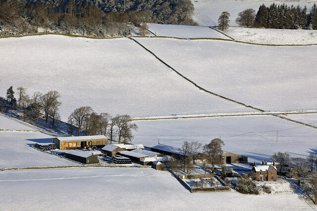
Caddonlee is a farm in the village of Clovenfords in the Scottish Borders area of Scotland, by the Caddon Water, near Caddonfoot where Caddon Water meets...

Peel Hospital

Peel Hospital was a health facility at Caddonfoot in the Scottish Borders, Scotland. It is a Category A Listed Building. == History == Peel House was designed...
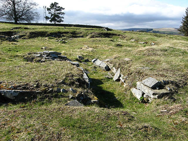
Torwoodlee Broch

Torwoodlee Broch is the remains of an iron-age broch located near the town of Galashiels in the Scottish Borders. == Description == Torwoodlee Broch...

Nearby Amenities

Located within 500m of 55.620009,-2.8767211
Clovenfords
Place: village
Population: 562
Wikidata: Q5135854
Wikipedia: en:Clovenfords
Lat/Long: 55.6181562/-2.876556
Post Office
Lat/Long: 55.618317/-2.8770245
Bus Stop
Caddonfoot Junction
Bus: yes
Naptan AtcoCode: 69001460
Naptan Bearing: NE
Naptan CommonName: Caddonfoot Jct
Naptan Indicator: opp
Naptan NaptanCode: 72725748
Naptan Street: A72
Operator: Scottish Borders Council
Public Transport: platform
Ref: 69001460
Source: NaPTAN
Lat/Long: 55.61765/-2.8769228
Bowland Road
Naptan AtcoCode: 69001643
Naptan Bearing: N
Naptan BusStopType: CUS
Naptan CommonName: Bowland Road
Naptan Indicator: At Whytbank Row
Naptan Landmark: Whytbank Row
Naptan NaptanCode: 72798752
Naptan Street: Bowland Road
Naptan Verified: no
Source: naptan_import
Lat/Long: 55.6201369/-2.8769185
Bus Stop
Meigle Row
Bus: yes
Naptan AtcoCode: 6900202
Naptan Bearing: SW
Naptan CommonName: Meigle Row
Naptan Indicator: nr
Naptan NaptanCode: 72724358
Naptan Street: Vine Street
Operator: Scottish Borders Council
Public Transport: platform
Ref: 6900202
Source: NaPTAN
Lat/Long: 55.6195332/-2.8741245
Bus Stop
Meigle Row
Bus: yes
Naptan AtcoCode: 6900203
Naptan Bearing: NE
Naptan CommonName: Meigle Row
Naptan Indicator: opp
Naptan NaptanCode: 72724362
Naptan Street: Vine Street
Operator: Scottish Borders Council
Public Transport: platform
Ref: 6900203
Source: NaPTAN
Lat/Long: 55.619676/-2.8740825
Bus Stop
Clovenfords Hotel
Bus: yes
Naptan AtcoCode: 6900205
Naptan Bearing: NE
Naptan CommonName: Hotel
Naptan Indicator: at
Naptan NaptanCode: 72724347
Naptan Street: Vine Street
Operator: Scottish Borders Council
Public Transport: platform
Ref: 6900205
Source: NaPTAN
Lat/Long: 55.6185445/-2.8762989
Bus Stop
Clovenfords Hotel
Bus: yes
Naptan AtcoCode: 6900206
Naptan Bearing: SW
Naptan CommonName: Hotel
Naptan Indicator: opp
Naptan NaptanCode: 72724329
Naptan Street: A72
Operator: Scottish Borders Council
Public Transport: platform
Ref: 6900206
Shelter: no
Source: NaPTAN
Lat/Long: 55.6175897/-2.8767039
Noexit: yes
Lat/Long: 55.6204065/-2.8730485
Noexit: yes
Lat/Long: 55.6198111/-2.8741188
Noexit: yes
Lat/Long: 55.6183619/-2.8777481
Noexit: yes
Lat/Long: 55.6215886/-2.8737419
Noexit: yes
Lat/Long: 55.6210872/-2.8759241
Noexit: yes
Lat/Long: 55.6178366/-2.8799452
Noexit: yes
Lat/Long: 55.6180994/-2.880082
Noexit: yes
Lat/Long: 55.6176266/-2.8786713
Crossing
Lat/Long: 55.6179754/-2.8756984
Crossing
Lat/Long: 55.6173802/-2.8752888
Noexit: yes
Lat/Long: 55.6185775/-2.8748905
Noexit: yes
Lat/Long: 55.6168089/-2.8740617
Noexit: yes
Lat/Long: 55.6168272/-2.8775459
Noexit: yes
Lat/Long: 55.616254/-2.8787345
Artwork Type: statue
Source: Mapillary
Tourism: artwork
Lat/Long: 55.6184897/-2.8765672
Entrance: yes
Lat/Long: 55.6185058/-2.8764734
Entrance: yes
Lat/Long: 55.6184854/-2.8766738
Post Box
Operator: Royal Mail
Post Box Mounting: building
Post Box Type: wall
Ref: TD1 27
Royal Cypher: GR
Lat/Long: 55.6182725/-2.8769761
Entrance: yes
Lat/Long: 55.6183049/-2.8769699
Noexit: yes
Lat/Long: 55.615857/-2.8782111
Noexit: yes
Lat/Long: 55.6189675/-2.8751189
Noexit: yes
Lat/Long: 55.6194583/-2.8743075
Give Way
Direction: forward
Lat/Long: 55.6189561/-2.8768638
Noexit: yes
Lat/Long: 55.6185805/-2.8803204
Noexit: yes
Lat/Long: 55.6186953/-2.8804601
Give Way
Direction: forward
Lat/Long: 55.6200299/-2.8767897
Give Way
Direction: forward
Lat/Long: 55.6200749/-2.8775363
Generator Method: photovoltaic
Generator Output Electricity: yes
Generator Source: solar
Generator Type: solar_photovoltaic_panel
Power: generator
Lat/Long: 55.6194487/-2.8779964
Generator Method: photovoltaic
Generator Output Electricity: yes
Generator Source: solar
Generator Type: solar_photovoltaic_panel
Power: generator
Lat/Long: 55.6179383/-2.8794792
Noexit: yes
Lat/Long: 55.6177591/-2.8787028
Give Way
Direction: forward
Lat/Long: 55.6181169/-2.8758468
Generator Method: photovoltaic
Generator Output Electricity: yes
Generator Source: solar
Generator Type: solar_photovoltaic_panel
Power: generator
Lat/Long: 55.6184097/-2.872797
Generator Method: photovoltaic
Generator Output Electricity: yes
Generator Source: solar
Generator Type: solar_photovoltaic_panel
Power: generator
Lat/Long: 55.6181019/-2.8725022
Noexit: yes
Lat/Long: 55.6175779/-2.8745475
Generator Method: photovoltaic
Generator Output Electricity: yes
Generator Source: solar
Generator Type: solar_photovoltaic_panel
Power: generator
Lat/Long: 55.6172875/-2.8733447
Noexit: yes
Lat/Long: 55.620545/-2.8696847
Barrier: cattle_grid
Lat/Long: 55.6193818/-2.8708783
Noexit: yes
Lat/Long: 55.6168523/-2.8743571
Give Way
Direction: forward
Lat/Long: 55.6177255/-2.872686
Give Way
Direction: forward
Lat/Long: 55.6187228/-2.8725829
Give Way
Direction: forward
Lat/Long: 55.6170904/-2.8751559
Generator Method: photovoltaic
Generator Output Electricity: yes
Generator Source: solar
Generator Type: solar_photovoltaic_panel
Power: generator
Lat/Long: 55.6175339/-2.8782892
Generator Method: photovoltaic
Generator Output Electricity: yes
Generator Source: solar
Generator Type: solar_photovoltaic_panel
Power: generator
Lat/Long: 55.61739/-2.8786191
Generator Method: photovoltaic
Generator Output Electricity: yes
Generator Source: solar
Generator Type: solar_photovoltaic_panel
Power: generator
Lat/Long: 55.6172537/-2.878013
Generator Method: photovoltaic
Generator Output Electricity: yes
Generator Source: solar
Generator Type: solar_photovoltaic_panel
Power: generator
Lat/Long: 55.6170795/-2.8784099
Generator Method: photovoltaic
Generator Output Electricity: yes
Generator Source: solar
Generator Type: solar_photovoltaic_panel
Power: generator
Lat/Long: 55.6169447/-2.8800555
Generator Method: photovoltaic
Generator Output Electricity: yes
Generator Source: solar
Generator Type: solar_photovoltaic_panel
Power: generator
Lat/Long: 55.6195003/-2.8763395
Give Way
Direction: forward
Lat/Long: 55.6239553/-2.8798138
Give Way
Direction: forward
Lat/Long: 55.6195572/-2.8745036
Noexit: yes
Lat/Long: 55.6202609/-2.8732125
Give Way
Direction: forward
Lat/Long: 55.6197156/-2.8739241
Noexit: yes
Lat/Long: 55.6216442/-2.8740028
Noexit: yes
Lat/Long: 55.6212266/-2.8758427
Give Way
Direction: forward
Lat/Long: 55.6207195/-2.8751051
Give Way
Direction: backward
Lat/Long: 55.6214339/-2.874821
Generator Method: photovoltaic
Generator Output Electricity: yes
Generator Source: solar
Generator Type: solar_photovoltaic_panel
Power: generator
Lat/Long: 55.6209798/-2.8756978
Give Way
Direction: forward
Lat/Long: 55.620384/-2.8766051
Noexit: yes
Lat/Long: 55.6211025/-2.872767
Noexit: yes
Lat/Long: 55.6212431/-2.873071
Generator Method: photovoltaic
Generator Output Electricity: yes
Generator Source: solar
Generator Type: solar_photovoltaic_panel
Power: generator
Lat/Long: 55.6209152/-2.8714514
Generator Method: photovoltaic
Generator Output Electricity: yes
Generator Source: solar
Generator Type: solar_photovoltaic_panel
Power: generator
Lat/Long: 55.6200887/-2.8733929
Generator Method: photovoltaic
Generator Output Electricity: yes
Generator Source: solar
Generator Type: solar_photovoltaic_panel
Power: generator
Lat/Long: 55.6203455/-2.8727754
Generator Method: photovoltaic
Generator Output Electricity: yes
Generator Source: solar
Generator Type: solar_photovoltaic_panel
Power: generator
Lat/Long: 55.6211219/-2.8707577
Generator Method: photovoltaic
Generator Output Electricity: yes
Generator Source: solar
Generator Type: solar_photovoltaic_panel
Power: generator
Lat/Long: 55.6213644/-2.8725874
Generator Method: photovoltaic
Generator Output Electricity: yes
Generator Source: solar
Generator Type: solar_photovoltaic_panel
Power: generator
Lat/Long: 55.6209683/-2.8741807
Generator Method: photovoltaic
Generator Output Electricity: yes
Generator Source: solar
Generator Type: solar_photovoltaic_panel
Power: generator
Lat/Long: 55.6203943/-2.8754895
Noexit: yes
Lat/Long: 55.6186565/-2.8774411
Power: pole
Lat/Long: 55.6240035/-2.874933
Power: pole
Lat/Long: 55.6235983/-2.8761953
Power: pole
Lat/Long: 55.623206/-2.8774017
Power: pole
Lat/Long: 55.6228999/-2.8785775
Power: pole
Lat/Long: 55.6229057/-2.8787659
Power: pole
Lat/Long: 55.6229315/-2.8800181
Power: pole
Lat/Long: 55.6229545/-2.8812677
Power: pole
Lat/Long: 55.6229775/-2.8824537
Traffic Calming: island
Lat/Long: 55.6173726/-2.8771412
The data included in this document is from www.openstreetmap.org. The data is made available under ODbL.

Have you been to Clovenfords?

Leave your review of Clovenfords below (or comments, questions and feedback).