Upper Park Wood

Wood, Forest in Herefordshire

England

Upper Park Wood

Hedging your bets The street sign for Llewellin Road - an unusual spelling - is buried deep in the hedge.
Hedging your bets Credit: Mike Parker

Upper Park Wood is a picturesque forest located in Herefordshire, England. Covering an area of approximately 100 acres, the wood is known for its serene ambiance and abundant wildlife. The wood is situated on a gently sloping terrain, offering visitors stunning panoramic views of the surrounding countryside.

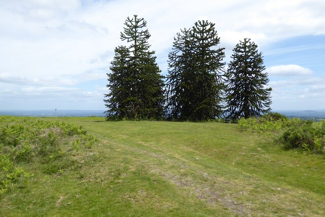
The diverse range of tree species present in Upper Park Wood adds to its natural beauty. Oak, beech, ash, and birch trees dominate the landscape, their vibrant foliage providing a mesmerizing display during autumn. The forest floor is adorned with a rich carpet of wildflowers and ferns, creating a vibrant and colorful environment.

The wood is home to numerous animal species, making it a popular destination for wildlife enthusiasts. Visitors may spot roe deer, badgers, foxes, and a wide variety of bird species, including woodpeckers and owls. The tranquil atmosphere of the wood makes it an ideal habitat for these creatures.

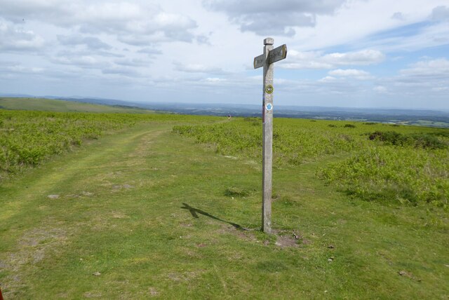
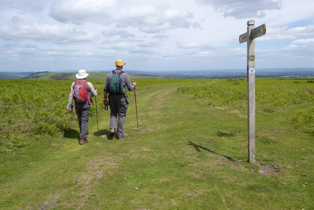
There are well-maintained walking trails that meander through the wood, allowing visitors to explore its natural wonders at their own pace. These paths are suitable for both casual strolls and more adventurous hikes, catering to all levels of fitness.

Upper Park Wood is a popular recreational spot for locals and tourists alike. Picnic areas are scattered throughout the wood, providing the perfect setting for a family day out or a peaceful lunch amidst nature. The forest also offers opportunities for photography, painting, and simply immersing oneself in the tranquility of the surroundings.

Overall, Upper Park Wood is a hidden gem in Herefordshire, offering a peaceful retreat and a haven for nature lovers. Its stunning beauty and abundant wildlife make it a must-visit destination for anyone seeking solace in the natural world.

If you have any feedback on the listing, please let us know in the comments section below.

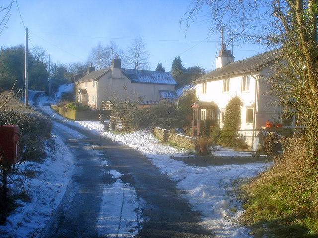
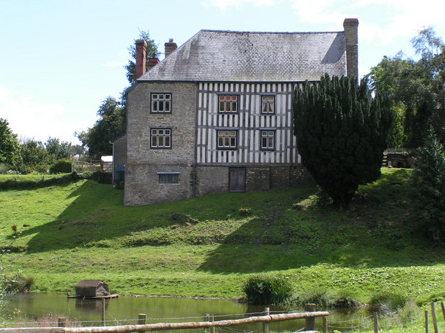
Upper Park Wood Images

Images are sourced within 2km of 52.199622/-3.0582054 or Grid Reference SO2756. Thanks to Geograph Open Source API. All images are credited.

Hedging your bets The street sign for Llewellin Road - an unusual spelling - is buried deep in the hedge.
Hedging your bets
The street sign for Llewellin Road - an unusual spelling - is buried deep in the hedge.
Monkey Puzzle trees on Hergest Ridge These Chilean pine or monkey puzzle trees are an unexpected sight near the summit of Hergest Ridge.
Monkey Puzzle trees on Hergest Ridge
These Chilean pine or monkey puzzle trees are an unexpected sight near the summit of Hergest Ridge.
Footpath sign on Hergest Ridge Footpath indicating the route of Offa's Dyke Path as it crosses Hergest Ridge.
Footpath sign on Hergest Ridge
Footpath indicating the route of Offa's Dyke Path as it crosses Hergest Ridge.
Walking Offa's Dyke Walking Offa's Dyke Path across Hergest Ridge, with the view to the east of England.
Walking Offa's Dyke
Walking Offa's Dyke Path across Hergest Ridge, with the view to the east of England.
View to Herrick Hill View to Herrick Hill from Offa's Dyke Path crossing Hergest Ridge. Bradnor Hill is on the right in the middle distance.
View to Herrick Hill
View to Herrick Hill from Offa's Dyke Path crossing Hergest Ridge. Bradnor Hill is on the right in the middle distance.
View north from Hergest Ridge The wooded hill in the middle distance is Navages Wood.  This hill includes Stanners Rocks which at 700 million years old are among the oldest rocks in Wales.
View north from Hergest Ridge
The wooded hill in the middle distance is Navages Wood. This hill includes Stanners Rocks which at 700 million years old are among the oldest rocks in Wales.
Ridgebourne Road Offa's Dyke Path follows Ridgebourne Road as it descends from Hergest Ridge into Kington.
Ridgebourne Road
Offa's Dyke Path follows Ridgebourne Road as it descends from Hergest Ridge into Kington.
War Memorial on The Square War Memorial on The Square in Kington.
War Memorial on The Square
War Memorial on The Square in Kington.
Market Hall, Kington Kington's Market Hall was built in the 1880s and is Grade II listed, see: <span class="nowrap"><a title="https://historicengland.org.uk/listing/the-list/list-entry/1208120?section=official-list-entry" rel="nofollow ugc noopener" href="https://historicengland.org.uk/listing/the-list/list-entry/1208120?section=official-list-entry">Link</a><img style="margin-left:2px;" alt="External link" title="External link - shift click to open in new window" src="https://s1.geograph.org.uk/img/external.png" width="10" height="10"/></span>
Market Hall, Kington
Kington's Market Hall was built in the 1880s and is Grade II listed, see: LinkExternal link
Farmland access track Farmland access track just inside England with the wooded hills in the background in Wales and formed of Stanner Rocks, at around 700 million years old among the oldest rocks in Wales.
Farmland access track
Farmland access track just inside England with the wooded hills in the background in Wales and formed of Stanner Rocks, at around 700 million years old among the oldest rocks in Wales.
Field below Bradnor Hill Field below Bradnor Hill just inside England to the west of Kington.
Field below Bradnor Hill
Field below Bradnor Hill just inside England to the west of Kington.
The Square, Kington The War Memorial is surrounded by eighteenth and nineteenth century houses.
The Square, Kington
The War Memorial is surrounded by eighteenth and nineteenth century houses.
Toll House, Kington "The Toll House". In Hergest Road in front Hergest Mill. Erected by the Kington Turnpike Trust in the 19ᵗʰ C. More local toll houses see <a title="https://www.geograph.org.uk/discuss/index.php?&action=vthread&forum=11&topic=33104" href="https://www.geograph.org.uk/discuss/index.php?&action=vthread&forum=11&topic=33104">Link</a>


Milestone Society National ID: HF.KIN04
Toll House, Kington
"The Toll House". In Hergest Road in front Hergest Mill. Erected by the Kington Turnpike Trust in the 19ᵗʰ C. More local toll houses see Link Milestone Society National ID: HF.KIN04
Toll House, Kington "The Toll House" on the A44 NW of Kington in the area known as Floodgates. Erected by the Kington Turnpike Trust in the 19ᵗʰ C. More local toll houses see <a title="https://www.geograph.org.uk/discuss/index.php?&action=vthread&forum=11&topic=33104" href="https://www.geograph.org.uk/discuss/index.php?&action=vthread&forum=11&topic=33104">Link</a>


Milestone Society National ID: HF.KIN01
Toll House, Kington
"The Toll House" on the A44 NW of Kington in the area known as Floodgates. Erected by the Kington Turnpike Trust in the 19ᵗʰ C. More local toll houses see Link Milestone Society National ID: HF.KIN01
The Coach House and Market Hall, Kington, Herefordshire
Junction of Church Street and High Street, Kington, Herefordshire
Church Street, Kington, Herefordshire
Market Hall, Kington, Herefordshire
Show me another place!

Upper Park Wood is located at Grid Ref: SO2756 (Lat: 52.199622, Lng: -3.0582054)

Unitary Authority: County of Herefordshire

Police Authority: West Mercia

What 3 Words

///narrate.hack.lecturers. Near Kington, Herefordshire

Related Wikis

Lower Hergest

Lower Hergest is a hamlet in Herefordshire, England. The local manor house, Hergest Court, is a Grade II* listed building built of a mixture of stone and...

Kington Rural

Kington Rural is a civil parish in west Herefordshire, England, and is approximately 17 miles (30 km) north-west from the city and county town of Hereford...

Lady Hawkins' School

Lady Hawkins' School is a 11-16 secondary school in Kington, Herefordshire. The headteacher is Mr Allen Brace. The school comprises four houses named...

Church of St Mary, Kington

The Church of St Mary, or St. Mary the Virgin Church, Kington, Herefordshire, England is a Grade I listed parish church. The church was established c....

Nearby Amenities

Located within 500m of 52.199622,-3.0582054
Information: guidepost
Tourism: information
Lat/Long: 52.1998928/-3.0606892
Barrier: stile
Lat/Long: 52.2015212/-3.0590383
Grove Farm
Building: yes
Lat/Long: 52.1981311/-3.0617539
Barrier: stile
Lat/Long: 52.2016116/-3.0569735
Information: guidepost
Tourism: information
Lat/Long: 52.1995821/-3.0528152
Barrier: swing_gate
Lat/Long: 52.1998863/-3.060524
Information: guidepost
Tourism: information
Lat/Long: 52.1999098/-3.0615914
Barrier: stile
Stile: squeezer
Lat/Long: 52.2008581/-3.0615857
Barrier: stile
Stile: squeezer
Lat/Long: 52.2025605/-3.0631967
Barrier: swing_gate
Material: steel
Lat/Long: 52.1998611/-3.0615146
Barrier: swing_gate
Lat/Long: 52.2027549/-3.0530564
Barrier: swing_gate
Lat/Long: 52.2027076/-3.0530163
Barrier: stile
Stile: squeezer
Lat/Long: 52.1976056/-3.0555083
Barrier: stile
Stile: squeezer
Lat/Long: 52.1971688/-3.0572714
Barrier: stile
Stile: squeezer
Lat/Long: 52.195329/-3.0588217
The data included in this document is from www.openstreetmap.org. The data is made available under ODbL.

Have you been to Upper Park Wood?

Leave your review of Upper Park Wood below (or comments, questions and feedback).