Mancoft Plantation

Wood, Forest in Dorset South Somerset

England

Mancoft Plantation

Metal Gate to a Field A metal gate into a field viewed from a minor road situated west of Chard and near Deerham's Farm in East Devon.
Metal Gate to a Field Credit: John P Reeves

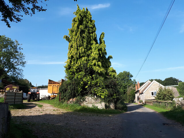
Mancoft Plantation is a scenic woodland area located in the county of Dorset, England. Covering a vast expanse, it is known for its dense and diverse forestation, making it a popular destination for nature enthusiasts and hikers alike.

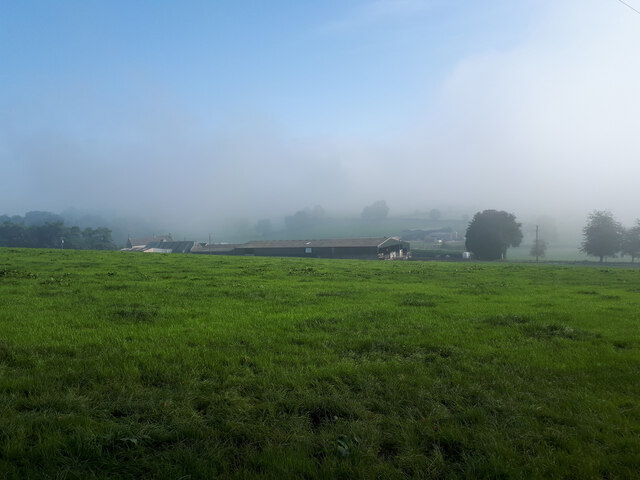
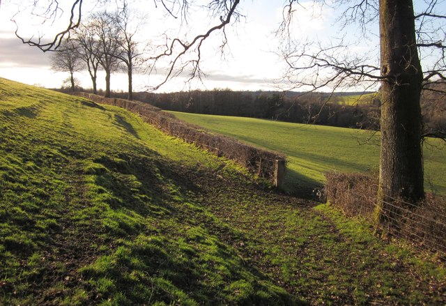
The plantation is situated in a picturesque countryside setting, with rolling hills and meandering streams adding to its natural charm. It boasts a rich variety of tree species, including oak, beech, ash, and birch, creating a lush and vibrant landscape throughout the year. The forest floor is adorned with an array of wildflowers, ferns, and mosses, providing a haven for various wildlife species.

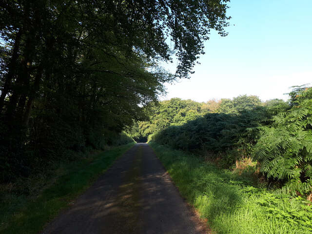
Visitors to Mancoft Plantation can explore the numerous well-maintained trails that wind through the woodland, offering a chance to immerse oneself in the beauty of nature. These paths cater to all levels of fitness, from leisurely strolls to more challenging hikes that reward with breathtaking panoramic views from elevated vantage points.

The plantation is also home to various fauna, with sightings of deer, rabbits, and squirrels being common. Birdwatchers will delight in the opportunity to spot a multitude of species, including woodpeckers, owls, and songbirds.

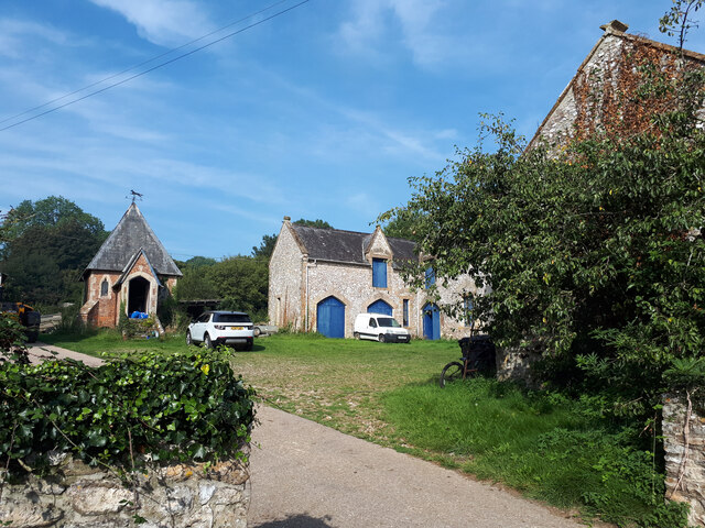
Mancoft Plantation is a cherished retreat for locals and tourists alike, offering a serene and tranquil environment away from the hustle and bustle of city life. Whether it's a peaceful walk, a family picnic, or an opportunity to reconnect with nature, this picturesque woodland provides a memorable experience for all who visit.

If you have any feedback on the listing, please let us know in the comments section below.

Mancoft Plantation Images

Images are sourced within 2km of 50.872817/-3.0279954 or Grid Reference ST2708. Thanks to Geograph Open Source API. All images are credited.

Metal Gate to a Field A metal gate into a field viewed from a minor road situated west of Chard and near Deerham's Farm in East Devon.
Metal Gate to a Field
A metal gate into a field viewed from a minor road situated west of Chard and near Deerham's Farm in East Devon.
Cyclist, country lane near Wambrook
Bend in lane Continue left for Mounter's Hill.
Bend in lane
Continue left for Mounter's Hill.
Linnington Farm
Linnington Farm
Granary and farm buildings, Wambrook Farm Grade II listed granary (on left, <span class="nowrap"><a title="https://britishlistedbuildings.co.uk/101249434-granary-at-wambrook-farm-wambrook" rel="nofollow ugc noopener" href="https://britishlistedbuildings.co.uk/101249434-granary-at-wambrook-farm-wambrook">Link</a><img style="margin-left:2px;" alt="External link" title="External link - shift click to open in new window" src="https://s1.geograph.org.uk/img/external.png" width="10" height="10"/></span> <span class="nowrap"><a title="https://historicengland.org.uk/listing/the-list/list-entry/1249434" rel="nofollow ugc noopener" href="https://historicengland.org.uk/listing/the-list/list-entry/1249434">Link</a><img style="margin-left:2px;" alt="External link" title="External link - shift click to open in new window" src="https://s1.geograph.org.uk/img/external.png" width="10" height="10"/></span> ) and Grade II listed farm buildings (<span class="nowrap"><a title="https://britishlistedbuildings.co.uk/101249482-range-of-farmbuidings-on-north-and-west-sides-of-foldyard-at-wambrook-farm-wambrook" rel="nofollow ugc noopener" href="https://britishlistedbuildings.co.uk/101249482-range-of-farmbuidings-on-north-and-west-sides-of-foldyard-at-wambrook-farm-wambrook">Link</a><img style="margin-left:2px;" alt="External link" title="External link - shift click to open in new window" src="https://s1.geograph.org.uk/img/external.png" width="10" height="10"/></span> ). The latter includes stables, a carriage house, a barn, a horse engine house and a roofless structure.
Granary and farm buildings, Wambrook Farm
Grade II listed granary (on left, LinkExternal link LinkExternal link ) and Grade II listed farm buildings (LinkExternal link ). The latter includes stables, a carriage house, a barn, a horse engine house and a roofless structure.
Weston Farm
Weston Farm
Minor road towards New Plantation
Minor road, Wambrook former Methodist Chapel in the distance See <a href="https://www.geograph.org.uk/photo/287988">ST2808 : Wambrook: Wambrook Methodist Chapel</a>.
Minor road, Wambrook former Methodist Chapel in the distance
Whitestaunton: St Andrew’s church Looking west-north-west. The cross seen by the south porch was restored after the first world war and serves to commemorate the men of the parish who died in that conflict. Incorporated into the gable of the south porch is a sundial, above a statue in a niche. Near the church the site of a Roman villa was discovered in the mid 1840s
Whitestaunton: St Andrew’s church
Looking west-north-west. The cross seen by the south porch was restored after the first world war and serves to commemorate the men of the parish who died in that conflict. Incorporated into the gable of the south porch is a sundial, above a statue in a niche. Near the church the site of a Roman villa was discovered in the mid 1840s
Church of St Andrew, Whitestaunton Another view of <a href="https://www.geograph.org.uk/photo/223373">ST2810 : Whitestaunton: St Andrew’s church</a>, which is described at <span class="nowrap"><a title="http://webapp1.somerset.gov.uk/her/details.asp?prn=56051" rel="nofollow ugc noopener" href="http://webapp1.somerset.gov.uk/her/details.asp?prn=56051">Link</a><img style="margin-left:2px;" alt="External link" title="External link - shift click to open in new window" src="https://s1.geograph.org.uk/img/external.png" width="10" height="10"/></span> .
Church of St Andrew, Whitestaunton
Another view of ST2810 : Whitestaunton: St Andrew’s church, which is described at LinkExternal link .
Churchyard, Whitestaunton With part of the village beyond. The church is shown in <a href="https://www.geograph.org.uk/photo/2829398">ST2810 : Church of St Andrew, Whitestaunton</a>.
Churchyard, Whitestaunton
With part of the village beyond. The church is shown in ST2810 : Church of St Andrew, Whitestaunton.
Footpath near Whitestaunton The path is heading towards Marsh along the southern slopes of the Lapswater Stream valley.
Footpath near Whitestaunton
The path is heading towards Marsh along the southern slopes of the Lapswater Stream valley.
Combe Lane Passing a pair of barns, the lane climbs to cross the ridge road above Combe St Nicholas. Seen from Whitestaunton Cross.
Combe Lane
Passing a pair of barns, the lane climbs to cross the ridge road above Combe St Nicholas. Seen from Whitestaunton Cross.
Whitestaunton from Great Hill footpath
Whitestaunton Manor
Whitestaunton Manor
School House at Whitestaunton Also church yard wall.
School House at Whitestaunton
Also church yard wall.
School House and Church, Whitestaunton
Manor Gardens and Church, Whitestaunton
Show me another place!

Mancoft Plantation is located at Grid Ref: ST2708 (Lat: 50.872817, Lng: -3.0279954)

Administrative County: Somerset

District: South Somerset

Police Authority: Avon and Somerset

What 3 Words

///symphonic.gross.crucially. Near Chard, Somerset

Related Wikis

Horse Pool Camp

Horse Pool Camp is a univallate Iron Age hill fort enclosure in the South Somerset district of Somerset, England. It is also known as Whitestaunton Camp...

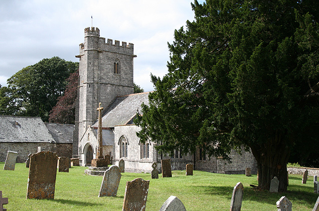
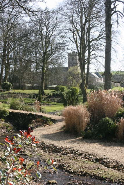
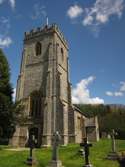
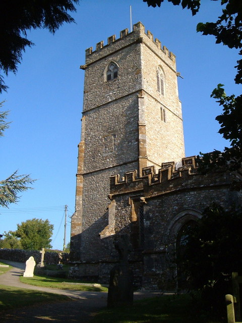
St Andrew's Church, Whitestaunton

The Church of St Andrew in Whitestaunton, Somerset, England, dates from the 13th century and has been designated as a Grade I listed building.The Perpendicular...

Whitestaunton

Whitestaunton is a village and civil parish in the South Somerset district of Somerset, England. The parish includes the hamlet of Northay. It was known...

Church of St Mary, Wambrook

The Anglican Church of St Mary in Wambrook, Somerset, England, was built in the 13th century. It is a Grade II* listed building. == History == The church...
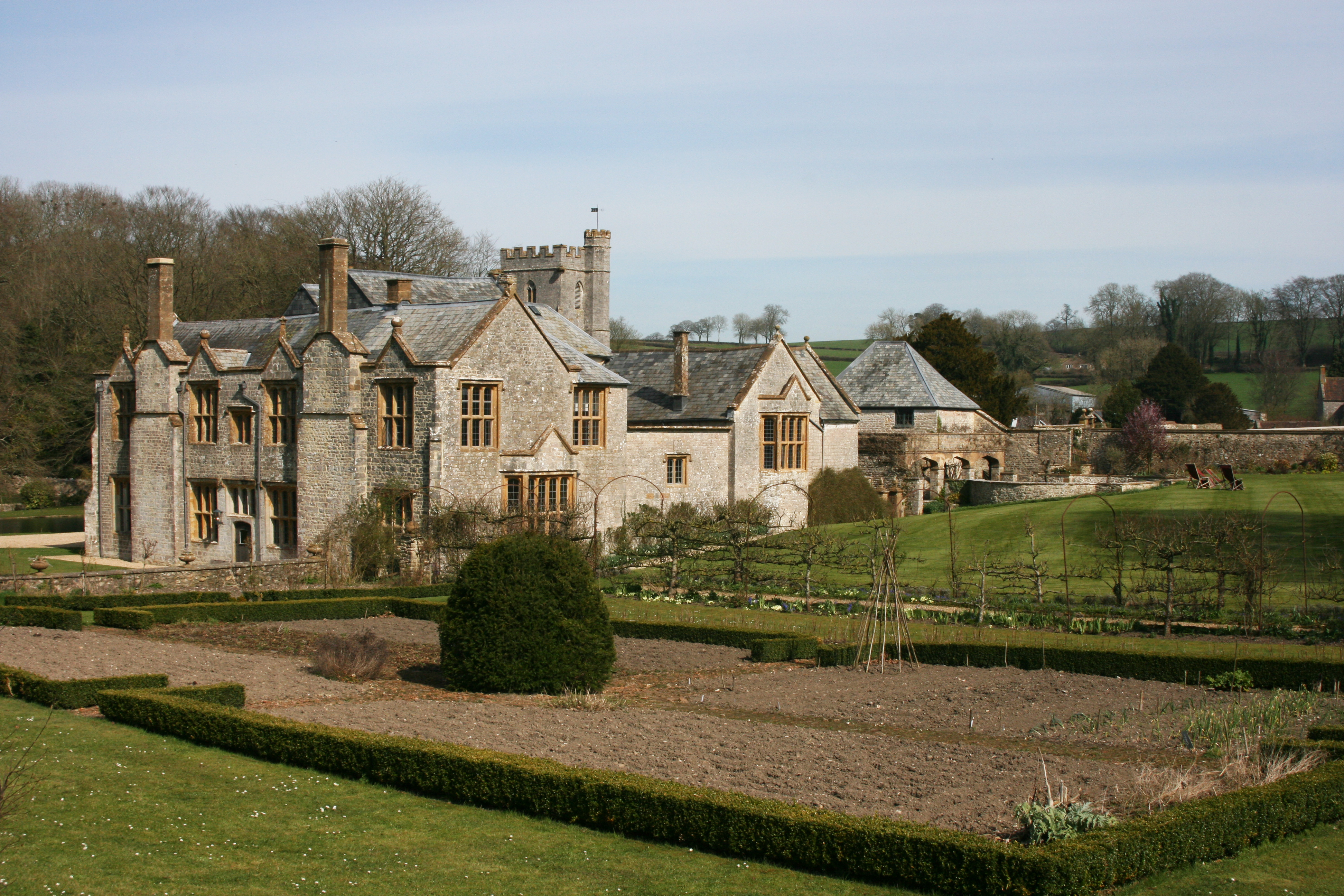
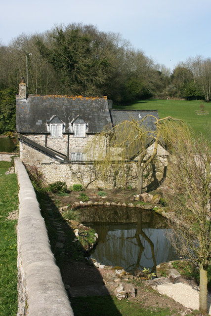
Whitestaunton Manor

Whitestaunton Manor in the village of Whitestaunton, Somerset, England was built in the 15th century as a Hall house and has been designated as a Grade...

Wambrook

Wambrook is a village and civil parish in the Blackdown Hills, Somerset, England. The village lies about 2 miles (3 km) southwest of the town of Chard...

Marsh, Devon

Marsh is a village in the Blackdown Hills, Devon, England. It is part of the East Devon district, and close to the River Yarty and border with Somerset...

Yarcombe

Yarcombe is a village and civil parish in the county of Devon, England, situated in the East Devon administrative district on the A30 road near the towns...

Nearby Amenities

Located within 500m of 50.872817,-3.0279954
Power: pole
Source: bing
Lat/Long: 50.8692846/-3.0307862
Power: pole
Source: bing
Lat/Long: 50.8700108/-3.0307802
Power: pole
Source: bing
Lat/Long: 50.8706379/-3.0311483
Power: pole
Source: bing
Lat/Long: 50.8713454/-3.0314836
Power: pole
Source: bing
Transformer: distribution
Lat/Long: 50.872306/-3.0320589
Power: pole
Source: bing
Lat/Long: 50.8730161/-3.0326477
Power: pole
Source: bing
Transformer: distribution
Lat/Long: 50.8719633/-3.0265617
Power: pole
Source: bing
Lat/Long: 50.8722849/-3.0261219
Power: pole
Source: bing
Lat/Long: 50.8727546/-3.0255009
Power: pole
Source: bing
Lat/Long: 50.87322/-3.0260628
Power: pole
Source: bing
Lat/Long: 50.8738065/-3.0266543
Power: pole
Source: bing
Lat/Long: 50.8741687/-3.0270553
Power: pole
Source: bing
Lat/Long: 50.8746367/-3.027581
Power: pole
Source: bing
Lat/Long: 50.8746908/-3.0299024
Power: pole
Source: bing
Transformer: distribution
Lat/Long: 50.8746705/-3.0289972
Power: pole
Source: bing
Lat/Long: 50.8747188/-3.0315265
Power: pole
Source: bing
Lat/Long: 50.8747391/-3.0327335
Power: pole
Source: bing
Lat/Long: 50.8739537/-3.033455
Power: pole
Source: bing
Lat/Long: 50.8747763/-3.0341443
The data included in this document is from www.openstreetmap.org. The data is made available under ODbL.

Have you been to Mancoft Plantation?

Leave your review of Mancoft Plantation below (or comments, questions and feedback).