Blawith Hall Coppice

Wood, Forest in Lancashire South Lakeland

England

Blawith Hall Coppice

Torver Goods Yard The old railway goods yard at Torver is now used by a local builder for storage.  The stone built goods shed contained a loading platform upon which was mounted a 1 ton hand operated crane manufactured by R. Kitchen ironfounders in Warrington.  The crane has subsequently been relocated to the rear of The Wilson’s Arms.  The goods shed was used as a hay barn after the railway closed but lost its roof in a fire and stood derelict for a number of years before being repaired, altered and re-roofed and brought back into use.
Torver Goods Yard Credit: Adrian Taylor

Blawith Hall Coppice is a picturesque woodland located in the county of Lancashire, England. Situated near the small village of Blawith, this woodland covers an area of approximately 50 acres and is known for its natural beauty and diverse range of flora and fauna.

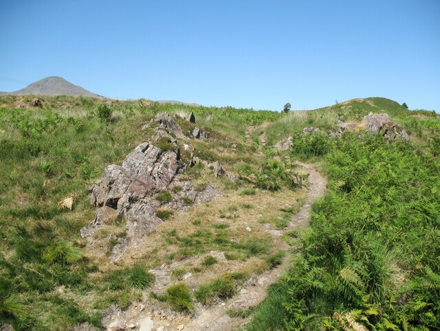
The woodland is primarily composed of native tree species such as oak, birch, and beech, creating a dense canopy that provides shelter and habitat for a variety of wildlife. It is home to several rare and protected species, including red deer, badgers, and bats, making it an important conservation area.

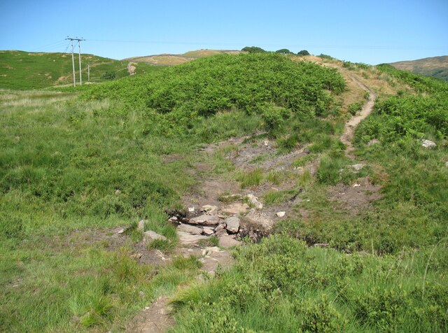
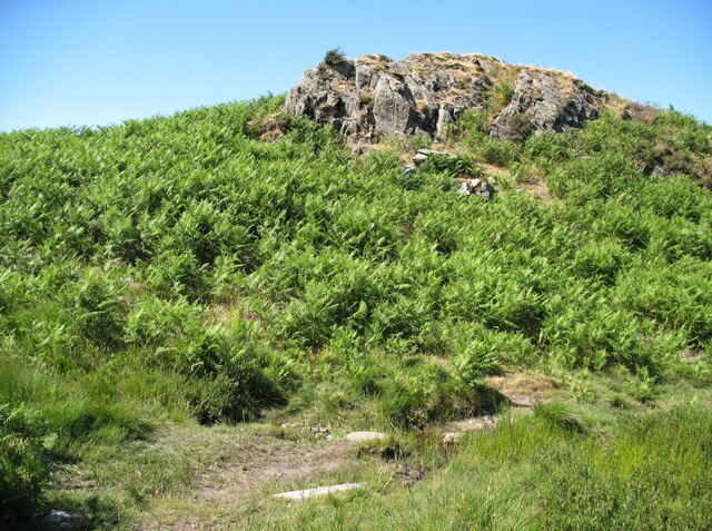
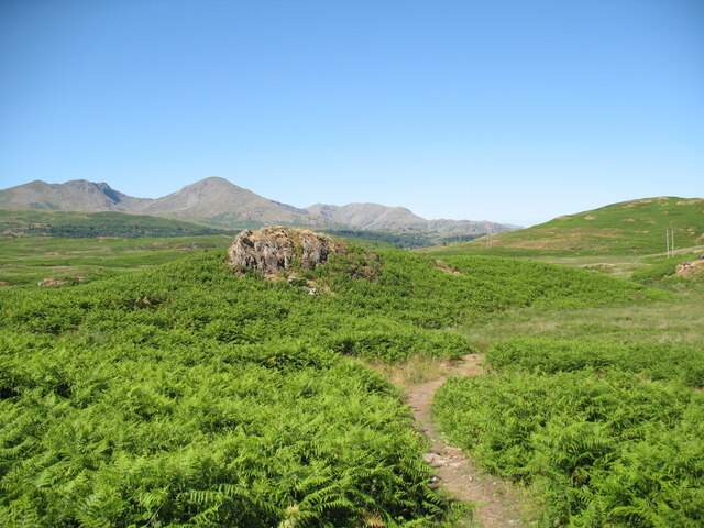
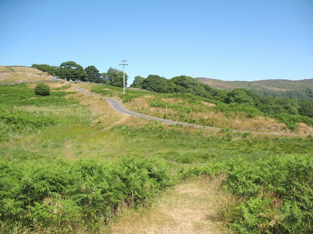
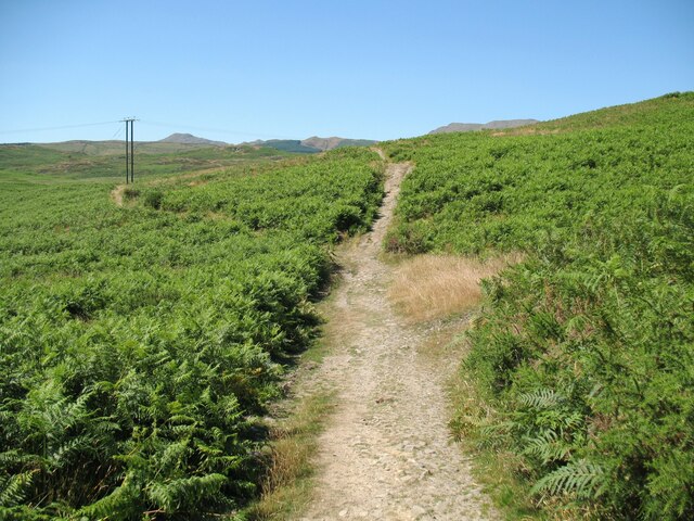
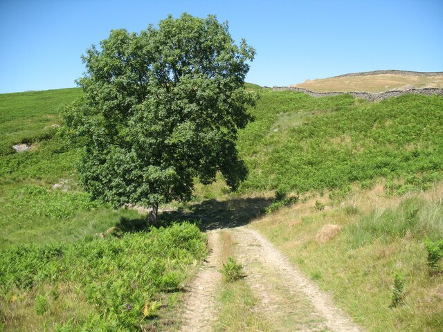
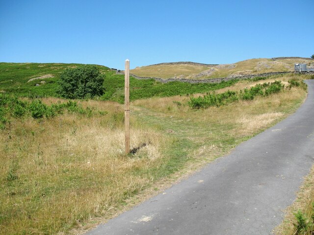
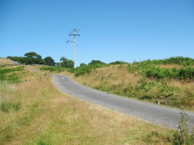
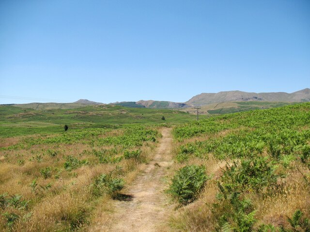
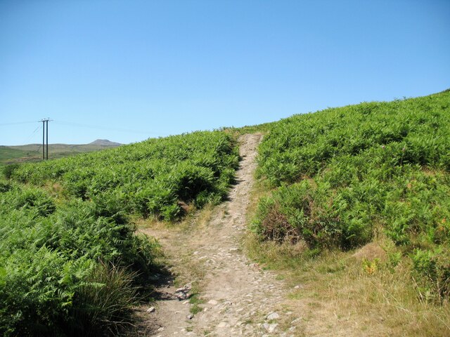
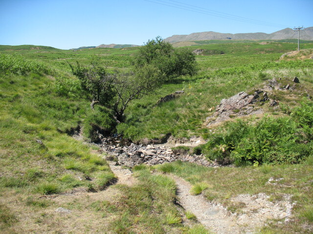
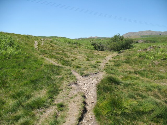
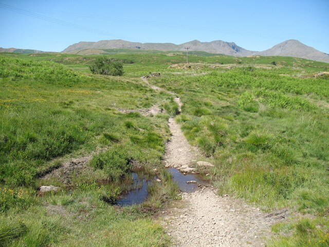
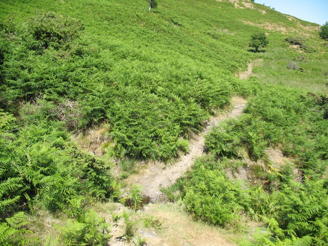
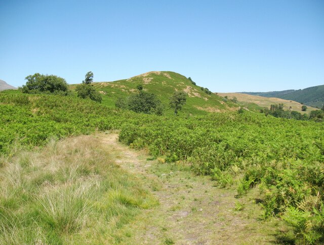
Blawith Hall Coppice offers visitors a tranquil and peaceful escape from the hustle and bustle of everyday life. The woodland is crisscrossed with a network of walking trails, allowing visitors to explore and immerse themselves in the natural surroundings. Along these trails, one can discover charming streams, small ponds, and wildflowers that add to the area's beauty.

The woodland is also known for its historical significance. Blawith Hall, a Grade II listed building dating back to the 17th century, is located nearby and adds to the charm and character of the area. Visitors can catch glimpses of the hall as they wander through the woodland.

Blawith Hall Coppice is a popular destination for nature lovers, walkers, and photographers, offering a unique opportunity to experience the beauty of Lancashire's natural landscape. Whether visitors are seeking a peaceful retreat or an adventure through the woods, this woodland provides an enchanting setting for all to enjoy.

If you have any feedback on the listing, please let us know in the comments section below.

Blawith Hall Coppice Images

Images are sourced within 2km of 54.331175/-3.1152106 or Grid Reference SD2793. Thanks to Geograph Open Source API. All images are credited.

Torver Goods Yard The old railway goods yard at Torver is now used by a local builder for storage.  The stone built goods shed contained a loading platform upon which was mounted a 1 ton hand operated crane manufactured by R. Kitchen ironfounders in Warrington.  The crane has subsequently been relocated to the rear of The Wilson’s Arms.  The goods shed was used as a hay barn after the railway closed but lost its roof in a fire and stood derelict for a number of years before being repaired, altered and re-roofed and brought back into use.
Torver Goods Yard
The old railway goods yard at Torver is now used by a local builder for storage. The stone built goods shed contained a loading platform upon which was mounted a 1 ton hand operated crane manufactured by R. Kitchen ironfounders in Warrington. The crane has subsequently been relocated to the rear of The Wilson’s Arms. The goods shed was used as a hay barn after the railway closed but lost its roof in a fire and stood derelict for a number of years before being repaired, altered and re-roofed and brought back into use.
Black Beck near Stable Harvey Moss Black Beck drains the bog of Stable Harvey Moss and the southern part of Torver Low Common and flows into Coniston Water.
The Cumbria Way long distance footpath crosses the beck by a small ford (next photograph <a href="https://www.geograph.org.uk/photo/6927171">SD2891 : The Cumbria Way near Stable Harvey</a>).
Black Beck near Stable Harvey Moss
Black Beck drains the bog of Stable Harvey Moss and the southern part of Torver Low Common and flows into Coniston Water. The Cumbria Way long distance footpath crosses the beck by a small ford (next photograph SD2891 : The Cumbria Way near Stable Harvey).
The Cumbria Way near Stable Harvey Moss The Cumbria Way, a 74 mile long distance path from Ulverston to Carlisle crosses a small boggy stream below a rocky outcrop near Stable Harvey Moss (next photograph <a href="https://www.geograph.org.uk/photo/6925738">SD2791 : Black Beck near Stable Harvey Moss</a>).
The Cumbria Way near Stable Harvey Moss
The Cumbria Way, a 74 mile long distance path from Ulverston to Carlisle crosses a small boggy stream below a rocky outcrop near Stable Harvey Moss (next photograph SD2791 : Black Beck near Stable Harvey Moss).
The Cumbria Way near Stable Harvey Moss The Cumbria Way descends the lower slopes of Beacon Fell near Stable Harvey Moss towards a rocky outcrop (next photograph <a href="https://www.geograph.org.uk/photo/6925747">SD2791 : The Cumbria Way near Stable Harvey Moss</a>).
Dow Crag, Coniston Old Man and Wetherlam are in the background.
The Cumbria Way near Stable Harvey Moss
The Cumbria Way descends the lower slopes of Beacon Fell near Stable Harvey Moss towards a rocky outcrop (next photograph SD2791 : The Cumbria Way near Stable Harvey Moss). Dow Crag, Coniston Old Man and Wetherlam are in the background.
The Cumbria Way near Stable Harvey The Cumbria Way crosses low lying undulating ground near Stable Harvey Moss as it approaches the road near Stable Harvey (next photograph <a href="https://www.geograph.org.uk/photo/6929558">SD2891 : The road to Stable Harvey</a>).
The Cumbria Way near Stable Harvey
The Cumbria Way crosses low lying undulating ground near Stable Harvey Moss as it approaches the road near Stable Harvey (next photograph SD2891 : The road to Stable Harvey).
Public bridleway near Stable Harvey Moss The bridleway runs from Stable Harvey to Mill Bridge near Torver and bears left at the path junction ahead.  It is the route of The Cumbria Way long distance footpath (next photograph <a href="https://www.geograph.org.uk/photo/6930295">SD2891 : The Cumbria Way near Stable Harvey Moss</a>).
Public bridleway near Stable Harvey Moss
The bridleway runs from Stable Harvey to Mill Bridge near Torver and bears left at the path junction ahead. It is the route of The Cumbria Way long distance footpath (next photograph SD2891 : The Cumbria Way near Stable Harvey Moss).
Ash tree near Stable Harvey Moss The path in the foreground joins a bridleway from Stable Harvey to Mill Bridge beside the tree.  Northbound walkers following The Cumbria Way long distance path continue north-west along the bridleway (next photograph <a href="https://www.geograph.org.uk/photo/6927965">SD2891 : Public bridleway near Stable Harvey Moss</a>).
The grass is dry due to a prolonged spell of fine weather.
Ash tree near Stable Harvey Moss
The path in the foreground joins a bridleway from Stable Harvey to Mill Bridge beside the tree. Northbound walkers following The Cumbria Way long distance path continue north-west along the bridleway (next photograph SD2891 : Public bridleway near Stable Harvey Moss). The grass is dry due to a prolonged spell of fine weather.
Torver Low Common near Stable Harvey The path leaves the minor road from Brown Howe to Stable Harvey.  It is signposted for The Cumbria Way long distance path which has followed the minor road northwards for approximately 60m (65 yards) and walkers following The Cumbria Way normally take this route (next photograph <a href="https://www.geograph.org.uk/photo/6927980">SD2891 : Ash tree near Stable Harvey Moss</a>).
The signpost is mis-located as the public right of way (and the official route of The Cumbria Way) leaves the road some 55m (60 yards) further to the north east towards Stable Harvey Farm.  The land here is Access Land so no trespass is incurred.
The grass is parched due to a prolonged period of dry weather.
Torver Low Common near Stable Harvey
The path leaves the minor road from Brown Howe to Stable Harvey. It is signposted for The Cumbria Way long distance path which has followed the minor road northwards for approximately 60m (65 yards) and walkers following The Cumbria Way normally take this route (next photograph SD2891 : Ash tree near Stable Harvey Moss). The signpost is mis-located as the public right of way (and the official route of The Cumbria Way) leaves the road some 55m (60 yards) further to the north east towards Stable Harvey Farm. The land here is Access Land so no trespass is incurred. The grass is parched due to a prolonged period of dry weather.
The road to Stable Harvey Stable Harvey is a farm and is the only property served by a minor road from the A5084 near Brown Howe.
The Cumbria Way long distance path joins the road on Torver Low Common near Black Beck (next photograph <a href="https://www.geograph.org.uk/photo/6928292">SD2891 : Torver Low Common near Stable Harvey</a>).
The grass is parched after a prolonged period of dry weather.
The road to Stable Harvey
Stable Harvey is a farm and is the only property served by a minor road from the A5084 near Brown Howe. The Cumbria Way long distance path joins the road on Torver Low Common near Black Beck (next photograph SD2891 : Torver Low Common near Stable Harvey). The grass is parched after a prolonged period of dry weather.
Path on Tottle Bank Crossing the open ground of Torver Low Common below Tottle Bank, this path is an alternative route for The Cumbria Way, a 74 mile long distance trail between Ulverston and Carlisle (next photograph <a href="https://www.geograph.org.uk/photo/6938645">SD2892 : Bridleway, Tottle Bank</a>).
The grass is dry after a long period of dry weather.
Path on Tottle Bank
Crossing the open ground of Torver Low Common below Tottle Bank, this path is an alternative route for The Cumbria Way, a 74 mile long distance trail between Ulverston and Carlisle (next photograph SD2892 : Bridleway, Tottle Bank). The grass is dry after a long period of dry weather.
The Cumbria Way near Stable Harvey Moss The Cumbria Way long distance path follows a public bridleway from near Stable Harvey to Mere Beck on Torver Low Common.  The bridleway makes a turn to the left near Stable Harvey Moss and a path continues straight ahead which is an alternative route for walkers following The Cumbria Way (next photograph <a href="https://www.geograph.org.uk/photo/6930288">SD2891 : Path on Tottle Bank</a>).
The Cumbria Way near Stable Harvey Moss
The Cumbria Way long distance path follows a public bridleway from near Stable Harvey to Mere Beck on Torver Low Common. The bridleway makes a turn to the left near Stable Harvey Moss and a path continues straight ahead which is an alternative route for walkers following The Cumbria Way (next photograph SD2891 : Path on Tottle Bank).
The Cumbria Way near Mere Beck The Cumbria Way long distance path climbs away from the ford across Mere Beck over some rocky ground (next photograph <a href="https://www.geograph.org.uk/photo/6938191">SD2892 : The Cumbria Way, Torver Low Common</a>).
The Cumbria Way near Mere Beck
The Cumbria Way long distance path climbs away from the ford across Mere Beck over some rocky ground (next photograph SD2892 : The Cumbria Way, Torver Low Common).
Ford across Mere Beck A public footpath crosses Mere Beck by a stony ford between Tottle Bank and Anne Riggs on Torver Low Common.  It is the route of The Cumbria Way, a long distance trail from Ulverston to Carlisle (next photograph <a href="https://www.geograph.org.uk/photo/6931224">SD2892 : The Cumbria Way near Mere Beck</a>).
Ford across Mere Beck
A public footpath crosses Mere Beck by a stony ford between Tottle Bank and Anne Riggs on Torver Low Common. It is the route of The Cumbria Way, a long distance trail from Ulverston to Carlisle (next photograph SD2892 : The Cumbria Way near Mere Beck).
The Cumbria Way near Mere Beck The Cumbria Way follows a well-defined path across Torver Low Common, diverging right approaching Mere Beck (next photograph <a href="https://www.geograph.org.uk/photo/6931244">SD2892 : Ford across Mere Beck</a>).
The Cumbria Way near Mere Beck
The Cumbria Way follows a well-defined path across Torver Low Common, diverging right approaching Mere Beck (next photograph SD2892 : Ford across Mere Beck).
Torver The road here passing in front of the cottages and The Wilson Arms was originally the A593 road until it was realigned between a point near Torver Station and Dalton Road Gates level crossing, taking advantage of the alignment of the former railway.
Torver
The road here passing in front of the cottages and The Wilson Arms was originally the A593 road until it was realigned between a point near Torver Station and Dalton Road Gates level crossing, taking advantage of the alignment of the former railway.
Ford on Torver Low Common This small ford crosses a tributary of Mere Beck on Torver Low Common.
Although not on the public bridleway, this path is a shortcut that has become an alternative route normally taken by walkers following The Cumbria Way long distance path (next photograph <a href="https://www.geograph.org.uk/photo/6931254">SD2892 : The Cumbria Way near Mere Beck</a>).  The bridleway and the official route of The Cumbria Way cross the same beck by the original ford 20m (21 yards) to the north east.
Ford on Torver Low Common
This small ford crosses a tributary of Mere Beck on Torver Low Common. Although not on the public bridleway, this path is a shortcut that has become an alternative route normally taken by walkers following The Cumbria Way long distance path (next photograph SD2892 : The Cumbria Way near Mere Beck). The bridleway and the official route of The Cumbria Way cross the same beck by the original ford 20m (21 yards) to the north east.
Ford on Throng Moss Beck The path from Mere Beck on Torver Low Common to Delicars crosses Throng Moss Beck by a small ford below the slopes of Anne Riggs.
This is the route of The Cumbria Way, a 74 mile long distance path between Ulverston and Carlisle (next photograph <a href="https://www.geograph.org.uk/photo/6939323">SD2892 : The Cumbria Way near Anne Riggs</a>).
There is little water in the ford after a prolonged period of dry weather.
Ford on Throng Moss Beck
The path from Mere Beck on Torver Low Common to Delicars crosses Throng Moss Beck by a small ford below the slopes of Anne Riggs. This is the route of The Cumbria Way, a 74 mile long distance path between Ulverston and Carlisle (next photograph SD2892 : The Cumbria Way near Anne Riggs). There is little water in the ford after a prolonged period of dry weather.
The Cumbria Way, Torver Low Common The Cumbria Way follows a well-defined path on Torver Low Common (next photograph <a href="https://www.geograph.org.uk/photo/6938183">SD2892 : Ford on Throng Moss Beck</a>).
The small fell in the background is Anne Riggs.
The Cumbria Way, Torver Low Common
The Cumbria Way follows a well-defined path on Torver Low Common (next photograph SD2892 : Ford on Throng Moss Beck). The small fell in the background is Anne Riggs.
Show me another place!

Blawith Hall Coppice is located at Grid Ref: SD2793 (Lat: 54.331175, Lng: -3.1152106)

Administrative County: Cumbria

District: South Lakeland

Police Authority: Cumbria

What 3 Words

///decks.asked.kneeled. Near Windermere, Cumbria

Related Wikis

Torver

Torver is a village and civil parish in the South Lakeland district of Cumbria, England, 3 miles (4.8 km) south west of the village of Coniston and 1 mile...

St Luke's Church, Torver

St Luke's Church is in the village of Torver, Cumbria, England. It is an active Anglican parish church in the deanery of Furness, the archdeaconry of...

Torver railway station

Torver railway station served the village of Torver, in Lancashire, England (now in Cumbria). It was on the branch line to Coniston. == History == Authorised...

Kelly Hall Tarn

Kelly Hall Tarn is a pool in Cumbria, England, to the west of Coniston Water. It is located about one km south-south-east of the village of Torver, on...

Peel Island, Cumbria

Peel Island (formerly known as Montague Island or the Gridiron) is one of the three islands of Coniston Water in the English Lake District, Cumbria. The...

Bowmanstead

Bowmanstead is a village in Cumbria, England. It is situated 1 mile to the south of Coniston and contains a Catholic church and a pub - The Ship Inn, it...

Beacon Fell, Cumbria

Beacon Fell is a fell in the southern Lake District of England with an altitude of 836 feet (255 m). It is the subject of a chapter of Wainwright's book...

Brown Pike

Brown Pike is a fell located in the Lake District National Park in Cumbria, England. Brown Pike is near the village of Coniston, and is most commonly approached...

Nearby Amenities

Located within 500m of 54.331175,-3.1152106
Brocklebank Ground Holiday Cottages
Addr City: Torver
Addr Housename: Barn House Cottages
Addr Postcode: LA21 8BS
Phone: +44 15394 49588
Tourism: guest_house
Website: brocklebankground.com
Lat/Long: 54.3353772/-3.1143074
Brocklebank Ground
Place: locality
Lat/Long: 54.3349822/-3.1148414
Southstead
Place: locality
Lat/Long: 54.3326178/-3.1168097
Tower Brow
Place: locality
Lat/Long: 54.3316874/-3.1082898
Barrier: stile
Lat/Long: 54.3300873/-3.1096985
Barrier: stile
Lat/Long: 54.3338611/-3.1114215
Barrier: stile
Lat/Long: 54.3331542/-3.1105417
Ford: yes
Lat/Long: 54.3273679/-3.1152626
Ford: yes
Lat/Long: 54.3277698/-3.1141321
Ford: yes
Lat/Long: 54.3301489/-3.1096986
Power: pole
Lat/Long: 54.3340184/-3.1117918
Power: pole
Lat/Long: 54.3342523/-3.1121398
Power: pole
Lat/Long: 54.3320431/-3.1171478
Power: pole
Lat/Long: 54.331784/-3.1169905
Power: pole
Lat/Long: 54.3315708/-3.1168666
Power: pole
Lat/Long: 54.3290563/-3.1218363
Power: pole
Lat/Long: 54.3296055/-3.120305
Power: pole
Lat/Long: 54.3300222/-3.1191878
Power: pole
Lat/Long: 54.3307323/-3.1178481
Power: pole
Lat/Long: 54.3313109/-3.1167195
Power: pole
Lat/Long: 54.3320144/-3.1153295
Power: pole
Lat/Long: 54.3327255/-3.113959
Material: wood
Power: pole
Lat/Long: 54.3334148/-3.1133906
Material: wood
Power: pole
Lat/Long: 54.3345083/-3.1125007
Power: pole
Lat/Long: 54.3350622/-3.1120477
Power: pole
Lat/Long: 54.3331687/-3.1094878
Power: pole
Lat/Long: 54.3330532/-3.1106188
Power: pole
Lat/Long: 54.3328988/-3.1122399
The data included in this document is from www.openstreetmap.org. The data is made available under ODbL.

Have you been to Blawith Hall Coppice?

Leave your review of Blawith Hall Coppice below (or comments, questions and feedback).