Clophill

Settlement in Bedfordshire

England

Clophill

The Stone Jug public house, Clophill
The Stone Jug public house, Clophill Credit: Mark Anderson

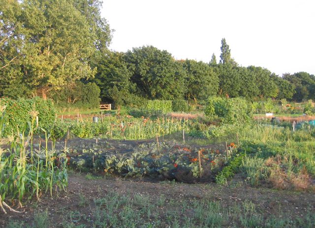
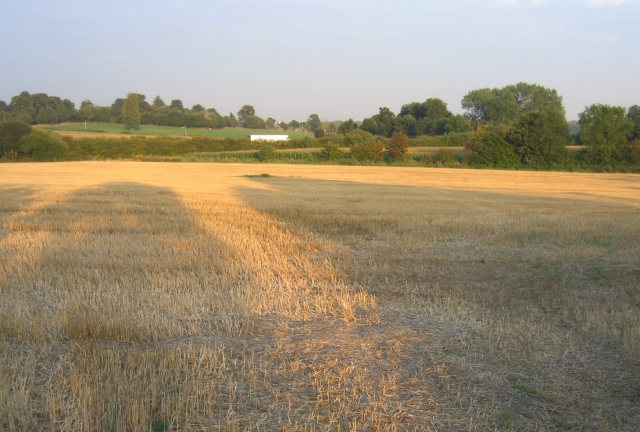
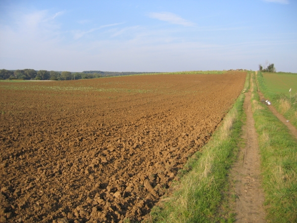
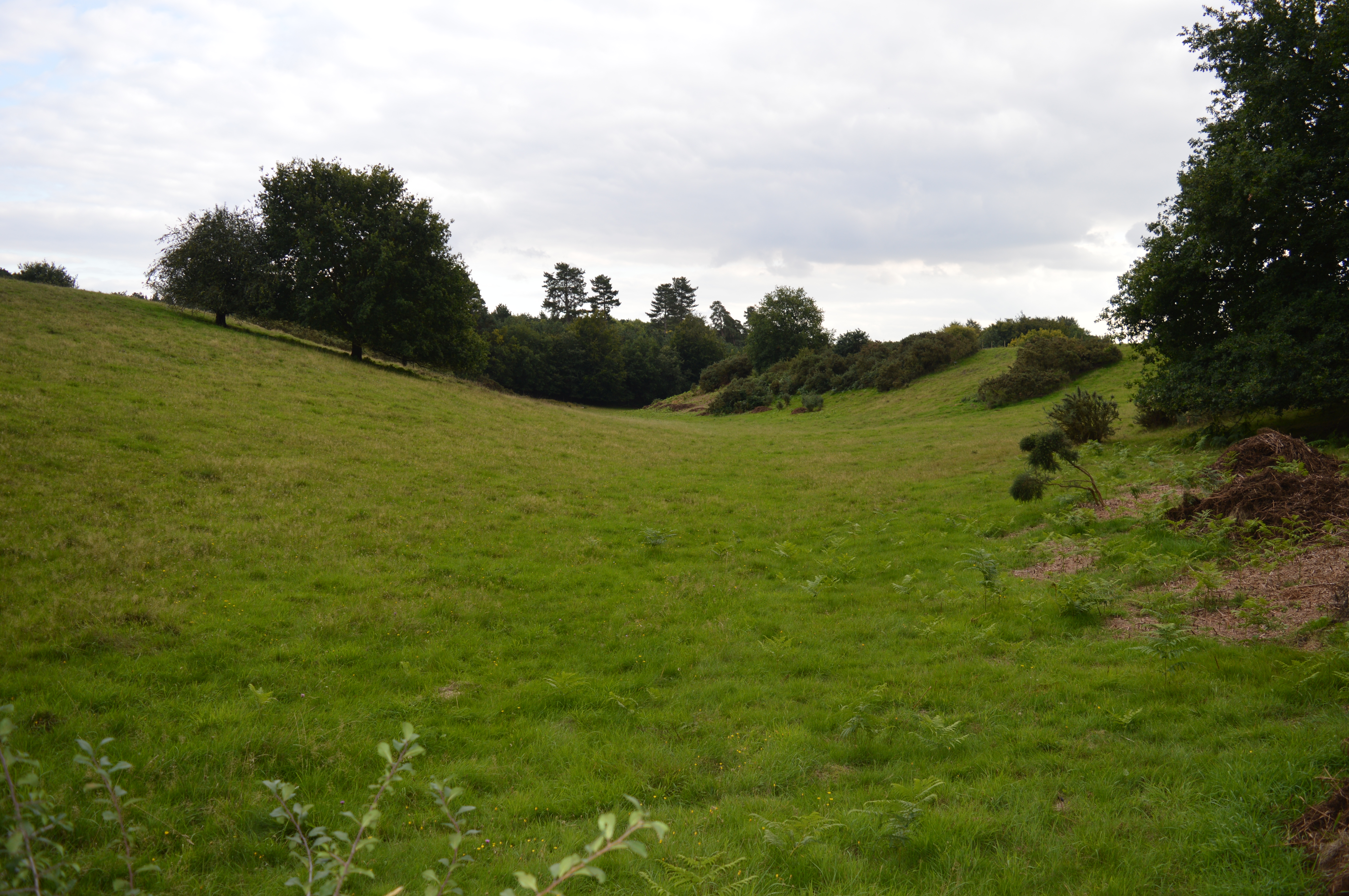
Clophill is a small village located in the county of Bedfordshire, England. Situated approximately 8 miles south-west of Bedford, it has a population of around 1,900 residents. The village is nestled in the beautiful Bedfordshire countryside, surrounded by rolling hills and farmland.

Historically, Clophill has ancient roots, with evidence of human habitation dating back to the Bronze Age. The village played a significant role during the English Civil War, as it was the site of a skirmish between Parliamentary and Royalist forces in 1648.

One of Clophill's notable landmarks is St Mary's Church, a Grade II* listed building. This 14th-century church is renowned for its unique octagonal tower and beautiful stained glass windows. The churchyard is also home to the famous Clophill Ghost, a local legend that attracts paranormal enthusiasts.

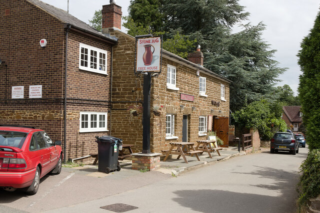
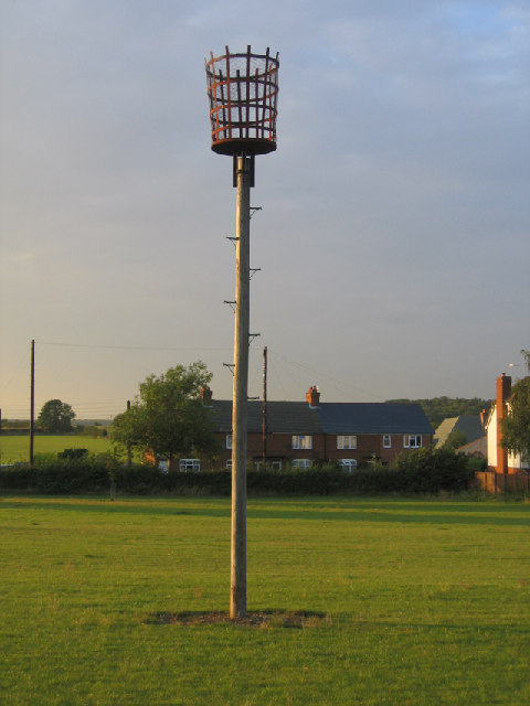
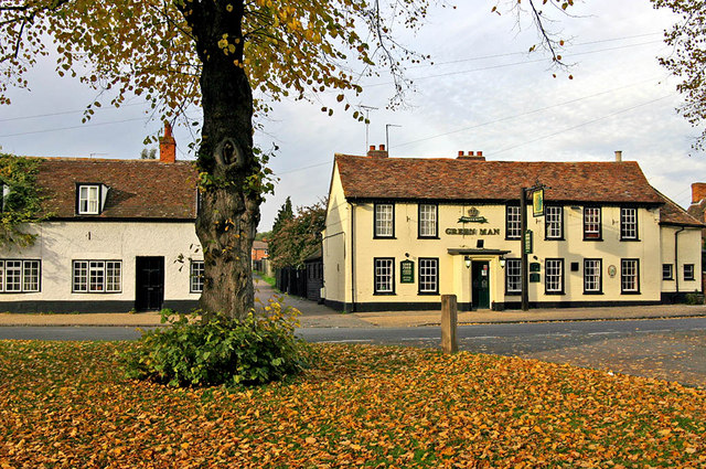
The village offers a range of amenities, including a primary school, village hall, and a handful of small shops and businesses. There is also a recreation ground with sports facilities, providing opportunities for outdoor activities.

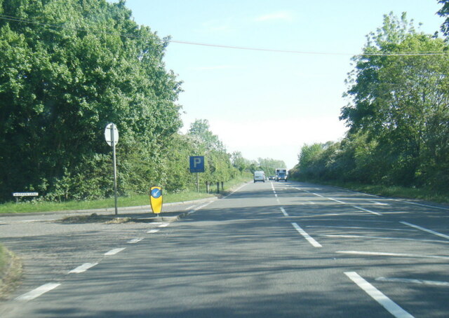
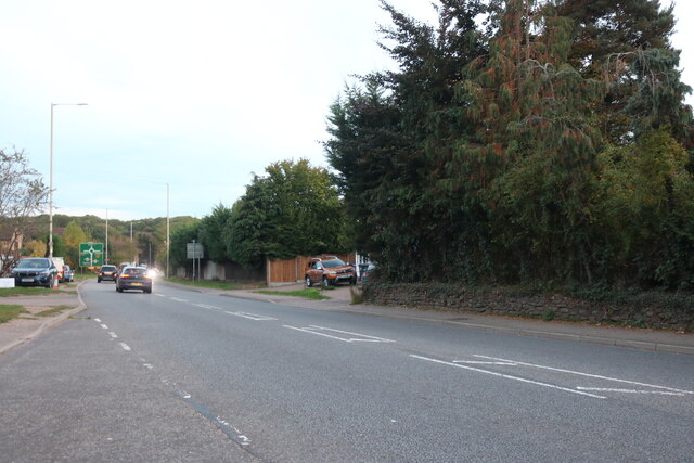
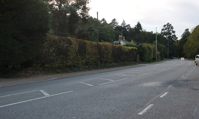
Clophill benefits from its proximity to major transport links, with the A6 road passing through the village, connecting it to nearby towns and cities. The village is well-connected by public transport, with regular bus services to Bedford and surrounding areas.

With its picturesque surroundings, rich history, and close-knit community, Clophill offers a peaceful and idyllic place to live, attracting residents who value a rural lifestyle within easy reach of urban amenities.

If you have any feedback on the listing, please let us know in the comments section below.
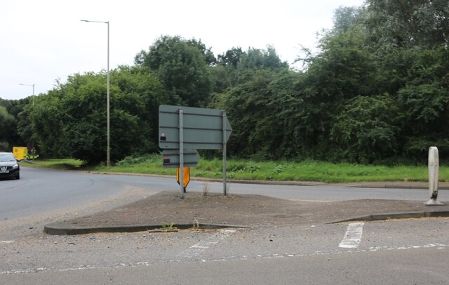
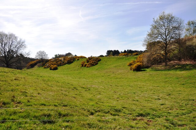
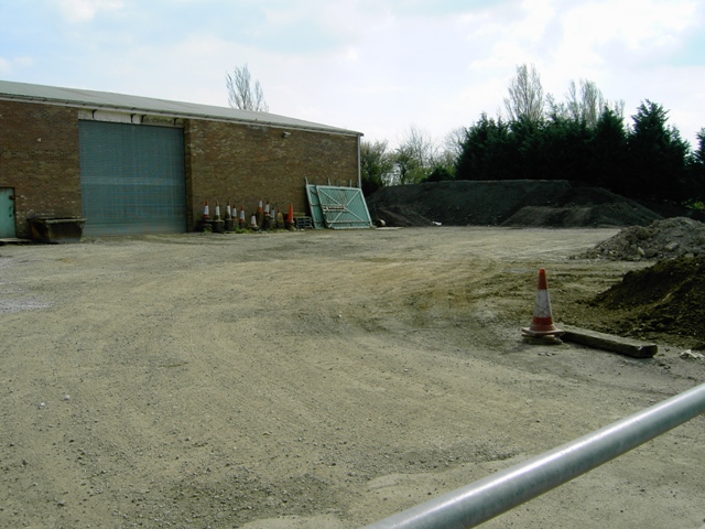
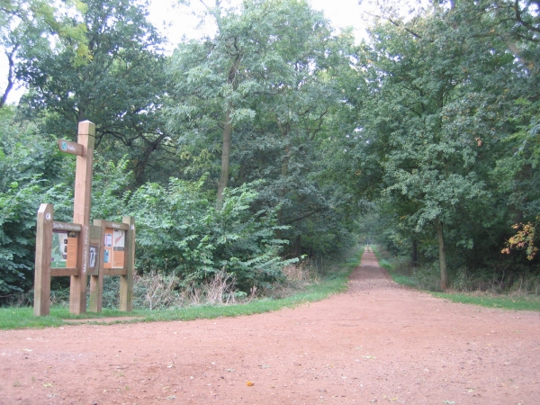
Clophill Images

Images are sourced within 2km of 52.02934/-0.418314 or Grid Reference TL0837. Thanks to Geograph Open Source API. All images are credited.

The Stone Jug public house, Clophill
Roundabout on the A507, Clophill
Gorse bushes in flower Gorse bushes in flower in the 'hidden valley' near Maulden Wood.
Gorse bushes in flower
Gorse bushes in flower in the 'hidden valley' near Maulden Wood.
Path in Maulden Wood A path going south from the A6 entrance to Maulden Wood.
Path in Maulden Wood
A path going south from the A6 entrance to Maulden Wood.
A6 southbound on Deadman's Hill
A6 southbound at Warren Lane
Bedford Road, Clophill
Cainhoe Manor Farm, Gravenhurst, Beds – entrance to the farmyard from Clophill Road.
Cainhoe Manor Farm, Gravenhurst, Beds
– entrance to the farmyard from Clophill Road.
Road towards Beadlow
Depot next to Beadlow
Quarry entrance
Quarry entrance
Disused farmland
Disused farmland
Millennium Beacon, Silsoe, Beds Erected in 2000 on the Millennium Green at the northern end of the village of Silsoe.
Millennium Beacon, Silsoe, Beds
Erected in 2000 on the Millennium Green at the northern end of the village of Silsoe.
Allotments, Silsoe, Beds. The village allotments are in the very south-west corner of the square, adjacent to the Millennium Green.
Allotments, Silsoe, Beds.
The village allotments are in the very south-west corner of the square, adjacent to the Millennium Green.
Hidden by-pass, Silsoe, Beds The A6 Silsoe by-pass is largely hidden by hedges to the north of the village; view from the old A6 of a passing lorry, with low evening sunlight casting long shadows.
Hidden by-pass, Silsoe, Beds
The A6 Silsoe by-pass is largely hidden by hedges to the north of the village; view from the old A6 of a passing lorry, with low evening sunlight casting long shadows.
Warren Lane, Clophill, Beds View of a maize field from Warren Lane north towards Warren Wood (partly in TL0837); the undulating land has sandy soils, as indicated by the name Warren.
Warren Lane, Clophill, Beds
View of a maize field from Warren Lane north towards Warren Wood (partly in TL0837); the undulating land has sandy soils, as indicated by the name Warren.
Farmland NW of Silsoe, Beds View NE from near the Ampthill Road.
Farmland NW of Silsoe, Beds
View NE from near the Ampthill Road.
Show me another place!

Clophill is located at Grid Ref: TL0837 (Lat: 52.02934, Lng: -0.418314)

Unitary Authority: Central Bedfordshire

Police Authority: Bedfordshire

What 3 Words

///handrail.froze.cracking. Near Clophill, Bedfordshire

Nearby Locations

Warren Wood Clophill

Related Wikis

Clophill

Clophill is a village and civil parish clustered on the north bank of the River Flit, Bedfordshire, England. It is recorded in the Domesday Book of 1086...

St Mary's Church, Clophill

The present St Mary's Church is located in the centre of the small village of Clophill, between Bedford and Luton in the South Midlands of England. The...

Cainhoe Castle

Cainhoe Castle was an 11th-century Norman castle, located near the village of Clophill, in the county of Bedfordshire, England. Cainhoe Castle was a motte...

Maulden Heath

Maulden Heath is a 7.6-hectare (19-acre) Site of Special Scientific Interest in Maulden in Bedfordshire. It was notified in 1986 under Section 28 of the...

Beadlow Priory

Beadlow Priory was a monastic foundation established between 1140 and 1146 by Robert D'Albini for a community of Benedictine monks. == History == Around...

Maulden Wood

Maulden Wood is a woodland situated in Bedfordshire, England, near the village of Maulden, on the greensand ridge that stretches from Leighton Buzzard...

Woburn Sands Formation

The Woburn Sands Formation is a geological formation in England. Part of the Lower Greensand Group, it is the only unit of the group where it occurs, and...

Haynes, Bedfordshire

Haynes is a village and civil parish in Bedfordshire, England, about seven miles (11 km) south of Bedford. It includes the small hamlet of Haynes Church...

Nearby Amenities

Located within 500m of 52.02934,-0.418314
Clophill
Place: village
Wikidata: Q1520109
Lat/Long: 52.0282641/-0.4233947
Turning Circle
Turning Circle: hammer
Lat/Long: 52.0292645/-0.423752
Turning Circle
Turning Circle: knuckle
Lat/Long: 52.0297116/-0.4208829
Turning Circle
Turning Circle: hammer
Lat/Long: 52.0285392/-0.4229833
Turning Circle
Turning Circle: hammer
Lat/Long: 52.0299807/-0.4215071
Leisure: playground
Lat/Long: 52.0314145/-0.4193076
Bench
Lat/Long: 52.0270719/-0.424208
Bench
Lat/Long: 52.0267351/-0.4235992
Addr Housename: Groom's Hairdresser's
Addr Housenumber: 1a
Addr Street: The High Street
Building: retail
Lat/Long: 52.0274004/-0.4236285
Pub
The Stone Jug
Addr City: Clophill
Addr Country: GB
Addr Housenumber: 10
Addr Postcode: MK45 4BY
Addr Street: Back Street
Fhrs Authority: Central Bedfordshire
Fhrs Id: 450201
Fhrs Local Authority Id: 1495
Lat/Long: 52.0306852/-0.4228817
Post Box
Collection Times: Mo-Fr 17:00; Sa 12:15
Operator: Royal Mail
Post Box Type: lamp
Ref: MK45 142
Royal Cypher: EIIR
Royal Cypher Wikidata: Q33102113
Source: survey
Survey Date: 2016-12-12
Lat/Long: 52.0269741/-0.4235201
Post Box
Collection Times: Mo-Fr 09:00; Sa 07:00
Operator: Royal Mail
Post Box Type: lamp
Ref: MK45 178D
Royal Cypher: EIIR
Royal Cypher Wikidata: Q33102113
Source: survey
Survey Date: 2016-12-12
Lat/Long: 52.0298657/-0.4170672
Post Box
Collection Times: Mo-Fr 09:00; Sa 07:00
Operator: Royal Mail
Post Box Type: lamp
Ref: MK45 275D
Royal Cypher: EIIR
Royal Cypher Wikidata: Q33102113
Source: survey
Survey Date: 2016-12-12
Lat/Long: 52.030681/-0.4218485
Addr City: Clophill
Addr Housenumber: 35
Addr Postcode: MK45 4AG
Addr Street: Readshill
Lat/Long: 52.0283723/-0.4244363
Bus Stop
Bus: yes
Naptan AtcoCode: 021021000
Naptan NaptanCode: ahlagmjd
Public Transport: platform
Shelter: no
Lat/Long: 52.027157/-0.4242442
Direction: 145
Generator Method: photovoltaic
Generator Output Electricity: yes
Generator Solar Modules: 16
Generator Source: solar
Generator Type: solar_photovoltaic_panel
Location: roof
Power: generator
Lat/Long: 52.0289866/-0.4207886
Turning Circle
Turning Circle: knuckle
Lat/Long: 52.0289252/-0.4174322
Direction: 150
Generator Method: photovoltaic
Generator Output Electricity: yes
Generator Solar Modules: 16
Generator Source: solar
Generator Type: solar_photovoltaic_panel
Location: roof
Power: generator
Lat/Long: 52.0305175/-0.4162646
Direction: 165
Generator Method: photovoltaic
Generator Output Electricity: yes
Generator Solar Modules: 16
Generator Source: solar
Generator Type: solar_photovoltaic_panel
Location: roof
Power: generator
Lat/Long: 52.0310375/-0.412684
Direction: 170
Generator Method: photovoltaic
Generator Output Electricity: yes
Generator Solar Modules: 16
Generator Source: solar
Generator Type: solar_photovoltaic_panel
Location: roof
Power: generator
Lat/Long: 52.0323698/-0.4132069
Direction: 250
Generator Method: photovoltaic
Generator Output Electricity: yes
Generator Solar Modules: 16
Generator Source: solar
Generator Type: solar_photovoltaic_panel
Location: roof
Power: generator
Lat/Long: 52.0327295/-0.4189384
Direction: 225
Generator Method: photovoltaic
Generator Output Electricity: yes
Generator Solar Modules: 7
Generator Source: solar
Generator Type: solar_photovoltaic_panel
Location: roof
Power: generator
Lat/Long: 52.0315352/-0.4203467
Direction: 135
Generator Method: photovoltaic
Generator Output Electricity: yes
Generator Solar Modules: 7
Generator Source: solar
Generator Type: solar_photovoltaic_panel
Location: roof
Power: generator
Lat/Long: 52.031555/-0.4204267
Direction: 155
Generator Method: photovoltaic
Generator Output Electricity: yes
Generator Solar Modules: 8
Generator Source: solar
Generator Type: solar_photovoltaic_panel
Location: roof
Power: generator
Lat/Long: 52.0301214/-0.4216057
Fixme: solar panels?
Lat/Long: 52.0303959/-0.4234949
Direction: 145
Generator Method: photovoltaic
Generator Output Electricity: yes
Generator Solar Modules: 16
Generator Source: solar
Generator Type: solar_photovoltaic_panel
Location: roof
Power: generator
Lat/Long: 52.0283678/-0.4229433
Place Of Worship
Methodist Chapel
Denomination: methodist
Religion: christian
Lat/Long: 52.02961/-0.4182436
Bus Stop
Bus: yes
Naptan AtcoCode: 021021001
Naptan NaptanCode: ahlagmjg
Public Transport: platform
Lat/Long: 52.0269205/-0.423989
Historic: memorial
Memorial: war_memorial
Lat/Long: 52.0313988/-0.4123937
HE Ref: 1137830
Heritage: 2
Historic: pound
Listed Status: Grade II
Wikimedia Commons: File:Greensand Cycleway Lock up and pound, Clophill, Bedfordshire.jpg
Lat/Long: 52.0270612/-0.4238686
The data included in this document is from www.openstreetmap.org. The data is made available under ODbL.

Have you been to Clophill?

Leave your review of Clophill below (or comments, questions and feedback).