Clive Vale

Settlement in Sussex Hastings

England

Clive Vale

Beach Hastings has the largest beach-based fishing fleet in England.

A harbour began construction in the late 1800's but funding ran out. The harbour arm was partially blown up during World War II to prevent the enemy using it, and so the boats have continued using the beach.

Around fifteen wooden and steel boats still fish and are moored on Harbour Beach to the East of the Harbour Arm. They are pushed into and pulled out of the water by bulldozers and winches. This would once have been done by horse walking around a circular winch.

The fleets future is constantly under threat due to increasing quota pressures.
Beach Credit: Oast House Archive

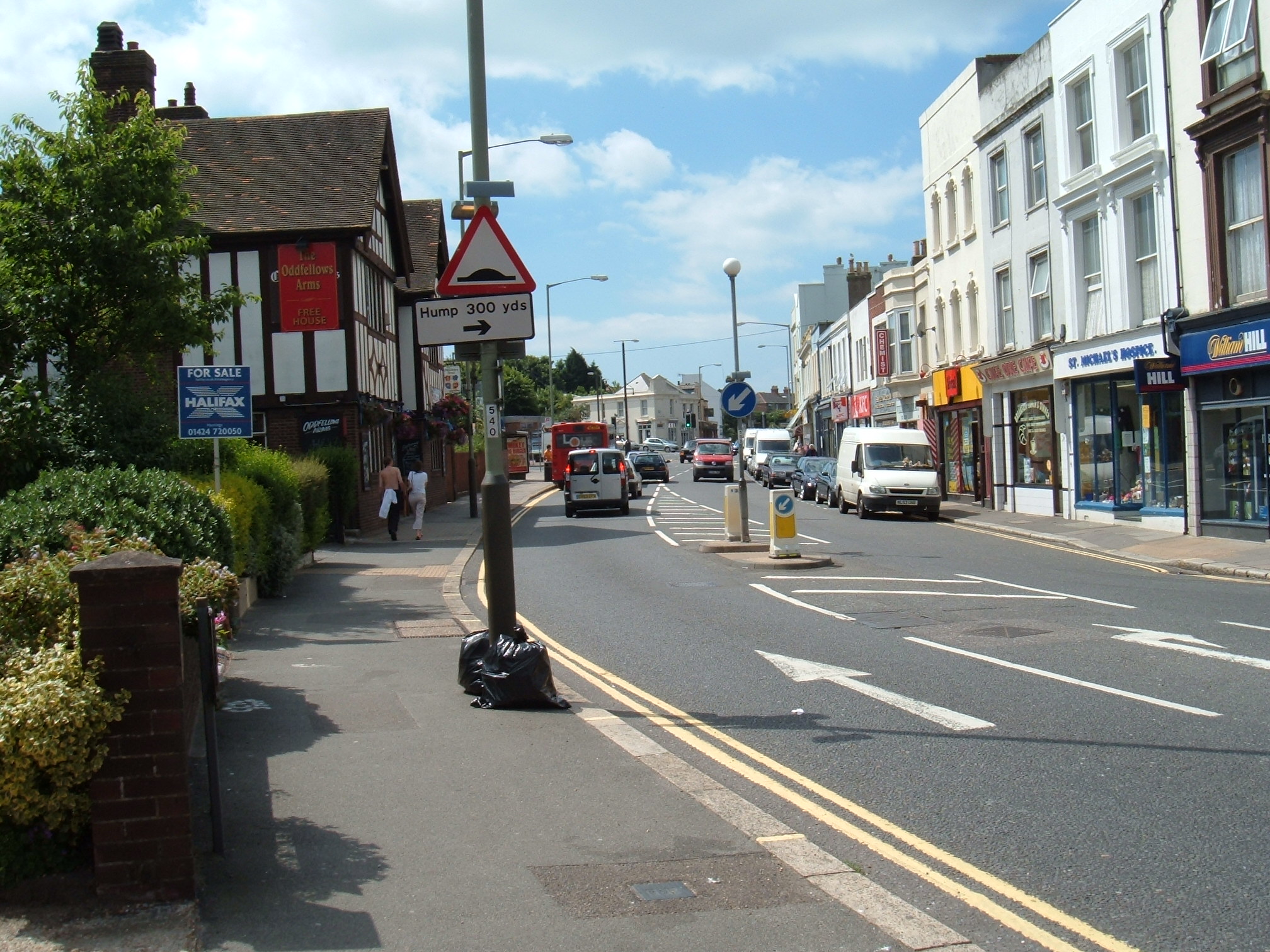
Clive Vale is a charming residential area located in the town of Hastings, East Sussex, England. Situated on the eastern outskirts of the town, it offers a peaceful and attractive living environment for its residents. The area is nestled between the scenic Hastings Country Park and the bustling Hastings town center.

Characterized by its tree-lined streets, Clive Vale is primarily a residential neighborhood, with a mix of period homes and more modern properties. The houses are typically well-maintained, and many retain their original architectural features, adding to the area's charm. The neighborhood is known for its sense of community, with friendly neighbors often engaging in local events and activities.

Clive Vale benefits from its proximity to various amenities. Within a short distance, residents can find schools, shops, and leisure facilities, ensuring convenient access to everyday necessities. The nearby Hastings Country Park offers stunning views of the coastline and a variety of walking trails, attracting both locals and visitors alike.

Transport links in Clive Vale are excellent, with regular bus services connecting the area to Hastings town center and other neighboring towns. The train station is easily accessible, providing convenient access to London and other major cities.

Overall, Clive Vale is a delightful place to live, offering a peaceful and picturesque setting with a strong sense of community. Its location, amenities, and natural beauty make it an attractive choice for residents seeking a balanced lifestyle in the heart of Sussex.

If you have any feedback on the listing, please let us know in the comments section below.

Clive Vale Images

Images are sourced within 2km of 50.867764/0.611148 or Grid Reference TQ8310. Thanks to Geograph Open Source API. All images are credited.

Beach Hastings has the largest beach-based fishing fleet in England.

A harbour began construction in the late 1800's but funding ran out. The harbour arm was partially blown up during World War II to prevent the enemy using it, and so the boats have continued using the beach.

Around fifteen wooden and steel boats still fish and are moored on Harbour Beach to the East of the Harbour Arm. They are pushed into and pulled out of the water by bulldozers and winches. This would once have been done by horse walking around a circular winch.

The fleets future is constantly under threat due to increasing quota pressures.
Beach
Hastings has the largest beach-based fishing fleet in England. A harbour began construction in the late 1800's but funding ran out. The harbour arm was partially blown up during World War II to prevent the enemy using it, and so the boats have continued using the beach. Around fifteen wooden and steel boats still fish and are moored on Harbour Beach to the East of the Harbour Arm. They are pushed into and pulled out of the water by bulldozers and winches. This would once have been done by horse walking around a circular winch. The fleets future is constantly under threat due to increasing quota pressures.
Beach The beach is used as by the beach based fishing boats.
Beach
The beach is used as by the beach based fishing boats.
Beach The beach is used as by the beach based fishing boats.
Beach
The beach is used as by the beach based fishing boats.
Electrical box
Electrical box
High Street At just less than 0.4 miles long the High Street has over one hundred listed buildings and structures, accounting for most of the Street.

Running diagonally from South-West to North-East. The South-West half starts from the junction of East Parade (A229), the buildings are predominantly shops, with flats above and contains a varied mix of shops such as antique shops, bric-a-brac, art shops and galleries, pubs and cafés, and the 'famous' Judge's Bakery. Half way along the street can be found,  a cinema, the old town hall, and old post office. The middle to North-West is predominately housing, and near the end St Mary's of the Sea church. The road then re-joins with The Bourne (also the A229).
High Street
At just less than 0.4 miles long the High Street has over one hundred listed buildings and structures, accounting for most of the Street. Running diagonally from South-West to North-East. The South-West half starts from the junction of East Parade (A229), the buildings are predominantly shops, with flats above and contains a varied mix of shops such as antique shops, bric-a-brac, art shops and galleries, pubs and cafés, and the 'famous' Judge's Bakery. Half way along the street can be found, a cinema, the old town hall, and old post office. The middle to North-West is predominately housing, and near the end St Mary's of the Sea church. The road then re-joins with The Bourne (also the A229).
Hestingas Plat
Hestingas Plat
Fishing Net Huts The huts were used to store fishing nets and equipment. The weatherboarded structures were around 25 feet high and 8 feet square. Due to the lack of space the huts were restricted to 8 square feet at the base, so they were built tall.

There are around 43 remaining in Hastings, which were Grade II listed in the 1970s. Most are found to the Fishermans Stade along Rock-A-Nore Road There were once many more which were destroyed by storms or demolished in the 1950s for redevelopment.
Fishing Net Huts
The huts were used to store fishing nets and equipment. The weatherboarded structures were around 25 feet high and 8 feet square. Due to the lack of space the huts were restricted to 8 square feet at the base, so they were built tall. There are around 43 remaining in Hastings, which were Grade II listed in the 1970s. Most are found to the Fishermans Stade along Rock-A-Nore Road There were once many more which were destroyed by storms or demolished in the 1950s for redevelopment.
Steps At just less than 0.4 miles long the High Street has over one hundred listed buildings and structures, accounting for most of the Street.

Running diagonally from South-West to North-East. The South-West half starts from the junction of East Parade (A229), the buildings are predominantly shops, with flats above and contains a varied mix of shops such as antique shops, bric-a-brac, art shops and galleries, pubs and cafés, and the 'famous' Judge's Bakery. Half way along the street can be found,  a cinema, the old town hall, and old post office. The middle to North-West is predominately housing, and near the end St Mary's of the Sea church. The road then re-joins with The Bourne (also the A229).
Steps
At just less than 0.4 miles long the High Street has over one hundred listed buildings and structures, accounting for most of the Street. Running diagonally from South-West to North-East. The South-West half starts from the junction of East Parade (A229), the buildings are predominantly shops, with flats above and contains a varied mix of shops such as antique shops, bric-a-brac, art shops and galleries, pubs and cafés, and the 'famous' Judge's Bakery. Half way along the street can be found, a cinema, the old town hall, and old post office. The middle to North-West is predominately housing, and near the end St Mary's of the Sea church. The road then re-joins with The Bourne (also the A229).
Street At just less than 0.4 miles long the High Street has over one hundred listed buildings and structures, accounting for most of the Street.

Running diagonally from South-West to North-East. The South-West half starts from the junction of East Parade (A229), the buildings are predominantly shops, with flats above and contains a varied mix of shops such as antique shops, bric-a-brac, art shops and galleries, pubs and cafés, and the 'famous' Judge's Bakery. Half way along the street can be found,  a cinema, the old town hall, and old post office. The middle to North-West is predominately housing, and near the end St Mary's of the Sea church. The road then re-joins with The Bourne (also the A229).
Street
At just less than 0.4 miles long the High Street has over one hundred listed buildings and structures, accounting for most of the Street. Running diagonally from South-West to North-East. The South-West half starts from the junction of East Parade (A229), the buildings are predominantly shops, with flats above and contains a varied mix of shops such as antique shops, bric-a-brac, art shops and galleries, pubs and cafés, and the 'famous' Judge's Bakery. Half way along the street can be found, a cinema, the old town hall, and old post office. The middle to North-West is predominately housing, and near the end St Mary's of the Sea church. The road then re-joins with The Bourne (also the A229).
A. G. Hendy & Co. Home Stores Looking northwards along High Street with Hendy's Home Stores on the right. Part shop, part museum, part restaurant it looks an amazing place.
Just looking around their website is an experience. <span class="nowrap"><a title="https://www.aghendy.com" rel="nofollow ugc noopener" href="https://www.aghendy.com">Link</a><img style="margin-left:2px;" alt="External link" title="External link - shift click to open in new window" src="https://s1.geograph.org.uk/img/external.png" width="10" height="10"/></span>
A. G. Hendy & Co. Home Stores
Looking northwards along High Street with Hendy's Home Stores on the right. Part shop, part museum, part restaurant it looks an amazing place. Just looking around their website is an experience. LinkExternal link
Cyclist in the High Street In the heart of the old town.
As High Streets go, this is a very quiet one.
Cyclist in the High Street
In the heart of the old town. As High Streets go, this is a very quiet one.
A lot in a small area In not much more than a few hundred square metres you've got a funicular railway, rocky cliffs, old boats, fishing net sheds, a museum and a narrow gauge railway.
That's certainly packing it in. Bring your camera.
A lot in a small area
In not much more than a few hundred square metres you've got a funicular railway, rocky cliffs, old boats, fishing net sheds, a museum and a narrow gauge railway. That's certainly packing it in. Bring your camera.
Rock-a-Nore Road Probably a unique street name. I found this by way of explanation - "Rock-a-Nore is an urban area of Hastings, East Sussex, England, stretching from the Old Town area along Rock-a-Nore Road between the cliffs and the beach called The Stade. Its name was officially adopted in 1859 and derives from a former building "lyinge to the Mayne Rock against the north". Sounds feasible, I guess.
The tall building, a hotel and apartments, is also unusual, built in a style which mimics the famous old black wooden huts on the other side of the road where fishermen stored their nets.
Rock-a-Nore Road
Probably a unique street name. I found this by way of explanation - "Rock-a-Nore is an urban area of Hastings, East Sussex, England, stretching from the Old Town area along Rock-a-Nore Road between the cliffs and the beach called The Stade. Its name was officially adopted in 1859 and derives from a former building "lyinge to the Mayne Rock against the north". Sounds feasible, I guess. The tall building, a hotel and apartments, is also unusual, built in a style which mimics the famous old black wooden huts on the other side of the road where fishermen stored their nets.
Old Sea Mine, Rock-a-Nore Road Once quite a common feature of seaside scenery, the casings of old WW2 floating bombs made useful collecting boxes for donations to marine charities.
Their numbers have been steadily dwindling over the years as rust and new ways of fund raising take a toll.
Old Sea Mine, Rock-a-Nore Road
Once quite a common feature of seaside scenery, the casings of old WW2 floating bombs made useful collecting boxes for donations to marine charities. Their numbers have been steadily dwindling over the years as rust and new ways of fund raising take a toll.
Raised Walkway, High Street The buildings on this side are at a higher level than over the road as the valley side slopes upwards.
Raised Walkway, High Street
The buildings on this side are at a higher level than over the road as the valley side slopes upwards.
Show me another place!

Clive Vale is located at Grid Ref: TQ8310 (Lat: 50.867764, Lng: 0.611148)

Administrative County: East Sussex

District: Hastings

Police Authority: Sussex

What 3 Words

///dads.jaws.policy. Near Hastings, East Sussex

Related Wikis

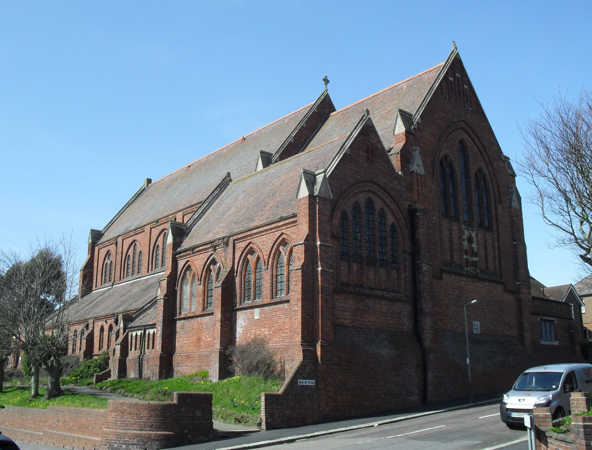
All Souls Church, Hastings

All Souls Church is a former Anglican church that served the Clive Vale suburb of Hastings, a seaside resort town and borough in the English county of...

Ore, East Sussex

Ore is a large suburb of the urban area of Hastings, in the Hastings district, in the county of East Sussex, England. Formerly a village, it is still known...
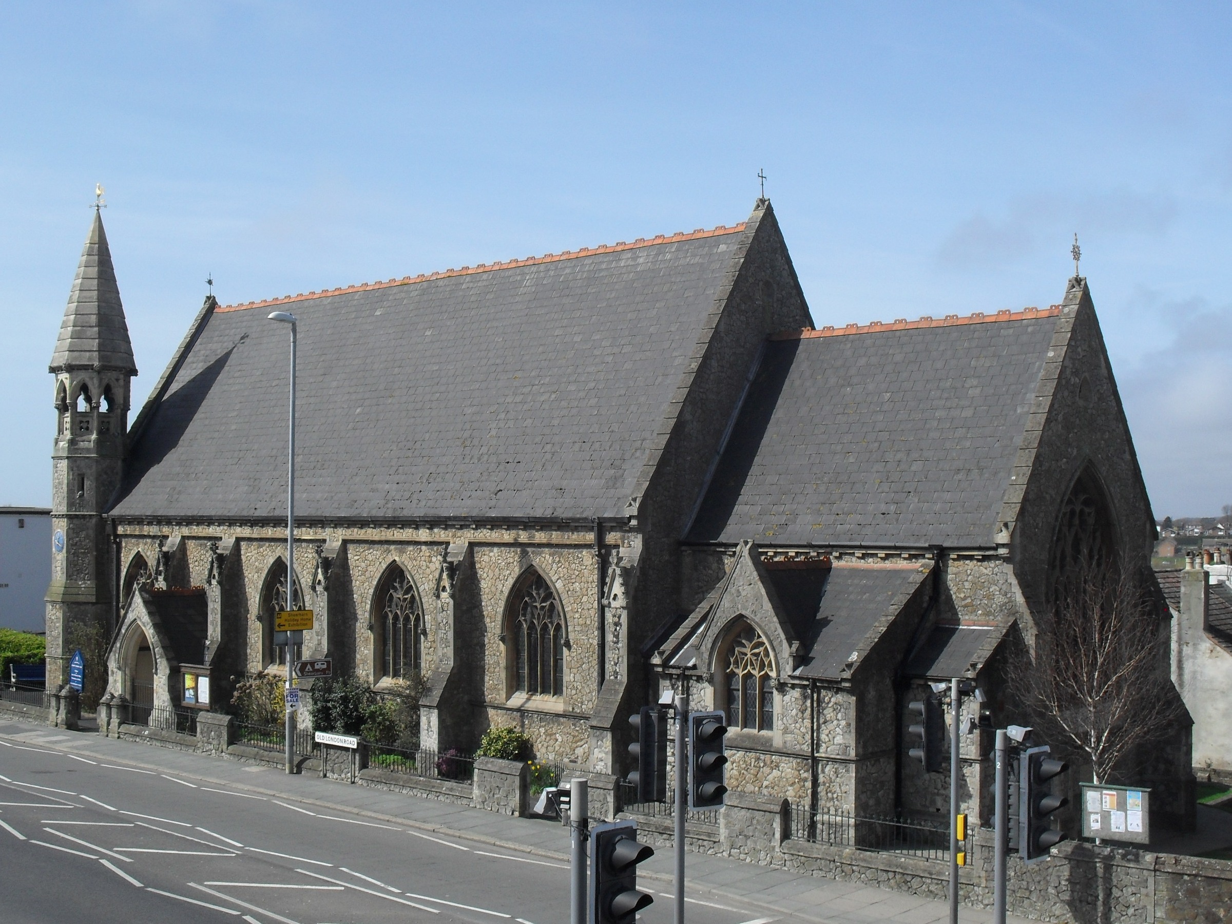
Christ Church, Ore

Christ Church is an Anglican church in the Ore area of the town and borough of Hastings, one of six local government districts in the English county of...

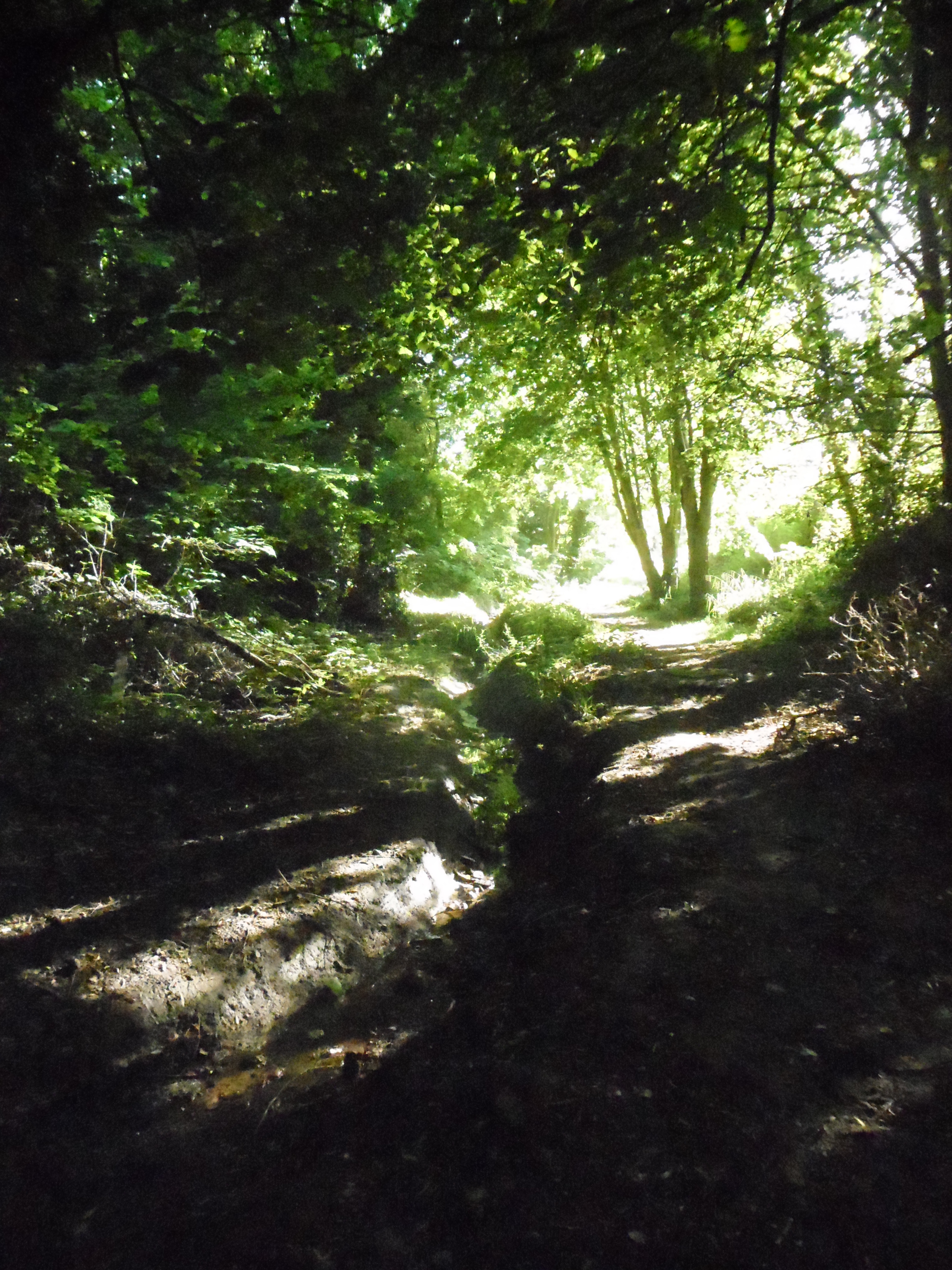
Speckled Wood, Hastings

Speckled Wood is a 12.7-acre (5.1 ha) woodland and park in Ore Village in the Ore Valley, Hastings, East Sussex, United Kingdom. The woodland park consists...

Windycroft

Windycroft is a Grade II* listed house in Hastings, East Sussex, England. It was built between 1883 and 1891 for Alex and Constantine Alexander Ionides...

Hastings Power Station

Hastings Power Station was a gas turbine power station situated in Hastings in East Sussex, England. It was built on the site of the Broomgrove coal-fired...
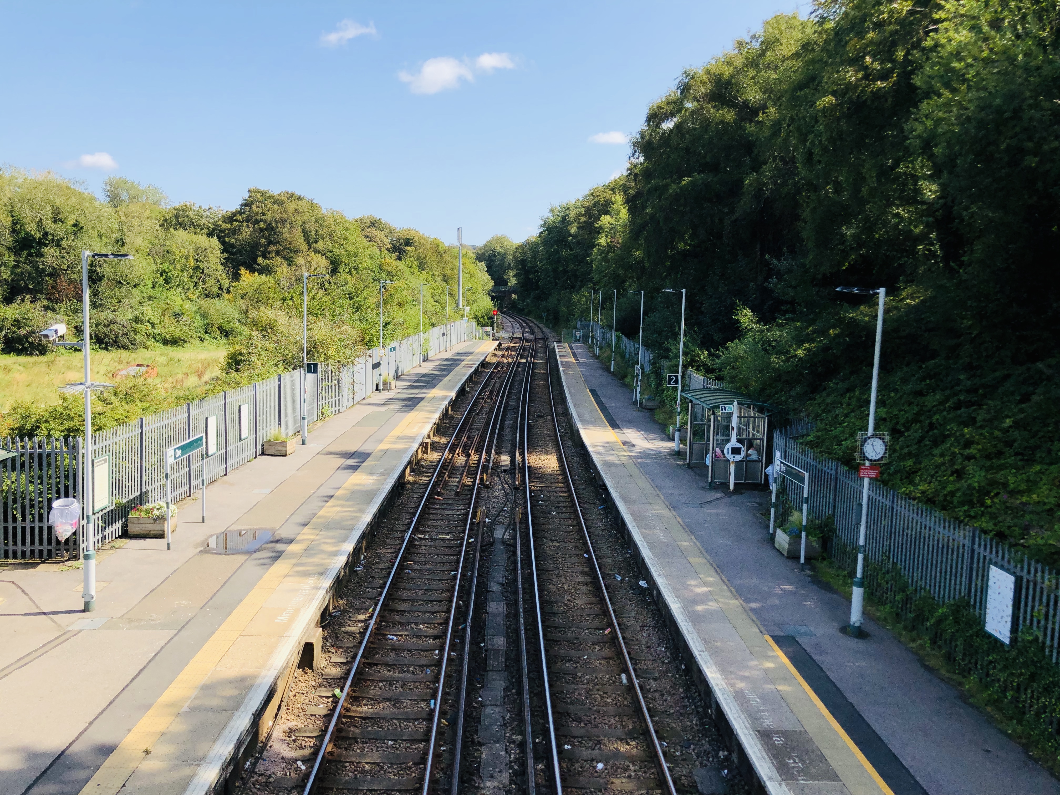
Ore railway station

Ore railway station serves Ore in East Sussex, England. It is on the Marshlink Line, and train services are provided by Southern, with a single peak hour...

Hastings Academy

The Hastings Academy, formerly known as Hillcrest, is a secondary school in Hastings, East Sussex, England. The Hastings Academy opened on 1 September...

Nearby Amenities

Located within 500m of 50.867764,0.611148
Clive Vale
Place: suburb
Source: OS_OpenData_StreetView
Lat/Long: 50.8661866/0.6093953
Hazells Convenience Store
Opening Hours: Mo-Sa 06:00-19:30; Su 07:00-13:00
Shop: convenience
Lat/Long: 50.8653907/0.6057311
Addr City: Hastings
Addr Housenumber: 2
Addr Postcode: TN35 5HU
Addr Street: Canute Road
Building: house
Lat/Long: 50.8703132/0.6086595
Information: map
Tourism: information
Lat/Long: 50.8648861/0.6114879
Vending Machine
Operator: Hastings Country Park
Vending: parking_tickets
Lat/Long: 50.8649067/0.6115198
Barrier: height_restrictor
Maxheight: 2
Lat/Long: 50.8650233/0.6113347
5
Information: guidepost
Operator: Hastings Country Park
Tourism: information
Lat/Long: 50.8636245/0.6101718
7
Information: guidepost
Operator: Hastings Country Park
Tourism: information
Lat/Long: 50.8637292/0.6128924
Post Box
Collection Times: Mo-Fr 09:00; Sa 07:00
Operator: Royal Mail
Operator Wikidata: Q638098
Post Box Type: pillar
Ref: TN35 244D
Royal Cypher: GVIR
Royal Cypher Wikidata: Q33102169
Source: survey
Survey Date: 2017-09-22
Lat/Long: 50.8637144/0.6082727
Childcare
The Athelstan Nursery
Addr City: Hastings
Addr Housename: Parish Rooms
Addr Postcode: TN35 5JE
Addr Street: Athelstan Road
Phone: +44 1424 446105
Website: https://www.theathelstannursery.co.uk/
Lat/Long: 50.8672071/0.6079918
Generator Method: photovoltaic
Generator Output Electricity: yes
Generator Source: solar
Generator Type: solar_photovoltaic_panel
Location: roof
Power: generator
Lat/Long: 50.8686894/0.6122668
Generator Method: photovoltaic
Generator Output Electricity: yes
Generator Source: solar
Generator Type: solar_photovoltaic_panel
Location: roof
Power: generator
Lat/Long: 50.8686776/0.6123151
Cafe
Shearbarn Cafe
Lat/Long: 50.8651847/0.6118977
The data included in this document is from www.openstreetmap.org. The data is made available under ODbL.

Have you been to Clive Vale?

Leave your review of Clive Vale below (or comments, questions and feedback).